
Related Manuals for GeoSlam ZEB-HORIZON


Summary of Contents for GeoSlam ZEB-HORIZON
- Page 1 Copyright ZEB‐HORIZON™ User’s Manual © 2019 GeoSLAM Ltd. All rights reserved. ZEB-HORIZON User Manual © 2019 GeoSLAM Ltd ZEB‐HORIZON User Manual v1.2...
-
Page 2: Table Of Contents
Duration of scanning ........................ 12 Survey areas with restricted or difficult access .................. 12 Moving objects in the environment ....................12 Data Processing ....................13 GeoSLAM Hub Software ......................13 Battery......................15 Specification ......................... 15 Recharging ........................... 15 Capacity and run‐time display ..................... 15 Battery care ......................... -
Page 3: Introduction
2D laser scan data with the IMU data to generate accurate 3D point clouds. The ZEB‐HORIZON captures raw laser range measurement and inertial data. This data must be processed using GeoSLAM’s SLAM algorithm to convert the raw data into a 3D point cloud. The data is processed using the GeoSLAM Hub processing application. -
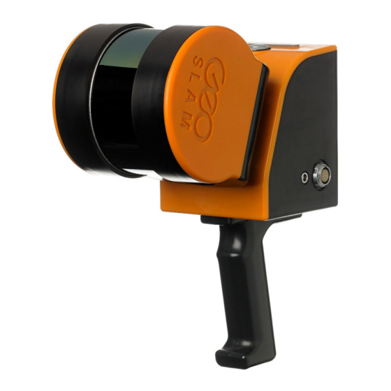
Page 4: List Of Parts
ZEB‐HORIZON main cable 4 GS_USB USB memory stick 5 PAG_ Battery charger and power supply unit 6 MUS_ Data logger shoulder strap 7 SWA_138576 Backpack Table 1-2: List of parts Figure 1-1 © 2019 GeoSLAM Ltd ZEB‐HORIZON User Manual v1.2... -
Page 5: Safety
Please refer all servicing of the equipment to qualified service personnel. Only use the components and accessories supplied with your system or other accessories recommended by GeoSLAM Ltd. Before operating the system for the first time please read this manual in full. -
Page 6: Installation
The ZEB‐HORIZON can be used as a handheld device using the supplied removable handle or can be mounted to mobile platform using threaded mounting points (see Section 7.2) or the optional mounting plate. FURTHER HELP AND INFORMATION Contact GeoSLAM by any of the following methods: Phone: +44 1949 831814 Email: info@geoslam.com... -
Page 7: Data Capture
The process of collecting data using the ZEB‐HORIZON scanning system is highly automated. However, care must be taken to ensure that the collected data can be successfully processed into a 3D point cloud using GeoSLAM’s unique SLAM algorithm. It is strongly recommended that the user conducts a survey plan, considering the recommendations set out in the Usage Guidelines in chapter 4, before commencing data collection. -
Page 8: Downloading The Raw Scan Data
Downloading data is an automatic process whereby only data that has not previously been downloaded will be transferred. Data that has been previously downloaded can be re‐downloaded using the Prepare USB tool described in chapter 7.1. © 2019 GeoSLAM Ltd ZEB‐HORIZON User Manual v1.2... -
Page 9: File Naming
The system date/time can be changed using the Prepare USB tool described in chapter 7.1. The ZIP file contains two files: YYYY‐MM‐DD_hh‐mm‐ss.geoslam ‐ file containing the raw scan data YYYY‐MM‐DD_hh‐mm‐ss.params ‐ file containing key parameters used for data collection SHUTTING DOWN To shut the ZEB‐HORIZON data logger down long press the power button until two beeps are emitted. - Page 10 Laser and IMU sensors not detected RED flash RED flash ORANGE ORANGE Data logger turned off during Data Formatting Shut down paused until data formatting is complete Table 3-2: LED ERROR status summary © 2019 GeoSLAM Ltd ZEB‐HORIZON User Manual v1.2...
-
Page 11: Usage Guidelines
Try to open all doors before starting the survey. Avoid scanning doors as they are being opened. If necessary, face away from the door and open from behind then pass through the doorway backwards. © 2019 GeoSLAM Ltd ZEB‐HORIZON User Manual v1.2... -
Page 12: Walking Speed
If people are required to follow the operator they should ideally maintain a distance of 20m or more from the operator. © 2019 GeoSLAM Ltd ZEB‐HORIZON User Manual v1.2... -
Page 13: Data Processing
Copy the zip file from the USB memory stick used to download the file from the data logger to a suitable folder on the PC running GeoSLAM Hub and extract the dot geoslam file (YYYY‐MM‐DD_hh‐mm‐ ss.geoslam). To extract a file from a zip file right click on the zip file and select “Extract All…” from the drop‐down list. - Page 14 To view the processed dataset, click the VIEW button next to the file name in the dataset list. A 3D view of the dataset opens in a new GS View window. Figure 5-3 Further instructions for data export and the other post processing options in GeoSLAM Hub are described in the separate GeoSLAM Hub User Guide. © 2019 GeoSLAM Ltd...
-
Page 15: Battery
When the battery is fully charged the display will indicate 100%. When connected to the ZEB‐HORIZON that is powered on, two presses of the battery’s display button will show a predicted run‐time against the given load, expressed in hours and minutes. © 2019 GeoSLAM Ltd ZEB‐HORIZON User Manual v1.2... -
Page 16: Battery Care
Never ship a damaged battery by air transportation. © 2019 GeoSLAM Ltd ZEB‐HORIZON User Manual v1.2... - Page 17 © 2019 GeoSLAM Ltd ZEB‐HORIZON User Manual v1.2...
-
Page 18: Appendices
For the download tasks, the data will be written to the USB memory stick. If you have selected Download All Files a USB memory stick of at least 128GB is recommended. © 2019 GeoSLAM Ltd ZEB‐HORIZON User Manual v1.2... -
Page 19: Appendix 2 - Dimensional Drawings
APPENDIX 2 – DIMENSIONAL DRAWINGS © 2019 GeoSLAM Ltd ZEB‐HORIZON User Manual v1.2... - Page 20 © 2019 GeoSLAM Ltd ZEB‐HORIZON User Manual v1.2...
Need help?
Do you have a question about the ZEB-HORIZON and is the answer not in the manual?
Questions and answers
Im trying to process scan data from the ZEB Horizon and get the error code: (importsitedatasetcommand)-GeoScriptInterpreterException: Execution error 'Execution error 'Execution error 'Execution error 'Execution error 'Execution error '(slam)- External executable error. Error Running SLAM: Error: Extract Horizon Calibration Exit code: 1. Last Message: Failed to Extract Horizon Calibration - exit code 1' at line 228.' at line 227.' at line 226.' at line 217.' at line 216.' at line 57. Is it possible to save the data and get the pointcloud to work? Hoping for an answer!
To resolve errors related to processing scan data from the GeoSLAM ZEB-HORIZON and successfully generate a point cloud:
1. Use the USB Prepare Tool to download the required scan data from the ZEB-HORIZON data logger to a USB memory stick.
2. Copy the zip file from the USB stick to a folder on your PC.
3. Extract the contents of the zip file, specifically the .geoslam file (format: YYYY-MM-DD_hh-mm-ss.geoslam).
4. Open GeoSLAM Hub software.
5. Drag and drop the .geoslam file into the application.
6. Begin processing the data. The software will merge the scan data with GNSS data and display a dialog when complete.
7. Dismiss the dialog box to view the trajectory registration and check the RMS error.
8. Save the processed data, which generates a registered point cloud.
9. Optionally, convert the LAZ file to an RCP file using Autodesk Recap for use in Infraworks or Civil 3D.
Ensure GPS accuracy is within acceptable limits, though minor gaps (e.g., under tree canopy) are tolerable if the rest of the scan is sufficient.
This answer is automatically generated