
Related Manuals for dji TOPODRONE PHANTOM 4 PRO L1 PPK


Summary of Contents for dji TOPODRONE PHANTOM 4 PRO L1 PPK
- Page 1 Topodrone SA CHE-354.723.874 TVA 1820, Rue de la Gare 13, Montreux, Switzerland +41 797 910 713 info@topodrone.org www.topodrone.org TOPODRONE DJI PHANTOM 4 PRO L1/L2 PPK USER MANUAL...
-
Page 2: Table Of Contents
Topodrone SA CHE-354.723.874 TVA Rue du Centre 39, 1637 Charmey, Switzerland +41 797 910 713 info@topodrone.org www.topodrone.org TABLE OF CONTENTS Description pages Drone preparation First steps before work Compass calibration Camera calibration settings IMU calibration features GNSS receiver settings GNSS data post processing and image geotagging Data preparation GNSS data postprocessing and image geotagging Photogrammetry processing in Pix4D mapper... -
Page 3: Drone Preparation
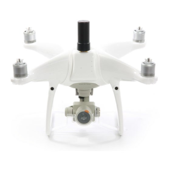
1.1 First steps before work DJI Phantom 4 Pro Topodrone PPK – is a ready-to-fly geodetic survey solution based on DJI Phantom 4 Pro drone. It is strongly recommended to learn the DJI P4P manual first, you can find it on the official web-site: https://www.dji.com/ru/phantom-4-pro/info#downloads. -
Page 4: Compass Calibration
1.2 Compass calibration. As the basic model, on DJI Phantom 4 Pro Topodrone PPK needs the compass calibration (CC) each time you move to the new location. CC helps your drone to adapt to local magnetic field lines. During CC, the accelerometer and the compass of your drone make two rotations in different axes. -
Page 5: Camera Calibration Settings
1.3.Camera calibration and settings Before the shooting process will be started, you should calibrate the focus of your DJI Phantom 4 Pro PPK camera and set optimal image settings. It is recommended to use the next order. 1. You should determine your drone’s working altitude. This value depends on many factors: scale of the final orthophoto map, properties of the lens, height of the obstacles, features of relief, etc. -
Page 6: Imu Calibration Features
Because of using the additional module upper the shell of DJI Phantom 4 Pro PPK, the process of IMU calibration is not the same as the default. To calibrate IMU you need to do next: 1. -
Page 7: Gnss Receiver Settings
Topodrone SA CHE-354.723.874 TVA Rue du Centre 39, 1637 Charmey, Switzerland +41 797 910 713 info@topodrone.org www.topodrone.org 1.5. GNSS receiver settings GNSS module is located in front of the drone in a special plastic shell. The receiver body has three holes in a row. -
Page 8: Gnss Data Post Processing And Image Geotagging
Topodrone SA CHE-354.723.874 TVA Rue du Centre 39, 1637 Charmey, Switzerland +41 797 910 713 info@topodrone.org www.topodrone.org 2. GNSS DATA POST PROCESSING AND IMAGES GEOTAGGING 2.1 Data preparation • Remove the SD card with images from your drone and copy photos to your computer. •... - Page 9 Topodrone SA CHE-354.723.874 TVA Rue du Centre 39, 1637 Charmey, Switzerland +41 797 910 713 info@topodrone.org www.topodrone.org Step 2. Select a folder with photos Page 8 from 42...
- Page 10 Topodrone SA CHE-354.723.874 TVA Rue du Centre 39, 1637 Charmey, Switzerland +41 797 910 713 info@topodrone.org www.topodrone.org Step 3. Select a UBX file from a drone Page 9 from 42...
- Page 11 Topodrone SA CHE-354.723.874 TVA Rue du Centre 39, 1637 Charmey, Switzerland +41 797 910 713 info@topodrone.org www.topodrone.org Step 4. Select a Rinex or UBX file from the base station Page 10 from 42...
- Page 12 Step 5. Impute coordinates of the base station in WGS 84. Define antenna offset for the drone. NOTICE. FOR DJI MAVIC 2 PRO PPK use the following parameters Height: 0.07 Offset forward/backward: -0.02 FOR DJI PHANTOM 4 PRO PPK use the following parameters Height: 0.17...
- Page 13 Topodrone SA CHE-354.723.874 TVA Rue du Centre 39, 1637 Charmey, Switzerland +41 797 910 713 info@topodrone.org www.topodrone.org Step 6. Setup data processing setting. Click advanced setting. Advanced setting will appear. To embed precise coordinates to photos EXIF tags check Burn exif check box. This option may lead to increasing of the data processing time.
- Page 14 Topodrone SA CHE-354.723.874 TVA Rue du Centre 39, 1637 Charmey, Switzerland +41 797 910 713 info@topodrone.org www.topodrone.org After finishing all steps of the data processing (data conversion, GNSS data post processing, images matching and geotagging) all results will be stored in the Output folder. File Coordinates.txt is stored in the PIX4D or Metashape folder.
- Page 15 Topodrone SA CHE-354.723.874 TVA Rue du Centre 39, 1637 Charmey, Switzerland +41 797 910 713 info@topodrone.org www.topodrone.org Step 7. Checking the processing results. After the processing finishes, the following buttons will appear. NOTICE. Click buttons in front of the Rover or Base fields to open GNSS observation files and check the quality of GNSS signal.
- Page 16 Topodrone SA CHE-354.723.874 TVA Rue du Centre 39, 1637 Charmey, Switzerland +41 797 910 713 info@topodrone.org www.topodrone.org On the map you can see the results of the GNSS data postprocessing. Green points of photos events stand for Fixed solution Yellow points – Float solution Red points –...
-
Page 17: Photogrammetry Processing In Pix4D Mapper
Topodrone SA CHE-354.723.874 TVA Rue du Centre 39, 1637 Charmey, Switzerland +41 797 910 713 info@topodrone.org www.topodrone.org 3. PHOTOGRAMMETRY PROCESSING IN PIX4D MAPPER SOFTWARE 3.1 Creating pix4d mapper project Run PIX4D mapper application. Click New Project. Select a project folder location. Click next Page 16 from 42... - Page 18 Topodrone SA CHE-354.723.874 TVA Rue du Centre 39, 1637 Charmey, Switzerland +41 797 910 713 info@topodrone.org www.topodrone.org Select images to be processed from output\UpdateTags folder. Click next Page 17 from 42...
- Page 19 NOTICE. It is possible to upload the coordinates from the .txt file. Click From File button and select the coordinates.txt file It is recommended to check the camera settings. Click Edit button and check if the Linear rolling shutter camera model is enabled if you have used a DJI MAVIC 2 PRO for survey. Page 18 from 42...
- Page 20 Topodrone SA CHE-354.723.874 TVA Rue du Centre 39, 1637 Charmey, Switzerland +41 797 910 713 info@topodrone.org www.topodrone.org Select an output coordinate system and click Next. Page 19 from 42...
- Page 21 Topodrone SA CHE-354.723.874 TVA Rue du Centre 39, 1637 Charmey, Switzerland +41 797 910 713 info@topodrone.org www.topodrone.org Select a type of data processing options. Click Finish. Page 20 from 42...
-
Page 22: Initial Aerial Triangulation
Topodrone SA CHE-354.723.874 TVA Rue du Centre 39, 1637 Charmey, Switzerland +41 797 910 713 info@topodrone.org www.topodrone.org 3.2 Initial aerial triangulation Once the images with precise coordinates are loaded to the project, we can start the initial aerial triangulation. Select the initial processing checkbox and start processing. Page 21 from 42... -
Page 23: Camera Calibration
Topodrone SA CHE-354.723.874 TVA Rue du Centre 39, 1637 Charmey, Switzerland +41 797 910 713 info@topodrone.org www.topodrone.org 3.3. Camera calibration In order to calibrate the focal length of the camera you need at least one GCP. Click GCP/MTP button. Page 22 from 42... - Page 24 Topodrone SA CHE-354.723.874 TVA Rue du Centre 39, 1637 Charmey, Switzerland +41 797 910 713 info@topodrone.org www.topodrone.org Select the coordinate system of ground control points and import GCPs. Click OK. Change the GCP type to Check point. Page 23 from 42...
- Page 25 Topodrone SA CHE-354.723.874 TVA Rue du Centre 39, 1637 Charmey, Switzerland +41 797 910 713 info@topodrone.org www.topodrone.org All GCPs will be shown on the map. Select one GCP, define the position of the ground control point at each image, change the type of the selected(?) GCP to 3D and set the horizontal accuracy to 50 meters.
- Page 26 Topodrone SA CHE-354.723.874 TVA Rue du Centre 39, 1637 Charmey, Switzerland +41 797 910 713 info@topodrone.org www.topodrone.org Click Reoptimize button. Click Ok on all warning messages. After finishing the reoptimization process click the Image property editor button. Page 25 from 42...
- Page 27 Topodrone SA CHE-354.723.874 TVA Rue du Centre 39, 1637 Charmey, Switzerland +41 797 910 713 info@topodrone.org www.topodrone.org Click the Edit camera model buttons in the Image Properties Editor window and in the Edit Camera Model window Page 26 from 42...
- Page 28 Topodrone SA CHE-354.723.874 TVA Rue du Centre 39, 1637 Charmey, Switzerland +41 797 910 713 info@topodrone.org www.topodrone.org Click Load Optimized parameters. Copy the Focal Length value for the future work. NOTICE. It will be possible to use the calibrated value of the focal length for the processing if you do not change your focus settings for the future flights.
-
Page 29: Accuracy Estimating
Topodrone SA CHE-354.723.874 TVA Rue du Centre 39, 1637 Charmey, Switzerland +41 797 910 713 info@topodrone.org www.topodrone.org 3.4 Accuracy estimating Load the ground control points. Set them up as check points. Select position of all check points at images to check accuracy. Page 28 from 42... - Page 30 Topodrone SA CHE-354.723.874 TVA Rue du Centre 39, 1637 Charmey, Switzerland +41 797 910 713 info@topodrone.org www.topodrone.org Go to the Processing options menu. Select None for Internal Parameters Optimization. Click Ok. Click Reoptimize. Page 29 from 42...
- Page 31 Topodrone SA CHE-354.723.874 TVA Rue du Centre 39, 1637 Charmey, Switzerland +41 797 910 713 info@topodrone.org www.topodrone.org After finishing the optimization process go to Process Menu, click Generate quality report. Data processing report will be generated. Go to Geolocation Details to estimate the accuracy of the project.
-
Page 32: Photogrammetry Processing In Agisoft Metashape
Topodrone SA CHE-354.723.874 TVA Rue du Centre 39, 1637 Charmey, Switzerland +41 797 910 713 info@topodrone.org www.topodrone.org 4. PHOTOGRAMMETRY PROCESSING IN AGISOFT METASHAPE SOFTWARE 4.1 Creating a project, photo alignment The following process should be performed in the Agisoft Metashape software. Add photos to the project. - Page 33 Topodrone SA CHE-354.723.874 TVA Rue du Centre 39, 1637 Charmey, Switzerland +41 797 910 713 info@topodrone.org www.topodrone.org Select WGS 84 coordinate system, setup columns order 1,3,2,4, click Accuracy checkbox, select field 5, click OK Accurate X,Y,Z coordinates and accuracy values will appear in the Reference window Page 32 from 42...
- Page 34 Topodrone SA CHE-354.723.874 TVA Rue du Centre 39, 1637 Charmey, Switzerland +41 797 910 713 info@topodrone.org www.topodrone.org Go to Tools, click Camera calibration and input the calibrated parameter for focal length 10.4777, select fixed F parameter Go to Workflow and click Align Photos for aerial triangulations Page 33 from 42...
- Page 35 Topodrone SA CHE-354.723.874 TVA Rue du Centre 39, 1637 Charmey, Switzerland +41 797 910 713 info@topodrone.org www.topodrone.org After finishing the aerial triangulation go to the Reference, click "Optimize Camera Alignment" and click on Fit additional corrections check box. Click OK. Page 34 from 42...
-
Page 36: Accuracy Estimating
Topodrone SA CHE-354.723.874 TVA Rue du Centre 39, 1637 Charmey, Switzerland +41 797 910 713 info@topodrone.org www.topodrone.org 4.2 Accuracy estimating After finishing the aerial triangulation go to the Reference, click "Import" and load the GCP.txt file. Use the following settings and click OK Click «Yes to All»... - Page 37 Topodrone SA CHE-354.723.874 TVA Rue du Centre 39, 1637 Charmey, Switzerland +41 797 910 713 info@topodrone.org www.topodrone.org Select the locations of each GCP on photos and look at accuracy report Page 36 from 42...
-
Page 38: Camera Calibration
Topodrone SA CHE-354.723.874 TVA Rue du Centre 39, 1637 Charmey, Switzerland +41 797 910 713 info@topodrone.org www.topodrone.org 4.3. Camera calibration To calibrate your camera focal length, load the images, import accurate coordinates of photos, perform the photo alignment (do not fix F parameter) and import the GCPs. Define the position of every marker on each photo. - Page 39 Topodrone SA CHE-354.723.874 TVA Rue du Centre 39, 1637 Charmey, Switzerland +41 797 910 713 info@topodrone.org www.topodrone.org After finishing the aerial triangulation, go to Tools, click Camera calibration. Select adjusted and Save button. Select Info Camera Calibration format and save file. Page 38 from 42...
- Page 40 Topodrone SA CHE-354.723.874 TVA Rue du Centre 39, 1637 Charmey, Switzerland +41 797 910 713 info@topodrone.org www.topodrone.org Open txt file and copy the focal length value NOTICE. It will be possible to use the calibrated value of your camera’s focal length for the processing in future, if you do not change your focus settings.
-
Page 41: Aerial Triangulation Accuracy Improvement. Tie Points Filtering
Topodrone SA CHE-354.723.874 TVA Rue du Centre 39, 1637 Charmey, Switzerland +41 797 910 713 info@topodrone.org www.topodrone.org 4.4. Aerial triangulation accuracy improvement. Tie points filtering In order to increase the accuracy of your model, we suggest filtering tie points with the Gradual Selection tool. - Page 42 Topodrone SA CHE-354.723.874 TVA Rue du Centre 39, 1637 Charmey, Switzerland +41 797 910 713 info@topodrone.org www.topodrone.org Go to Edit menu and delete the selected points Click "Optimize Camera Alignment" Check the accuracy and repeat the steps described above until the Reprojection error reaches 0.65- 0.35 value.
Need help?
Do you have a question about the TOPODRONE PHANTOM 4 PRO L1 PPK and is the answer not in the manual?
Questions and answers