Table of Contents
Advertisement
Advertisement
Table of Contents

Related Manuals for Rand McNally TND 740


Summary of Contents for Rand McNally TND 740
- Page 2 Intentional or unintentional changes or modifications to the equipment not accordance with the instructions. However, there is no guarantee that expressly approved by Rand McNally could void the user’s authority interference will not occur in a particular installation. If this equipment does to operate the equipment.
- Page 3 About GPS The Global Positioning System (GPS) is a constellation of satellites that a GPS receiver uses to calculate geographical positions. To determine a position, data from at least three satellites is required. To determine elevation, the data from four or more satellites is required. Accuracy of the positioning varies from 10 feet to several hundred feet, depending on vehicle placement and the surrounding environment.
-
Page 4: Table Of Contents
Table of Contents 1. Your Device ........................1 4. Maps & Routing ......................31 Safety Information ......................1 Route Map Window .....................31 What’s Included ......................2 Exits Quick View ......................32 Charge the Battery ...................... 2 Directions Slide-Out List ...................33 Install the Mount ......................2 Virtual Dashboard .................... -
Page 5: Your Device
Do not open the navigation device casing. • Follow navigation system instructions only when local regulations and • Do not attempt to replace the battery. Contact Rand McNally road traffic allow you do so. Customer Support with questions about the battery. •... -
Page 6: What's Included
1. Your Device What’s Included Install the Mount • Rand McNally TND Note: Follow all local regulations governing the placement of the mount. ™ • Magnetic mount Select an area with a line of sight to the sky and GPS satellites. -
Page 7: Your Tnd
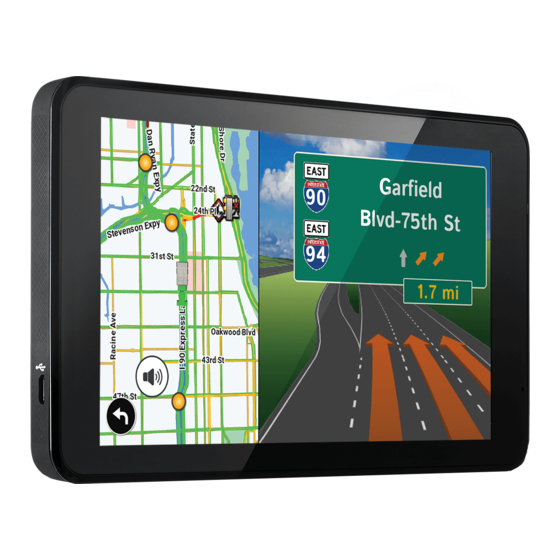
1. Your Device User Manual ™... -
Page 8: Settings
Tap to launch the DriverConnect app and log hours of service (HOS), Driver-Vehicle Inspection Reports (DVIRs), and other compliance fea tures. Note: You must connect the TND to Rand McNally electronic logging device (ELD), such as the ELD-50 or DC-200, in order to use this software. -
Page 9: Guide To Truck Tools And Device Preferences
2. Settings to view the options. Device Preferences Page Device Preferences Page 2. Tap the option to be set. 3. Enter the new information. Route Warnings Warning/Alert Prompts ........10 4. Tap X to close and save changes. Use Traffic ............. 8 Auto Dismiss Warnings ........10 Recalculation ............ -
Page 10: Truck Info
2. Settings Truck Info Options Truck Info Options Hazmat Type None Width Use the + and - buttons or enter a numeric Explosives value by tapping the calculator. Gases Flammable Liquids Trailers Straight Flammable Solids 48’ Oxidizers 53’ Poison Double Radioactive Triple Corrosives... -
Page 11: General Preferences
2. Settings Preferences General Preferences Options to view the options. • My Custom POIs Manage Custom POIs • Tap the option to be set. Select a Category to Edit • Enter the new information. Hide All Icons on Map • Tap X to close and save changes. -
Page 12: Route Preferences
2. Settings Preferences - continued Route Preferences Options General Preferences Options Turn Announcements Set three distances at which you want to be warned about an upcoming turn. Toll Prompt/ Enabled The first announcement will be the farthest Notification Disabled from the turn and the third the closest. Clock Setting 12-Hour Clock Junction View Distance... -
Page 13: Map Preferences
2. Settings Preferences - continued Map Preferences Options Map Preferences Options .Map Style Light Truck POI Icons Dark High Contrast Select icons to display on map. Map Auto Zoom On, Auto Scale Address Book Icons On, Street Scale On, City Scale On, State Scale Truck Icon Set to auto scale to keep the current... -
Page 14: Warnings
2. Settings Preferences - continued Warning Preferences Options Warning Preferences Options Warning/Alert Prompts None Warning Display Size Full Screen Audio & Visual Small Bar Visual Audio Toll Booth Alert Set warning distance to toll booths by using the + and - buttons. Auto Dismiss Warnings Never After 2 Seconds... -
Page 15: Destinations
3. Destinations Destinations To access this window, tap Guided Search on the map. Back Tap to return to the map. New Location Tap to route to a new location by address, city center, intersection, or latitude/longitude. History Tap to route to a recently entered location. Address Book Tap to view a list of saved locations. -
Page 16: Tips
3. Destinations Helpful Tips on Entering Addresses Auto-Complete Feature: Enter the first few characters in a name and a short list displays a couple of names that start with the typed characters. On the keyboard, the only keys available are for the next valid characters in a search name. -
Page 17: New Location
3. Destinations New Location Address Tap to route to an address by entering the city, street, and number, or by entering the zip code and street. City Center Tap to route to a city center. Intersection Tap to route to two intersecting roads in a city. Back Tap to return to the previous window. -
Page 18: Route To Address/City/Intersection
3. Destinations > Addresses Search for an Address Tap Guided Search > New Location > Address. 2. Type the first few characters in the city name. As you type, a short list of matching city names displays. 3. Tap on a city to select it. •... - Page 19 3. Destinations > Addresses Route to a City Center Tap Guided Search > New Location > City Center. 2. Type the first few characters in the city name. 3. Tap on the city/state name. The Confirmation Window displays. 4. Tap Begin New Route to navigate to the location. Route to an Intersection 5.
- Page 20 3. Destinations > Addresses Route to a Latitude/Longitude Tap Guided Search > New Location > Enter Lat/Long 2. Tap in the Latitude field. 3. Enter the latitude of the location and tap Enter. 4. Tap in the Longitude field. 5. Enter the longitude of the location and tap Enter. 6.
-
Page 21: Address Book
3. Destinations > Address Book Address Book Add Locations to the Address Book from the Confirmation Window Tap Save to Address Book. 2. Tap Yes to accept the default name or tap No to display a keyboard. 3. Type the name of the location and tap Enter to save the location in the Address Book. -
Page 22: Address Book
3. Destinations > Address Book Create a Group Tap Guided Search > Address Book. 2. Tap on the Groups tab. 3. Tap New Group. 4. Type the group name. 5. To select a different color folder, tap 6. Tap on a color, then tap Close. 7. -
Page 23: Multi-Stop Trips
3. Destinations > Multi-Stop Trips Create a Multi-Stop Trip Tap Guided Search > Multi-Stop Trips. 2. Tap New Trip. 3. Type the trip name. 4. To select a different color folder, tap 5. Tap on a color, then tap Close. 6. - Page 24 3. Destinations > Multi-Stop Trips Reorder Routes Optimize Automatically After all locations have been added to a multi-stop trip, you can run the optimizer wizard to organize your trip. Tap Guided Search > Multi-Stop Trips. 2. Tap on the route you want to optimize. 3.
-
Page 25: Multi-Stop Trips
3. Destinations > Multi-Stop Trips Select and Run a Saved Route Tap Guided Search > Multi-Stop Trips. 2. Tap on the route to select it. 3. Tap Start Trip. The Confirmation Window displays. 4. Tap Begin New Route to navigate to the location. 5. -
Page 26: Tap On Map
3. Destinations > Tap Map Tap on the Map When you tap on the map screen, the crosshairs display. Route to Here Tap Begin New Route to navigate to the location. Set Origin Set the location as the starting point of the route. Save to Address Book Add the location to your address book. -
Page 27: Avoidlist
3. Destinations > Avoid List Avoid List Avoid Options From the map, set specific locations to avoid. Tap on the map and select Permanent Avoid. Choose Avoid Route, Avoid Road, or Avoid Area. Or, if the location is along an active route, choose Detour. Avoid Route Choose whether to avoid an upcoming distance on an active route, in the left column, or a specific road section, in the right column. -
Page 28: Points Of Interest (Pois)
3. Destinations > POIs Points of Interest (POIs) My Truck Tap to search for a point of interest near the current vehicle location. City Tap to search for a point of interest in a city. My Route Tap to search for a point of interest along the vehicle route. Destination Tap to search for a point of interest near the route destination. -
Page 29: Points Of Interest (Pois)
3. Destinations > POIs Points of Interest (POIs) Travel Center Tap to search for a travel center with truck amenities. (See page 28 to filter by amenities.) Truck Services Tap to search for a truck services POI. (See page 28 to filter by amenities.) Parking &... - Page 30 3. Destinations > POIs Other Categories 1. Tap Guided Search > Points of Interest. 2. Select a search type (My Truck/My Car, City, My Route, End of Day, or Destination). 3. Tap Other Categories. 4. Tap on a category. (For example, tap Hospital/Emergency.) 5.
- Page 31 3. Destinations > POIs Select and Filter Travel Center Amenities and Truck Services Truck-related Travel Center points of interest can include over 70 different types of amenities. To select only the travel centers with the amenities that you are interested in, filter your search results. Tap Guided Search >...
-
Page 32: Local Search
3. Destinations > Local Search Note: This feature requires a Wi-Fi connection. Use Local Search to search the Internet for a restaurant, business, or any type of location by name, keyword, or category. Tap Guided Search > Lo- cal Search. Choose whether to search: near your truck in a specific city... -
Page 33: Confirmation Windows
Add the location to the Address Book or add to Address Book group. (See Truck POI page 18). Atlas Cross-reference to printed Rand McNally Motor Carriers’ Road Atlas. (Page numbers apply to the most recent Atlas.) Go to Map Tap to view this location on a map. -
Page 34: Toll Costs, Route Compare
3. Destinations > Toll Costs, Route Compare Toll Costs From the destination confirmation screen, tap Begin New Route. If the calculated route includes tolls, a message appears. Use Current Route Show estimated toll costs and continue along the calculated route. Compare Routes Compare the calculated toll route to an alternate route without tolls. -
Page 35: Maps & Routing
4. Maps & Routing Route Map Window Map View Tab Tap to simplify the map screen. Icons are minimized to show simply the zoom, next maneuver, and miles/time. Home Screen Miles/Time Displays remaining distance. Tap to select from: yard arrival time, arrival time, remaining time, yard time, and elevation. -
Page 36: Exits Quick View
4. Maps & Routing Exits Quick View Slide out to show Points of Interest and amenities at upcoming exits. The list displays the distance to the next exit, exit name and number, and a count of available amenities. Tap on an exit to display locations by category. 2. -
Page 37: Directions Slide-Out List
4. Maps & Routing Directions Slide-Out List Highway View Route Display Options When first opened, the slide-out list displays in Detail View showing each maneuver. 2. Use to view the instructions. 3. To change the display option, tap the radio button on the bottom of the screen. -
Page 38: Virtual Dashboard
4. Maps & Routing Virtual Dashboard To show the Virtual Dashboard, tap the Current Speed. Current direction of travel. Displays current times at the yard, current location and destination, as well as estimated time of arrival. Sunrise and sunset times based on vehicle location (latitude/longitude) and day. - Page 39 4. Maps & Routing Manually Reset Trip Information Tap on the tab you want to reset. 2. To set the odometer for the selected tab back to zero, tap Reset All. 3. Information is captured as you travel the route. Automatically Reset Trip Information To reset trip information after the vehicle has remained stationary after a specific number of hours:...
-
Page 40: Junction View, Turn View
4. Maps & Routing Junction View When on a route, Junction View displays when you have an upcoming maneuver. Set distance in Preferences > Route. Once past the maneuver, Junction View closes and the previous window displays. Signs to follow for the next maneuver. Number and direction of lanes for the next maneuver. -
Page 41: Location And Route Options
4. Maps & Routing Location and Route Options Nearest cross street Current road you’re on, current town you’re in Latitude and longitude at current location Return to previous window Detour Detour the entire route and add it to the avoid list. Around Part of the Route 1. -
Page 42: Tools & Features
5. Tools & Features Wi-Fi For information on setting up a Wi-Fi hotspot through your cellular phone or laptop computer, please visit www.randmcnally.com/wifihelp for basic instructions, or contact your wireless carrier. Note: Wi-Fi connectivity requires a supporting feature and data plan from your wireless service provider. -
Page 43: Weather
5. Tools & Features Weather Notes: • This feature requires a Wi-Fi connection. • The refresh speed of the weather display is dependent on the connection speed. Weather information is updated every few minutes while Wi-Fi connection is active. • Weather display depends on active weather patterns and map zoom level. -
Page 44: Fuel Prices
5. Tools & Features Fuel Prices Note: This feature requires a Wi-Fi connection. To show fuel prices, tap the Live Data icon on the map screen and tap the Fuel Prices tab. Displays stations and prices, with distance as the crow flies. Check to show the icons and prices on the map screen. -
Page 45: Traffic
5. Tools & Features Traffic NOTE: This feature requires a Wi-Fi connection. To view current traffic information along your route and near your loca- tion: Tap Live Data > Settings on the map screen. Tap the Traffic radio button to display the traffic overlay on the map. Tap the Traffic tab. -
Page 46: Traffic
5. Tools & Features Traffic Icons Accident Accident Incident Closure Carriageway Exit blocked Entrance blocked Traffic Carpool Road work Obstruction Dangerous Road condition Temperature Chance of precipitation Wind Activities Security Delay Cancel Size/weight limit Visibility Light Travel time Heavy Moderate traffic traffic traffic... -
Page 47: Truck Tools
(See pages 44-47.) Motor Carrier’s Road Atlas Displays the Road Atlas app. Rand Motor Carrier’s Road Info View Rand McNally Truck Emergency contact information and truck regulations. Quick Planner Between any two cities or towns, quickly calculate the distance, driving time, and cost. -
Page 48: Status
5. Tools & Features Status Note: Odometers count up and record the current mileage. Maintenance counters count down. When a maintenance timer counts down to 2,000 miles, a reminder displays each time the TND starts. Tap Truck Tools. 2. Tap Status, Trails, Mileage, and Fuel. 3. -
Page 49: Mileage
5. Tools & Features Mileage Tap Truck Tools. 2. Tap Status, Trails, Mileage, and Fuel. 3. Tap the Mileage tab to view list of logs for the current year, ordered by quarter. 4. To view quarterly mileage logs for previous years, tap Year. Tap on a quarter to view log entries. -
Page 50: Trails
5. Tools & Features Trails Use Trails to record a “bread-crumb” path of GPS coordinates where your truck has traveled. Tap Truck Tools. 2. Tap Status, Trails, Mileage, and Fuel. 3. Tap the Trails tab. 4. To record a trail, tap New Trail. 5. -
Page 51: Fuel Logs
5. Tools & Features Fuel Logs Tap Truck Tools. 2. Tap Status, Trails, Mileage, and Fuel. 3. Tap the Fuel tab to view a list of fuel logs by quarter. 4. Tap +Fuel to record the date, location and cost of fuel purchase. 5. -
Page 52: Quick Planner
5. Tools & Features Quick Planner Use this tool to quickly estimate the mileage and time between any two cities or towns. Tap Truck Tools. 2. Tap Quick Planner. The revenue or cost per mile used in the last computation displays. 3. -
Page 53: Road Atlas Information
5. Tools & Features Road Atlas Information To reference the Rand McNally Motor Carriers’ Road Atlas: Tap Truck Tools. 2. Tap Motor Carrier’s Road Atlas. 3. Select the appropriate country tab. 4. Select the appropriate state/province to view emergency and other key phone numbers. -
Page 54: Calendar, Notes, Unit Converter, Calculator
5. Tools & Features Calendar Tap Truck Tools. 2. Tap Calendar. 3. Use the arrows to view other months and years. 4. Tap Today to return to the current date. Notes Tap Truck Tools. 2. Tap Notes. 3. Tap New Note. 4. -
Page 55: Driverconnect
The DriverConnect app connects to a Rand McNally Electronic Logging Device (ELD) over a Bluetooth connection. The app automatically syncs driving data from the ELD with the Rand McNally DriverConnect web services via a Wi-Fi or cellular transmission. Visit http://www.randmcnally.com/category/e-logs for up-to-date information on compatible ELDs. -
Page 56: Connect With Rand
, you can enter messages for Rand ™ McNally regarding construction, truck restrictions, addresses, your device, and more. The next time you connect to the Rand McNally Dock, you can reopen, edit, and send the message. Tap Truck Tools. 2. Tap Tell Rand. On the left side, tap Current Location. -
Page 57: More Information
6. Connect With Rand For more information • Rand McNally Website www.randmcnally.com/trucking • Support www.randmcnally.com/support • GPS accessories store.randmcnally.com • Facebook www.facebook.com/randtrucking User Manual ™... - Page 58 Neither this manual nor any parts thereof may be reproduced for any purpose whatsoever without the express written consent of Rand McNally, Inc., nor may it be transmitted in any form either electronically or mechanically, including photocopying, and recording. All technical specifications, drawings, etc. are subject to copyright law.
Need help?
Do you have a question about the TND 740 and is the answer not in the manual?
Questions and answers
How to reset gps