Sign In
Upload
Manuals
Brands
Garmin Manuals
GPS
Diamond DA40F
Garmin Diamond DA40F Manuals
Manuals and User Guides for Garmin Diamond DA40F. We have
1
Garmin Diamond DA40F manual available for free PDF download: Pilot's Manual
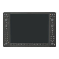
Garmin Diamond DA40F Pilot's Manual (538 pages)
Integrated Flight Deck for DA40 Diamond Star
Brand:
Garmin
| Category:
GPS
| Size: 102.52 MB
Table of Contents
Limited Warranty
5
Table of Contents
10
Section 1 System Overview
13
Line Replaceable Units
14
Secure Digital (SD) Cards
19
System Power-Up
20
System Operation
21
Display Operation
21
G1000 System Annunciations
22
System Status
23
AHRS Operation
25
GPS Receiver Operation
26
G1000 Controls
30
PFD/MFD Controls
30
Softkey Function
32
Accessing G1000 Functionality
39
Menus
39
Data Entry
39
Page Groups
41
System Settings
45
Timers
50
Display Backlighting
53
Section 2 Flight Instruments
55
Flight Instruments
58
Airspeed Indicator
58
SECTION 2 FLIGHT INSTRUMENTS 2.1 Flight Instruments
58
Attitude Indicator
60
Altimeter
61
Vertical Speed Indicator (VSI)
63
Vertical Deviation
64
Horizontal Situation Indicator (HSI)
65
Course Deviation Indicator (CDI)
70
Supplemental Flight Data
77
Outside Air Temperature
77
Wind Data
79
Vertical Navigation (VNV) Indications
80
PFD Annunciations and Alerting Functions
81
System Alerting
81
Marker Beacon Annunciations
82
Traffic Annunciation
82
TAWS Annunciations
83
Altitude Alerting
84
Low Altitude Annunciation
84
Minimum Descent Altitude/Decision Height Alerting
85
Abnormal Operations
86
Abnormal GPS Conditions
86
Unusual Attitudes
87
Section 3 Engine Indication System
89
EIS Display
90
SECTION 3 ENGINE INDICATION SYSTEM 3.1 EIS Display
90
Engine Page
92
Fuel Calculations
94
Leaning Assist Mode
95
EIS Display in Reversionary Mode
96
Lean Display
98
System Display
100
Section 4 Audio Panel and Cns
103
Overview
103
MFD/PFD Controls and Frequency Display
104
Audio Panel Controls
106
COM Operation
108
COM Transceiver Selection and Activation
108
COM Transceiver Manual Tuning
109
Quick-Tuning and Activating 121.500 Mhz
110
Auto-Tuning the COM Frequency
111
Frequency Spacing
115
Automatic Squelch
116
Volume
116
NAV Operation
117
NAV Radio Selection and Activation
117
NAV Receiver Manual Tuning
118
Auto-Tuning a NAV Frequency from the MFD
120
Marker Beacon Receiver
125
ADF/DME Tuning
126
GTX 33 Mode S Transponder
130
Transponder Controls
130
Transponder Mode Selection
131
Entering a Transponder Code
134
IDENT Function
135
Additional Audio Panel Functions
136
Power-Up
136
Mono/Stereo Headsets
136
Speaker
136
Intercom
137
Passenger Address (PA) System
139
Clearance Recorder and Player
139
Entertainment Inputs
140
Audio Panel Preflight Procedure
141
Abnormal Operation
142
Stuck Microphone
142
COM Tuning Failure
142
Audio Panel Fail-Safe Operation
142
Reversionary Mode
142
Section 5 Flight Management
143
Introduction
143
Navigation Status Box
145
Using Map Displays
146
Map Orientation
146
Map Range
148
Map Panning
150
Measuring Bearing and Distance
155
Topography
156
Map Symbols
159
Airways
165
Track Vector
167
Wind Vector
168
Nav Range Ring
169
Fuel Range Ring
170
Field of View (SVS)
171
Waypoints
172
Airports
173
Intersections
179
Intersection (INT WAYPOINT)
179
Ndbs
181
Vors
183
Vor (vor Waypoint)
183
User Waypoints
185
Airspaces
191
Class C Airspace/Tca (CLASS C/TCA) 200
191
Class D Airspace (CLASS
191
Restricted Area (RESTRICTED)
191
Temporary Flight Restriction (TFR)
191
Direct-To-Navigation
195
Flight Planning
201
Flight Plan Creation
202
Adding Waypoints to an Existing Flight Plan
207
Adding Airways to a Flight Plan
209
Adding Procedures to a Stored Flight Plan
212
Flight Plan Storage
219
Flight Plan Editing
221
Along Track Offsets
224
Parallel Track
226
Activating a Flight Plan Leg
229
Inverting a Flight Plan
230
Flight Plan Views
231
Closest Point of FPL
233
Vertical Navigation
234
Altitude Constraints
236
Procedures
240
Departures
240
Arrivals
243
Approaches
245
Trip Planning
251
RAIM Prediction
255
Navigating a Flight Plan
259
Abnormal Operation
287
Section 6 Hazard Avoidance
289
XM Satellite Weather
289
Activating Services
290
Using XM Satellite Weather Products
291
Stormscope
318
Setting up Stormscope on the Navigation Map
318
Selecting the Stormscope Page
322
Terrain Proximity
323
Displaying Terrain Proximity Data
323
Terrain Proximity Page
326
Terrain-SVS
328
TERRAIN-SVS Page
332
TERRAIN-SVS Alerts
334
System Status
337
Terrain Awareness & Warning System (TAWS)
338
Displaying TAWS Data
339
TAWS-B Page
341
TAWS Alerts
343
System Status
349
Traffic Information Service (TIS)
351
Displaying TRAFFIC Data
352
Traffic Map Page
354
TIS Alerts
355
System Status
357
Traffic Advisory System
360
TAS Symbology
360
Displaying Traffic Data
361
Traffic Map Page Display Range
363
TAS Alerts
365
TAS Voice Alerts
365
System Status
366
Section 7 Automatic Flight Control System
369
AFCS Controls
370
SECTION 7 AUTOMATIC FLIGHT CONTROL SYSTEM 7.1 AFCS Controls
370
Flight Director Operation
372
Activating the Flight Director
372
AFCS Status Box
373
Command Bars
374
Flight Director Modes
374
Vertical Modes
375
Pitch Hold Mode (PIT)
376
Selected Altitude Capture Mode (ALTS)
377
Altitude Hold Mode (ALT)
378
Vertical Speed Mode (VS)
379
Flight Level Change Mode (FLC)
380
Vertical Navigation Modes (VPTH, ALTV)
382
Glidepath Mode (GP) (WAAS Only)
387
Glideslope Mode (GS)
389
Go Around Mode (GA)
390
Lateral Modes
391
Roll Hold Mode (ROL)
392
Heading Select Mode (HDG)
393
Navigation Modes (GPS, VOR, LOC, BC)
394
Approach Modes (GPS, VAPP, LOC)
396
Autopilot Operation
398
Engaging the Autopilot
398
Control Wheel Steering
399
Disengaging the Autopilot
399
Example Flight Plan
400
Departure
401
Intercepting a vor Radial
403
Flying a Flight Plan/Gps Course
404
Descent
405
Approach
409
Go Around/Missed Approach
411
AFCS Annunciations and Alerts
413
AFCS Status Alerts
413
Overspeed Protection
414
Annunciations for KAP 140 Autopilot System
414
Section 8 Additional Features
415
Synthetic Vision System (SVS) (Optional)
416
SECTION 8 ADDITIONAL FEATURES 8.1 Synthetic Vision System (SVS) (Optional)
416
SVS Operation
417
SVS Features
419
Field of View
427
Safetaxi
429
Safetaxi Cycle Number and Revision
432
Chartview
435
Chartview Softkeys
435
Terminal Procedures Charts
436
Chart Options
444
Day/Night View
450
Chartview Cycle Number and Expiration Date
452
Flitecharts
456
Flitecharts Softkeys
456
Terminal Procedures Charts
457
Chart Options
464
Day/Night View
468
Flitecharts Cycle Number and Expiration Date
470
XM Radio Entertainment (Optional)
474
Activating XM Satellite Radio Services
474
Using XM Radio
476
Scheduler
479
Electronic Checklists
481
Flight Data Logging
484
Abnormal Operation
486
SVS Troubleshooting
486
Reversionary Mode
486
Unusual Attitudes
487
Annunciations and Alerts
491
Voice Alerts
494
G1000 System Message Advisories
497
SVS Terrain Alerts
508
SVS Terrain Status Annunciations
508
SD Card Use and Databases
511
Garmin Databases
512
Glossary
515
Frequently Asked Questions
521
General TIS Information
525
Map Symbols
527
Index
531
Index
536
Advertisement
Advertisement
Related Products
Garmin Diamond DA40
Garmin DAKOTA 10
Garmin Dakota 20 - Hiking GPS Receiver
Garmin Dakota 20
Garmin Dacota 10
Garmin DAKOTA
Garmin D?zl 770 series
Garmin Drive 50
Garmin DRIVE 5 PRO
Garmin DRIVE 52
Garmin Categories
GPS
Watch
Car Navigation system
Avionics Display
Marine GPS System
More Garmin Manuals
Login
Sign In
OR
Sign in with Facebook
Sign in with Google
Upload manual
Upload from disk
Upload from URL