User Manuals: Garmin GPSMAP 696 Portable Aviation GPS
Manuals and User Guides for Garmin GPSMAP 696 Portable Aviation GPS. We have 7 Garmin GPSMAP 696 Portable Aviation GPS manuals available for free PDF download: Owner's Manual, Quick Reference Manual, Declaration Of Conformity

Advertisement

Advertisement


Garmin GPSMAP 696 Quick Reference Manual (6 pages)
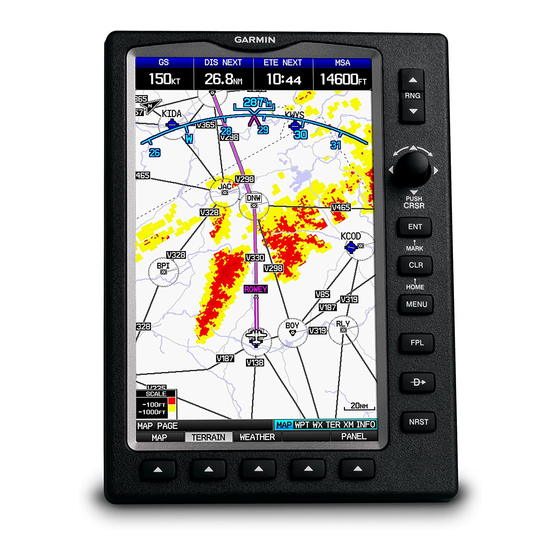
Portable aviation receiver

Garmin GPSMAP 696 Declaration Of Conformity (1 page)
Declaration of Conformity