Sign In
Upload
Manuals
Brands
Garmin Manuals
GPS
GPSMAP 276C
Garmin GPSMAP 276C Manuals
Manuals and User Guides for Garmin GPSMAP 276C. We have
6
Garmin GPSMAP 276C manuals available for free PDF download: Owner's Manual, Quick Reference Manual, Declaration Of Conformity
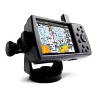
Garmin GPSMAP 276C Owner's Manual (136 pages)
Garmin chartplotting receiver owner's manual GPSMAP 276C
Brand:
Garmin
| Category:
GPS
| Size: 3.26 MB
Table of Contents
About this Manual
3
Table of Contents
4
Care Information
8
Cleaning the Unit
8
Storing the GPSMAP 276C
8
Immersing the Unit in Water
8
Getting Started
9
Unit Overview
9
Charging the GPSMAP 276C
10
Information about Charge Mode
10
Turning on the GPSMAP 276C
11
Adjusting the Backlight and Volume
11
Getting Satellite Signals
12
Viewing GPS Status with the GPS Page
12
Receiver Status
13
GPS Options
14
GPS Tips
14
Learning about the Keypad
15
Using the GPSMAP 276C
16
Understanding Features
16
Selecting Options and Entering Data
17
Using the Databases
18
Simulated Basic Navigation
19
Activating Simulator Mode
19
Entering a New Location
19
Simulating Navigation
20
Basic Operation in Marine Mode
22
Marine Mode
22
Navigating in Marine Mode
23
Initiating Navigation
23
Man Overboard (MOB)
25
Finding an Item
26
Using the Find from Feature
26
Recently Found Items
27
Viewing the Information Page
28
Find Menu Options
28
Creating and Using Routes
29
Creating a Route
29
Navigating a Saved Route
30
Editing a Route
31
Using the Route Tab Options
33
Manually Transitioning to the Next Waypoint
33
Creating and Using Waypoints
34
Marking Your Present Position
34
Creating Waypoints Using the Map
35
Creating a Waypoint by Entering Coordinates
36
Reviewing a Waypoint
37
Adding a Waypoint to a Route
38
Averaging the Waypoint's Location
38
Projecting a Waypoint
39
Editing a Waypoint
40
Organizing Waypoints into Categories
41
Deleting Waypoints
42
Proximity Points
43
Managing Your Tracks
45
Setting up and Saving Your Tracks
45
Saved Tracks
47
Navigating a Saved Track
48
Tracback Tips
48
Following a Marine Route
49
See Your Route on the Map Page
49
View Your Heading with the Compass Page
49
View Your Path on the Highway Page
49
See Your Progress on the Active Route Page
50
Watch Your Trip Data on the Position Data Page
50
Marine Mode Pages and Features
51
Map Page
51
Map Orientation
51
Zooming in and out of the Map
52
Panning the Map
53
Clearing Unwanted Details from the Map
54
Measuring Distance
55
Compass Page
56
Turning on the Compass Page
56
Compass Page Options
56
Using the Marine Timer
57
Highway Page
58
Using the Highway Page
58
Highway Page Options
59
Active Route Page
60
Active Route Page Options
60
Position Data Page
61
Position Data Page Options
61
Dsc
62
Understanding Distress Calls
62
Understanding Position Reports
62
Receiving DSC Calls
63
DSC Call List
63
DSC Log
64
Receiving a Position Report or Distress Call
64
DSC Directory
64
Making a Distress Call
65
Setting up DSC
65
Basic Operation in Automotive Mode
66
Automotive Mode Page Sequence
66
Navigating in Automotive Mode
67
Initiating Navigation
67
Following a Saved Route
69
Stopping and Resuming Navigation
69
Editing Your Route
70
Entering Custom Avoids
70
Creating a Detour
71
Adding and Editing Stops (Via Points)
71
Following an Automotive Route
72
Track Your Progress with the Map Page
72
Watch Your Trip Data
72
See Your Next Turn with the Current Route Page
72
Automotive Mode Pages and Features
73
Map Page
73
Current Route Page
74
Saving the Current Route
74
Trip Computer Page
75
Trip Computer Page Options Menu
75
Additional Pages and Features
76
Setting Alarms
76
Navigation (Nav) Alarms
76
System Alarms
77
Sonar Alarms
77
Using the Calendar
78
Day View
78
Week View
78
Month View
78
Calendar Options
78
Viewing Celestial Information
79
Tide Tab
79
Sun & Moon Tab
81
Hunt & Fish Tab
82
Viewing Messages
83
Viewing the Temperature
84
Changing the Temperature Display
84
Reset the Temperature Graph
84
Customizing Your GPSMAP 276C
85
Setting up the System
85
Adding a Welcome Message
85
Changing the Page Layout and Data Fields
86
Setting up the Map Page
86
Additional Map Data Displayed
87
Changing the Display
88
Changing the Sounds
89
Changing the System Settings
90
Setting the Timers
91
Changing the Time
91
Customizing the Units
92
Restoring Defaults
92
Customizing the Routing and Guidance Settings
93
Road Routing Settings
93
Guidance Settings
94
Changing the Location Settings
95
Changing the Location Format
95
Selecting a Different Map Datum
95
Selecting a Different Heading Reference
95
Changing the Data Format
96
Advanced NMEA Output Setup
98
Setting up and Using Sonar
99
Showing Sonar on the Map Page
99
Using the Sonar Page
100
Adjusting the Sonar Page
101
Adjustment Options
101
Resizing the Split Screen
103
Using the Pointer on the Sonar Page
103
Setting up the Sonar
104
Calibrating the Water Speed
105
Setting up the Sonar Display
106
Understanding Sonar
107
Understanding the Sonar Display
107
Transducer Coverage
108
Whiteline
109
Thermoclines
109
Appendix
110
Specifications
110
Physical Specifications
110
Power
110
Performance
110
Accuracy
110
Optional Accessories
111
Installation Information
112
Connecting the Power/Data Cable
112
Connecting Your GPSMAP 276C to a Computer
113
Information about USB Drivers
113
Using Ximage for Customized Waypoint Icons
114
Installing and Removing Data Cards
114
Interfacing
115
Removing the Antenna
115
Learning about GPS
116
Common GPS Terms
116
What Is Differential GPS (DGPS)
116
Differential Field
116
What Is WAAS
117
LORAN TD Setup
118
LORAN TD Feature
118
Using the LORAN TD Format
118
Map Datums and Location Formats
120
What Are a Map Datum and Which Should I Use
120
What Is a Location Format and Which Should I Use
120
Digital Selective Calling (DSC)
121
What Is a Maritime Mobile Service Identity (MMSI) Number
121
How Are MMSI Assignments Obtained
122
Non-Federal Users in the United States
122
Federal Users in the United States
122
Users Outside the United States
122
Users in Canada
122
How Can Garmin Help You with DSC
122
Messages
123
Data Field Options
124
Safety and Product Information
126
Limited Warranty
127
Fcc Compliance
128
Safety Information
128
Index
131
Advertisement
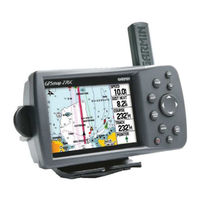
Garmin GPSMAP 276C Owner's Manual (124 pages)
Garmin Chartplotting Receiver Owners Manual GPSMAP 276C
Brand:
Garmin
| Category:
GPS
| Size: 3.31 MB
Table of Contents
Introduction
3
Preface
3
About this Manual
3
Table of Contents
4
Getting Started
7
Unit Overview
7
Learning about the Keypad
8
Charging the GPSMAP 276C
9
Information about the Charge Mode
9
Turning on the GPSMAP 276C
10
Initializing the GPSMAP 276C
10
Adjusting the Backlight and Volume
11
Using the GPSMAP 276C
12
Understanding the Features
12
Selecting Options and Entering Data
13
Using Additional Map Data
14
Simulated Basic Navigation
15
Activating the Simulator Mode
15
Entering a New Location
15
Simulating Navigation
16
Main Pages: Marine Mode and Automotive Mode
18
Marine Mode Page Sequence
19
Automotive Mode Page Sequence
19
Basic Operation
20
Finding an Item
20
Using the Find Menu
20
Viewing the Information Page
21
Using the Find from Feature
21
Recently Found Items
22
Find Menu Options Menu
22
Navigating in Marine Mode
23
Going to a Destination in Marine Mode
23
Go to Point
23
Navigate Route
24
Navigate Track (Tracback Navigation)
25
Man Overboard (MOB)
26
Navigating in Automotive Mode
27
Going to a Destination in Automotive Mode
27
New Route
27
Navigate Route
28
Navigate Track (Tracback Navigation)
28
Edit Vias
28
Using Routes
29
Creating a Route
29
Route Tab Options Menu
30
Active Route Page
31
Route Review Page
31
Route Review Options Menu
32
Following a Route
33
Using Waypoints
34
Creating and Using Waypoints
34
Marking Your Present Position
34
Creating Waypoints Graphically
35
Additional Options for Creating Waypoints
36
Waypoint Menu Options
38
Reviewing and Editing Waypoints
39
Points Tab
41
User' Tab
41
Proximity' Tab
44
Main Pages
46
Map Page
46
Using the Map Page
46
Panning the Map with the Cursor
47
Main Pages
48
Selecting Map Scales and Additional Maps
49
Map Page Options Menu
50
Map Page Setup Menu
53
General' Tab
54
Map' Tab
54
Line' Tab
55
Waypoint' Tab
55
Marine' Tab
56
Mrn Nav' (Marine Navaids) Tab
56
City' Tab
56
Road' Tab
57
Point' Tab
57
Area' Tab
57
Topo' Tab
57
Compass Page
58
Using the Compass Page
58
Compass Page Options Menu
59
Highway Page
60
Highway
60
Using the Highway Page
60
Highway Page Options Menu
61
Active Route Page: Marine Mode
62
Active Route Page
62
Active Route Page Options Menu
62
Current Route Page: Automotive Mode
63
Current Route Page
63
Saving the Current Route
63
Position Data Page: Marine Mode
64
Understanding the Position Data Page
64
Position Data Page Options Menu
64
Trip Computer Page: Automotive Mode
65
Understanding the Trip Computer Page
65
Trip Computer Page Options Menu
65
Main Menu
66
Overview
66
Using the Main Menu
66
GPS Tab
67
Using the GPS Tab
67
Receiver Status
68
Differential Field
69
GPS Tab Options Menu
69
Route Tab
70
Using the Route Tab
70
Route Tab Options Menu
70
Points Tab
71
Points Tab Overview
71
User' Tab
71
Proximity' Tab
71
Track Tab
72
Track Tab Overview
72
Active' Tab
73
Saved' Tab
75
Alarms Tab
76
Using the Alarms Tab
76
Nav' (Navigation) Alarms
77
System' Alarms
78
Sonar' Alarms
78
Celestial Tab
79
Using the Celestial Tab
79
Tide' Tab
79
Sun & Moon' Tab
81
Hunt & Fish' Tab
82
Message Tab
83
Viewing the Message Tab
83
Display Tab
84
Adjusting the Display Using the Display Tab
84
Sound Tab
85
Adjusting the Unit's Sound
85
Setup Tab
86
Setup Tab Overview
86
System' Tab
86
Road Routing' Tab
87
Guidance' Tab
88
Timers' Tab
88
Time' Tab
89
Units' Tab
89
Location' Tab
90
Owner' Tab
91
COM 1' and 'COM 2' Tabs
92
Appendix
96
Specifi Cations
96
Physical Specifi Cations
96
Performance
96
Power
96
Care Information
97
Cleaning the Unit
97
Storing the GPSMAP 276C
97
Immersing the Unit in Water
97
Accessories
98
Standard Accessories
98
Optional Accessories
98
Wiring and Interfacing
100
Connecting the Power/Data Cable
100
Interfacing
100
Map Datums and Location Formats
101
What Are Map Datums and Which Should I Use
101
What Is a Location Format and Which Should I Use
101
Map Datum List
102
Time Offsets
104
Messages
105
LORAN TD Setup
107
LORAN TD System
107
LORAN TD Feature
107
Using the LORAN TD Format
107
Garmin Data Cards
109
Installing and Removing Data Cards
109
WAAS and DGPS
110
What Is WAAS
110
What Is Differential GPS (DGPS)
110
Data Field Options
111
Compliance, License, and Warranty Information107
113
FCC Compliance
113
Software License Agreement
114
Product Registration and Support
114
Limited Warranty
115
Safety Information
116
Index
118
Garmin GPSMAP 276C Owner's Manual (134 pages)
Chartplotting receiver
Brand:
Garmin
| Category:
GPS
| Size: 3.13 MB
Table of Contents
Table of Contents
4
Introduction
6
Caring for the GPSMAP 276C
6
Cleaning the Case
6
Cleaning the Screen
6
Water Immersion
6
Warning
7
Caution
8
Getting Started
9
Unit Overview
9
Charging the GPSMAP 276C
10
Turning on the GPSMAP 276C
11
Getting Satellite Signals
12
Receiver Status
13
Gps Options
14
Gps Tips
14
Using the GPSMAP 276C
16
Selecting Options and Entering Data
17
Using the Databases
18
Restoring Default Settings
18
Simulator Mode
19
Basic Operation in Marine Mode
20
Marine Mode
20
Navigating in Marine Mode
21
Finding an Item
24
Recently Found Items
25
Find Menu Options
26
Creating and Using Routes
27
Navigating a Saved Route
28
Editing a Route
29
Manually Transitioning to the Next Waypoint
31
Creating and Using Waypoints
32
Creating Waypoints Using the Map
33
Creating a Waypoint by Entering Coordinates
34
Reviewing a Waypoint
35
Adding a Waypoint to a Route
36
Projecting a Waypoint
37
Editing a Waypoint
38
Organizing Waypoints into Categories
39
Deleting Waypoints
40
Proximity Points
41
Managing Your Tracks
43
Saved Tracks
45
Navigating a Saved Track
46
Tracback Tips
46
Following a Marine Route
47
Marine Mode Pages and Features
49
Map Page
49
Changing the Page Layout and Data Fields
49
Zooming in and out of the Map
52
Map Orientation
52
Panning the Map
53
Clearing Unwanted Details from the Map
54
Compass Page
55
Using the Marine Timer
56
Highway Page
58
Active Route Page
60
Position Data Page
61
Basic Operation in Automotive Mode
62
Automotive Mode Page Sequence
62
Navigating in Automotive Mode
63
Following a Saved Route
65
Stopping and Resuming Navigation
65
Editing Your Route
66
Following an Automotive Route
68
Automotive Mode Pages and Features
69
Map Page
69
Current Route Page
70
Trip Computer Page
71
Main Menu
72
GPS Tab
72
Route Tab
73
Points Tab
73
Track Tab
74
DSC Tab
74
Understanding Distress Calls
75
Understanding Position Reports
75
Receiving Dsc Calls
75
Receiving a Position Report or Distress Call
76
Dsc Directory
76
Making a Distress Call
77
Sonar Tab
78
Alarms Tab
79
Sonar Alarms
80
System Alarms
80
Calendar Tab
81
Celestial Tab
82
Message Tab
86
Display Tab
87
Sound Tab
88
Setup Tab
88
Location Sub Tab
92
Changing the Location Format
92
Selecting a Different Map Datum
92
Selecting a Different Heading Reference
93
Advanced Nmea Output Setup
96
Setting up and Using Sonar
97
Showing Sonar on the Map Page
97
Using the Sonar Page
98
Adjustment Options
99
Setting up Sonar
101
Calibrating the Water Speed
102
Setting up the Sonar Display
103
Viewing the Temperature
104
Understanding Sonar
105
Understanding the Sonar Display
106
Transducer Coverage
106
Appendix
109
Specifications
109
Optional Accessories
110
Installation Information
111
Information about Usb Drivers
112
Using Ximage for Customized Waypoint Icons
113
Installing and Removing Data Cards
113
Learning about GPS
115
What Is Waas
116
LORAN TD Setup
117
Map Datums and Location Formats
119
Digital Selective Calling (DSC)
120
How Are Mmsi Assignments Obtained
121
Users Outside the United States
121
How Can Garmin Help You with Dsc
121
Messages
122
Data Field Options
124
Software License Agreement
126
Product Registration
126
Limited Warranty
127
FCC Compliance
128
Index
129
Advertisement
Garmin GPSMAP 276C Owner's Manual (134 pages)
Garmin Chartplotting Receiver Owner's Manual
Brand:
Garmin
| Category:
GPS
| Size: 6.62 MB
Table of Contents
Introduction
4
Table of Contents
4
Caring for the GPSMAP 276C
6
Cleaning the Case
6
Cleaning the Screen
6
Water Immersion
6
Warnings
7
Battery Warnings
8
Important Information
8
Getting Started
9
Unit Overview
9
Charging the GPSMAP 276C
10
Turning Your GPSMAP 276C on or off
11
Adjusting the Backlight and Volume
11
Getting Satellite Signals
12
Receiver Status
13
Gps Tips
14
Using the GPSMAP 276C
16
Selecting Options and Entering Data
17
Restoring Default Settings
18
Using the Main Menu
19
Using Simulator Mode
20
Marine Mode
21
Navigating to a Destination
22
Finding an Item
25
Find Menu Options
27
Creating and Using Routes
28
Navigating a Saved Route
29
Editing a Route
29
Creating and Using Waypoints
32
Marking Your Present Location
33
Creating Waypoints Using the Map
33
Creating a Waypoint by Entering Coordinates
34
Reviewing a Waypoint
34
Adding a Waypoint to a Route
35
Projecting a Waypoint
36
Editing a Waypoint
37
Organizing Waypoints into Categories
38
Deleting Waypoints
39
Proximity Points
40
Managing Your Tracks
42
Saved Tracks
44
Navigating a Saved Track
45
Tracback Tips
45
Marine Mode
46
Map Orientation
49
Zooming in and out of the Map
49
Panning the Map
50
Clearing Unwanted Details from the Map
51
Measuring Distance
52
Compass Page
53
Using the Marine Timer
54
Highway Page
56
Active Route Page
58
Position Data Page
59
Automotive Mode
60
Navigating to a Destination
61
Stopping and Resuming Navigation
62
Editing Your Route
64
Entering Custom Avoids
65
Creating a Detour
65
Following an Automotive Route
67
Automotive Mode
68
Current Route Page
69
Trip Computer Page
70
Main Menu
71
Main Menu Tabs
71
GPS Tab
72
Route Tab
72
Points Tab
73
Track Tab
73
DSC Tab
74
Understanding Distress Calls
74
Understanding Position Reports
74
Receiving Dsc Calls
74
Receiving a Position Report or Distress Call
76
Setting up Dsc
77
Making a Distress Call
77
Sonar Tab
78
Alarms Tab
78
System Alarms
79
Calendar Tab
80
Celestial Tab
81
Tide Sub Tab
82
Message Tab
85
Display Tab
86
Sound Tab
87
Setup Tab
88
Changing the Location Format
92
Location Sub Tab
92
Selecting a Different Heading Reference
92
Selecting a Different Map Datum
92
Advanced Nmea Output Setup
96
Setting up and Using Sonar
97
Showing Sonar on the Map Page
97
Using the Sonar Page
98
Resizing the Split Screen
101
Setting up Sonar
102
Calibrating the Water Speed
103
Setting up the Sonar Display
104
Changing the Temperature Display
105
Viewing the Temperature
105
Understanding Sonar
106
Transducer Coverage
107
Appendix
109
Specifications
109
Optional Accessories
110
Installation Information
111
Information about Usb Drivers
112
Using Ximage for Customized Waypoint Icons
113
Installing and Removing Data Cards
113
Satellite Information
115
What Is Differential GPS (DGPS)
115
What Is Waas
116
LORAN TD Setup
117
Map Datums and Location Formats
119
Digital Selective Calling (DSC)
120
How Are Mmsi Assignments Obtained
121
How Can Garmin Help You with Dsc
121
Messages
122
Data Field Options
124
Software License Agreement
126
Product Registration
126
Limited Warranty
127
FCC Compliance
128
Declaration of Conformity (Doc)
128
Index
129
Garmin GPSMAP 276C Quick Reference Manual (2 pages)
Garmin GPSMAP 276C: Quick Start
Brand:
Garmin
| Category:
GPS
| Size: 0.4 MB
Garmin GPSMAP 276C Declaration Of Conformity (1 page)
Garmin GPSMAP 276C: Release Note
Brand:
Garmin
| Category:
GPS
| Size: 0.06 MB
Advertisement
Related Products
Garmin GPSMAP 278 - Marine GPS Receiver
Garmin StreetPilot 2730
Garmin Nuvi 275T - Automotive GPS Receiver
Garmin nuvi 2757LM
Garmin nuvi 2797LMT
Garmin StreetPilot 2720 - Automotive GPS Receiver
Garmin West Marine 276C Plus
Garmin 276Cx
Garmin nuvi 255W(T)
Garmin 20SM - Mobile - For BlackBerry
Garmin Categories
GPS
Watch
Car Navigation system
Avionics Display
Marine GPS System
More Garmin Manuals
Login
Sign In
OR
Sign in with Facebook
Sign in with Google
Upload manual
Upload from disk
Upload from URL