Garmin GPS 500W WAAS Receiver Manuals
Manuals and User Guides for Garmin GPS 500W WAAS Receiver. We have 12 Garmin GPS 500W WAAS Receiver manuals available for free PDF download: Pilot's Manual & Reference, Installation Manual, Pilot's Manual, Manual, Pilot's Manual Addendum, Quick Reference, Instructions Manual, Supplementary Manual
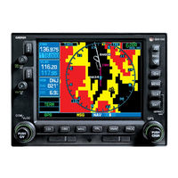
Garmin GPS 500W Pilot's Manual & Reference (236 pages)
Garmin GPS Receiver Pilots Guide and Reference Guide
Table of Contents
Advertisement

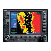
Garmin GPS 500W Installation Manual (216 pages)
500W SERIES
Brand: Garmin
|
Category: Marine GPS System
|
Size: 8 MB
Table of Contents
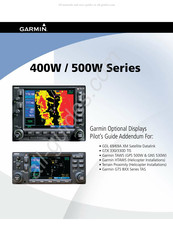
Garmin GPS 500W Pilot's Manual (78 pages)
400W / 500W Series XM Satellite Datalink, TIS, TAWS, HTAWS, TAS
Table of Contents
Advertisement
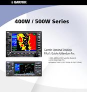

Garmin GPS 500W Pilot's Manual Addendum (50 pages)
400W / 500W Series XM Satellite Datalink, TIS and TAWS
Table of Contents

Garmin GPS 500W Pilot's Manual Addendum (24 pages)
400W Series 500W Series Display Interfaces
Table of Contents


Garmin GPS 500W Instructions Manual (23 pages)
For Continued Airworthiness Bell 206B
Table of Contents


Garmin GPS 500W Supplementary Manual (12 pages)
400W/500W Series