
Related Manuals for Alpine KTX-NS01


Summary of Contents for Alpine KTX-NS01
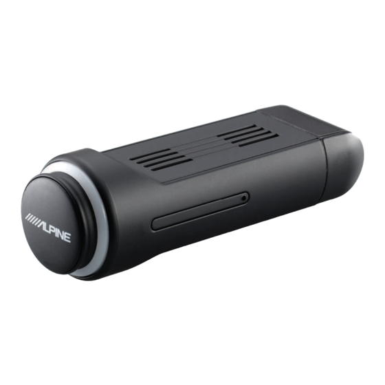
- Page 1 User Manual Navigation software for the Alpine USB Navigation US English March 2023, ver. 1.1...
-
Page 2: Table Of Contents
Table of contents 1 Warnings and safety information ....................5 2 Getting started ..........................6 2.1 Initial set-up ................................... 6 2.2 Screen controls..................................8 2.2.1 Using the buttons and other controls ........................... 8 2.2.2 Using the cursor ..................................8 2.2.3 Using the keyboard ................................9 2.2.4 Using touch gestures ................................ - Page 3 3.7.5 Managing off-road trip logs ............................. 56 3.8 Updating the navigation software and the maps ....................56 Remove the ALPINE Navi Stick safely from your PC, and plug it back into your Alpine infotainment system4 Reference guide ..................58 4.1 Concepts ....................................58 4.1.1 2D/3D GPS reception .................................
- Page 4 4.1.7.4 Hints upon detour ....................................61 4.2 Information menu ................................62 4.2.1 Where Am I ..................................... 63 4.2.2 Trip Monitor ................................... 63 4.3 Settings menu ..................................64 4.3.1 Route preferences ................................66 4.3.1.1 Route Planning Method types ................................66 4.3.1.2 Road types ........................................67 4.3.2 Sound ......................................
-
Page 5: Warnings And Safety Information
1 Warnings and safety information The navigation system helps you find your way to your destination with the built-in GPS receiver. Alpine USB Navigation does not transmit your GPS position; others cannot track you. It is important to look at the display only when it is safe to do so. If you are the driver of the vehicle, we recommend that you plan and review your route before you start your journey. -
Page 6: Getting Started
2 Getting started Alpine USB Navigation is optimized for in-car use. You can use it easily by tapping the screen buttons and the map with your fingertips. Easy map updates Update your maps regularly as road networks are continuously evolving all over the world. About 15% of the roads are changed each year, new ones are built, directions are altered, new speed limits are set, and many other changes are made. - Page 7 Select the language and speaker used for voice guidance messages. Later you can change it in Regional settings (page 67). Tap to continue. If needed, modify the time format and unit settings. Later you can change them in Regional settings (page 71). Tap to continue.
-
Page 8: Screen Controls
You need to confirm selections or changes only if the application needs to be restarted, if it needs to perform a major reconfiguration, or if you are about to lose some of your data or settings. Otherwise, Alpine USB Navigation saves your selections and applies the new settings without confirmation as soon as you use the controls. -
Page 9: Using The Keyboard
The location of the cursor can be used as the destination of the route or a new Alert Point. You can also search for Places around it or add this location to your saved locations. You can also select some of the objects on the map. If you tap the map at the icon of a Place or traffic event, the object is selected, and you can get information about this object or use it as a route point. -
Page 10: Using Touch Gestures
2.2.4 Using touch gestures You usually need to tap the screen only once. However, some useful features can be accessed with other gestures. See the table below. Action Function Tapping and Tap and keep pressing the following buttons to reach extra functions: holding the screen •... - Page 11 Zooming in and Change how much of the map is displayed on the screen. Alpine USB Navigation uses maps that let you examine the locations at various zoom levels, always with optimized content. It always displays street names and other text with the same font size, never upside-down, and you only see the streets and objects that you need.
-
Page 12: Navigation View
2.3 Navigation view The navigation view is the main screen of Alpine USB Navigation that shows the planned route on a map. Alpine USB Navigation works with digital maps which are not simply the computerized versions of traditional paper maps. Similarly to paper road maps, the 2D mode of digital maps shows you streets and roads. - Page 13 3D map view mode. In North up mode, the map faces North. Zoom You can change how much of the map is displayed on the screen. Alpine USB Navigation uses maps that let you zoom in and out on the map. See...
-
Page 14: Streets And Roads
When entering a tunnel, the map is replaced with a generic tunnel image. See page 18. 2.3.1 Streets and roads Alpine USB Navigation shows the streets similarly to paper road maps. Their width and colors correspond to their importance; you can easily tell a freeway from a small street. -
Page 15: Gps Position Markers
2.3.2 GPS position markers When your GPS position is available, Alpine USB Navigation marks your current position. By default, this marker is a blue arrow. The dot near the arrow shows the GPS position as perceived by the GPS receiver. -
Page 16: Turn Preview And Next Street
2.3.4 Turn preview and next street When navigating a route, the top section of the Navigation view shows information about the next route event (maneuver) and the next street or the next town. There is a field in the top left corner displaying the next maneuver. Both the type of the maneuver (turn, traffic circle, exiting freeway, and so on) and its distance from the current position are displayed. -
Page 17: Lane Information And Signposts
When navigating on multi-lane roads, it is important to take the appropriate lane in order to follow the planned route. If lane information is available in the map data, Alpine USB Navigation displays the lanes and their directions using small arrows at the bottom of the map. Highlighted arrows represent the lanes and the direction you need to take. -
Page 18: Junction View
2.3.7 Junction view If you are approaching a freeway exit or a complex intersection and the needed information exists, the map is replaced with a 3D view of the junction. The lanes you need to take are displayed with arrows. At the top of the screen, road signs show you additional information. -
Page 19: Freeway Services
Type Description 3D terrain Alpine USB Navigation displays 3D hills and mountains in the Navigation view, and illustrates them by coloring and shading on the 2D map. Elevated roads Elevated roads are complex intersections and vertically isolated roads (such as overpasses or bridges) displayed in 3D. -
Page 20: Navigation Menu
2.4 Navigation menu Press the navigation hardkey button to open the Navigation menu. You can see the following menu options when you are navigating without a planned route: Button Function Select your destination by entering an address or its coordinate, or by selecting a Place, a Saved Location, or a Saved Route. - Page 21 Delete the next waypoint or the whole route. The following options are also available on many of the menu screens: Button Function Tap the Menu button to return to the main menu. The More button appears on the screen to display additional features. Tap it to open the list of additional features on certain screens.
-
Page 22: Using The Navigation
3 Using the navigation By default, Alpine USB Navigation calculates routes using the road network of the maps provided with the product. You can select the destination and start navigating to it right away (normal navigation) if you need a route for immediate navigation. - Page 23 . You can see the input field at the top of the screen. Right next to it you can see the search area, the town around which the search is carried out. The default search area is the area where you are located. For a local search, skip the next step. (optional) To search in a different area, tap the input field with the search area, and start entering the name of the new search area on the keyboard.
-
Page 24: Selecting An Address
• to see the list of recent destinations with a matching name or address. • to see the list of your saved locations with a matching name. • to see the list of matching addresses. • to see the list of matching Place category names. Scroll the list and select one of the categories. -
Page 25: Entering An Address With States
Select the country or state by performing the following steps: By default, the Alpine USB Navigation proposes the country and state where you are or in case there is no valid GPS position, the country and state of the last known position. If needed, change the country or the state. - Page 26 c. Otherwise, start entering the first few letters of the city on the keyboard. The names that match the string appear in a list. To open this list, tap , and select the city. Enter the street name by performing the following steps: Tap the Street name field.
- Page 27 Tap the selected address to finish the address search. A full screen map appears with the selected point in the middle. If necessary, tap the map somewhere else to modify the destination. The cursor ( ) appears at the new location. Check the settings for road types and change them if necessary.
-
Page 28: Entering An Address Starting With The Street Name
Press the navigation hardkey button to access the Navigation menu. By default, Alpine USB Navigation proposes the country and state where you are. If needed, change the country. Tap In the Select Country screen, you can immediately select a country from the list below the... - Page 29 c. Otherwise, start entering the first few letters of the city on the keyboard. The names that match the string appear in a list. To open this list, tap , and select the city. Enter the street name by performing the following steps: Tap the Street name field.
-
Page 30: Selecting A Town Center
Tap the selected address to finish the address search. A full screen map appears with the selected point in the middle. If necessary, tap the map somewhere else to modify the destination. The cursor ( ) appears at the new location. Check the settings for road types and change them if necessary. -
Page 31: Selecting The Midpoint Of A Street Or An Intersection
Press the navigation hardkey button to access the Navigation menu. Go to and modify the country and state as described earlier (page 25), if necessary. Select a new town or ZIP code by performing the following steps: and start entering the first few letters of the town or the first few numbers of the ZIP code. -
Page 32: Using The Zip Code To Select A Destination
3.1.2.5 Using the ZIP code to select a destination You can also select any kind of destination by entering the ZIP code instead of the city name. To select the ZIP code, perform the following steps: Go to and modify the country and state as described earlier (page 25), if necessary. to open the numeric keypad and start entering the ZIP code. - Page 33 Press the navigation hardkey button to access the Navigation menu. The following Quick search categories appear: • : If a planned route exists, gas stations are searched along the route. • : If a planned route exists, accommodation is searched around the destination.
-
Page 34: Searching By Category
The route is calculated and the map appears showing the entire route, where you can check route information and route alternatives. Tap to modify the route parameters, or tap to start your journey. 3.1.3.2 Searching by category To search for Places by their categories and subcategories, perform the following steps: Press the navigation hardkey button to access the Navigation menu. -
Page 35: Searching By Name
(optional) If you have selected , select the town to search in. Select one of the main Place categories (for example, Accommodation), then browse the subcategories (for example, Hotel or Motel) to find your destination. You can turn the Category View off at any level to list all Places around the selected location or along the route. - Page 36 Press the navigation hardkey button to access the Navigation menu. Select the area around which you would like to search for the Place. By default, the search area is around the current position (or if it is not available, around the last known position). In this case, the result list is ordered by the distance from this position.
-
Page 37: Finding Help Nearby
You can search for the name of a Place in all categories by performing the following steps: . Using the keyboard, start entering the name of the Place or browse in the categories. After entering a few letters, tap to open the list of Places or Place categories with names containing the entered character sequence. -
Page 38: Selecting A Saved Location
• : Medical and emergency services • : Police stations • : Gas stations Tap any of the quick search buttons to get an instant list of those types of Places. (optional) The Places in the list can be ordered by the following criteria: •... -
Page 39: Selecting A History Item
(optional) If needed, tap to enable the editing option so that you can rename the Saved Locations or delete any of them. The route is calculated and the map appears showing the entire route, where you can check route information and route alternatives. Tap to modify the route parameters, or tap to start your journey. -
Page 40: Selecting A Saved Route
Three of the Smart History Items are displayed in the History screen for easy access. You can select one of them as your destination. 3.1.6 Selecting a saved route The routes that you have saved earlier appear in a list. To select a previous route, perform the following steps: Press the navigation hardkey button to access the Navigation menu. -
Page 41: Entering Coordinates
3.1.7 Entering coordinates To select a destination by entering its coordinates, perform the following steps: Press the navigation hardkey button to access the Navigation menu. You can enter the latitude and longitude values in any of the following formats: decimal degrees, degrees and decimal minutes, or degrees, minutes and decimal seconds. -
Page 42: Selecting A Location On The Map
3.1.8 Selecting a location on the map To select a map location, perform the following steps: Locate your destination on the map. Move and scale the map as necessary. Tap the location that you want to select as your destination. The cursor ( ) appears there. - Page 43 There is only one line in the list of route points, the starting point of the route, which is normally the current GPS position. to select the destination. The New Route to... screen appears, where you can select the destination of the route the same way as described in the previous sections.
-
Page 44: Checking Route Information And Alternatives
3.2 Checking Route Information and Alternatives To get a map overview of the planned route and check different parameters of the planned route, perform the following steps: Press the navigation hardkey button to access the Navigation menu. In the Navigation menu, tap The planned route is displayed in its full length on the map with the following additional information: •... -
Page 45: Editing The Route
3.3 Editing the route When navigation has already started, there are several ways to modify the planned route. You have the following options: • Setting a new starting point, see page 45 • Adding an additional destination, see page 46 •... -
Page 46: Adding An Additional Destination
The Change Start to... screen appears. Select the starting point of the route the same way you select a destination. The Multipoint Route screen appears where you can continue adding a destination to your route. to continue. The map returns with a transparent position marker (showing that there is no GPS reception). -
Page 47: Modifying The List Of Destinations
3.3.3 Modifying the list of destinations To edit your route, perform the following steps: Press the navigation hardkey button to access the Navigation menu. In the Navigation menu, tap You have the following options on this screen: • to delete all the destinations, or optimize the waypoints or the route. -
Page 48: Deleting The Planned Route
The route is saved and it is available in in the Navigation menu. By selecting a previously saved route, Alpine USB Navigation recalculates the route using the saved destination and/or the waypoints. 3.3.5 Deleting the planned route You have the following two options to delete the navigated route: •... -
Page 49: Selecting A Route Alternative For An Existing Route
Select one of the route alternatives and tap to return to the previous screen. Alpine USB Navigation recalculates the route. Tap to start your journey. The orange line now shows the new planned route. 3.3.7 Selecting a route alternative for an existing route... -
Page 50: Saving A Location
Select one of the route alternatives and tap to return to the previous screen. Alpine USB Navigation replaces the original route. Tap to start your journey. The orange line now shows the new planned route. 3.4 Saving a location... -
Page 51: Editing A Saved Location
(optional) Using the keyboard, you can change the name offered for the Saved Location. to save the location. To add your home and work address to the saved locations, perform the following steps: Press the navigation hardkey button, and tap on the Navigation view . -
Page 52: Adding An Alert Point
In Saved Locations, Home and Work cannot be renamed. To change your home or Note! work location, tap , and confirm the address change. Adding a location to the list of Saved Locations is described on page 50. 3.5 Adding an Alert Point You can save any map location as an Alert Point, for example a speed camera or a school zone. -
Page 53: Running A Simulation
Select the type of the Alert Point, the direction from which you expect the alert, and (if applicable) the speed limit for this Alert Point. to save the location as a new Alert Point. 3.6 Running a Simulation To run a simulated navigation that demonstrates the planned route, perform the following steps: Press the navigation hardkey button to access the Navigation menu. -
Page 54: Off-Road Navigation
3.7 Off-road navigation When first started, Alpine USB Navigation calculates routes using the road network of the maps provided with the product. If you want to disregard roads during navigation, you can switch to off-road mode, for example when driving in a desert. -
Page 55: Selecting The Destination In Off-Road Mode
3.7.2 Selecting the destination in off-road mode Selecting a destination (waypoint or final destination) is the same as described in the previous sections. The only difference is that route points are linked to form a route with straight lines regardless of the road network and traffic regulations. -
Page 56: Managing Off-Road Trip Logs
Microsoft Windows® operating system (Windows XP Service Pack 2 or later) • Internet connection • USB port To perform the update, follow these steps: Download and install the Toolbox PC tool on your PC. Go to the alpine.naviextras.com website. If you do not have a user account yet, create one. - Page 57 Follow the instructions on the site to download and install the Toolbox PC tool on your PC. Plug in your ALPINE Navi Stick to a USB port on your PC. Download updates with Naviextras Toolbox. Start Naviextras Toolbox on your PC and sign in with your Naviextras user name and password.
-
Page 58: Remove The Alpine Navi Stick Safely From Your Pc, And Plug It Back Into Your Alpine Infotainment System4 Reference Guide
Remove the ALPINE Navi Stick safely from your PC, and plug it back into your Alpine infotainment system4 Reference guide The following sections describe the different concepts and menu screens of Alpine USB Navigation. 4.1 Concepts The following sections describe and explain navigation-related concepts. -
Page 59: Route Calculation And Recalculation
4.1.6 Speed limit warning Maps may contain information about the speed limits of the road segments. Alpine USB Navigation is able to warn you if you exceed the current limit. This information may not be available for your region, or may not be fully correct for all roads on the map. -
Page 60: Intelligent Navigation
The following sections describe these features. 4.1.7.1 Congestion detour on highways Alpine USB Navigation may offer a detour when you slow down on a highway due to a traffic jam. The Potential congestion detour window appears and shows the length and duration of the detour. -
Page 61: Parking Around Destination
4.1.7.3 Parking around destination If you leave the planned route by exiting a freeway, Alpine USB Navigation tries to guess the reason for making a detour. By tapping , you can open a top-down map with the recommended parking Places around the destination. -
Page 62: Information Menu
By tapping one of the Places, Alpine USB Navigation creates a waypoint and navigates you to the selected place. You can ignore them by tapping 4.2 Information menu The Information menu provides various additional functions. It can be found in the Navigation menu. You need an Internet connection via your cell phone to access online services, like parking and weather information. -
Page 63: Where Am I
4.2.1 Where Am I This screen contains information about the current position (or about the last known position if GPS reception is not available). You can access it the following two ways: • By going to the Navigation menu and tapping •... -
Page 64: Settings Menu
4.3 Settings menu You can configure the navigation settings, and modify the behavior of Alpine USB Navigation, by pressing the navigation hardkey button, and tapping Tap the arrows to view the content of other pages. - Page 65 The Settings menu provides the following options: Button Function Select the type of vehicle you are driving, the road types used in route planning, and the route planning method. Adjust the different sound volumes. Enable and set up warnings for speed limit, Alert Points (such as speed cameras), and road signs.
-
Page 66: Route Preferences
Results in a route with fewer turns and no difficult maneuvers. With this option, you can make Alpine USB Navigation take, for example, the freeway instead of a series of smaller roads or streets. -
Page 67: Road Types
Per-use toll roads are pay roads where there is a per-use charge in the routes by default. If you disable toll roads, Alpine USB Navigation plans the best toll-free route. Alpine USB Navigation includes ferries in a planned route by default. However, a map does not necessarily contain information about the accessibility of temporary ferries. -
Page 68: Warnings
You can enable and modify the following settings: Button Description Alpine USB Navigation is able to warn you if you exceed the current speed limit. This information may not be available in your region, or may not be fully correct for all roads on the map. -
Page 69: Navigation View
Tap it to receive a warning when approaching Alert Points like school zones or railroad crossings. You must make sure that using this feature is legal in the country where you intend to use it. You can set the warning type for the different Alert Point categories (alert types) individually. - Page 70 You can modify the following settings: Button Function Adjust the basic zoom and tilt levels to your needs. Three levels are available. Turn Smart Zoom on or off. It enables the dynamic change of the zoom level depending on the situation. For a detailed description of the feature, see page <page 59>.
-
Page 71: Regional
A top-down overview of the tunnel and the remaining distance are also displayed. In certain situations, Alpine USB Navigation offers a detour when there is a traffic jam on a highway. See page 60. -
Page 72: User Profiles
Here you can manually set the time zone and the daylight saving time. 4.3.6 User Profiles If more drivers use Alpine USB Navigationfor navigating, their settings can be remembered by using one of the user profiles. You can create a new profile by tapping enter a name, and select a car model. -
Page 73: Copyright Note
5 Copyright note The product and the information contained herein are subject to change without prior notification. This manual may not, in whole or in part, be reproduced or transmitted in any form either electronically or mechanically, including photocopying and recording, without the express written consent of NNG. ©...
Need help?
Do you have a question about the KTX-NS01 and is the answer not in the manual?
Questions and answers