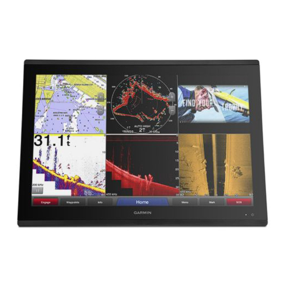
Garmin GPSMAP 8600 Series Owner's Manual
Hide thumbs
Also See for GPSMAP 8600 Series:
- Owner's manual (256 pages) ,
- Field service manual (12 pages) ,
- Installation instructions manual (9 pages)
Table of Contents
Advertisement
Quick Links
Advertisement
Table of Contents

Related Manuals for Garmin GPSMAP 8600 Series


Summary of Contents for Garmin GPSMAP 8600 Series
- Page 1 GPSMAP 8400/8600 SERIES ® Owner’s Manual...
- Page 2 © 2016–2018 Garmin Ltd. or its subsidiaries All rights reserved. Under the copyright laws, this manual may not be copied, in whole or in part, without the written consent of Garmin. Garmin reserves the right to change or improve its products and to make changes in the content of this manual without obligation to notify any person or organization of such changes or improvements.
-
Page 3: Device Overview
There is also contact Opens the Presets menu for the page or function information to Garmin support should you have any questions. Locking and Unlocking the Touchscreen Device Overview You can lock the touchscreen to prevent inadvertent screen touches. -
Page 4: Accessing Owner's Manuals On The Chartplotter
Garmin Marine Network. To remove the cover, hold the edge, and pull forward. The chartplotter and card reader support up to a 32 GB SD memory card, formatted to FAT32. -
Page 5: Customizing The Layout Of A Smartmode Or Combination Page
Settings button is accessible only from the home screen. on the right. When multiple displays are installed on the Garmin Marine • To change how the screens are split, drag the arrows to a Network, you can group them together into a station. A station new location. -
Page 6: Adjusting The Backlight
Select a preset. Select an option: • To rename the preset, select Rename, enter a name, and select Done. • To edit the preset, select Edit, and update the preset. • To delete the preset, select Delete. • To reset all presets to factory settings, select Reset All. Setting the Vessel Type You can select your boat type to configure the chartplotter settings and to use features customized for your boat type. -
Page 7: Activecaptain Roles
Garmin device, using on the information submitted by users is at your own risk. the name and password you entered in the Garmin device. The ActiveCaptain app provides a connection to your GPSMAP Enabling Smart Notifications device, charts, maps, and the community for a connected boating experience. -
Page 8: Updating Software With The Activecaptain App
ActiveCaptain app to download only the areas of the chart you need. Changing the Wi‑Fi Host If you are downloading an entire chart, you can use the Garmin You can change which chartplotter is serving as the Wi‑Fi host. Express ™... -
Page 9: Wireless Wind Sensor
On the chartplotter, select Settings > Communications > compatible devices for better coverage on larger vessels. Wireless Devices > Wireless Remotes > GPSMAP® Bring the a Garmin Nautix device within range (3 m) of the Remote > Backlight. chartplotter. Follow the on-screen instructions. -
Page 10: Navigation Chart And Fishing Chart
Navigation Chart and Fishing Chart A list of options appears along the top of the chart. The options that appear vary based on the location or object you NOTE: The Fishing chart is available with premium charts, in selected. some areas. If necessary, select . -
Page 11: Viewing Tide Station Information
The Auto Guidance feature is based on electronic chart also enable animated icons in the chart settings (Showing Tides information. That data does not ensure obstacle and bottom and Current Indicators, page clearance. Carefully compare the course to all visual sightings, An indicator for a tide station appears on the chart as a vertical and avoid any land, shallow water, or other obstacles that may bar graph with an arrow. -
Page 12: Automatic Identification System
• To view a perspective photo, select . The photo was speed information, or if the vessel is not moving, a projected taken from the location of the camera, pointed in the course line does not appear. Changes in the speed, course over direction of the cone. -
Page 13: Turning Off Ais Reception
Water: Shows and hides depth items (Water Layer Settings, page 12). AIS Distress Signal Device Targeting Symbols Quickdraw: Shows and hides Garmin Quickdraw data (Garmin Symbol Description Quickdraw Contours Settings, page 14). AIS distress signal device transmission. Select to see more... - Page 14 Compass Rose: Shows a compass rose around your boat, Proj. Heading: Sets the projected heading time for AIS- indicating compass direction oriented to the heading of the activated and MARPA-tagged vessels. boat. Enabling this option disables the Wind Rose option. Collision Alarm: Sets the safe-zone collision alarm (Setting the Vessel Icon: Sets the icon that represents your present location...
-
Page 15: Supported Maps
Adding a Label to a Garmin Quickdraw Sonar Cone: Shows a cone that indicates the area covered by Contours Map the transducer. You can add labels to a Garmin Quickdraw Contours map to Fish Symbols: Shows suspended targets. mark hazards or points of interest. Supported Maps From the Navigation chart, select a location. -
Page 16: Connecting To The Garmin Quickdraw Community With Garmin Connect
From a chart, select Menu > Quickdraw Contours > Settings. Started. Display: Displays Garmin Quickdraw Contours. The User If you do not have a Garmin Connect account, create one. Contours option shows your own Garmin Quickdraw Sign in to your Garmin Connect account. -
Page 17: Navigation With A Chartplotter
You can create up to ten depth ranges. page 18). For inland fishing, a maximum of five depth ranges can help When you are using a compatible Garmin autopilot reduce map clutter. connected to the chartplotter using NMEA 2000 , the ®... -
Page 18: Stopping Navigation
Setting and Following a Direct Course Using Go To Projecting a Waypoint You can create a new waypoint by projecting the distance and WARNING bearing from a different location. This can be helpful when When using Go To, a direct course and a corrected course may creating sail racing start and finish lines. -
Page 19: Deleting All Waypoints
Select Navigate To. Viewing a List of Routes and Auto Guidance Paths Select Info > User Data > Routes & Auto Guidance Paths. Select an option: If necessary, select Filter to see routes only or Auto • To navigate directly to the location, select Go To. Guidance paths only. -
Page 20: Auto Guidance Path Configurations
If necessary, select Done. Select Start Navigation. A magenta line appears. In the center of the magenta line is Follow the magenta line, steering to avoid land, shallow a thinner purple line that represents the corrected course water, and other obstacles. from your present location to the destination. -
Page 21: Showing Tracks
Preferred Depth: Sets the minimum water depth, based on If you selected Nearest or Farthest in step 8, review the chart depth data, that your boat can safely travel over. placement of the Auto Guidance line, and determine whether the line safely avoids known obstacles and the turns NOTE: The minimum water depth for the premium charts enable efficient travel. -
Page 22: Deleting All Saved Waypoints, Routes, And Tracks
Follow the line along each leg in the route, steering to avoid Creating a Boundary land, shallow water, and other obstacles. Select Info > User Data > Boundaries > New. Select a boundary shape. Deleting a Saved Track Select Info > User Data > Tracks > Saved Tracks. Follow the on-screen instructions. -
Page 23: Sailing Features
Sailing Features Start the racing timer (Starting the Race Timer, page 21). Starting the Race Timer Setting the Vessel Type The race timer is added to the Sail Racing combination screen You can select your boat type to configure the chartplotter by default. -
Page 24: Sailboat Autopilot Operation
to view the depth of the water below the keel or the true depth of From the autopilot screen, select Menu > Autopilot Setup > the water, depending on your needs. Wind Hold Type. If you want to know the water depth below the keel or the lowest Select Apparent or True. -
Page 25: Sonar Fishfinder
NOTE: To receive Garmin ClearVü scanning sonar, you need a compatible chartplotter or fishfinder and a compatible without an xsv or xs in their names require a Garmin sounder module and transducer to display sonar information. transducer. For information about compatible transducers, go to www.garmin.com/transducers. -
Page 26: Sidevü Sonar View
Measuring Distance on the Sonar Screen You can measure the distance between two points on the SideVü sonar view. From the SideVü sonar view, select . Select a location on the screen. Select Measure. A push pin appears on the screen at the selected location. Select another location. -
Page 27: Realvü 3D Historical Sonar View
Fish Bottom RealVü 3D Historical Sonar View This sonar view provides a three-dimensional view of what is behind your boat as you are moving and shows the entire water column in 3D, from the bottom to the top of the water. This view is used for finding fish. -
Page 28: Viewing Sonar History
If you want to see all return information, you can increase the gain or brightness to see more sonar view. For example, if you have two sources for Garmin ClearVü, you can select the source to use from the Garmin information on the screen. -
Page 29: Traditional, Garmin Clearvü, And Sidevü Sonar Setup
Select a sonar recording from your device list. You can adjust the range of the depth scale traditional and Right-click the sonar recording in the lower pane. Garmin ClearVü sonar views and the range of the width scale Select Playback. for the SideVü sonar view. - Page 30 Traditional, Garmin ClearVü, and SideVü Transducer Installation Settings From a Traditional, Garmin ClearVü, or SideVü sonar view, select Menu > Sonar Setup > Installation. Transmit Rate: Sets the length of time between sonar pings.
-
Page 31: Panoptix Sonar Setup
can also reduce the strength of the returns. This option is For more information on frequencies, see (Sonar available on the Traditional sonar view only. Frequencies, page 29). Filter Width: Defines the edges of the target. A shorter filter Creating a Frequency Preset more clearly defines the edges of the targets but may allow NOTE: Not available with all transducers. - Page 32 Adjusting the RealVü Viewing Angle and Zoom Level Setting the LiveVü and FrontVü Transducer Transmit Angle This feature is available only with RealVü capable Panoptix You can change the viewing angle of the RealVü sonar views. transducers, such as the PS30, PS31, and PS60. You can also zoom in and out of the view.
-
Page 33: Panoptix Transducer Installation Settings
Measure the horizontal distance from the transducer to the When you connect your compatible chartplotter to an optional bow. Garmin marine radar, such as a GMR Fantom 6 radar or a ™ ™ GMR 24 xHD, you can view more information about your surroundings. -
Page 34: Radar Interpretation
From a radar screen, select Menu > Radar Setup > Installation > No Transmit Zone. Radar Overlay When you connect your chartplotter to an optional Garmin The no-transmit zone is indicated by a shaded area on the marine radar, you can use overlay radar information on the radar screen. -
Page 35: Motionscope ™ Doppler Radar Technology
• Select the shortest effective range, given your reason for using radar and the present environmental conditions. MotionScope Doppler Radar Technology ™ The GMR Fantom radar uses the Doppler effect to detect and highlight moving targets to help you avoid potential collisions, find flocks of birds, and track weather formations. -
Page 36: Turning On Echo Trails
From a Radar screen, select Menu > Layers > Other Vessels > List > Show. Select the type of threats to include in the list. Showing AIS Vessels on the Radar Screen AIS requires the use of an external AIS device and active transponder signals from other vessels. -
Page 37: Radar Options Menu
From a Radar screen or the Radar overlay, select Menu > the appearance of clutter caused by nearby waves, but it can Gain. also reduce or eliminate the appearance of nearby targets. Select Up to raise the gain, until light speckles appear across NOTE: Depending upon the radar in use, the sea clutter setting the Radar screen. -
Page 38: Selecting A Different Radar Source
32). steering functions and patterns. Front-of-Boat Offset When the chartplotter is connected to a compatible Garmin The front-of-boat offset compensates for the physical location of autopilot system, you can engage and control the autopilot from the radar scanner on a boat, if the radar scanner does not align the chartplotter. -
Page 39: Autopilot Screen
Opening the Autopilot Screen Autopilot Overlay Bar Before you can open the autopilot screen, you must have a compatible Garmin autopilot installed and configured. Select OneHelm™, A/V, Gauges > Autopilot. Actual heading Autopilot Screen Intended heading (heading the autopilot is steering toward) -
Page 40: Enabling The Autopilot Controls On A Garmin Watch
Enabling the Autopilot Controls on a Garmin position reports. Watch If you have a Garmin NMEA 2000 VHF radio connected to your chartplotter, these features are also enabled. You can control the Garmin autopilot with a compatible Garmin • The chartplotter allows you to quickly set up and send watch. -
Page 41: Turning On Dsc
Chartplotter For example, if you select 4 Hours, all trail points that are When your chartplotter is connected to a Garmin NMEA 2000 less than four hours old appear for all tracked vessels. compatible radio and you mark an SOS or man-overboard location, the radio shows the Distress Call page so you can quickly initiate a distress call. -
Page 42: Individual Routine Calls
Customizing the Gauges You can change the layout of the gauge pages, how the gauges When you connect the chartplotter to a Garmin VHF radio, you pages are displayed, and the data in each gauge. can use the chartplotter interface to set up an individual routine call. -
Page 43: Engine Gauges
Enabling Some Engine Gauge Status Alarms Engine overheating. Stop the engine immediately. Check the cooling water inlet, and From the engine gauges screen, select Menu > Installation clear it if it is blocked. > Status Alarms > Custom. Select one or more engine gauge alarms to turn on or off. NOTICE Do not continue to run the engine if this indicator is on. -
Page 44: Setting The Fuel Alarm
Tanks: Displays detailed tank level sensor information. • To show true or apparent wind angle, select Needle, and select an option. Trim: Displays the trim angle of the engines. • To show true or apparent wind speed, select Wind Speed, Active Alarms: Displays any active alarms for the engines. -
Page 45: Tide, Current, And Celestial Information
If necessary, select Name, enter a name for this device, and Preset messages are messages that you created at select Done. explore.garmin.com. Preset messages have predefined text and If necessary, select Change Icon, select a new symbol, and recipients. select Done. -
Page 46: Warning Manager
Select an option: Icon Description • To view information for a different date, select Change Saves or deletes a channel as a preset Date > Manual, and enter a date. Repeats all songs • To view information for today, select Change Date > Current. -
Page 47: Adjusting The Volume
To leave the FUSION PartyBus network, you can select Source Presets > Leave PartyBus. You can save your favorite AM stations and FM stations as presets for easy access. Adjusting the Volume You can save your favorite SiriusXM channels if you are connected to an optional SiriusXM tuner and antenna. -
Page 48: Siriusxm Satellite Radio
Select a category from the list. • If the media device is a GXM antenna, select Media > ™ Category. Select a station from the list. Saving a SiriusXM Channel to the Presets List DAB Presets You can save your favorite channels to the presets list. You can save your favorite DAB stations as presets for easy Select Media. -
Page 49: Siriusxm Weather
For example, radar is broadcast at five-minute intervals. The Forecast chart shows city forecasts, marine forecasts, When the Garmin receiver is turned on, or when a different warnings, hurricane warnings, METARS, county warnings, weather feature is selected, the receiver must receive new data weather fronts and pressure centers, surface pressure, and before it can be shown. -
Page 50: Viewing Sea Conditions
Select an option: Wind Barb Wind Speed Wind Barb Wind Speed • To view the weather forecast for the next 48 hours, in 12- Calm 20 knots hour increments, select multiple times. 5 knots 50 knots • To view the weather forecast for the previous 48 hours, in 12-hour increments, select multiple times. -
Page 51: Viewing Video
The camera restores the video settings saved for that preset. source. TIP: You can also save and activate presets using the video Compatible devices include video devices connected to the menu. ports on the chartplotter or to the Garmin Marine Network, as Viewing Video... -
Page 52: Configuring The Video Appearance
• To allow the chartplotter to automatically select the source You may need to associate the camera with a video source. format, select Standard > Auto. From the video screen, select Menu > Source. Garmin VIRB Action Cameras ® Select the camera. -
Page 53: Controlling The Virb Action Camera With The Chartplotter
access point using the name and password on the camera • To pan and tilt the VIRB 360, drag your finger on the screen. screen. On your mobile device, start the GarminVIRB app. • To return the VIRB 360 view to the home position, select The app searches for your camera. -
Page 54: Device Configuration
Sounds and Display: Adjusts the display and audio settings. cannot view HDCP content on the duplicated screen. The Garmin GPSMAP HDMI accessory cable is 4.5 m (15 ft) GPS: Provides information about the GPS satellites and long. If you need a longer cable, you should use an active HDMI settings. -
Page 55: Viewing E-Label Regulatory And Compliance Information
Startup Image: Sets the image that appears when you turn on supplemental map information (if applicable), the software the device. version for an optional Garmin radar (if applicable), and the unit ID number. You may need this information to update the system Audio Settings software or to purchase additional map data information. -
Page 56: Communications Settings
Route Labels: Sets the type of labels shown with route turns on Select Navigate To > Auto Guidance. the map. Review the placement of the Auto Guidance line, and Turn Transition: Adjusts how the chartplotter transitions to the determine whether the line safely avoids known obstacles next turn or leg or the route. -
Page 57: Setting Alarms
AIS receivers, select NMEA High Speed. than the specified value. • To support the input or output of Garmin proprietary data Deep Water: Sets an alarm to sound when the depth is greater for interfacing with Garmin software, select Garmin. -
Page 58: My Vessel Settings
Select OK, and safely increase the boat speed. If the message appears again, stop the boat, and ensure the speed-sensor wheel is not stuck. If the wheel turns freely, check the cable connections. If you continue to get the message, contact Garmin product support. Device Configuration... -
Page 59: Sharing And Managing User Data
You can share data between compatible devices. • Shallow Water • You can share data across the Garmin Marine Network. • Deep Water (Not available in the GPSMAP 8400/8600 • You can share and manage user data using a memory card. -
Page 60: Updating Built-In Maps With A Memory Card And Garmin Express
To transfer data with Garmin devices again, select the ADM file On the chartplotter, select Settings > System > System type. Information > Update Built-In Map. The updated chart appears on your chartplotter. Copying User Data from a Memory Card... -
Page 61: Software Update
HDMI IN port. To control the Next > Finish. computer using the chartplotter touchscreen, you must connect A Garmin folder containing the software update is created on the the computer to the USB port. memory card. The software update can take several minutes to The Garmin GPSMAP HDMI accessory cable is 4.5 m (15 ft) -
Page 62: Pairing The Grid Device With The Chartplotter From The Chartplotter
Before you can pair the GRID device with the chartplotter, you into a card reader that is attached to a computer. must connect it to the Garmin Marine Network. From Windows Explorer, open the Garmin\scrn folder on the Select Settings > System > Station Information > GRID™ memory card. -
Page 63: Contacting Garmin Support
Max. power usage at 40.1 W • If the device is receiving enough power but does not turn on, 10 Vdc contact Garmin product support. Typical current draw at 1.5 A 12 Vdc My device is not creating waypoints in the correct Max. -
Page 64: Nmea 2000 Pgn Information
Input voltage From 10 to 35 Vdc Transmit power CHIRP: 1000 W Fuse 15 A (RMS) Garmin ClearVü and SideVü Max. power usage 40 W CHIRP: 500 W Typical current draw at 2.8 A Depth 5,000 ft. at 1 kW... - Page 65 Description Description 127258 Magnetic variance 130313 Humidity 127488 Engine parameters: Rapid update 130314 Actual pressure 127489 Engine parameters: Dynamic 130316 Temperature: Extended range 127493 Transmission parameters: Dynamic 130576 Trim tab status 127505 Fluid level 130577 Direction data 127508 Battery status NMEA 0183 Information 128259 Speed: Water referenced...
- Page 66 Sentence Description 65252 Shutdown 65253 Engine hours and revolutions 65262 Engine temperature 1 65263 Engine fluid level or pressure 1 65270 Inlet or exhaust conditions 1 65271 Vehicle electrical power 65279 Water in fuel indicator 65272 Transmission fluids 1 65248 Vehicle distance 65266 Fuel economy (liquid)
- Page 68 December 2018 190-01978-00_0H...
Need help?
Do you have a question about the GPSMAP 8600 Series and is the answer not in the manual?
Questions and answers