Table of Contents
Advertisement
Quick Links
Advertisement
Table of Contents

Subscribe to Our Youtube Channel
Related Manuals for Garmin GPSMAP 86


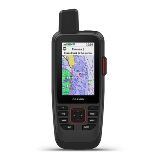
Summary of Contents for Garmin GPSMAP 86
- Page 1 GPSMAP ® Owner’s Manual...
- Page 2 © 2019 Garmin Ltd. or its subsidiaries All rights reserved. Under the copyright laws, this manual may not be copied, in whole or in part, without the written consent of Garmin. Garmin reserves the right to change or improve its products and to make changes in the content of this manual without obligation to notify any person or organization of such changes or improvements. Go to www.garmin.com...
-
Page 3: Table Of Contents
Message.......... 8 Viewing Connect IQ Widgets.... 16 Canceling an SOS Request....9 Controlling and Viewing Compatible Marine Devices........16 Testing the Device......9 Garmin Explore........17 Syncing inReach Data.......9 Navigation........17 Contacts.......... 9 Navigating to a Destination....17 Navigating with the Map....17 Adding a Contact........ - Page 4 Navigating with the Compass..17 Requesting an inReach Weather Forecast..........23 Stopping Navigation......17 Updating an inReach Weather Waypoints..........17 Forecast..........23 Saving Your Current Location as a Deleting an inReach Weather Waypoint..........17 Forecast..........23 Saving a Location on the Map as a Viewing an Active Weather Forecast...24 Waypoint..........
- Page 5 Removing Your Device Registration Device Information......40 From Geocaching.com..... 30 Product Updates........40 Setting a Proximity Alarm....30 Setting Up Garmin Express....40 Editing or Deleting a Proximity Getting More Information..... 40 Alarm..........31 Battery Information.......41 Sending and Receiving Data Maximizing Battery Life....
-
Page 7: Introduction
Introduction WARNING See the Important Safety and Product Information guide in the product box for product warnings and other important information. GPSMAP 86s/sc Device Overview Internal and GNSS antenna Power button Buttons Micro-USB port (under weather cap) Flashlight microSD card slot (under weather cap) ®... -
Page 8: Gpsmap 86I/Sci Device Overview
GPSMAP 86i/sci Device Overview Internal Iridium ® and GNSS antenna Power button SOS button Keypad Micro-USB port (under weather cap) Flashlight microSD card slot (under weather cap) Mounting spine Introduction... -
Page 9: Buttons
Buttons Select to open the search menu. FIND Hold to mark your current location as a man overboard (MOB) location and activate naviga tion. MARK Select to save your current location as a waypoint. Select to cancel or return to the previous menu or page. QUIT Select to scroll through the main pages. -
Page 10: Adjusting The Backlight
Do not charge the device using the USB port in wet conditions. For all-weather charging, use the optional spine mount accessory (buy.garmin.com). NOTE: The device does not charge when it is outside the approved temperature range... -
Page 11: Activating The Device
SMS phone number, an email address, or another device that uses inReach technology. Each message you send includes your location details where allowed. Sending a Preset Message Preset messages are messages that you created at explore.garmin.com. Preset messages have predefined text and recipients. 1 From the Messages page, select Send Preset. -
Page 12: Sending A Text Message
1 From the Messages page, select New Message. 2 Select an option: • To start with a pre-written message, select Send Quick Text. NOTE: You can add and edit quick text messages on the Garmin Explore ™ website. • To write a custom message, select Type Message. -
Page 13: Including Location Coordinates In A Message
Tracking You can use the tracking feature on your GPSMAP 86i/sci device to record track points and transmit them over the Iridium satellite network at the specified send interval. Track points appear on the Garmin Explore website and the MapShare tracking page. -
Page 14: Sos
Garmin IERCC, and they notify the appropriate emergency responders of your situation. You can communicate with the Garmin IERCC during your emergency while you wait for help to arrive. You should only use the SOS function in a real emergency situation. -
Page 15: Canceling An Sos Request
Syncing inReach Data You can sync data from your Garmin Explore account to your device using the Garmin Explore app. After you make edits to your data, such as contacts, preset messages, or quick text messages, you must sync them to your device using the mobile app. -
Page 16: Opening The Main Menu
Opening the Main Menu The main menu gives you access to tools and setup screens for waypoints, activities, routes, and more (Main Menu Tools, page Setup Menu, page 33). From any page, select MENU twice. represents your location on the map. As you travel, moves and displays your path. -
Page 17: Advanced Map Settings
Advanced Map Settings From the map, select MENU, and select Map Setup > Advanced Setup. Auto Zoom: Automatically selects the appropriate zoom level for optimal use on your map. When Off is selected, you must zoom in or out manually. Detail: Selects the amount of detail shown on the map. -
Page 18: Navigating With Sight 'N Go
Navigating with Sight 'N Go You can point the device at an object in the distance, lock in the direction, and navigate to the object. 1 Select Sight 'N Go. 2 Point the device at an object. 3 Select Lock Direction > Set Course. 4 Navigate using the compass. -
Page 19: Trip Computer Settings
Trip Computer Settings From the trip computer, select MENU. Reset: Resets all the trip computer values to zero. For accurate information, reset the trip information before beginning a trip. Change Data Fields: Customizes the trip computer data fields. Change Dashboard: Changes the theme and information displayed on the dashboard. NOTE: Your customized settings are remembered by the dashboard. -
Page 20: Calibrating The Barometric Altimeter
EPO Downloads: Allows you to download an extended prediction orbit file to quickly locate GPS satellites and reduce the time it takes to get an initial GPS fix using the Garmin Connect app or when connected to a Wi‑Fi ®... -
Page 21: Connected Feature Requirements
Select Setup > Bluetooth > Notifications > Hide. Managing Notifications You can use your compatible smartphone to manage notifications that appear on your GPSMAP 86 device. Select an option: • If you are using an iPhone device, go to the iOS notifications settings to select the items to show on the ®... -
Page 22: Connecting To A Wireless Network
Apps: Add interactive features to your device, such as new outdoor and fitness activity types. Downloading Connect IQ Features Before you can download features from the Connect IQ app, you must pair your GPSMAP 86 device with your smartphone (Pairing a Smartphone with Your Device, page 15). -
Page 23: Garmin Explore
Garmin Explore The Garmin Explore website and mobile app allow you to plan trips and use cloud storage for your waypoints, routes, and tracks. They offer advanced planning both online and offline, allowing you to share and sync data with your compatible Garmin device. You can use the mobile app to download maps for offline access, and then navigate anywhere without using your cellular service. -
Page 24: Saving A Location On The Map As A Waypoint
Saving a Location on the Map as a Waypoint You can save a location on the map as a waypoint. 1 From the map, move the cursor to a location. An information bar appears at the top of the screen. 2 Select ENTER. -
Page 25: Projecting A Waypoint From A Saved Waypoint
Projecting a Waypoint from a Saved Waypoint You can save a new waypoint by projecting the distance and bearing from a saved waypoint to a new location. 1 Select Waypoint Manager. 2 Select a waypoint. 3 Select MENU > Project Waypoint. 4 Enter the bearing, and select Done. -
Page 26: Routes
Routes A route is a sequence of waypoints or locations that leads you to your final destination. Creating a Route 1 Select Route Planner > Create Route > Select First Point. 2 Select a category. 3 Select the first point in the route. 4 Select Use. -
Page 27: Editing The Name Of A Route
(File Types, page 43). The FIT option records your activity with fitness information that is tailored for the Garmin Connect application and can be used for navigation. The FIT and GPX option records your activity as both a traditional track that can be viewed on the map and used for navigation, and as an activity with fitness information. -
Page 28: Viewing The Current Activity
3 Select MENU > Copy Reversed. Creating a Track from a Saved Activity You can create a track from a saved activity. This allows you to share your track wirelessly with other compatible Garmin devices. 1 Select Recorded Activities. 2 Select an activity. -
Page 29: Weather
Weather Active Weather: While your GPSMAP 86 device is connected to your smartphone or to a Wi‑Fi network and has an active internet connection, it can receive detailed weather information from the internet. This feature provides hourly and daily forecasts and live graphical weather maps. -
Page 30: Viewing An Active Weather Forecast
Viewing an Active Weather Forecast While your GPSMAP 86 device is connected to your smartphone or to a Wi‑Fi network and has an active internet connection, it can receive detailed weather information from the internet. 1 Select Active Weather. The device automatically downloads a weather forecast for your current location. -
Page 31: Data Use And History
Data Use and History Viewing Plan Details 1 Select inReach Utilities. 2 Select Plan Details. Viewing Data Use You can view the number of messages, preset messages, and track points sent during the current billing cycle. The data use counter resets automatically at the beginning of each billing cycle. 1 Select inReach Utilities. -
Page 32: Main Menu Tools
VIRB Remote: Provides camera controls when you have a VIRB ® device paired with your GPSMAP 86 device (Using the VIRB Remote, page 31). Stopwatch: Allows you to use a timer, mark a lap, and time laps. -
Page 33: Birdseye Imagery
1 Connect to a wireless network (Connecting to a Wireless Network, page 16) or to the Garmin Connect app (Pairing a Smartphone with Your Device, page 15). 2 Select Setup > Geocaching > Register Device. -
Page 34: Downloading Geocaches Using A Computer
Downloading Geocaches Using a Computer You can load geocaches manually onto your device using a computer (Transferring Files to Your Device, page 44). You can place the geocache files into a GPX file and import them into the GPX folder on the device. With a premium membership to geocaching.com, you can use the "pocket query"... -
Page 35: Filtering The Geocache List
Filtering the Geocache List You can filter your geocache list based on certain factors, such as the level of difficulty. 1 Select Geocaching > MENU > Filter. 2 Select one or more options to filter: • To filter by a geocache category, such as puzzle or event, select Type. •... -
Page 36: Logging The Attempt
A chirp is a small Garmin accessory that is programmed and left in a geocache. You can use your device to find a chirp in a geocache. Enabling chirp Searching 1 Select Setup > Geocaching. 2 Select chirp™ Searching > On. -
Page 37: Editing Or Deleting A Proximity Alarm
Sending and Receiving Data Wirelessly Before you can share data wirelessly, you must be within 3 m (10 ft.) of a compatible Garmin device. Your device can send and receive data wirelessly when connected with a compatible Garmin device using ANT+ technology. -
Page 38: Using The Flashlight
Single Color: Allows you to select whether the satellite page is displayed in multicolor or single color. Set Location On Map: Allows you to mark your current location on the map. You can use this location to create routes or search for saved locations. AutoLocate Position: Calculates your GPS position using the Garmin AutoLocate ® feature. -
Page 39: Setup Menu
Setup Menu Select MENU twice, and select Setup. NOTE: Some settings may not be available for all device models. System: Allows you to customize system settings (System Settings, page 33). Display: Adjusts the backlight and display settings (Display Settings, page 34). -
Page 40: Satellite Settings
Garmin Spanner: Allows you to use the device USB port with most NMEA 0183-compliant mapping programs by creating a virtual serial port. Garmin Serial: Sets the device to use a Garmin proprietary format to exchange waypoint, route, and track data with a computer. -
Page 41: Bluetooth Settings
Bluetooth Settings Select Setup > Bluetooth. Status: Enables Bluetooth wireless technology, and shows current connection status. Notifications: Shows or hides smartphone notifications. Forget Phone: Removes the connected device from the list of paired devices. This option is available only after a device is paired. -
Page 42: Geocaching Settings
Wireless Sensors Your device can be used with wireless ANT+ or Bluetooth sensors. For more information about compatibility and purchasing optional sensors, go to buy.garmin.com. Pairing Your Wireless Sensors Before you can pair, you must put on the heart rate monitor or install the sensor. -
Page 43: Marine Settings
Marine Settings Select Setup > Marine. Marine Chart Mode: Sets the type of chart the device uses when displaying marine data. Nautical displays various map features in different colors so the marine POIs are more readable and so the map reflects the drawing scheme of paper charts. -
Page 44: Changing The Page Sequence
Changing the Page Sequence 1 Select Setup > Menus > Page Sequence > Edit Page Sequence. 2 Select a page. 3 Select an option: • To move the page up or down in the list, select Move. • To add a new page to the page sequence, select Insert, and select a category. •... -
Page 45: Changing The Units Of Measure
Changing the Units of Measure 1 Select Setup > Units. 2 Select an option: • To change the unit of measure for speed and distance, select Speed/Distance. • To change the unit of measure for vertical speed, select Vertical Speed. •... -
Page 46: Resetting Data And Settings
You can find more information about this product on the Garmin website. • Go to support.garmin.com for additional manuals, articles, and software updates. • Go to buy.garmin.com, or contact your Garmin dealer for information about optional accessories and replacement parts. Device Information... -
Page 47: Battery Information
Battery Information The actual battery life depends on your device settings, such as the tracking and message checking intervals. Battery Life Mode Up to 200 hr. Expedition mode with 30-minute tracking interval Up to 35 hr. Default mode with 10-minute tracking interval with auto recording Up to 1 yr. -
Page 48: Attaching The Carabiner Clip
Attaching the Carabiner Clip 1 Position the carabiner clip in the slots on the mounting spine of the device. 2 Slide the carabiner clip up until it locks in place. Removing the Carabiner Clip Lift up on the bottom of the carabiner clip, and slide the carabiner clip off the mounting spine. Attaching a Lanyard 1 Insert the loop of the lanyard through the slot in the device. -
Page 49: File Types
(Downloading Geocaches Using a Computer, page 28). • JPEG photo files. • GPI custom POI files from the Garmin POI Loader. Go to www.garmin.com/products/poiloader. • FIT files for exporting to Garmin Connect. Installing a Memory Card You can install a microSD memory card for additional storage or pre-loaded maps. The device supports memory cards up to 32 GB. -
Page 50: Transferring Files To Your Device
If you do not know the purpose of a file, do not delete it. Your device memory contains important system files that should not be deleted. 1 Open the Garmin drive or volume. 2 If necessary, open a folder or volume. -
Page 51: Specifications
FCC or regional compliance markings, as well as applicable product and licensing information. 1 Select Setup. 2 Select About. The device withstands incidental exposure to water of up to 1 m for up to 30 min. For more information, go to www.garmin.com/waterrating. Device Information... -
Page 52: Appendix
Appendix Data Fields Some data fields require you to be navigating or require wireless accessories to display data. 24 hr. Max. Temperature: The maximum temperature recorded in the last 24 hours from a compatible temperature sensor. 24 hr. Min. Temperature: The minimum temperature recorded in the last 24 hours from a compatible temperature sensor. - Page 53 Elevation - Minimum: The lowest elevation reached since the last reset. ETA at Destination: The estimated time of day when you will reach the final destination (adjusted to the local time of the destination). You must be navigating for this data to appear. ETA at Next: The estimated time of day when you will reach the next waypoint on the route (adjusted to the local time of the waypoint).
-
Page 54: Getting More Information
• Go to support.garmin.com for additional manuals, articles, and software updates. • Go to buy.garmin.com, or contact your Garmin dealer for information about optional accessories and replacement parts. Optional Accessories Optional accessories, such as mounts, maps, fitness accessories, and replacement parts, are available at http://buy.garmin.com... -
Page 55: Tempe
Tips for Pairing ANT+ Accessories with Your Garmin Device • Verify that the ANT+ accessory is compatible with your Garmin device. • Before you pair the ANT+ accessory with your Garmin device, move 10 m (33 ft.) away from other ANT+ accessories. -
Page 56: Index
Index routes 19–21 creating 20 Garmin Connect 14, 15 deleting 21 Garmin Explore 43 editing 20, 21 Garmin Express 40 accessories 36, 40, 48, 49 navigating 20 updating software 40 activities 21, 22 settings 35 geocaches 26–30, 43 alarms viewing on the map 20 downloading 27, 28 clock 26 navigating to 29 marine 37 settings 36 proximity 19, 30, 31 satellite page 32... - Page 57 Wi‑Fi 14, 15 connecting 16, 35 widgets 16 wrist strap 42 Index...
- Page 58 May 2021 GUID-3D87F918-B81E-4956-8EFC-5C8C977D195D v6...
Need help?
Do you have a question about the GPSMAP 86 and is the answer not in the manual?
Questions and answers