Table of Contents
Advertisement
Quick Links
Advertisement
Table of Contents

Related Manuals for Garmin 010-02236-02


Summary of Contents for Garmin 010-02236-02
- Page 1 GPSMAP ® Owner’s Manual...
- Page 2 © 2019 Garmin Ltd. or its subsidiaries All rights reserved. Under the copyright laws, this manual may not be copied, in whole or in part, without the written consent of Garmin. Garmin reserves the right to change or improve its products and to make changes in the content of this manual without obligation to notify any person or organization of such changes or improvements.
- Page 3 Viewing Connect IQ Widgets ..........6 GPSMAP 86i/sci Device Overview ..........1 Controlling and Viewing Compatible Marine Devices .... 7 Keys .................... 1 Garmin Explore ................7 Turning On the Device ............1 Navigation............... 7 Locking the Keys ..............1 Turning On the Backlight ............
-
Page 4: Table Of Contents
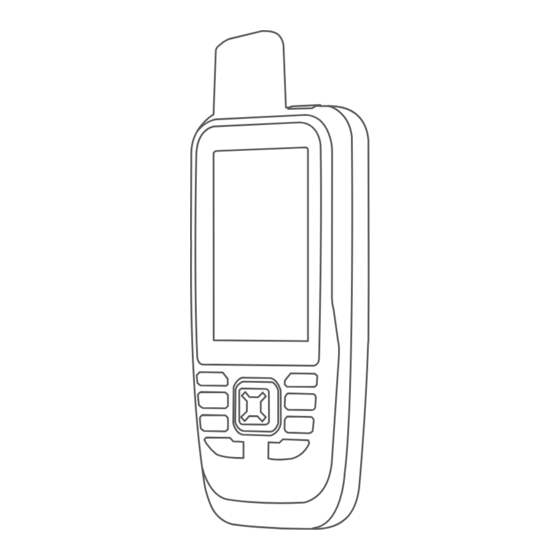
Editing or Deleting a Proximity Alarm ........11 tempe ................... 19 Sending and Receiving Data Wirelessly ........11 Tips for Pairing ANT+ Accessories with Your Garmin Selecting a Profile ..............12 Device .................. 19 Calculating the Size of an Area ..........12 About Heart Rate Zones ............ - Page 5 Introduction Keys WARNING See the Important Safety and Product Information guide in the product box for product warnings and other important information. GPSMAP 86s/sc Device Overview FIND Select to open the search menu. MARK Select to save your current location as a waypoint. QUIT Select to cancel or return to the previous menu or page.
- Page 6 Navigating to a Message Location NOTE: A preset message includes predefined text with When you receive a message from another device with inReach predetermined recipients, and you must set it up on the Garmin technology, the message may include location information. For Explore website.
- Page 7 Pressing the SOS button sends a message to the rescue coordination center, and they notify the appropriate emergency You can sync data from your Garmin Explore account to your responders of your situation. You can communicate with the device using the Garmin Explore app. After you make edits to...
- Page 8 Open the Garmin Explore app. Advanced Map Settings From the map, select MENU, and select Map Setup > Changes made to data such as collections, waypoints, Advanced Setup. routes, and tracks update automatically. Auto Zoom: Automatically selects the appropriate zoom level You can now sync your data to your GPSMAP 86 device.
- Page 9 Additional features are available when profiles (Profiles, page 15). ™ you connect your paired device to the Garmin Explore app on Insert Page: Inserts an additional page of customizable data your smartphone. Go to garmin.com/apps for more information. fields.
- Page 10 Mobile App Activity uploads to Connect IQ Features Garmin Connect You can add Connect IQ features to your device from Garmin ® Software updates and other providers using the Connect IQ Mobile app. You can EPO downloads customize your device with data fields, widgets, and apps.
- Page 11 Garmin Explore Select Waypoint Manager. Select a waypoint. The Garmin Explore website and mobile app allow you to plan trips and use cloud storage for your waypoints, routes, and Select an item to edit, such as the name. tracks. They offer advanced planning both online and offline, Enter the new information, and select Done.
- Page 12 Select a point. • FIT records your activity with fitness information that is Select an option: tailored for the Garmin Connect application and can be • To view the point on the map, select Review. used for navigation. • To change the order of the points on the route, select •...
- Page 13 (Connect IQ Features, page You can create a track from a saved activity. This allows you to BirdsEye Direct: Allows you to download BirdsEye Satellite share your track wirelessly with other compatible Garmin Imagery to your device (BirdsEye Imagery, page 10).
- Page 14 Sun and Moon: Displays sunrise and sunset times, along with wirelessly. the moon phase, based on your GPS position. • Connect to the Garmin Connect Mobile app. Photo Viewer: Displays saved photos. • Connect to a Wi‑Fi network. Waypoint Averaging: Allows you to refine a waypoint location...
-
Page 15: Finding A Geocache With A Chirp
• To filter by the physical size of the geocache container, select Cache Size. A chirp is a small Garmin accessory that is programmed and left in a geocache. You can use your device to find a chirp in a •... -
Page 16: Selecting A Profile
You can share waypoints, geocaches, routes, and AutoLocate Position: Calculates your GPS position using the tracks. Garmin AutoLocate feature. ® Select Share Wirelessly. Satellite Setup: Sets the satellite system options (Satellite Settings, page 13). Select an option: • Select Send, and select a type of data. -
Page 17: System Settings
Select Setup > System > Interface. navigating away from an active route. Garmin Spanner: Allows you to use the device USB port with Avoidance Setup: Sets the types of roads, terrain, and most NMEA 0183-compliant mapping programs by creating a transportation methods to avoid while navigating. -
Page 18: Wireless Sensors
This allows your activity to appear as the • To remove a page from the page sequence, select correct type when you transfer it to Garmin Connect. Remove. User: Sets your user profile information. The device uses this TIP: You can select PAGE to view the page sequence. -
Page 19: Time Settings
You can customize your settings and data fields for a particular activity or trip. Getting More Information Select Setup > Profiles > Create Profile > OK. You can find more information about this product on the Garmin Customize your settings and data fields. website. • Go to support.garmin.com... -
Page 20: Long-Term Storage
• JPEG photo files. spine of the device. • GPI custom POI files from the Garmin POI Loader. Go to www.garmin.com/products/poiloader. • FIT files for exporting to Garmin Connect. Installing a Memory Card You can install a microSD memory card for additional storage or pre-loaded maps. -
Page 21: Deleting Files
Ascent - Maximum: The maximum rate of ascent in feet per minute or meters per minute since the last reset. Open the Garmin drive or volume. Ascent - Total: The total elevation distance ascended during If necessary, open a folder or volume. -
Page 22: Getting More Information
Pointer: An arrow points in the direction of the next waypoint or You can find more information about this product on the Garmin turn. You must be navigating for this data to appear. website. -
Page 23: Optional Accessories
• Before you pair the ANT+ accessory with your Garmin device, move 10 m (33 ft.) away from other ANT+ accessories. • Bring the Garmin device within range 3 m (10 ft.) of the ANT+ accessory. • After you pair the first time, your Garmin device automatically recognizes the ANT+ accessory each time it is activated. -
Page 24: Index
16 routes 8 fitness 14 creating 8 flashlight 9, 12 deleting 8 FUSION-Link 7 editing 8 navigating 8 settings 13 Garmin Connect 5, 6 viewing on the map 8 Garmin Explore 16 Garmin Express 15 updating software 15 satellite page 12 geocaches 9–11, 16 satellite signals 2, 9, 12 downloading 10... - Page 26 August 2019 190-02580-00_0A...
Need help?
Do you have a question about the 010-02236-02 and is the answer not in the manual?
Questions and answers