Table of Contents
Advertisement
Advertisement
Table of Contents

Related Manuals for Leica NA300 Series


Summary of Contents for Leica NA300 Series
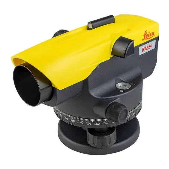
- Page 1 Leica NA320/24/32 Version 1.0...
- Page 2 Setting up the Colocación del Careful handling of tripod Manejo cuidadoso del tripod trípode Sorgfältige Behandlung des trípode Aufstellen des Mise en place du Statives Manipulation correcte du Stativs trépied trépied Levelling up Nivelación Horizontierung Calage à l'horizontale 004171_001 Focusing Enfoque Centering Centrado...
- Page 3 Leica NA320/24/32 User Manual Version 1.0 English...
- Page 4 Product Identifica- The type and serial number of your product are indicated on the type plate. tion Always refer to this information when you need to contact your agency or Leica Geosystems authorised service workshop. Symbols The symbols used in this manual have the following meanings:...
-
Page 5: Table Of Contents
Table of Contents In this manual Chapter Page Safety Directions General Introduction Definition of Use Limits of Use Responsibilities Hazards of Use Description of the System Description of the System Container Contents Instrument Components Operation Distance and Angle measurement Check & Adjust the line of sight Care and Transport Transport Storage... -
Page 6: Safety Directions
• To ensure that it is used in accordance with the instructions. • To be familiar with local regulations relating to safety and accident prevention. • To inform Leica Geosystems immediately if the product and the application becomes unsafe. • To ensure that the national laws, regulations and conditions for the operation of e.g. -
Page 7: Hazards Of Use
Hazards of Use Watch out for erroneous measurement results if the product has been dropped or has CAUTION been misused, modified, stored for long periods or transported. Precautions: Periodically carry out test measurements and perform the field adjustments indicated in the user manual, particularly after the product has been subjected to abnormal use as well as before and after important measurements. - Page 8 Product-specific treatment and waste management information can be downloaded from the Leica Geosystems home page at http://www.leica- geosystems.com/treatment or received from your Leica Geosystems distributor. Only Leica Geosystems authorised service workshops are entitled to repair these prod- WARNING ucts. NA320/24/32, Safety Directions...
-
Page 9: Description Of The System
Description of the System Description of the System General description The NA320/24/32 is a modern automatic level for the construction industry. It is a level for all construction levelling and alignment works. Operating this level is simple. Learning is effortless and it works for anyone in your team. -
Page 10: Instrument Components
Instrument Components Instrument Compo- nents 011145_001 a) Focusing knob f) Peep Sight b) Objective g) Eyepiece c) Endless drive (both sides) h) Horizontal Circle d) Circular Bubble i) Footscrew e) Reflecting Mirror j) Adjustment screw cover NA320/24/32, Description of the System... -
Page 11: Operation
Operation Distance and Angle measurement Distance measure- Calculating the distance ment ∆ Reading Upper distance line (l 2.670 m Lower distance line (l -2.502 m Difference L 0.168 m Δ ∆ d = L x 100 ∆ x 100 Result 003990_001 Distance d: 16.8 m... -
Page 12: Check & Adjust The Line Of Sight
Check & Adjust the line of sight Checking the line of Step Description sight With the circular bubble centred and H=1.832 H=1.616 adjusted, the line of sight should be δ δ horizontal. Choose a distance of appr. 30 m within a gentle terrain. -
Page 13: Care And Transport
Shipping When transporting the product by rail, air or sea, always use the complete original Leica Geosystems packaging, transport container and cardboard box, or its equivalent, to protect against shock and vibration. Field adjustment Periodically carry out test measurements and perform the field adjustments indicated in the User Manual, particularly after the product has been dropped, stored for long periods or transported. -
Page 14: Technical Data
Technical Data Accuracy Standard deviation for 1 km double levelling ISO17123-2: NA320: 2.5 mm NA324: 2.0 mm NA332: 1.8 mm Telescope Erect image Magnification NA320: 20 x NA324: 24 x NA332: 32 x Field of view: < 2.1 m at 100 m Shortest target distance <...
Need help?
Do you have a question about the NA300 Series and is the answer not in the manual?
Questions and answers