Advertisement
Quick Links
Using the GPS – Garmin Oregon300
To turn GPS on and check satellites
Turn GPS on by holding down the button on the right
•
side.
Wait for it to pick up satellites and recalibrate. Wait at
•
least 5 minutes before you try and do anything with it;
these GPS units take a while to recalibrate.
To see if it is picking up satellites, look at the bars at the
•
bottom of the screen. It needs at least 4 green bars to
work accurately.
Some basics
The screen is not very sensitive to touch in the cold. It
•
can be helpful to use the eraser end of a pencil.
To go back to the previous screen without saving
•
anything, press the red X at the bottom left of the
screen. To save changes, press the green check mark at
the bottom right of the screen.
Replacing batteries
Batteries don't work well when cold. If it is winter out
•
and the low battery light comes on, first try putting it in
a coat pocket to warm it up.
To change batteries, pull up on the lower end of the
•
black plastic piece on the back of the unit, then pull it
down and off.
Lift up on the metal latch on the lower end of the unit,
•
and pull.
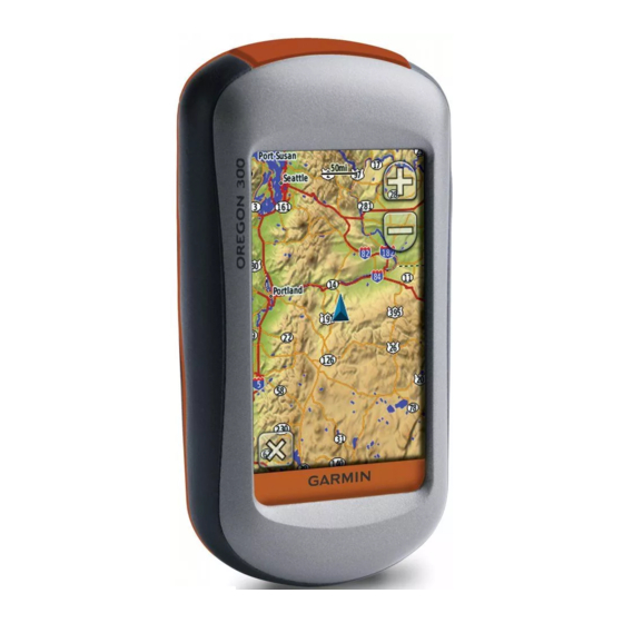
To use the map
On the main page, press "Map". If this button doesn't show up,
•
scroll until you see it.
The blue diamond shows where you are.
•
Use the + and – buttons to zoom in or out.
•
Move your finger across the screen to scroll.
•
If you touch the screen briefly, a red pin will appear at that spot,
•
and directions to where the pin is will appear on the top of the
page. To get rid of the pin, press the back arrow at the bottom left.
To navigate to a waypoint
On the main page, press "Where To"
•
Press "Waypoints"
•
Press the waypoint you want to go to. This will take you to the
•
map page
The distance and azimuth to the waypoint will appear at the top of
•
the page.
DO NOT press "Go". This will remove the distance and bearing
•
from the top of the page. If you do press go, start over.
If you accidentally get the red pin when you touch the screen,
•
press the back arrow button to go back to navigating to the
waypoint, otherwise you will be navigating to the red pin.
Use the azimuth that the GPS gives you, and enter that into your
•
compass to navigate to the waypoint.
To take a waypoint
Press "Mark Waypoint"
•
Press "Save"
•
It is a good idea to double check that you still have good satellite
•
coverage when taking a waypoint.
To save the route you travel
The GPS calls the route you travel the "Track"
To start, save and clear what is in the "current track":
•
On the main page press "Track Manager"
•
Press "Current Track"
•
Press "Save Track"
•
Advertisement

Related Manuals for Garmin Oregon300


Summary of Contents for Garmin Oregon300
- Page 1 Using the GPS – Garmin Oregon300 To use the map On the main page, press “Map”. If this button doesn’t show up, • scroll until you see it. The blue diamond shows where you are. To turn GPS on and check satellites •...
- Page 2 Unless you want to change the name, just press To see how far you have traveled • Before you start walking, clear the odometer: the green arrow at the bottom of the page • When it asks you if you want to clear the current From the main page, press “Set Up”...
Need help?
Do you have a question about the Oregon300 and is the answer not in the manual?
Questions and answers