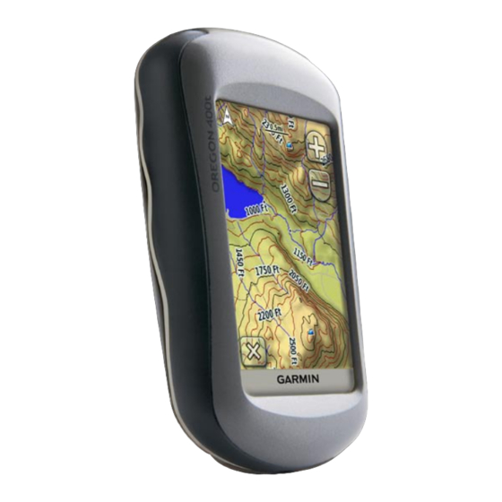
Garmin Colorado 400t Owner's Manual
Oregon series
Hide thumbs
Also See for Colorado 400t:
- Quick start manual (64 pages) ,
- Owner's manual (48 pages) ,
- Owner's manual (26 pages)
Table of Contents
Advertisement
Advertisement
Table of Contents

Related Manuals for Garmin Colorado 400t


Summary of Contents for Garmin Colorado 400t
- Page 1 Oregon series ™ owner’s manual...
- Page 2 Garmin. Garmin hereby grants permission to download a single copy of this manual onto a hard drive or other electronic storage medium to be viewed and to print one copy of...
-
Page 3: Tips And Shortcuts
Tracks. Product Registration Help us better support you by completing our online registration today! Connect to our Web site at http://my.garmin.com. Keep the original sales receipt, or a photocopy, in a safe place. -
Page 4: Contact Garmin
Contact Garmin Contact Garmin if you have any questions while using your Oregon. In the USA contact Garmin Product Support by phone: (913) 397-8200 or (800) 800-1020, or go to www.garmin.com/support/. In Europe, contact Garmin (Europe) Ltd. at +44 (0) 870.8501241 (outside the UK) or 0808 2380000 (within the UK). -
Page 5: Table Of Contents
Introduction ...i Tips and Shortcuts ...i Manual Conventions ...i Product Registration ...i Contact Garmin ... Optional Accessories ... Oregon Series Features ... Getting Started ...1 Installing the Batteries Turning the Oregon On and Off Acquiring GPS Satellite Signals Locking the Screen ...3... - Page 6 Altimeter Setup ...29 Fitness Setup ...30 Reset ...30 About..30 Appendix ...31 Specifications ...31 Using Demo Mode ...32 Connecting Your Oregon to a Computer ...32 Installing a microSD Card ™ Transferring Tracks, Routes, or Waypoints ...33 Loading and Deleting Files Optimizing Battery Life Restoring Factory Default Settings Attaching the Carabiner...
-
Page 7: Getting Started
Getting Started Getting Started Power key Battery cover Touchscreen Mounting spine Latch Mini-B USB jack (under weather cap) Oregon Series Owner’s Manual... -
Page 8: Installing The Batteries
Installing the Batteries The Oregon operates on two AA batteries (not included). Use alkaline, NiMH, or lithium batteries. To install the batteries: 1. Lift the latch and remove the battery cover. Battery cover 2. Insert the batteries, observing polarity. 3. Replace the battery cover and push the latch down. -
Page 9: Acquiring Gps Satellite Signals
To adjust the backlight level: 1. While the Oregon is on, press and quickly release the 2. Touch to adjust the brightness levels. page 22 to change the backlight timeout. Acquiring GPS Satellite Signals Before the Oregon can find your current location and navigate a route, you must acquire GPS signals. -
Page 10: Basic Navigation
Basic Navigation All Oregon applications can be accessed on the Main Menu. Touch access additional applications. Main Menu Creating Waypoints Waypoints are locations you record and store in the Oregon that you might want to return to later, or to share with other users. -
Page 11: Navigating To A Destination
To edit or delete a waypoint, see page Navigating to a Destination You can navigate to a destination with Where To? the Oregon by using the menu or by choosing a point on the map. To navigate to a point using To?: 1. - Page 12 To find a POI by spelling the name: 1. On the Main Menu, touch > POI. 2. Touch 3. Touch characters to spell at least a portion of the name of your destination. 4. Touch 5. Touch the item to which you want to navigate.
-
Page 13: Stop Navigating
To navigate to a destination near a waypoint or a recent find: 1. On the Main Menu, touch To?. 2. Touch 3. Touch ...A Recent Find Waypoint. 4. Touch the location you want to search near. 5. Touch a category. Items are listed in order of distance from the location you selected. -
Page 14: Applications
Applications Satellite Page The Satellite page shows your current location, the GPS accuracy, your current elevation, satellite locations, and satellite signal strength. To open the Satellite page, touch at the bottom of the Main Menu. Satellite Page The green bars indicate GPS satellite strength. - Page 15 To review detailed information about a point on the map: 1. Pan to the location you want to review, if necessary, and then touch 2. Touch the information button at the top of the screen for additional information. To show or hide data fields: 1.
-
Page 16: Compass Page
Compass Page The Compass page guides you to your destination by displaying a compass and a bearing pointer. It also provides navigation data such as current speed, distance to the next point on the route, and estimated arrival time. The electronic compass (Oregon 300, 400t, 400c, and 400i) is similar to a magnetic compass when you are stationary or walking. -
Page 17: Calibrating The Compass
direction, turn toward that direction until the arrow is pointing toward the top of the compass. Direction you are currently traveling Scale Bearing to destination Course deviation indicator Course line to destination Course Pointer The course pointer provides an indication of drift (right or left) according to the scale shown at the edge of the compass ring. -
Page 18: Trip Computer
To calibrate the electronic compass: 1. On the Main Menu, touch > Heading > Press To Begin Compass Calibration. From the Compass page, touch and hold the middle of the compass for about 2 seconds. 2. Touch Start and follow the on-screen directions. -
Page 19: 3D View
2. Touch Default, Automotive, or Geocaching. 3D View The Oregon 400t has a 3D view. Other Oregon models require DEM (digital elevation model) data that can be found in some Garmin topographic cartography. Go to http://buy.garmin.com for compatible map products. 3D View Oregon Series Owner’s Manual... -
Page 20: Elevation Plot
Oregon. To navigate to a geocache using Geocaches: 1. Touch Geocaches > Find a Geocache. 2. Touch a geocache location. 3. Touch Go. A colored line indicates your course. -
Page 21: Wherigo
Share Wirelessly The Oregon 300, 400t, 400c, and 400i can wirelessly share waypoints, routes, tracks, and geocaches with another Oregon or a Garmin Colorado Elevation To share wirelessly with another Oregon or Colorado: 1. Place the units within 10 feet (3 meters) of each other. -
Page 22: Image Viewer
Oregon or on a microSD To view images: 1. Copy .jpg images from your computer to the Oregon. You can load them directly to the Garmin drive or create a new folder on the Garmin drive (page 34). -
Page 23: Profile Change
To reposition a waypoint to your current location: 1. On the Main Menu, touch Manager. 2. Touch the waypoint you want to reposition. Reposition Here. 3. Touch To delete a waypoint: 1. On the Main Menu, touch Manager. 2. Touch the waypoint you want to delete. -
Page 24: Active Route
5. Repeat until the route is complete. 6. Touch to save the route. 7. Touch > Where To? navigate the route. To edit a route: 1. On the Main Menu, touch Planner. 2. Touch the route you want to edit > Edit Route. -
Page 25: Track Manager
Track Manager A track is a recording of the path you have traveled. To record your tracks: 1. On the Main Menu, touch Tracks > Track Log. 2. Touch Record, Do Not Show Record, Show On Map. If you select Record, Show On a line on the Map page indicates your track. -
Page 26: Calendar
2. Walk around the perimeter of the area you want to calculate. Calculate 3. Touch when finished. Calendar On the Main Menu, touch open the Oregon calendar. Calculator On the Main Menu, touch open the Oregon calculator. Sun and Moon The Sun and Moon page shows sunrise time, sunset time, moonrise time, moonset time, and moon phase for a... -
Page 27: Hunt And Fish
Hunt and Fish The hunting and fishing almanac provides the predicted best dates and times for hunting and fishing at your current location. On the Main Menu, touch Touch to view hunting and fishing information for a different date. Stopwatch To use the Stopwatch: 1. -
Page 28: Customizing The Oregon
Battery Type—select the type of battery you are using. Tones—turn audible tones Interface—set the Oregon serial interface: Garmin Spanner—allows you to • use the Oregon USB port with most NMEA 0183-compliant mapping programs by creating a virtual serial Setup >... -
Page 29: Map Setup
Power key. 4. Connect the Oregon to your computer with the included USB cable (page 32). The bitmap file is saved in the Garmin\scrn folder on the Oregon drive. Map Setup On the Main Menu, touch Orientation—select how the map is shown on the page. -
Page 30: Tracks Setup
• Text Size—select the text size for map items. Detail—select the amount of detail • shown on the map. Showing more detail may cause the map to redraw more slowly. Map Information—touch the check box to display a map. This can be helpful if several maps are loaded on the Oregon. -
Page 31: Profiles Setup
Profiles Setup To change the name of a profile: 1. On the Main Menu, touch Profiles. Edit Name. 2. Touch a profile > 3. Touch letters, numbers, or symbols to make the changes. 4. Touch To change the order of the profiles: 1. -
Page 32: Marine Setup
• On Road For Distance—calculates on-road routes that are shorter in distance. Calculate Routes for—select a transportation method to optimize your routes for. Lock On Road—lock the current location marker on the nearest road, compensating for variances in map position accuracy (requires routable maps). -
Page 33: Time Setup
• Off course Alarm—set an alarm to sound when you are a specified distance off course. • Deep Water—set an alarm to sound when you enter an area of water that is too deep. • Shallow Water—set an alarm to sound when you enter an area that is too shallow. -
Page 34: Heading Setup
Heading Setup On the Main Menu, touch Heading. Display—select the type of directional heading shown on the compass: • Directional Letters—sets the compass page reading to directional letters (N, S, E, W). Numeric Degrees—sets the compass • page reading to degrees (0°–359°). •... -
Page 35: Altimeter Setup
Altimeter Setup On the Main Menu, touch Altimeter. Auto Calibration—allow the altimeter to self-calibrate each time you turn the Oregon on. Barometer Mode—select Variable Elevation (used when moving) or Fixed Elevation (used when stationary, allowing the altimeter to function as a standard barometer). -
Page 36: Fitness Setup
Garmin speed/cadence bike sensor to display your pedaling cadence. When connected to the appropriate Garmin device, the heart rate and bike cadence values are listed as data-field options on the Map page, the Compass page, and the trip computer. -
Page 37: Appendix
*Subject to accuracy degradation to 100 m 2DRMS under the U.S. DoD imposed Selective Availability (SA) Program when activated. DGPS: Velocity: 0.328 ft./sec. (0.1 m/sec) Interfaces: Garmin Proprietary serial, Data Storage Life: Indefinite; no F to ° ° Map Storage:... -
Page 38: Using Demo Mode
30,000 ft. (from -610 to 9144 m) Subject to proper user calibration. Using Demo Mode Demo mode turns the GPS receiver off for use indoors or for practice. The unit does not track satellites in Demo mode. CAUTION: Do not try to navigate using Demo mode because the GPS receiver is turned off. -
Page 39: Transferring Tracks, Routes, Or Waypoints
Garmin dealer. Go to http://buy.garmin.com for compatible map products. To install or remove a microSD card: 1. Lift the latch on the back of the Oregon (page 2) and remove the battery cover and the batteries. 2. Lift the metal cover. -
Page 40: Loading And Deleting Files
2. Connect the USB cable to the Oregon and your computer. 3. Copy the file from your computer. 4. Paste the file into the Garmin or the microSD card/volume. To delete a file from the Oregon or microSD card: 1. -
Page 41: Restoring Factory Default Settings
You can restore your Oregon to the original factory settings. Changes you have made using Setup are restored to the default settings. To restore factory settings, touch Reset > Settings (page 28). (http://buy.garmin.com). Setup Restore Defaults to Factory > > Yes. -
Page 42: Attaching The Carabiner
TO BE BOUND BY THE TERMS AND CONDITIONS OF THE FOLLOWING SOFTWARE LICENSE AGREEMENT. PLEASE READ THIS AGREEMENT CAREFULLY. Garmin grants you a limited license to use the software embedded in this device (the “Software”) in binary executable form in the Power key for Oregon Series Owner’s Manual... -
Page 43: Declaration Of Conformity (Doc)
You further acknowledge that the structure, organization, and code of the Software are valuable trade secrets of Garmin and that the Software in source code form remains a valuable trade secret of Garmin. You agree not to decompile, disassemble, modify,... -
Page 44: Index
Communicator Garmin compass calibration north reference contact Garmin course data fields changing 9, 11, setup show or hide daylight saving time default settings demo mode detail, on map directional letters edit... - Page 45 heading setup heart rate monitor hunt and fish image viewer installing batteries interface language light sectors lock on road lock screen magnetic north main menu setup map information map page map setup marine alarms colors setup mark waypoint Oregon Series Owner’s Manual microSD card image viewer installing...
- Page 46 Garmin serial number setup share wirelessly spanner, Garmin speed/cadence bike sensor spot soundings stop navigating stopwatch sun and moon system setup text out text size, maps timeout, backlight time setup time zone tones tracks recording recording method recording rate...
- Page 48 For the latest free software updates (excluding map data) throughout the life of your Garmin products, visit the Garmin Web site at www.garmin.com. © 2008 Garmin Ltd. or its subsidiaries Garmin International, Inc. 1200 East 151 Street, Olathe, Kansas 66062, USA Garmin (Europe) Ltd.
Need help?
Do you have a question about the Colorado 400t and is the answer not in the manual?
Questions and answers