Table of Contents
Advertisement
Advertisement
Table of Contents

Related Manuals for Garmin Oregon 190-01070-00


Summary of Contents for Garmin Oregon 190-01070-00
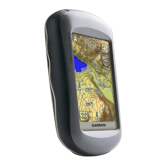
- Page 1 OREGON series ® 200, 300, 400t, 400c, 400i, 550, 550t owner’s manual...
-
Page 2: Printed In Taiwan
Garmin. Garmin hereby grants permission to download a single copy of this manual onto a hard drive or other electronic storage medium to be viewed and to print one copy of... -
Page 3: Tips And Shortcuts
Tracks. Product Registration Help us better support you by completing our online registration today. Connect to our Web site at http://my.garmin.com. Keep the original sales receipt, or a photocopy, in a safe place. Introduction... -
Page 4: Contact Garmin
If needed, the serial number of your Oregon is located in the battery compartment. Remove batteries as indicated on page Optional Accessories For a list of available accessories and maps, refer to the Garmin Web site at http://buy.garmin.com. Oregon Series Owner’s Manual... -
Page 5: Oregon Series Features
Oregon Series Features Features US Inland Lakes Optional Mapping US, UK, or Aus Optional BlueChart Mapping US, European, Optional Aus, or Canada Topography Altimeter Audio Tones Wireless Communication RS-232/NMEA Serial Alarm Clock 3-Axis Compass 2-Axis Compass Camera High-Speed USB Oregon Series Owner’s Manual 400t 400c Optional... -
Page 6: Table Of Contents
Table of Contents Introduction ... Tips and Shortcuts ...i Manual Conventions ...i Product Registration ...i Contact Garmin ...ii Optional Accessories Oregon Series Features Caring for the Oregon Getting Started ... Battery Information ... Turning On and Off the Oregon ... - Page 7 GPS Games ... Geocaches ... Wherigo ™ Customizing the Oregon .. Changing the Profile ... Setting Up Profiles ... Using System Setup ... Customizing the Display ... Map Setup ... Tracks Setup ... Customizing the Main Menu ... Routing Setup ... Changing the Camera Settings ...
-
Page 8: Cleaning The Screen
Caring for the Oregon Cleaning the case Use a cloth dampened with a mild detergent solution, and then wipe it dry. Avoid cleaners that may damage the plastic components. Cleaning the screen Use a soft, clean, lint-free cloth. Use water, isopropyl alcohol, or eyeglass lens cleaner. -
Page 9: Getting Started
Oregon Series Owner’s Manual Getting Started Power key Touchscreen Getting Started Battery cover Mounting spine Latch mini-USB connector (under weather cap) -
Page 10: Battery Information
Getting Started Battery Information Oregon units operate on two AA batteries. Use alkaline, NiMH, or lithium batteries. Use precharged NiMH or lithium batteries for best results. Standard alkaline batteries are not recommended for Oregon 550 units when using the camera feature. -
Page 11: Adjusting The Backlight Level
Adjusting the Backlight Level 1. While the Oregon is on, press and quickly release 2. Touch to adjust the brightness levels. (page 26) to change the backlight timeout. Oregon Series Owner’s Manual Acquiring GPS Satellite Signals Before the Oregon can find your current location and navigate a route, you must acquire GPS signals. -
Page 12: Basic Navigation
Basic Navigation Basic Navigation Accessing Applications from the Main menu You can access all Oregon applications from the Main menu. Main menu Touch to access additional applications. Creating Waypoints Waypoints are locations you record and store in the Oregon. To mark your current location as a waypoint: 1. -
Page 13: Navigating To A Destination
Navigating to a Destination You can use Where To? or choose a point on the map to navigate to a destination with the Oregon. noTe: Depending on your device, you may not see all of the options listed below. See page (page iii) for a list of features available on your device. - Page 14 Basic Navigation To find a destination by spelling the name: 1. On the Main menu, touch > POI. 2. Touch 3. Touch characters to spell a part of the name of your destination. 4. Touch 5. Touch the destination. 6. Touch Go. A colored line indicates your course.
-
Page 15: Stop Navigating
To navigate to a destination near a waypoint or a recent find: 1. Touch Where To?. 2. Touch 3. Select from the following options: • A Recent Find • Waypoint. • My Current Location • A Map Point 4. Touch the location you want to search near. -
Page 16: Map Page
Basic Navigation Zoom range Zoom buttons Location marker Map Page To review detailed information about a point on the map: 1. If necessary, pan to the location you want to review. 2. Touch the location. 3. Touch the information button at the top of the screen for additional information. -
Page 17: Using The Compass
To save a waypoint on the Map page: 1. On the Map page, touch the point you want to save. 2. Touch the information button at the top of the screen. 3. Touch to save the waypoint. Using the Compass The Compass page guides you to your destination by displaying a compass and a bearing pointer. -
Page 18: Calibrating The Compass
Basic Navigation Calibrating the Compass Calibrate the electronic compass (Oregon 300, 400t, 400c, 400i, 550, and 550t) outdoors. For all Oregons except the 550 or 550t, hold the device level while calibrating. Do not stand near objects that influence magnetic fields, such as cars, buildings, or overhead power lines. -
Page 19: Bearing And Course Pointers
Bearing and Course Pointers The Oregon can use either a bearing or course pointer on the compass. The bearing pointer indicates the direction to your destination, and the course pointer indicates your relationship to a course line leading to the destination. To select a bearing or course pointer, see page Direction you... -
Page 20: Data Fields
Basic Navigation The course pointer provides an indication of drift (right or left) according to the scale shown at the edge of the compass ring. The scale refers to the distance between dots on the course deviation indicator. The course line to your destination is based on your original starting point. -
Page 21: Managing Waypoints, Routes, And Tracks
Managing Waypoints, Routes, and Tracks Modifying Waypoints You can edit waypoints to change the name, symbol, comment, location, elevation, and depth of the waypoint. On the Oregon 550 or 550t, you can change the picture. You can also use the Waypoint Manager to relocate a waypoint to your current location, and to delete waypoints. -
Page 22: Creating Routes
Waypoints, Routes, and Tracks Creating Routes You can create and store up to 50 routes. To create and navigate a new route: 1. Touch Route Planner Route> > <Select First Point> select a starting point. 2. Touch a category. 3. Touch the first item on the route. <Select Next 4. -
Page 23: Viewing The Active Route
• Insert—adds an additional point on the route. The additional point is inserted before the point you are editing. • Remove—removes the point from the route. To reverse the order of points on a route: Route Planner. 1. Touch 2. Touch the route you want to reverse >... - Page 24 Waypoints, Routes, and Tracks To record your tracks: 1. Touch Setup > Tracks Log. 2. Touch Do Not Record; Do Not Show; or Record, Show Map. If you select Record, Show On Map, a line on the Map page indicates your track. For more information on Tracks setup, see page...
-
Page 25: Additional Tools
Additional Tools Using the 3D View The Oregon 400t and 550t have a 3D view. Other Oregon models require DEM (digital elevation model) data that can be found in some Garmin topographic cartography. Go to http://buy.garmin.com for compatible map products. -
Page 26: Sharing Information Wirelessly
Wirelessly The Oregon 300, 400t, 400c, 400i, 550, and 550t can wirelessly share waypoints, routes, tracks, and geocaches with another wireless enabled Garmin recreational handheld. 1. Place the units within 10 feet (3 meters) of each other. Distance or time scale 2. -
Page 27: Using The Camera
6. On the sending unit, touch an item to send > Send. 7. Both units indicate that the transfer is complete. 8. Touch on both units. Using the Camera You can take pictures with the Oregon 550 and 550t. These pictures save a location that you can navigate noTe: Pictures will be saved and displayed with either landscape... -
Page 28: Viewing Images
™ 1. Copy .jpg images from your computer to the Oregon. You can load them directly to the Garmin drive or create a new folder on the Garmin drive Insert a microSD card with .jpg images in the microSD card tray (page 37). -
Page 29: Other Tools
Other Tools Depending on your Oregon (see page iii), you can access additional tools. Select from the following options on the Main menu: • Calendar—use a calendar. • Calculator—use a calculator. • Sun and Moon—view sunrise and sunset times along with the moon phase. -
Page 30: Trip Computer
Additional Tools The green bars indicate GPS satellite strength. White bars indicate that the Oregon is still collecting data. Trip Computer The Trip Computer displays your current speed, average speed, maximum speed, trip odometer, and other helpful statistics. Trip Computer Touch a field to change what is shown in that field. -
Page 31: Gps Games
You can download Geocache sites from www.geocaching.com. The Web site supports the transfer of geocache sites to your Oregon, and, after registering and installing the Garmin Communicator plug-in from www.garmin.com/products /communicator, you can download geocaches directly to your Oregon. Oregon Series Owner’s Manual... -
Page 32: Customizing The Oregon
Customizing the Oregon Customizing the Oregon Changing the Profile Profiles are a collection of settings that allow you to optimize your Oregon from one type of use to another, such as moving from recreational use to automotive use. When you are in a profile and change settings such as data fields, units of measurement, or position settings, they are saved automatically as part... -
Page 33: Using System Setup
Oregon Series Owner’s Manual Tones—turn audible tones > off. Interface—set the Oregon serial interface: • Garmin Spanner—allows you to use the Oregon USB port with most NMEA 0183-compliant mapping programs by creating a virtual serial port. • Garmin Serial—Garmin proprietary format used to provide PVT protocol data. -
Page 34: Customizing The Display
3. Press and quickly release 4. Connect the Oregon to your computer with the included USB cable (page 37). The bitmap file is saved in the Garmin\scrn folder on the Oregon drive. Map Setup On the Main menu, touch Map. orientation—select how the map is shown on the page. -
Page 35: Tracks Setup
Auto Zoom—automatically selects the appropriate zoom level for optimal use on your map. When off is selected, you must zoom in or out manually. Show Data Fields—hide or show data fields on the Map page. Advanced Map Setup—set the zoom levels, the text size, and the detail level of the map. -
Page 36: Customizing The Main Menu
Customizing the Oregon Customizing the Main Menu You can put frequently-used applications on the first page of the Main menu. To change the order of applications on the Main menu: 1. Touch Setup > Main 2. Touch the application you want to move. -
Page 37: Changing The Camera Settings
within a specified distance of your current point. Avoidance Setup—touch the road type you want to avoid. Changing the Camera Settings 1. Touch Setup > Camera. 2. Touch Photo Resolution. 3. Touch High, Normal, or change the resolution of your pictures. -
Page 38: Changing Time Settings
Customizing the Oregon sound when you enter an area that is too shallow. Changing Time Settings Setup > Time. Touch Time Format—select a 12-hour or 24-hour format. Time Zone—select the time zone for your location. Daylight Saving Time—select Yes to use Daylight Saving Time, no to ignore it, or Automatic to automatically turn on and off Daylight Saving Time. -
Page 39: Altimeter Setup
compass: • Directional Letters—sets the Compass page reading to directional letters (N, S, E, W). • numeric Degrees—sets the Compass page reading to degrees (0°–359°). • Mils—sets the Compass page reading to mils (0 mils–1000 mils). north Reference—select the north reference of the compass: •... - Page 40 Customizing the Oregon you turn the Oregon on. Barometer Mode—select Variable elevation (used when moving) or Fixed elevation (used when stationary, allowing the altimeter to function as a standard barometer). Pressure Trending—select when the pressure data is recorded. Touch Save Always to record pressure data every 15 minutes, even when the Oregon is turned off.
-
Page 41: Pairing The Oregon
The Oregon can be used with an optional Garmin heart rate monitor to display your heart rate. It can also be used with an optional Garmin cadence bike sensor to display your pedaling cadence. When connected to the appropriate Garmin device, the... -
Page 42: Oregon Series Owner's Manual
Customizing the Oregon Reset 1. Touch Setup > Reset. 2. Touch an item to reset it. Viewing Your Oregon Information On the Main menu, touch Setup About... > to view the Oregon software version, unit ID number, GPS software version, and legal information.v Oregon Series Owner’s Manual... -
Page 43: Appendix
Appendix Specifications Physical Size: 4.5 in. H × 2.3 in. W × 1.4 in. D (114 × 58 × 36 mm) Weight: 5.1 oz. (146 g) without batteries 191.4 g with batteries Display: 3 in. diagonal (76 mm) backlit 65K color TFT display (240 ×... -
Page 44: Using Demo Mode
Appendix Interfaces: Garmin Proprietary serial, USB mass storage device, NMEA 0183 Data Storage Life: Indefinite; no memory battery required Map Storage: Internal or microSD Card Performance Receiver: more than 12 channel WAAS enabled/High sensitivity Acquisition Times: (warm start) < 33 seconds (cold start) <... -
Page 45: Connecting Your Oregon To A Computer
You can purchase microSD memory cards from an electronics supplier, or purchase preloaded detailed map data cards from your Garmin dealer. In addition to map and data storage, the memory cards can be used to store files such as images, cartridges, geocaches, routes, waypoints, and custom POIs. -
Page 46: Transferring Files To Your Computer
1. Browse your computer for the file. card 2. Select the file. 3. Select 4. Open the “Garmin” or memory card drive/volume. 5. Select Before transferring data to or from a Web site directly to the Oregon, install the Garmin Communicator plug-in from /products/communicator. -
Page 47: Loading And Deleting Files
2. Connect the USB cable to the Oregon and your computer. 3. Copy the file from your computer. 4. Paste the file into the Garmin or the microSD card/volume. Oregon Series Owner’s Manual To delete a file from the Oregon or microSD card: 1. -
Page 48: Restoring Factory Default Settings
(page 31). • If you plan on using the Oregon extensively in your automobile, consider purchasing a vehicle power cable (http://buy.garmin. com). Restoring Factory Default Settings You can restore your Oregon to the 3). Using original factory settings. Changes you have made using Setup are restored to the default settings. -
Page 49: Attaching The Carabiner
Attaching the Carabiner A carabiner with a clip comes with the Oregon 300 and 400 series units and is optional with 200 series units. 1. Position the carabiner clip in the slots on the mounting spine of the Oregon. Carabiner Mounting spine Carabiner clip 2. -
Page 50: Software License Agreement
TERMS AND CONDITIONS OF THE FOLLOWING SOFTWARE LICENSE AGREEMENT. PLEASE READ THIS AGREEMENT CAREFULLY. Garmin grants you a limited license to use the software embedded in this device (the “Software”) in binary executable form in the normal operation of the product. -
Page 51: Index
18, 27 show or hide Index daylight saving time default settings demo mode directional letters edit routes elevation fixed or variable elevation/distance elevation/time elevation plot customizing factory settings fitness setup fixed elevation Garmin serial Garmin spanner geocaches GPS setting grid north... - Page 52 Oregon Series Owner’s Manual trending unit of measurement profiles recent finds record method, tracks registering the Oregon routes calculate edit setup view satellite signals SD card sensors serial, Garmin serial number share wirelessly spanner, Garmin spot soundings stop navigating stopwatch...
- Page 53 text out text size, maps timeout, backlight time zone tones tracks recording setup track up trip computer true north unlock screen variable elevation WAAS waypoints creating Wherigo wireless sharing Oregon Series Owner’s Manual zoom Index...
- Page 56 For the latest free software updates (excluding map data) throughout the life of your Garmin products, visit the Garmin Web site at www.garmin.com. © 2009–2010 Garmin Ltd. or its subsidiaries Garmin International, Inc. 1200 East 151st Street, Olathe, Kansas 66062, USA Garmin (Europe) Ltd.
Need help?
Do you have a question about the Oregon 190-01070-00 and is the answer not in the manual?
Questions and answers