Table of Contents
Advertisement
Advertisement
Table of Contents

Related Manuals for Geonav 6 SUNSHINE


Summary of Contents for Geonav 6 SUNSHINE
- Page 1 SUNSHINE User and Installation Guide...
- Page 2 SUNSHINE User and Installation Guide...
- Page 3 FOR THE SAFETY OF NAVIGATION AND, AS ALWAYS, THE CAPTAIN IS RESPONSIBLE FOR THEIR PROPER USE. The use of the GEONAV implies knowledge and accep- tance of this warning by the user. NOTE: The technical characteristics and functions described in this manual are...
-
Page 4: Introduction
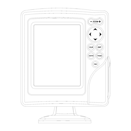
Characteristics Introduction INTRODUCTION CHARACTERISTICS The GEONAV is a chart plotter that displays your boat’s cur- General characteristics rent position with respect to an electronic chart. • Compact chart plotter with optional built-in GPS receiver GPS inside model and antenna The unit can be optionally equipped with a built-in GPS re- •... - Page 5 Characteristics • Operating temperature: 0° to +60° C, humidity 93% • Storage temperature: -20°C to +70°C, humidity 93% • Color LCD, TFT 5.6”, sunlight visible • Adjustable backlight and contrast • Backlight keypad • Pixel resolution: 240 x 320 • 32-bit RISC processor Memory characteristics •...
-
Page 6: Installation And Precautions
0.35 meters away from magnetic compasses • Depth sounder: To connect the GEONAV to a depth sounder, use or flux-gate sensors, such as those used on autopilots and the data cable provided with the unit (see the Connections Sec- remote electronic compasses. -
Page 7: Connections
If sent by the autopilot, the following NMEA messages are transmitted to external devices: GGA - RMC - ZDA The GEONAV will add the following messages: APA - APB - XTE - RMB - BWC - GLL - VTG The data cable is supplied together with the GEONAV plotter. -
Page 8: Cartridge Installation
Windows • Cursor mode: Cursor mode. Explorer not to erase the content of the \NAVIONIC and \GEONAV folders. Damaging • Allows selecting from Allows switching from the files stored in such directories may result in loss of data or improper operation of... -
Page 9: Diagnostic
Converting depth values into the units WARNING: The internal memory can be cleared by pressing simultaneously the PWR and CLR keys. This operation will delete all the settings stored in the GEONAV Press PAGE to display the menu, and restore factory settings. - Page 10 NAVIONICS Electronic Charts Changing chart symbols Displaying abbreviated navaid charac- The symbols used to represent the objects on the chart (buoys, teristics lights, landmarks, etc.), as well as chart colors, can be se- Position the manual cursor on lected between paper-chart International or US styles. the navaid symbol.
-
Page 11: Navionics Electronic Charts
GRAPHIC ITEMS Health and first aid Customer services and port services authorities Besides chart data, the GEONAV displays some graphic items use- ful during navigation. Tourist services and Water Tide station The figure below shows some of these items. shops... - Page 12 FUNCTIONAL CHARACTERISTICS tion mode. This chapter describes some of the most important functions 5 - Route leg of the GEONAV, as well as the terms most commonly used in Part of route between two waypoints. this document. 6 - Waypoint Switching on/Switching off the unit Waypoints are identified by a circle and a number.
-
Page 13: Functional Characteristics
To deactivate the Autozoom function, press the ZOOM key once. correspond to reality. For example, when traveling southwards, the chart When the GEONAV is turned on, and if at least one waypoint shows, on the right side of the boat, has been previously entered, the Autozoom function is auto- what is actually located on the left side, matically activated. - Page 14 Functional Characteristics replacing RANGE with OVZ (blinking) within the navigation To cancel local time, press PAGE until the menu bar is dis- window. played, select SETUP, SET TIME and then GMT. Chart presentation To activate/deactivate the Overzoom function, press PAGE un- til the menu bar is displayed, then select SETUP, OVERZOOM This function allows the user to select the symbols and colors and ON/OFF.
- Page 15 The window situated in the lower part of the screen will display the boat’s speed, route and chart scale. The GEONAV is in Navigation mode; by pressing the CURSOR English English...
-
Page 16: Getting Started
(Cursor mode), starting from the last entered. To go back to Navigation mode, press PAGE. If an autopilot is connected to the GEONAV, the plotted route is au- tomatically followed as soon as the Navigation mode is enabled. English... -
Page 17: Operating Modes
Info window. CURSOR MODE At start-up the satellite window When the GEONAV is in Cursor mode, the crosshair cursor is displays how many and which displayed. The CURSOR key allow browsing through the elec- satellites are tracked by the GPS tronic chart, as well as editing or creating the route. -
Page 18: Satellite Window
If no route is present, speed, course and chart range are dis- played at the bottom of the screen. As soon as a valid fix is available, the GEONAV will automati- cally switch to Navigation mode and display the boat’s posi- By using the ZOOM key, the chart detail level can be increased, tion at the best chart range available;... -
Page 19: Menu
Depth Sounder Window DEPTH SOUNDER WINDOW MENU A depth sensor can be interfaced with the GEONAV via NMEA. The menu bar, displayed at the top of the screen, allows selecting from the following options: In this case, the GEONAV auto-... -
Page 20: Info Window
Info Window Trip Window INFO WINDOW TRIP WINDOW When a NAVIONICS cartridge featuring Tides and Currents The trip window shows the data data is present, this window displays further information, relating to the route followed and, besides the forecast data supplied by selecting the Tides and in particular: Currents station. -
Page 21: Route
Route ROUTE show the leg captured. Move the manual cursor to the position desired, insert the new waypoint and confirm by pressing ENTER. EDITING A ROUTE (CURSOR MODE) Creating a waypoint EDITING A ROUTE (NAVIGATION MODE) Using the CURSOR key, move the cursor on the position de- If the manual cursor is displayed, press the PAGE key to enter sired and press ENTER to insert a waypoint. - Page 22 Route The time to arrive to the waypoint Storing a route in the CompactFlash™ and fuel consumption are dis- Press the PAGE key to display the played provided that estimated menu, select ROUTE, STORE speed and fuel consumption val- and press ENTER. To change the ues have been entered (see the default name and to confirm the Entering speed and fuel consump-...
-
Page 23: Track
Track Route TRACK Reversing a route Press the PAGE key to display the menu, select ROUTE and then REVERSE (if no route is currently displayed, the “NO The Track function allows recording the track actually fol- ROUTE PRESENT” message is displayed). lowed by the boat. -
Page 24: Marker
Marker Track Deleting a track MARKER Press the PAGE key to display the menu, select TRACK, DE- LETE and press ENTER to confirm. Markers are used to identify points of interest to which names and symbols can be assigned. The catalog that lists the tracks stored in the CompactFlash™ will show the CURRENT item indicating the track currently NOTE: Marker names are displayed starting from the 32 NM chart range. -
Page 25: Setup
Marker Setup assigned to the marker; to change the marker symbol and name SETUP according to the type of marker to store (e.g., fishing spots, submerged wrecks, rocks, etc.), use the CURSOR and the -ZOOM+ The SETUP menu allows setting the available options. keys. -
Page 26: Goto
• GPS (EXT/INT) GPS inside Selects the built-in GPS (if model As the GEONAV will plot a new route, the waypoint selected available) or an external antenna. will become the first waypoint in the route, whereas previous • Bearings (TRUE/MAG) waypoints will be deleted. - Page 27 GEONAV will insert a waypoint at the marker The GEONAV will insert a waypoint in the port selected, de- position and append the new leg lete automatically the existing route (if in Navigation mode), or...
- Page 28 TER or -ZOOM+. Press GOTO, select NEAR by the CURSOR key, choose the Tides or Currents service, then press ENTER to confirm. The GEONAV NOTE: The same information can be ac- will allow selecting one of the three nearest Tides and Cur- cessed by positioning the manual cursor on rents stations.
-
Page 29: Table Of Contents
Autopilot Table of Contents AUTOPILOT TABLE OF CONTENTS The GEONAV allows a boat equipped with an autopilot to fol- INTRODUCTION ................4 low automatically the entered route, compensating for any CHARACTERISTICS ................ 5 diversion caused by external conditions (wind, currents, etc.).
Need help?
Do you have a question about the 6 SUNSHINE and is the answer not in the manual?
Questions and answers