YUNEEC H520 Owner's Manual
Hide thumbs
Also See for H520:
- Owner's manual (69 pages) ,
- Quick start manual (46 pages) ,
- Assembly instructions manual (16 pages)
Table of Contents
Advertisement
Quick Links
Advertisement
Table of Contents

Related Manuals for YUNEEC H520


Summary of Contents for YUNEEC H520
- Page 1 YUNEEC H520 OWNERS GUIDE V1.1.10...
- Page 2 NFOLDING Once the H520 has been removed from the storage/transport case, lock the arms in place. Gently lift the arms until a click is heard. Test the locks by gently lifting up and pressing down on the arms several times.
-
Page 3: Selecting A Camera
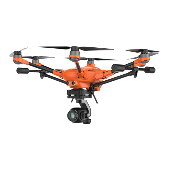
Yuneec has several different camera/payload devices for use on the H520. Yuneec’s E90 camera is a one-inch lens with seven CCDs to capture high quality images with 4k 10 bit in- camera color processing. Images may be captured in 20MB formats of JPEG or 40MB DNG format, or simultaneous capture of both formats. - Page 4 AMERA IMBAL Power down the H520 using the power button on the top of the airframe, press the camera latch on the front of the camera mount and slide the camera gimbal of the mount. Select the preferred camera gimbal for use.
- Page 5 ST16S OVERVIEW Start/Emergency Stop Motors Button Gimbal Pan Mode (Follow Mode/Follow Controllable Mode/Global Mode) (Switch 2) Gimbal Tilt Mode (Angle Mode/ Velocity Mode) (Switch 1) Gimbal Pan Control Rudder/Yaw Control (Mode 2 and Mode 1) Throttle/Altitude Control (Mode 2) Elevator/pitch control (Mode 1) Take Still Photo Button Landing Gear Switch Sonar Obstacle Avoidance Switch (Switch 3)
- Page 6 Ask your dealer about the DY5 multi-charger for the H520 battery; with two charging docks, charging batteries is more than twice as fast, and the DY5 is capable of discharging batteries, preparing them for storage.
- Page 7 Power on the ST16S Controller by sliding the switch at the bottom of the ST16S to the left. A blue light will illuminate next to the switch and a “YUNEEC” splash screen will appear. DataPilot™ will automatically start, and the DataPilot™ Home screen will display.
- Page 8 Selecting the Update soft button will open up the Yuneec UpdatePilot application and users will be asked to if they’d like to register the H520 system. We highly recommend registering to best remain informed about Yuneec updates, opportunities, and product announcements. Registration data is securely stored...
- Page 9 After registering, power on the H520 first by inserting a battery with the YUNEEC logo on the rear facing up, gently push the battery into the rear of the H520 while lifting the rear lever on the back of the battery pack.
- Page 10 Repeat this procedure for all six positions. If Compass calibration fails, ensure there are no electronic devices or metal objects within ten feet of the H520. A yellow box with a green arrow indicates the current calibration. A green box indicates a completed position.
- Page 11 Note: If all six led lights flash Red rapidly, the Compass calibration has failed. Restart the procedure. If the issue persists, move the H520 to a different location. CCELEROMETER In the Settings Menu, select Sensors | Accelerometer. Follow the onscreen display and instructions. During Accelerometer calibration, aircraft must be set on level ground as instructed.
- Page 12 NSTALLING THE ROPELLERS Each arm of the H520 has a letter A or letter B labeled on it. “A” arms have black center buttons; “B” arms have white center buttons. Each propeller has an A or B label etched into the blade. “A” propellers cannot be attached to “B” motors, nor can “B”...
- Page 13 H520 will move towards the Pilot. Check the roll axis by moving the right stick right, the H520 will slide to the right, moving the right stick to the left will cause the H520 to slide left.
- Page 14 When the Flight Mode Selector (Switch 4 on the right side of the controller) is in the full forward position, the H520 is in Manual Flight Mode. In Manual Mode, the H520 is not connect to the GPS system, the H520 will maintain altitude.
-
Page 15: Landing And Motor Shutdown
ANDING If at any time the H520 has been lost from Line Of Sight (VLOS), move the Flight Mode Selector (Switch 4 on the right side of the controller) to the full down position (HOME). This will activate RETURN TO HOME Mode and the H520 will start an automatic return to the Launch point. - Page 16 Power on the ST16S using the slider switch on the lower right of the ST16S case. Tap the WiFi icon button on the top right corner of the DataPilot™ screen. Tap the Link Management button under the WiFi icon. Select the camera attached to the H520 (e.g. E90_123456). If required, the default password is 1234567890.
- Page 17 ST16S. However, the Autopilot, camera, and gimbal firmware require a connection to the ST16S. These components may be updated at any time after the H520 is connected to the ST16S by using the Yuneec Update Pilot application found on the home menu screen of the ST16S ground station controller.
- Page 18 The horizontal battery icon indicates the battery level of the ST16S. The GPS Satellite soft key enables the Pilot to view the GPS status of the H520. A red Satellite icon indicates poor GPS signal. A yellow GPS Satellite icon indicates moderate GPS signal. A green GPS icon indicates a good GPS signal.
- Page 19 The WiFi soft key displays the current signal status between the ST16S and the H520. Tapping the WiFi soft key will display the current camera connected to the ST16S and the RSSI status in Db. Tapping the Link Management soft key will display other connectable cameras within WiFi range.
- Page 20 Tap the Takeoff soft key located to the left of DataPilot™ screen and the H520 will fly to the preset altitude. To auto land the H520, tap the RTL soft key -- the H520 will return to the takeoff location and land.
- Page 21 The Flight Telemetry Display on the lower right corner of the DataPilot™ Home Screen indicates: • Black Compass • Compass heading of the H520 (direction the nose of the aircraft is facing) • Current ground speed of the H520 •...
- Page 22 AP AND AMERA To toggle between the full screen Map and full screen live camera view, tap the rectangle box on the lower left of the DataPilot™ Home Screen. Depending on the current screen displayed, the Pilot will see a small map or a small camera rectangle in the lower left.
- Page 23 When the Obstacle Avoidance System (OBS) is activated, the H520 uses the two sonar sensors (sender and receiver units on the front of the H520) to detect and avoid forward collisions with objects. OBS will limit the forward speed to 4 m/s of the H520 to ensure the highest probability of avoiding a forward collision.
-
Page 24: Hdmi Output
Pilot or Video operator. The Camera control panel displays the current type of camera connected to the ST16S and H520. To access Camera settings, tap the video display window in the lower left corner of DataPilot™. - Page 25 This feature enables photographers to check the frame composition of their image so that if necessary, the position of the H520 or camera angle may be adjusted in real-time. Video Playback during a flight is not recommended.
- Page 26 Camera Settings Menu If there is no MicroSD card inserted to the camera, the camera mode may not be changed and only limited adjustments are possible within the camera Settings menu. DataPilot™ will notify/remind the pilot when there is no Micro SD card inserted to the camera. Open the Camera Setting Menu by tapping the slider icon on the camera menu.
- Page 27 Disabling Auto Exposure setting will enable the Pilot/Video Operator to change ISO and Shutter Speed.
- Page 28 Video Recording Mode Tapping the Camera Settings soft key in Video Recording Mode will enable the Pilot/Video Operator to access the Video Resolution setting.
- Page 29 Video Format The following settings are available in the Video Format drop down list for E90. This setting will only be available for 4K resolution @ 30 fps and below. H.264 (MPEG-4) HEVC (H265) Video Resolution The following settings are available in the Video Resolution drop down list for Frames per Second (FPS) ...
- Page 30 The following settings are available in the Video Resolution drop down list for UHD - 4096 X 2160 at 25 FPS UHD – 1920 X 1080 at 60 FPS UHD - 4096 X 2160 at 24 FPS UHD –...
- Page 31 TIP! In environments where clouds and building shade may cause shifting exposure, allow the camera to auto-white balance for best results. Exposure Compensation The following settings are available in the Exposure Compensation drop down menu for E90: -3.0 +0.5 ...
- Page 32 Photo Aspect Ratio The aspect ratio of photos may be set in this dropdown box. Users may choose between three settings; ∧ 3:2 (common for print sizes of 4 x 6 to 20 x 30, and similar to 35mm fullframe SLR cameras) ∧...
- Page 33 Night For images that will be processed in photo, mapping, or video processing software after a flight, Yuneec recommends using either “Unprocessed” or “Neutral” color modes for best results/greatest dynamic range. Using “Vivid” or “Enhanced” for mapping projects may be oversaturated.
- Page 34 For images that will be processed in photo, mapping, or video processing software after a flight, Yuneec recommends using either “Unprocessed” or “Neutral” color modes for best results/greatest dynamic range. Using “Vivid” or “Enhanced” for mapping projects may be oversaturated.
- Page 35 Image Quality The following options are available for the image quality drop down menu for E90: High Medium Ultra The E50 does not offer the Image Quality option. Distortion Correction The E90 is a 23mm equivalent lens, meaning it’s a wide-angle lens. As a result there is optical distortion that may be seen in wide horizon images.
- Page 36 • Spot - Takes a reading from a specific spot in the frame to adjust the image o Spot mode is useful when identifying a small area in an object, or shooting against a bright background such as snow or sky. The camera will identify a small spot in the center/point of focus, and adjust the exposure accordingly.
- Page 37 MAGE OUNT Whether manually capturing images, or capturing images in a mapping mission, DataPilot™ will display a count of captured images in the Photo indicator box, just below the Photo trigger soft key. This provides instant feedback indicating photos are being captured/stored on the MicroSD card inserted to the camera. Tapping the Screen Grid soft key will display a rule-of-thirds grid in the Camera View.
- Page 38 H520. The yellow arrow shows the yaw angle of the gimbal, for which pointing upward is in the direction of the nose of the H520, and downward in the direction of the back of the aircraft.
- Page 39 RGB camera into a single unit able to capture thermal spectrum and visible light images or video at the same time. The CGOET for H520 was developed for end-users who require thermal imaging for a wide array of creative, commercial and public service applications.
- Page 40 Step 7) The ST16S will begin to bind, indicated by a thin green progress bar at the top of the DataPilot™ interface. When the green line reaches the right side of the interface, the H520 will chime and video will...
-
Page 41: Gimbal Camera Pan Control
CAMERA CONTROLS GIMBAL CAMERA TILT CONTROL Slider C GIMBAL CAMERA PAN CONTROL Using the “Slider C” Tilt Control found on the left underside of the ST16S, the camera pitch may be adjusted between 90 and +20 degrees for Nadir (straight down) angles, or for an upward tilt of 20 degrees. -
Page 42: Recording Video
Video from the CGOET for H520 is 1920 x 1080 at 30 frames per second (fps). CAUTION: Video recording must stop before capturing still photos. It will take approximately 1-2 seconds to capture a still photo and before capturing another image while in video mode. -
Page 43: Other Settings
“OFF” : Tap the “OFF” option and the screen will only display the RGB images. OTHER SETTINGS The CGOET for H520 may be operated using only presets, or manually controlled to specific user settings. If at any time a user-selected value becomes confusing or undesired, selecting a preset will clear all user- settings. - Page 44 70% is typically optimal. In lit scenarios, a value of 75-85% is frequently preferred. PRESETS: The CGOET for H520 has several presets related to common uses of Thermal camera systems. While these settings are optimized for specific users, they are also valuable starting points for...
- Page 45 In this image, opacity is set to 85%. Details are visible through the IR image. INFRARED PALETTE: The CGOET for H520 has several palettes. These are methods in which various temperature ranges may be displayed. There is no right nor wrong palette for any particular use; these are personal preferences.
- Page 46 Enable IR Locked Range: Manually set the highest and lowest temperature. The default mode is automatic acquisition, when it is switched to the manual mode, the "lock button" on the right side of the screen will be shown in locked form. Auto Calibrate: Automatically calibrate the temperature to the current environment.
- Page 47 screen will be shown in locked form. These fields allow very narrow temperature ranges for situations where a specific temperature range is a search parameter. Reset Camera Defaults: Selecting this option resets the camera to all factory settings. Format MicroSD card: Using this option will format the MicroSD card in the CGOET. This will not format any MicroSD card in the ST16S card slot.
-
Page 48: General Settings Menu
Tap the horizontal three-line icon on the top menu bar of the ST16S. The General Settings Menu enables the Pilot to modify H520 and ST16S settings prior to launching the H520. These settings will auto-update the first time DataPilot™ is launched and the “Units” preference is set. Users may change original preferences at any time via the General Settings Menu. - Page 49 ISTANCE The Distance menu allows the pilot to select the displayed distance units, either Feet or Meters. The Area drop down menu allows the Pilot to change display indication between the following settings: Square Feet Hectares Square Meters Acres ...
- Page 50 PEED The Speed drop menu allows the Pilot to change display between the following settings: Feet/second Kilometers/hour Meters/second Knots Miles/hour EMPERATURE The temperature setting relates to the CGOET/E10T camera and how it displays temperature. Users may designate Celcius or Farenheit display settings.
- Page 51 MISCELLANEOUS The Misc. menu allows the Pilot to change the settings of the ST16S and H520. The following options are available: Color Scheme, Map Provider, Map Type, Mute, Save Telemetry Log, Clear All Settings, Announce Battery Low, and Default Mission Altitude.
- Page 52 “Outdoor” display properties The “Outdoor” view does have a slightly higher battery consumption, while allowing pilots to more clearly see data on the screen. Map Provider The Map Provider drop down menu allows the Pilot to change the Map overlay on the ST16S Home Screen and Mission Planner menu.
- Page 53 Save Telemetry Log Even If Aircraft Was Not Armed When this is checked, telemetry log recording will begin once the H520 is turned on and connected to the ST16S. When unchecked, telemetry recording will not begin until the H520 is armed. Logs are stored to the local ST16S memory and can be accessed by the “Export Data button”...
- Page 54 The current installed version of DataPilot™ will be shown here. It is highly advised to install the most current versions of Firmware to ensure proper operation of the H520 and ST16S. This can be accomplished via UpdatePilot or manually checking the Yuneec Commercial website for updates.
- Page 55 FFLINE Offline Maps allows the Pilot to download and save map tiles of mission areas. Downloading Offline Maps requires a WiFi connection to the Internet to access the map provider download servers. Downloading Offline Maps allows the Pilot to use map tiles in Mission Planner mode to visually assess the location of the mission flight area.
- Page 56 Using the slider bars, the Pilot can adjust the Min and Max Zoom levels for the downloaded map tiles. Tile Count indicates the number of map tiles to be downloaded to the ST16S. Est Size indicates the approximate size of the map tile files downloaded to the ST16S. Once the Pilot has the desired map tiles indicated tap the Download button to initiate the downloading of the map tiles.
- Page 57 Default Tile Set Using the Default Tile Set menu, the Pilot can view which map tiles are currently stored on the ST16S. The Pilot can zoom in and out using the pinch method on the map. Displayed on the Default Tile Set is the current size of the Default Tile Set in Megabytes and the current tile count.
- Page 58 Options Tap the Options menu to set the following Offline map settings: Max Cache Disk Size (MB) Sets the maximum amount of disk space used to cache tiles while using the maps. Default is set to 1024MB. Max Cache Memory Size (MB) Sets the maximum amount of system memory used to cache tiles while using the maps.
-
Page 59: Export Data
ANUAL Manual bind allows the Pilot to bind the ST16S to the H520 without a camera. Power on the H520, tap the Manual Bind button, and flip the H520 upside down. The H520 LEDs will begin flashing yellow on all motors. -
Page 60: Update Firmware
Update Firmware enables the Pilot to upgrade the ST16S firmware. The file (update.zip) must be present on the root directory of the microSD Card. Yuneec recommends using UpdatePilot™ for updating software. UpdatePilot will auto-update all components of the H520. Yuneec UpdatePilot™ may be found at play.google.com... - Page 61 Tap the large round button in the application to begin the update check process. This is the most efficient means of updating the H520 Autopilot, DataPilot™, mounted camera, and gimbal. However, users may also wish to manually update various components.
- Page 62 Tap the “OPEN” button in the dialog to start the new version of DataPilot™.
- Page 63 A HOBBs meter is found at the bottom of the versions window; this provides information related to total aircraft flight time /cycles, and helps provide guidance for maintenance hours as defined in the Yuneec H520 maintenance guide as per FAR 43 and 91. The Hobbs meter is a genericized trademark for devices used in aviation to measure the time that an aircraft is in use.
- Page 64 IMPORTING OTHER MISSION TYPES DataPilot™ may also import .kml missions from Google Earth. Files may be imported either via the DesktopPlanner or from missions transferred from USB or MicroSD to the Mission Folder on the ST16S or the MicroSD card. This feature allows mission areas to be planned in applications such as Google Earth, exported as a .kml file, and imported to DataPilot, where a mission plan is output to the aircraft.
- Page 65 Once transferred to DataPilot™, the mission will display in a flat, 2D display identical to missions generated in DataPilot™. CREATING A NON-NADIR SURVEY Sometimes cameras need to fly very close to objects of interest and a nadir mission may not allow for full coverage.
- Page 66 ENSORS EALTH Displayed in the Sensors Health window is the status of the H520 sensors. A ‘Not Ready’ status will be shown for all sensors that need to be checked (gyro, accelerometer, barometer, GPS, etc.). It is equivalent to a warning condition, and not a critical issue.
- Page 67 Each box indicates what is required to calibrate the compass. Pick up the H520 by the two arms, with green dots, as close to the Arm joints as possible. Rotate the H520 in the direction indicated in the box highlighted in yellow.
- Page 68 To calibrate the Accelerometer, tap the Accelerometer soft key and tap OK on the right side of the screen. A six-box grid will appear with the H520 in different positions. Place the H520 on the ground as shown in the highlighted box. After each position, the H520 will give an audible tone and the highlight box on the ST16S will change to the next position.
- Page 69 ETURN TO ETTINGS Using the Return to Home settings menu, the Pilot can set the altitude of the H520 upon executing a RTL. This setting is useful for avoiding any trees or obstacles on the return path to home. Ensure this...
- Page 70 IMBAL TART IMBAL ALIBRATION To calibrate the camera gimbal, place the aircraft on a flat and level surface, then tap the Start Gimbal Calibration soft key near the bottom of the screen. The gimbal calibration will begin automatically. This procedure can take several minutes to accomplish. Follow instructions on the ST16S prior to beginning a gimbal calibration.
- Page 71 Goto Location The most elementary automated feature of the H520 is “Goto Location/Tap to Fly.” After taking off, tap a point on the map on the screen, a slider will open. Slide the control to the right and the aircraft will fly to that location.
- Page 72 Active or cached maps may be displayed in this screen (see GENERAL | MAPS screen for options) and missions may be planned on the displayed map. AYPOINT UMBERING A mission is comprised of mission commands such as capture photo and stop capturing photos that include waypoints as well.
-
Page 73: Survey Mode
AYPOINT ODE VS URVEY Waypoint mode allows the Pilot to establish a non-gridded flight plan over an area with control points for location, camera, altitude, speed, and camera or aircraft yaw. Each waypoint is separately controlled, enabling the aircraft to ascend, descend, point the camera at an area, speed up/slow down, etc. URVEY Survey mode allows the Pilot to quickly place a survey grid over a desired area. - Page 74 OCATION When planning offline, i.e. no known location for the H520, the home position is automatically set to be at an offset position from the first placed waypoint. The home position can be changed by tapping the waypoint and dragging it to a new location. During mission takeoff, the home position is reset to the location of the aircraft, but will not be saved when offline.
- Page 75 ISSION Return to Launch – Automatic RTL on mission end. This will return the H520 to where it took off/launched. LANNED OSITION Altitude – Sets the home position altitude in Mean Sea Level (MSL). Upon connection to an aircraft, this value will adjust to the actual aircraft altitude.
- Page 76 Example: Moving from Waypoint 3 to Waypoint 4 requires a 25 foot gain in altitude, adding 25 feet to the mission altitude in Waypoint 3 will cause the H520 to gain 25 feet at Waypoint 3 before moving to Waypoint 4.
- Page 77 -91 to -180 Full left to full rear Camera position/yaw is relative to the nose-forward flight direction of the H520, and is indicated by white quarter-circle indicators, allowing the mission controller or pilot to determine what the camera will view...
- Page 78 Recommended values of 60%-85%. Hover and Capture image – Stops the H520 at each survey waypoint to capture a steady image of the target area. This is useful in high-wind scenarios, or when ultra-sharp images are required. The aircraft will hover for 4 seconds between point to point movement, enabling the aircraft to stop movement and capture a sharp image.
- Page 79 Angle – Adjust the angle of the survey grid lines. Turnaround Distance – Sets the distance outside the survey for the H520 to turnaround. Entry – Selects the mission beginning/data capturing point (Position x where x corresponds to the Survey waypoint number) of the survey.
-
Page 80: Region Of Interest (Roi)
ORBIT FLIGHT Orbit flight mode allows the user to fly the H520 in a circular path with the camera pointed at the center of the orbit. This is ideal for circling towers, statues, buildings, or other objects that require equidistant image capture. This feature may be used following (or prior to) a Survey mission as an alternative to automated oblique flights, or for capturing ideal circular flights around an object without setting up an automated flight path. - Page 81 A new series of menu options will display on the left side of the interface. Tap the RC CALIBRATION option on the left. If the aircraft is powered on, the soft buttons will be greyed out/inaccessible. Power off the H520 aircraft to access this feature.
- Page 82 Choose “START CALIBRATION” when the “Ready to start calibration” prompt is seen at the bottom of the calibration page. A prompt will appear, indicating that following calibration, all switches (Sticks, Camera Pitch, Camera Rotation, and Throttle controls) must be at their center point before exiting the calibration feature. If the switches are not at their centered position, the aircraft will not be properly calibrated.
- Page 83 If working with an older, dirty, or heavily used ST16S, this process may be repeated two or three additional times to ensure complete movement. We recommend calibration with every maintenance cycle as described in Yuneec H520 Maintenance Guide.
- Page 84 DIGITAL ZOOM (E90-only) Yuneec camera E90 is capable of digital zoom. Digital zoom is an ideal tool for many types of inspection, or getting a closer view of objects further than the camera is able to originally see. Digital zoom and optical zoom differ, as optical zoom uses placement of lenses to generate a closer image where digital zoom enlarges pixels.
- Page 85 RETURN TO CONTROLLER (vs Home/Launch Point) The H520 may be programmed to land at the location of the controller rather than the default RTH point/ where the aircraft launched. This is particularly useful when the pilot must remain mobile, or where a launch point is not ideal for landing.
- Page 86 LOSS OF LINK ON MISSION The H520 is capable of flying missions in RF-congested areas, and by default, the H520 will return to point of launch when RC link control between GCS and H520 is interrupted/lost. It is possible to instruct the H520 to continue flying in the event of link loss.
- Page 87 A warning window will display. Choose “YES” to enter this menu. Note the new menu options on the left side of the screen. On the left side of the screen, scroll to the bottom of the menu options and find the PARAMETERS option.
- Page 88 In the upper left of the parameters window, there is a SEARCH box. Type “Com_rc_loss_man” into the SEARCH window. By default, this setting is ENABLED, instructing the H520 to return to home when loss of link occurs. Tap the instruction line found in the search.
- Page 89 STRUCTURE SCANS A Structure Scan allows users to create a grid flight pattern that captures images over vertical surfaces (e.g. walls) around a structure with an arbitrary polygonal (or circular) ground footprint. Structure Scans may be combined with nadir/survey flights to better serve architects, engineers, and construction companies looking to create accurate 3D models, or output .las files to products such as Revit or Autodesk workflows.
- Page 90 Configure the flight plan or KML import using the Structure Scan editor on the right hand side of the view. First select whether a manual scan, a scan using a particular camera, or a scan using a custom camera definition is the desired technique. The Structure Scan editor is pre-configured for all current Yuneec camera systems.
- Page 91 Users can manually input Universal Transverse Mercators (UTM). The system is a system of coordinates that describes position on a map. GPS receivers can display locations in UTM coordinates. Most maps, especially those for hikers, display UTM coordinate points. Users may input coordinate points by hovering directly over the centerpoint of a communications tower, and save those points for future flights/inspections/inventory audits, etc.
- Page 92 Various mission types may be mixed dependent on user needs.
- Page 93 Roadways, powerlines, train tracks, footpaths, and other narrow winding areas may be set up as “corridor scans.” Corridor scans enable the H520 to fly long pathways with overlap for these sorts of missions. This is an example of a corridor scan, with inserted zoom to provide an idea of the detail available To create the CORRIDOR SCAN, tap the “Survey”...
- Page 94 The previous finished example on the preceding page was captured at an altitude of 150’/45m. Ground resolution (inches per pixel) will display below the altitude. Ground resolution may also be used to determine height; use caution with high resolution; the altitude/height of the H520 may be too low for safe/obstruction- free flight.
- Page 95 Local regulations may or may not allow for the pilot to operate the H520 from a moving vehicle. Setting the RETURN TO GCS causes the H520 aircraft to return to the location of the ST16S.
- Page 96 The area map and the terrain map will download as separate files. Note the elevation information is very small compared to the area map file. These may be exported to USB drive from the ST16S for later reference, or recall to refly/rescan the same area again.
- Page 97 Not Connected General Add New Set • � Offline Maps Default Tile Set 43.5MB (2830 tiles) Flight Services • 95 with terrain 22.5MB (2167 tiles) RC Monitor • 95 with terrain Elevation 40.BkB (15 tiles) Vehicle • Mojave way pjct 896.0kB (90 tiles) Summary •...
- Page 98 It is recommended that large tile sets be exported, archived, and re-imported when not being used to save storage space on the ST16S. DataPilot makes corridor capture/scan very efficient when multiple vertices and terrain following are used together.
- Page 99 The Terrain Following feature may also be applied to WayPoints. When a WayPoint is inserted and Terrain Following is desired, tap the ALTITUDE down arrow in the WayPoint submenu. Three choices appear;...
- Page 100 WARNING Use extreme caution when selecting the ALTITUDE ABOVE MEAN SEA LEVEL/MSL. If the absolute MSL is not known, use Altitude Above Terrain as the default choice. Without knowing absolute Mean Sea Level, the aircraft may collide with the earth.
- Page 101 OMBINING MISSIONS Surveys and Waypoint flights may be combined in one mission, removing the requirement that the aircraft land and be re-set for oblique flights. Surveys require “nadir” or downward-facing camera angles. This is ideal for creating an orthomap, and provides an identical angle for all images.
- Page 102 ISSION After successfully uploading the mission from the mission planning view to the H520, tap the Y icon on the top left of the ST16S. This will return to the DataPilot™ home display screen. To begin a mission, swipe the ‘Slide to Confirm’...
- Page 103 Current Location – Centers the map on the current location of the ST16S. Disabled if no GPS signal is available on the ST16S. Aircraft – Centers the map on the current location of the H520. Disabled if no GPS signal is available on the H520. ISSION The mission status bar is located on top of the mission planning view.
- Page 104 Y icon. Tap the map rectangle in the lower left corner to switch to the map view. The map view shows the planned mission with the current location of the H520 overlaid on a map. The Pilot can follow and track the status of the mission in this view, as well as see camera indicators where images are being captured.
- Page 105 The Pilot may want to pause a mission to avoid obstacles or regain his bearings. To pause a mission, tap on the Pause button in the Fly panel. This will cause the H520 to hover and maintain its position. This feature...
- Page 106 EMOVING A ISSION To remove the current mission on the H520, either upload a new mission or select ‘Remove All’ from the Sync button in the Plan panel. Turning off the power to the aircraft and restarting will not remove the mission.
- Page 107 Return to Launch flight mode is selected by placing switch S4 in the full down position or by tapping the RTL soft key on the ST16S Fly panel. Return to Launch Flight mode is an automatic execution of the H520 to return to the launch point.
- Page 108 The application is useful in organizations where missions are planned away from a mission location, where mission planners may not be piloting the H520 aircraft, or missions are to be programmed in an office environment. Any mission programmed in the desktop application may be transferred to the ST16S via remote connection, thumbdrive, MicroSD card, or by emailing the ST16S directly from the desktop.
- Page 109 In the General Menu, preferred Units are set (Requires restart of the application after settings are selected). In this menu, Distance units (feet/meters), Area (Square Miles, Square Feet, Square Kilometers, Hectares, Acres), Speed (Miles/hour, Meters per Second, Feet Per Second, Kilometers per Hour, Knots), the Color Scheme (Outdoor/Indoor), Map Provider (Google, Esri, Bing, Statkart), and Map Type (Satellite, Street, Terrain) may be selected.
- Page 110 Load the .plan mission file and execute the desktop-planned mission. Following the mission execution, .plan files may be stored with images from the mapping mission for project management purposes. Use the “Export Mission” feature found in DataPilot™ to export the mission to a MicroSD card that may be copied to a storage device, or email the .plan file to a desktop, Project Manager, IT department, etc.
- Page 111 The ST16S will display a window, demonstrating the connection and that DataPilot™ on the ST16S is not accessible during remote connection sessions. DataPilot™ Planner will then offer options for data transfer.
- Page 112 Local dialog. This will open a file chooser where a mission plan may be selected and transferred directly to the ST16S for upload to the H520 aircraft. Choose a mission(s) to be transferred and select “Start.” The mission(s) will be transferred to the ST16S.
- Page 113 Logs may also be deleted in this window, enabling users to free up space on the ST16S. EHICLE Aircraft/Vehicle logs may also be downloaded by connecting the H520 via USB to the computer. Select “Refresh” from the Log Download menu, and the aircraft log file chooser will open. Missions may be downloaded here.
- Page 114 If no logs are shown, select the “Refresh” button on the right side of the chooser. This will refresh the view, and all logs on the aircraft will be visible and available for download. If the aircraft has flown many times, there may be quite a few logs and may take a few minutes to fully populate the chooser.
- Page 115 Please contact your local dealer for updated information regarding this H520 aircraft, DataPilot™, DataPilot™ Planner, UpdaterPilot™ or the ST16S Ground Station Control. Our warranty conditions can be found on our website at www.yuneec.com. Yuneec Americas (USA) Yuneec Europe (GmbH) Yuneec Asia (HK) Yuneec 中国(上海)...
Need help?
Do you have a question about the H520 and is the answer not in the manual?
Questions and answers