Table of Contents
Advertisement
Advertisement
Table of Contents

Related Manuals for Raymarine GPM400


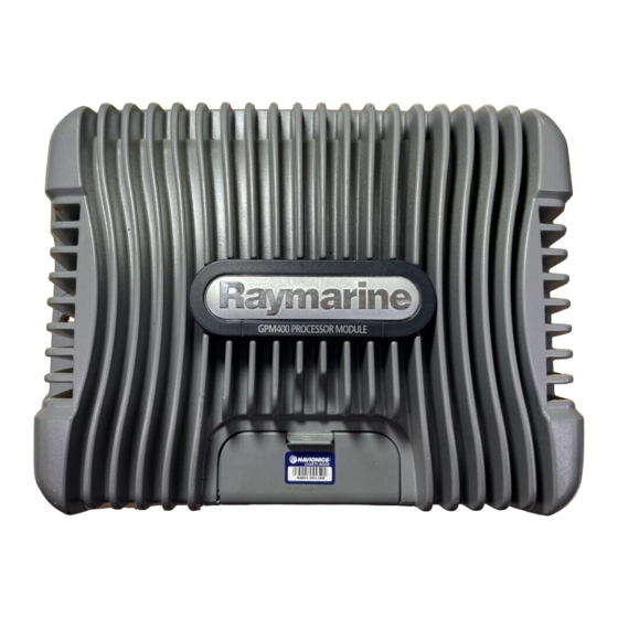
Summary of Contents for Raymarine GPM400
- Page 1 G-Series Systems Reference Guide...
- Page 3 G-Series System Reference Guide Document Number: 81276-1 Date: June 2007...
- Page 4 Trademarks and registered trademarks Autohelm, HSB, Raymarine, RayTech, Sail Pilot, SeaTalk and Sportpilot are registered trademarks of Raymarine Limited. Apelco is a regis- tered trademark of Raymarine Holdings Limited (Registered in all major marketing territories). AST, Autoadapt, Auto GST, Autoseastate, Autotrim, Bidata, Marine Intelligence, Maxiview, On Board, Raychart, Raynav, Raypilot, Raystar, ST40, ST60, Seaclutter, Smart Route, Tridata and Waypoint Navigation are trademarks of Raymarine Limited.
-
Page 5: Table Of Contents
Contents Chapter 5: The Chart Application ...... 43 5.1 Warnings and cautions ..........44 5.2 Supplied cartography ..........44 Chapter 1: System Overview ......13 5.4 Chart setup ...............46 1.1 Hardware overview ..........14 5.8 Heading and course information ......62 1.2 Display and keyboard ..........15 5.10 Showing and hiding waypoints .......64 1.3 Installing and commissioning ........ - Page 6 Chapter 8: The Fishfinder .........91 Chapter 12: Automatic Identification System ..157 8.1 The fishfinder display ..........92 12.1 Background ............158 8.2 Background information ........... 92 12.2 System requirements ........... 158 8.3 Operating the fishfinder ........... 92 12.3 System settings ............ 158 8.4 Explaining the readout ..........
- Page 7 Chapter 16: The Data Application ....179 Chapter 22: Disclaimers and Licenses ... 217 16.1 The data display ........... 180 22.1 Sirius Weather ............218 16.2 Using the data application ........180 22.2 Navionics license agreement .......219 Chapter 17: Engine Monitor ......183 17.1 The engine monitor ..........
- Page 8 G-Series Installation & Commissioning...
- Page 9 Warnings and Cautions High voltage The system described in this book may form part of a marine navi- gational radar or GPS-based system intended for use on (non-IMO/ The display unit and scanner unit contain high voltages. SOLAS class) leisure vessels or small workboats. Adjustments require specialized service procedures and tools only available to qualified service technicians - This handbook contains important information on the operation and...
- Page 10 When archiving use a different CompactFlash card. Raymarine does not warrant that this product is error-free or that it DO NOT use a metallic instrument such as a screwdriver or is compatible with products manufactured by any person or entity pliers to remove a card, as doing this can cause irrepa- other than Raymarine.
-
Page 11: Emc Conformance
Raymarine does not necessarily support all the features in particu- To obtain Navionics cards, contact your local dealer or visit the Nav- lar Navionics cartography. ionics web site. - Page 12 G-Series Reference Manual...
-
Page 13: Chapter 1: System Overview
Chapter 1: System Overview This chapter gives you an overview of the G-Series system components and features. Chapter contents • 1.1 Hardware overview on page 14 • 1.2 Display and keyboard on page 15 • 1.3 Installing and commissioning on page 17 •... -
Page 14: Hardware Overview
Hardware overview The diagram below shows a G-Series system with one GPM400 and two monitors (second monitor is a repeater). SeaTalk NG SeaTalkNG Instruments/pilot Navstation 1 Monitor 1 Monitor 2 CANCEL ENTER CANCEL ENTER MENU MENU (repeater) and/or SeaTalk Instruments/pilot... -
Page 15: Display And Keyboard
Display and keyboard You access the features and functions of a G-Series system through Nav Stations, which comprise monitors and keyboards. This section gives you an overview of the controls in a Nav Station. For detailed information about how to operate the system, see Chapter 2:Operating Principles on page 21. - Page 16 Softkeys are color-coded with softkey labels. Autopilot control keys If you have a Raymarine autopilot connected to the G-Series sys- Confirm the selection of a highlighted list, menu or screen object. tem, you can control some of its features from the G-Series keyboard.
-
Page 17: Installing And Commissioning
Display controls If you have a Raymarine monitor you can customize display set- tings, including choosing between day or night-time color palettes, using the G-Series setup menus. For information about how to do that, see Introducing Nav Stations on page 22. - Page 18 Chart Radar • Locate where you are • Detect landmasses & navigation markers. • Interpret your surroundings. • Detect and measure the range and distance • of other vessels. Monitor where you are going. • • Acquire targets and track them for collision Record where you have been.
- Page 19 You can receive and manage radio broadcasts on the G-Series system using Sirius Audio (Sirius SR100 data receiver required). Autopilot If you have a Raymarine autopilot installed, you can make use of Sirius Weather the pilot control features of the G-Series system. You can engage the autopilot from the G-Series keyboard instead of the pilot control •...
- Page 20 G-Series Reference Manual...
-
Page 21: Chapter 2: Operating Principles
Chapter 2: Operating Principles The first section of this chapter introduces Nav Stations: the networked keyboards and monitors you use to operate the G-Series. The second section describes how you control the applications using the various buttons, softkeys, menus and toolbars. The operating principles described in this section apply to all applications. -
Page 22: Introducing Nav Stations
Standard cursor. For each monitor, you can have a repeat monitor. This is driven by the same GPM400 as the first monitor, but would be placed at a dif- ferent Nav Station to make information available at two locations. If the cursor is not moved for... - Page 23 Toolbars and softkeys A toolbar is a set of softkey labels displayed along the bottom of a Setup Menus for the display. Each label is color-keyed to match the corresponding soft- Radar Setup ... active application key on the keyboard. GPS Status...
- Page 24 2. Change the setting: To enter data into a dialog box 1. Select the appropriate field. Cartography Setup Menu Chart Display Detailed e.g. Chart Grid Symbol EDIT NAME Chart Text Chart Boundary Name Waypoint 1 Spot Soundings Safety Contour 66ft My Waypoints Group Depth Contour...
-
Page 25: Displaying Applications
Displaying applications Each G-Series application is displayed in a window. The system can display up to four windows at once, on a single page. Page set Weather Video 3D Chart Fishfinder Data Radar Engine monitor 2D Chart Page Window (consists of 1, 2, 3 or 4 windows in various configurations) You can configure pages to contain the window or windows that best suit your requirements. - Page 26 None of the preconfigured sets includes a page for the engine Selecting application windows monitor, weather or video applications. To configure a set that When the selected page has more than one window, the window does, or to create a custom set for any combination of applications, that is currently active has a red border.
- Page 27 Panning and zooming In the appropriate application windows, you can pan and zoom the view to display a different geographic area (pan) or change the scale at which an area is displayed (zoom). Panning In the chart, 3D chart and weather applications, you move the cur- sor using the trackpad.
- Page 28 2.4 On-screen information Information is displayed on screen in a variety of ways: Menus (see next page) Status bar Data bar Status icons • • Used to configure system to your Gives information specific to Gives information associated with Confirm status of DSM, particular needs.
-
Page 29: Simulator Mode
MOB waypoint and your 4. Press OK. vessel. • MOB message transmitted to other Raymarine equipment. Emergencies and warnings • Current position to MOB position is represented on screen by a dotted line. - Page 30 • The databar mode is reset. To cancel an alarm 1. Press the ACKNOWLEDGE softkey. • GOTO and route functions return. Note: If you have a MOB keypad fitted, you can also press and • If an anchor alarm is silenced but the alarm condition persists, hold the MOB key.
-
Page 31: Chapter 3: Nav Station Setup
Chapter 3: Nav Station Setup This chapter describes initial power-on and system setup procedures. Chapter contents • 3.1 Controlling system power on page 32 • 3.2 Monitor settings on page 32 • 3.3 Keyboard settings on page 33 • 3.4 Setting language, date and time, and units of measurement on page 33 •... -
Page 32: Monitor Settings
1. With the system powered on, press the power button once. If you are using a Raymarine monitor, the power control screen Note: The power button does not control power to the GPM400 allows you to set the monitor brightness level and color palette. You unit. -
Page 33: Keyboard Settings
To select a different color palette Local settings 1. On the power control toolbar, press MONITOR CONTROLS. The majority of functions, settings, and changes that you make on 2. Toggle to the palette you want to use on the PALETTE softkey. a Nav Station are detected by all the Nav Stations in the system. - Page 34 G-Series Reference Manual...
-
Page 35: Chapter 4: Using Waypoints
Chapter 4: Using Waypoints This chapter introduces waypoints and explains how to use them for navigation with the G-Series system. Chapter contents • 4.1 Introducing waypoints on page 36 • 4.2 The waypoint toolbar on page 37 • 4.3 Waypoint list on page 38 •... -
Page 36: Introducing Waypoints
Introducing waypoints Radar and 2D chart windows Waypoints are used to mark points to navigate to, for marking loca- A waypoint is represented on a radar or chart window when it is tions for fishing and diving, and as building-blocks in routes. inactive or active (i.e. - Page 37 4.2 The waypoint toolbar Pressing the WPTS/MOB button opens the toolbars shown below: WAYPOINT AT WAYPOINT AT WAYPOINT AT GOTO WAYPOINT REVIEW AND EDIT CURSOR VESSEL LAT/LON OPTIONS WAYPOINTS Erase waypoints Sort list Set default symbol and group Set up default symbol/group Edit default Waypoint groups Erase groups...
-
Page 38: Waypoint List
WAYPOINT AT WAYPOINT AT WAYPOINT AT GOTO WAYPOINT REVIEW AND EDIT CURSOR VESSEL LAT/LON OPTIONS WAYPOINTS Place waypoint Goto waypoint Advance waypoint Stop goto Restart XTE D10551-1 Waypoint list Waypoint lists can be password protected. The details of all waypoints, irrespective of the application they Placing waypoints were created in, are stored in a dedicated waypoint list which holds up to 3000 waypoints. -
Page 39: Navigating To Waypoints
To place a waypoint at the cursor To stop navigating to a waypoint 1. Press the WPTS/MOB button. 1. Highlight the waypoint. 2. Move the cursor to the waypoint position. 2. Press the STOP GOTO softkey. 3. Press the WAYPOINT AT CURSOR softkey. 4. - Page 40 • Change the waypoint group. • Add a comment. • Move a waypoint. Default symbol • Erase a waypoint. • Change the default symbol and group of newly placed waypoints. Changing the waypoint name, symbol or group When you create a waypoint, the system automatically assigns it a name, symbol and group.
-
Page 41: Sorting The Waypoint List
You can move any waypoint except the active one. There are two 6. Confirm the deletion. methods of moving a waypoint: by entering a new set of coordi- nates for it (under the VIEW AND EDIT DETAILS softkey), or by Sorting the waypoint list selecting and dragging it to a new position. - Page 42 To open the waypoint group list Deleting groups 1. Press the WPTS/MOB button. When you erase a group, the group name and all the associated 2. Press the REVIEW AND EDIT WAYPOINTS softkey. waypoints are removed from the system. If a group contains one or 3.
-
Page 43: Chapter 5: The Chart Application
Chapter 5: The Chart Application The chart application provides navigation, hazard awareness and planning features. Use the chart applica- tion to establish your position; navigate using waypoints and routes; record your progress; measure distance and bearing; overlay chart and radar data; view AIS data, and view aerial photography. For information about autopilot integration, see page Chapter contents... -
Page 44: Warnings And Cautions
Warnings and cautions Supplied cartography Always check that your route is safe. Use the Range key to zoom in The G-Series system comes preloaded with Navionics cartography. to check for hazards that may not be visible on a larger scale view. Depending on your region, different levels of cartography (Platinum or Gold) are available in different areas. - Page 45 5.3 Chart Overview The illustration below shows the components of a typical chart view. Chart orientation Motion mode Chart view Status Chart range Active waypoint Current position Port Services Carto- graphic object Softkeys Your position If your position is outside the area of chart currently shown in the chart window, the vessel symbol will not be visible.
-
Page 46: Chart Setup
Chart setup FUNCTION OPTIONS Navionics cartography comes pre-installed on your system. You Vector Width can also use Navionics chart cards: in that case, the system uses Sets the width of the COG and Thin whichever cartography is the latest. HEADING chart vector lines. Normal Wide To suit your particular requirements, you can configure how the... - Page 47 If you have a Raymarine GPS attached, it will automatically update 2. Highlight Cartography Setup. when you adjust the datum. If you use a third-party GPS, you need 3. Press the right-arrow on the trackpad. to update its datum separately.
- Page 48 FUNCTION OPTIONS FUNCTION OPTIONS Nav. Marks Roads Major coastal roads Nav. Marks Symbols International Additional Wrecks The set of symbology used for navigation Extended wrecks data for new wrecks marks. Corresponds to paper charts. Light Sectors Chart scale The sector of light cast by a fixed beacon. Use the Range key to change the scale of your chart view.
- Page 49 When an alarm is triggered, a buzzer sounds and a pop-up window describing the alarm and how to clear it is displayed. In some cases, appropriate action is taken automatically by the G-Series system. For example, following an arrival alarm, the next route leg is activated.
- Page 50 5.5 Quick waypoints The GOTO softkey gives you access to simple navigation functions on the G-Series system and opens the toolbars shown below. FIND GOTO ROUTES TRACKS PRESENTATION Goto cursor Follow route options Route list Follow route Goto waypoint options Reverse and follow Waypoint list Sort list...
- Page 51 The WPTS/MOB button gives you access to more waypoint func- Resetting XTE sets a new course from your current position to the tions. For information about using it, see Placing waypoints on target waypoint. page 38. To reset XTE Note: To set up and store a route consisting of more than one 1.
- Page 52 5.6 Building a route Using routes gives you more flexibility and planning options than the goto feature. FIND GOTO ROUTES TRACKS PRESENTATION Show/hide routes Follow route options Build new route Review and edit routes Place waypoint Save route Use waypoint list Follow from here Make route Move waypoint...
- Page 53 Use the ROUTES softkey to create and manage waypoints that Building a route in chart view form part of a route. The ROUTES softkey gives you more flexibility The chart view lets you build a route from existing waypoints or by than the GOTO softkey;...
- Page 54 • Undo the last waypoint (chart view only). • Delete a waypoint from the route list (waypoint list only). • Abandon the route build. To remove waypoints from a route in chart view 1. Highlight the waypoint you want to remove from your route. 2.
- Page 55 Following routes FIND GOTO ROUTES TRACKS PRESENTATION Show/hide routes Follow route options Route list Build new route Route on chart show/hide Review and edit routes Sort list by Waypoint index on/off Follow route Reverse and follow D10554-1 You select a route to follow either by highlighting it with the cursor To select a route to follow in the routes list or by selecting it within the routes list.
- Page 56 Arriving at a waypoint This is useful if you find yourself off course and want to go straight to your target, rather than get back onto the original track. When the distance to the next waypoint in the route is less than that Although RESTART XTE causes your vessel to change course, it specified for the arrival alarm radius (see page...
-
Page 57: Editing Routes
Editing routes When you have built and saved a route, you can make updates or changes to it if necessary. FIND GOTO ROUTES TRACKS PRESENTATION Show/hide routes Follow route options Build new route Review and edit routes Route list Erase route Amend route course Place waypoint Route details... - Page 58 You can edit a route in a variety of ways. You can: To create and add a new waypoint 1. Highlight the route you want to add a waypoint to. • Change the course of a route. 2. Press the INSERT WAYPOINT softkey. •...
- Page 59 To change a route’s name or color 1. Select the route you want to edit. 2. Press the EDIT NAME AND COLOR softkey. 3. Select EDIT NAME or EDIT COLOR. 4. Make your desired changes to the route’s details. 5. Press OK. Erasing a route You can delete any route in your system except for the one that you are following.
- Page 60 5.7 Tracking your progress The TRACKS softkey opens the toolbars shown below. FIND GOTO ROUTES TRACKS PRESENTATION Show/hide tracks Create route from track Track list Start track Track list Review and edit tracks Track starts Track list Stop track Discard track Save track Cancel stop command D10556-1...
- Page 61 You can personalize track options to suit your requirements: Note: If the power fails while a track is being recorded, or if the position fix is lost, a break will occur in the track. Only the • Rename a track. last contiguous segment of a track can be converted into a •...
-
Page 62: Heading And Course Information
You can now choose to edit the name and color of the track, or to For the wind arrows feature to work, you must have a wind instru- delete it from the system. ment enabled. For tide arrows, you need a GPS and speed through water instrument. - Page 63 5.9 Presentation options The PRESENTATION softkey gives you control over how data is displayed on a chart window. It opens the toolbars shown below. FIND GOTO ROUTES TRACKS PRESENTATION Show/hide waypoints Show waypoints Show by sym/group Chart layers Aerial overlay On chart show/hide Radar overlay Waypoint name on/off...
-
Page 64: Showing And Hiding Waypoints
5.10 Showing and hiding waypoints Radar overlay Overlaying the chart image with radar data allows for better distinc- This option lets you specify which waypoints are displayed on the tion between stationary and moving objects. For best results, screen. You can show all waypoints, or display them by symbol or switch on radar-chart synchronization. - Page 65 • ‘Sync’ is indicated in the top left-hand corner of the chart • Target display window. • Change range (using the Range button) • If you change the radar range in any radar window, all synchro- Navigation options: nized chart views change scale to match. •...
-
Page 66: Chart Mode And Orientation
5.12 Chart mode and orientation Heading Mode settings control how the chart displays information. You can Large synchronize the chart display with the radar application; set how vessel movement is represented; set the position of your vessel’s repre- Direction of turn sentation on-screen, and choose your preferred chart orientation. - Page 67 Course Up (C-UP) Relative motion In Course Up mode, the chart is static and oriented with your cur- The default motion mode is relative motion. In this mode, the chart rent course upwards. When you change heading, the ship symbol is redrawn relative to your position as you make progress, so that moves accordingly.
-
Page 68: Chart View
5.14 Chart detail You can adjust the level of detail shown on the chart by choosing to show or hide certain features. To show or hide routes and tracks 1. Highlight a route or track and press the HIDE softkey. 0 Vessel offset 1. -
Page 69: Journey Planning
5.15 Journey planning Depending on the object type, its additional information might allow Navionics chart data is preinstalled on the GPM400. The data pro- you to: vides you with some or all of the following information: •... - Page 70 • GOTO the selected waypoint. You can set the date for the animation and choose to see the whole animation from the beginning or start it at any point within a 24-hour • View tidal/current data for the selected tidal/current station. period.
- Page 71 The animation plays in a loop: when it reaches the end of a 24-hour Port services animation period, it starts again at the beginning. You can display details of port services by using the FIND NEAR- EST function. Alternatively, you can use either of the methods To start or stop the animation below.
- Page 72 Panoramic photography You can view panoramic photography of many ports and marinas. Business services/points of interest symbols The availability of photography is indicated by a camera symbol on the chart, placed at the point the photograph was taken. The view- point is indicated by the angle of the camera symbol.
-
Page 73: Measuring Distance, Range And Bearing
To overlay aerial photography 5.16 Measuring distance, range and 1. Press the PRESENTATION softkey. bearing 2. Press CHART LAYERS. Options for measuring distance, range and bearing are outlined in 3. Toggle AERIAL OVERLAY to ON or OFF as appropriate. the table below. 4. - Page 74 To clear the ruler 1. Press DATA. 2. Press the RULER softkey. 3. Press CLEAR RULER. G-Series Reference Manual...
-
Page 75: Chapter 6: 3D Chart
Chapter 6: 3D Chart The 3D chart gives you an accurate, three-dimensional view of the area around your vessel. This can help you navigate more confidently if the area is new to you or if visibility is poor. Navigation functions are available in the 3D chart. Chapter contents •... -
Page 76: Safety Notice
Safety notice The 3D chart setup menu gives you the following options: The 3D chart is an aid to visualization only. Always check your nor- FUNCTION OPTIONS mal charts to ensure your route is safe. Description (Default in bold) Until you are familiar with interpreting the 3D chart display, take Centre-of-view indicator every opportunity to compare what you see on-screen with your Centre-of-view indicator (marked with a white cross) -
Page 77: Operation Modes
• Planning mode. Range Mode Boat symbol Rotation Horizontal distance across Shows mode Boat's position on Shows in degrees true, screen (halfway up the window application is chart. Select sail how far the on-screen Active motion mode or at center of view). Shown in working iin. - Page 78 6.6 Using the 3D chart The default toolbar on the 3D chart gives you access to navigation and presentation options. ADJUST ON ADJUST FIND SHIP GOTO PRESENTATION EYE CENTER ROTATE PITCH Follow route options Goto waypoint options Route list Waypoint list D10558-1 Find Ship Adjusting the chart view...
-
Page 79: Navigation Options
2. Toggle to the setting you want to adjust. 3. Make the adjustment with the rotary controller. 4. Press OK. Note: The rotary controller is always active to adjust pitch and rotation. This is different to most other uses of the rotary controller, which require you to press a softkey to enable adjustment. - Page 80 6.7 Presentation options The PRESENTATION softkey opens the toolbars shown below: FIND SHIP GOTO ADJUST ON ADJUST PRESENTATION EYE CENTER ROTATE PITCH Chart layers Depth overlay on/off 3D view options Depth plane value Waypoint name on/off View to forward/starboard/aft/port Trans cone on/off Depth scale on/off Adjust exaggeration Waypoint name on/off...
-
Page 81: Tuning The View
View options 3. Toggle to your preferred view on the VIEW TO softkey. 4. Press OK. There are four view options to choose from: forward, aft, port and starboard. Multiple views 2.431nm ROTATE 106 2.431nm ROTATE 280 You can display multiple 3D chart views by creating a page that contains up to four windows. - Page 82 Exaggeration The declutter feature removes some chart objects from view to make the chart clearer to read and navigation simpler. Sometimes it is easier to see certain topographical features if they are exaggerated. Adjusting the exaggeration has the effect of verti- cally stretching objects on the chart, making it easier to see their shape and position.
-
Page 83: Using The Standard And 3D Charts Together
3D view locator Using the standard and 3D charts together The view locator is a polygon displayed on the standard chart which outlines the boundaries of the area shown on the 3D chart. It is If the area in which you are navigating is unfamiliar, or visibility is shown as a blue line extending from the virtual eye point icon. -
Page 84: Aerial Photography Overlay
• Pressing FIND SHIP from any synchronized application returns 6.10 Aerial photography overlay the 3D chart to the default view and synchronizes the 2D chart to You can overlay aerial photography onto the 3D image. This can the same view. help you interpret the chart view of your surroundings. -
Page 85: Chapter 7: Autopilot Integration
Chapter 7: Autopilot Integration If you have a Raymarine autopilot installed, you can access some of its functions from the G-Series keyboard. The autopilot functions do not replace the autopilot control head. You must have a pilot control head installed before you enable or engage the autopilot. -
Page 86: Emergency Disengage
Emergency disengage When the autopilot is engaged, or you hotspot an active route or waypoint, the toolbar gives you the following options: To disable the autopilot 1. Press the STANDBY button. STOP GOTO/FOLLOW Opens the Pilot Control screen. If the autopilot is in track mode, the route complete alarm sounds. -
Page 87: The Autopilot Control Screen
Autopilot toolbar Icon Autopilot mode Auto. AUTO Engage the autopilot and hold the current course (available when the autopilot is in Track or Standby mode). No autopilot detected. ENGAGE PILOT Engage the autopilot and track to the current -TRACK- target waypoint. STANDBY Disengages the autopilot (only available when Autopilot alarm is active. - Page 88 • sounds the waypoint arrival alarm • displays the Pilot Control screen with ‘Last Waypoint’ in the Next Waypoint field. The toolbar gives you three options: Press CLEAR ALARM to silence the alarm and keep the autopilot engaged in auto mode, continuing on the current heading. Press STANDBY to silence the alarm and disengage the autopilot.
- Page 89 Chapter 7: Autopilot Integration...
- Page 90 G-Series Reference Manual...
-
Page 91: The Fishfinder Display
Chapter 8: The Fishfinder The fishfinder uses acoustic sounding to display fish, seabed structure, and underwater obstructions like wrecks. Chapter contents • 8.1 The fishfinder display on page 92 • 8.2 Background information on page 92 • 8.3 Operating the fishfinder on page 92 •... - Page 92 The fishfinder display A transducer on the bottom of the boat sends pulses of sound waves into the water and measures the time it takes for the sound The fishfinder displays a scrolling image of the seabed, updating wave to travel to the bottom and back. The returning echoes are from the right as your vessel makes progress.
-
Page 93: Explaining The Readout
Explaining the readout Boat speed The fishfinder’s reading of the bottom changes as your speed changes. Slower speeds return flatter, more horizontal marks; as A hard bottom (sand) produces a thin line your speed increases, the image will tend to thicken and arch, until at high speeds the bottom resembles a double line on the fishfinder display. - Page 94 • Higher frequencies (200 Khz) scan a narrow area but produce more detail, especially at high boat speed. They are most useful in shallower waters (up to 1000 feet). Various frequencies may be available on your system, depending on the transducers fitted to your vessel. Viewing single or dual frequencies If the preset you are using includes two frequencies, you can use one fishfinder window to view both frequencies or just one.
- Page 95 8.6 Display mode settings When a fishfinder preset is selected, its softkey label changes to ADJUST. Pressing this key allows you to configure the display mode settings to suit your requirements. (Changes to the display mode are saved with the preset at power-off.) ADJUST P1 PRESET 2 PRESET 3...
- Page 96 For each preset (and for each frequency within the preset), you can change the following display mode settings: • Zoom Zoom pane Standard pane • Bottom Lock • A-Scope To change the settings for a preset 1. Press the ADJUST <preset name> softkey. 2.
- Page 97 Adjusting the position of the zoomed area When the zoom function is selected, the system automatically Bottom lock range (distance from bottom) Depth from the surface selects the zoom position so that the bottom details are always in SHALLOW Freq1: 200 kHz-Auto Freq2: None the lower half of the display.
- Page 98 MODE 3 The A-scope MODE 2 image angles The left-hand side outward as MODE 1 of the Mode 1 signal width The A-scope image is expanded increases with image is centred to give a more in the window. detailed view. depth.
- Page 99 Changing the range You can change the range for each displayed frequency from the Range Adjust toolbar, which gives you control over the range and range- shift settings. Range auto/manual Range shift Select frequency high/low High frequency shift D10563-1 The DSM automatically adjusts the display to show the shallowest Range shift required range.
- Page 100 To return to the standard fishfinder image 1. Toggle to AUTO on the RANGE softkey. 2. Press OK. G-Series Reference Manual...
- Page 101 8.7 Presentation toolbar The PRESENTATION softkey gives you access to VRM features (for measuring depth and distance), frequency view selection and a scroll control. These settings affect the monitor you are working on. ADJUST P1 PRESET 2 PRESET 3 PRESET 4 PRESENTATION SINGLE DUAL...
- Page 102 Adjusting gain and power Manually-set gain levels If necessary you can set gain levels manually. Manually-set gain Changing the preset gain settings alters the way the fishfinder pro- levels are applied to the active window and any other fishfinder win- cesses background noise (also called clutter), and can improve the dows displaying that frequency.
- Page 103 Power setting The power setting controls the power level of the transducer. SHALLOW Freq1: 200 kHz-Auto Freq2: None F1: 200 kHz 1768ft Auto VRM marker indicating This is the default setting. When it is selected the DSM automati- distance behind boat cally determines the required power setting based on the current Depth line depth, speed, and (bottom) signal strength.
- Page 104 Note: When multiple fishfinder windows are open, we recommend To return the marker to its previous position, press CANCEL. you have the depth reading displayed in at least one window. Adjusting the scroll mode and speed You can adjust the speed at which the display scrolls, but the same Measuring depth and distance with VRM section of the bottom is displayed regardless of scrolling speed.
-
Page 105: Editing Presets
Viewing frequencies within a preset 8.11 Editing presets If the preset you are using has two frequencies, you can view either You can select frequencies for each preset from the Setup Fre- one or both of those frequencies in separate windows. quency Preset screen. - Page 106 Frequency 1 Behaviour Frequency 2 Behaviour DSM400 AUTO Automatically NONE/MAN Manual setting adjusts to suit is fixed. depth. MANUAL Fixed at NONE/MAN Manual setting selection. is fixed. AUTO Automatically AUTO Automatically selects highest adjusts to suit frequency and depth. widest beam. DSM300 AUTO Changes with MANUAL...
-
Page 107: Fishfinder Configuration
8.12 Fishfinder configuration This section describes the settings you can change using the fishfinder setup menu. The setup menu contains settings that are likely to be changed infrequently. For information on how to use setup menus, see Setup menus on page 23. Fishfi... - Page 108 DSM and transducer setup Nearby vessels equipped with a fishfinder, or certain physical con- 200 kHz: Auto Gain: Auto High Standard fishfinder image ditions (like hard seabeds), can affect the DSM. Its setup menus The standard fishfinder image displays the enable you to change settings to allow for this.
- Page 109 Manual Scroll Speed Ping Rate Limit (per sec) Specify the speed at which the fishfinder view updates and scrolls. Provides a speed limiter. It can be useful to adjust ping rate to suit local conditions, for example when you are over a hard seabed or Select Transducer in shallow water.
- Page 110 G-Series Reference Manual...
-
Page 111: Disclaimer
Chapter 9: Sirius Weather (US only) Overview The weather application superimposes historical, live and forecast weather data onto a world map. You can use the data to check the weather for your current position or for areas you are planning to visit. For a basic weather glossary, see the appendix at the back of this manual.
Need help?
Do you have a question about the GPM400 and is the answer not in the manual?
Questions and answers