Garmin echoMAP CHIRP 40 Owner's Manual
Hide thumbs
Also See for echoMAP CHIRP 40:
- Installation instructions manual (6 pages) ,
- Owner's manual (34 pages)
Table of Contents
Advertisement
Quick Links
Advertisement
Table of Contents

Subscribe to Our Youtube Channel
Related Manuals for Garmin echoMAP CHIRP 40


Summary of Contents for Garmin echoMAP CHIRP 40
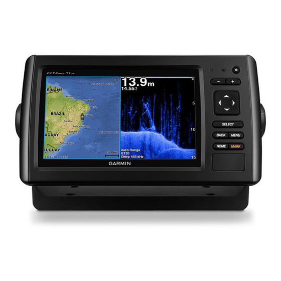
- Page 1 echoMAP CHIRP 40/50/70/90 Series ™ Owner’s Manual September 2016 190-01951-10_0A...
- Page 2 All rights reserved. Under the copyright laws, this manual may not be copied, in whole or in part, without the written consent of Garmin. Garmin reserves the right to change or improve its products and to make changes in the content of this manual without obligation to notify any person or organization of such changes or improvements.
-
Page 3: Table Of Contents
Editing a Boundary ............... 15 Contours Feature ................ 9 Setting a Boundary Alarm ............ 15 Adding a Label to a Garmin Quickdraw Contours Map ....9 Deleting a Boundary ............15 Garmin Quickdraw Community ........... 9 Accessing the Garmin Quickdraw Community ....... 9 Autopilot................ - Page 4 Synchronizing the Fuel Data with the Actual Vessel Fuel ... 24 Traditional Sonar View ............16 Viewing the Wind Gauges ............24 Garmin ClearVü Sonar View ..........16 Configuring the Sailing Wind Gauge ........24 SideVü Sonar View .............. 16 Configuring the Speed Source ..........
- Page 5 Scanning for DAB Stations ..........27 Changing DAB Stations ............28 DAB Presets ................ 28 SiriusXM Satellite Radio ............28 Locating a SiriusXM Radio ID ..........28 Activating a SiriusXM Subscription ........28 Customizing the Channel Guide .......... 28 Saving a SiriusXM Channel to the Presets List ....28 Unlocking SiriusXM Parental Controls .........
-
Page 7: Introduction
You can use blank memory cards to record sonar data and transfer data such as waypoints, routes, and Power key tracks to another compatible Garmin chartplotter or a computer. Device keys Open the access flap or door on the front of the chartplotter. -
Page 8: Gps Satellite Signals
• To change the arrangement of the information on the screen, select Change Layout, and select a new layout. For more information about GPS, go to www.garmin.com /aboutGPS. • To change the information shown on the screen, select Change Function, and select new information. -
Page 9: Navigation Chart And Offshore Fishing Chart
Measuring a Distance on the Chart data includes buoys, lights, cables, depth soundings, marinas, and tide stations in an overhead view. From a chart, select a location. Perspective 3D: Provides a view from above and behind the Select Measure Distance. boat (according to your course) and provides a visual A push pin appears on the screen at your present location. -
Page 10: Viewing Details About Navaids
Premium Charts From the Navigation chart or Fishing chart, select a location or object. CAUTION A list of options appears along the right side of the chart. The The Auto Guidance feature is based on electronic chart options that appear vary based on the location or object you information. -
Page 11: Showing Satellite Imagery On The Navigation Chart
vessel was reported, nearest approach, and time to the nearest Color Current Speed Range approach. Yellow 0 to 1 knot Some chartplotter models also support Blue Force Tracking. Orange 1 to 2 knots Vessels being tracked with Blue Force Tracking are indicated on 2 or more knots the chartplotter with a blue-green color. -
Page 12: Showing Ais Vessels On A Chart Or 3D Chart View
When course over ground and heading information are provided alarm will sound 10 minutes before the vessel intersects the by an activated AIS target, but rate of turn information is not safe zone. provided, the projected course of the target is calculated based AIS Distress Signals on the course over ground information. -
Page 13: Navigation And Fishing Chart Setup
Overlay Numbers: See Overlay Numbers Settings, page Shallow Shading: Sets the shades from the shoreline to the This might appear in the Chart Setup menu. specified depth. Chart Appearance: See Chart Appearance Settings, page Depth Range Shading: Specifies an upper and lower depth to This might appear in the Chart Setup menu. -
Page 14: Showing A Navigation Inset
When you record data on a memory card in your chartplotter, Overlay Numbers Settings the new data is added to your existing Garmin Quickdraw From a chart, 3D chart view, the Radar screen, or a Contours map, and is saved on the memory card. When you Combinations screen, select MENU >... -
Page 15: Mapping A Body Of Water Using The Garmin Quickdraw Contours Feature
TIP: If you cannot find the file, look in the "Downloads" folder. Contours Map The browser may have saved the file there. You can add labels to a Garmin Quickdraw Contours map to Remove the memory card from your computer. mark hazards or points of interest. -
Page 16: Basic Navigation Questions
Setting and Following an Auto Guidance Path, CAUTION page Garmin recommends using Guide To only under motor power. How do I change the Auto Auto Guidance Path Using Guide To while under sail can cause an unexpected gybe, Guidance settings for my Configurations, page risking damage to the sailboat. -
Page 17: Setting And Following A Direct Course Using Go To
When you • To move the position of the waypoint, select Move. are using a compatible Garmin autopilot connected to the Browsing for and Navigating to a Saved Waypoint chartplotter using NMEA 2000, the autopilot follows the Auto Guidance route. -
Page 18: Creating And Saving A Route
NOTE: The offshore Fishing chart is available with premium Follow the magenta line along each leg in the route, steering charts, in some areas. to avoid land, shallow water, and other obstacles. From the Navigation chart or Fishing chart, select a If you are off course, follow the purple line (corrected course) destination. -
Page 19: Viewing A List Of Saved Tracks
Select an option: • To record a track log until the track memory is full, select Fill. • Select the time the active track began. • To continuously record a track log, replacing the oldest • Select Entire Log. track data with new data, select Wrap. Viewing a List of Saved Tracks Configuring the Recording Interval of the Track Log Select User Data >... -
Page 20: Reviewing An Auto Guidance Path
Reviewing an Auto Guidance Path Near or Nearest. As a result, the chartplotter may not reposition the Auto Guidance line, unless the destination From the Navigation chart, select a path. selected requires navigation through a narrow waterway. Select an option: Select an option: •... -
Page 21: Creating A Boundary
You can create boundary areas, lines, and circles using the Select Edit Boundary > Delete. map. You can also convert saved tracks and routes into boundary lines. You can create a boundary area using Autopilot waypoints by creating a route from the waypoints, and converting the route into a boundary line. -
Page 22: Steering Patterns
Garmin ClearVü Sonar View > Circles. If necessary, select Time, and select a time for the autopilot NOTE: To receive Garmin ClearVü scanning sonar, you need a to steer one complete circle. compatible chartplotter or fishfinder and a compatible transducer. -
Page 23: Split-Zoom Sonar View
Left side of the boat Right side of the boat The transducer on your vessel Trees Old tires Logs Distance from the side of the boat Water between the vessel and the bottom SideVü Scanning Technology Instead of a more common conical beam, the SideVü transducer Panoptix down view history in a scrolling sonar view uses a flat beam to scan the water and bottom to the sides of Boat... -
Page 24: Changing The Sonar View
From a sonar view, select MENU > Pause Sonar. kind of transducer you have. Use the arrow keys. This chartplotter is compatible with the Garmin ClearVü ™ transducer as well as a range of accessory transducers Adjusting the Level of Detail... -
Page 25: Adjusting The Color Intensity
When viewing Select an option: Garmin ClearVü or SideVü sonar views, it is recommend • While in the Garmin ClearVü or SideVü sonar view, select to use the Auto setting. Contrast. • To use a very fast scroll speed, select Ultrascroll®. -
Page 26: Creating A Frequency Preset
Trails, and select an option. This chartplotter is compatible with the Garmin ClearVü • To distinguish the bottom from the water by coloring the transducer as well as a range of accessory transducers bottom brown, select Bottom Fill. -
Page 27: Realvü Sonar Settings
color schemes provide color assignments to the low intensity The lowest interference setting that achieves the desired returns that are similar to the background color. improvement should be used to remove interference from the screen. Correcting installation issues that cause noise is the Appearance: See Sonar Appearance Settings, page best way to eliminate interference. -
Page 28: Stopping The Sonar Recording
From a sonar view, select MENU > Sonar Setup > Sonar When the end point is past the start line, the line is red. This Recording > Record Sonar. indicates the boat must reduce speed to avoid a penalty for reaching the start line before the timer expires. -
Page 29: Setting The Keel Offset
a higher number. For laylines that display a higher sensitivity Engaging Wind Hold to changes in the boat's heading or true wind angle, enter a Before you can enable the wind hold type, you must connect a lower number. NMEA 2000 or NMEA 0183 wind sensor to the autopilot. When the autopilot is in standby mode, select Wind Hold. -
Page 30: Viewing Trip Gauges
Viewing Trip Gauges Synchronizing the Fuel Data with the Actual Vessel Fuel Trip gauges show information for odometer, speed, time, and You can synchronize the fuel levels in the chartplotter with the fuel for your present trip. actual fuel in the vessel when you add fuel to your vessel. Select Gauges >... -
Page 31: Tide, Current, And Celestial Information
• To view true or apparent wind, select Wind, and select an • The chartplotter can transfer your GPS position to your radio. option. If your radio is capable, GPS position information is transmitted with DSC calls. • The chartplotter can receive digital selective calling (DSC) Tide, Current, and Celestial distress and position information from the radio. -
Page 32: Navigating To A Tracked Vessel
Repeats one song Individual Routine Calls Scans for stations When you connect the chartplotter to a Garmin VHF radio, you can use the chartplotter interface to set up an individual routine Searches for stations or skips songs call. -
Page 33: Playing Music
Playing Music Select an option. Changing the Radio Station Browsing for Music From the media screen, select an applicable source, such as From the media screen, select Browse or MENU > Browse. Select SELECT or select an option. Select to tune to a station. Enabling Alphabetical Search Changing the Tuning Mode You can enable the alphabetical search feature to find a song or... -
Page 34: Changing Dab Stations
Changing DAB Stations United States. Contact SiriusXM by phone at (877) 438-9677 or go to www.siriusxm.ca/activatexm to subscribe in Canada. Select the DAB source. Provide the Radio ID. If necessary, select Scan to scan for local DAB stations. The activation process usually takes 10 to 15 minutes, but Select to change the station. -
Page 35: Setting The Device Name
(if applicable), the software Insert the USB flash drive into the USB port of the stereo. version for an optional Garmin radar (if applicable), and the unit On the chartplotter media screen, select MENU > ID number. You may need this information to update the system Installation >... -
Page 36: Setting The Keel Offset
If the wheel turns freely, check the cable connections. Complete an action, based on the location of the transducer: If you continue to get the message, contact Garmin product • If the transducer is installed at the water line , measure support. -
Page 37: Nmea 0183
Naming Devices and Sensors on the Network Auto Guidance: Sets the parameters the chartplotter uses You can name devices and sensors connected to the Garmin when calculating an Auto Guidance path, when you are using Marine Network and the NMEA 2000 network. -
Page 38: Other Vessel Settings
Other Vessel Settings To transfer data with Garmin devices again, select the ADM file type. When your compatible chartplotter is connected to an AIS device or VHF radio, you can set up how other vessels are Sharing Waypoints and Routes Across displayed on the chartplotter. -
Page 39: Cleaning The Screen
On the chartplotter, select Settings > Units. From Windows ® Explorer, open the Garmin\scrn folder on the Select the correct map datum and position format settings. memory card. Create the waypoint again. -
Page 40: Nmea 2000 Pgn Information
Type Sentence Description Type Description Waypoint location 130576 Small craft status Digital selective calling information This data applies only to NMEA 2000-compatible products. Expanded digital selective calling Heading, deviation, and variation Heading, magnetic Wind direction and speed Meteorological composite Wind speed and angle AIS VHF data-link message You can purchase complete information about National Marine Electronics Association (NMEA) format and... -
Page 41: Index
Williamson turn pattern 16 navigation inset 8 zigzag pattern 16 Garmin ClearVü 16 NMEA 0183 25, 30, 31, 33 Garmin Marine Network 30, 31 NMEA 2000 31, 34 Garmin product support, contact information 1 backlight 2 gauges boundary line 15 engine 24 off course alarm 31 boundary lines 14 fuel 24, 30 other vessels limits 30 AIS 8... - Page 42 20 adjusting 23 FrontVü 18 gain 18 Garmin ClearVü 16 zoom interference 21 chart 3 measuring distances 18 sonar 19 noise 18, 19, 21 overlay numbers 20 Panoptix 17, 18, 20, 21 recording 21, 22 scroll speed 20 SideVü 16 surface noise 21...
- Page 44 +34 93 275 44 97 +27 (0)11 251 9800 + 46 7744 52020 +886 2 2642-9199 ext 2 +49 (0) 89 858364880 0808 238 0000 zum Ortstarif - Mobilfunk +44 870 850 1242 kann abweichen 913-397-8200 1-800-800-1020 © 2016 Garmin Ltd. or its subsidiaries...
- Page 50 ➀ ➁ ➀ ➁...
- Page 51 ➀ ➀ ➁ ➂ ➀ ➃ ➄ ➅ ➆ ➇...
- Page 52 ➀ ➁ ➂ ➃ ➀ ➁ ➂ ➊ ➋ ➌ ➍ ➎...
- Page 55 If the paper size is not large enough, select Properties and select a Page Size that is larger than the template. Notice Garmin is not responsible for any damages or expenses resulting from a miscut mounting surface arising from a failure to follow these instructions.
- Page 56 echoMAP 70 Series Flush Mount Template ™ 232.7 mm (9.19 in.) 3.2 mm (.125 in.) 122.4 mm (4.81 in.) November 2014 190-01835-03_0B Printed in Taiwan...
- Page 57 ➀ ➁ ➂ ➃ ➄ ➅ ➆ ➇...
- Page 58 ➀ ➃ ➅ ➀ ➁ ➃ ➄...
- Page 59 ➂ ➀ ➁ ➂ ➃ ➄ ➀ ➁...
Need help?
Do you have a question about the echoMAP CHIRP 40 and is the answer not in the manual?
Questions and answers