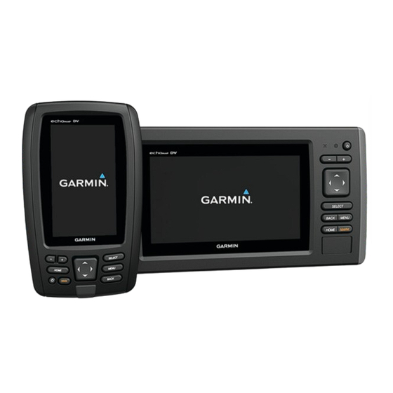
Garmin echoMAP CHIRP 40 SERIES Owner's Manual
Hide thumbs
Also See for echoMAP CHIRP 40 SERIES:
- Installation instructions manual (6 pages) ,
- Owner's manual (65 pages)
Table of Contents
Advertisement
Quick Links
Download this manual
See also:
Owner's Manual
Advertisement
Table of Contents

Related Manuals for Garmin echoMAP CHIRP 40 SERIES


Summary of Contents for Garmin echoMAP CHIRP 40 SERIES
- Page 1 echoMAP CHIRP 40/50/70/90 Series ™ Owner’s Manual January 2016 190-01951-00_0B...
- Page 2 All rights reserved. Under the copyright laws, this manual may not be copied, in whole or in part, without the written consent of Garmin. Garmin reserves the right to change or improve its products and to make changes in the content of this manual without obligation to notify any person or organization of such changes or improvements.
-
Page 3: Table Of Contents
Deleting All Saved Waypoints, Routes, and Tracks ....12 Contours Feature ..............5 Auto Guidance ................12 Adding a Label to a Garmin Quickdraw Contours Map ..5 Setting and Following an Auto Guidance Path ....12 Garmin Quickdraw Contours Settings ........5 Creating an Auto Guidance Path ......... - Page 4 Sonar................15 Making an Individual Routine Call to an AIS Target .... 21 Sonar Views ................15 Chartplotter Data Management ........21 Traditional Sonar View ............15 Copying Waypoints, Routes, and Tracks from HomePort to a DownVü Sonar View ............15 Chartplotter ................
-
Page 5: Introduction
You can use blank memory cards to record sonar data and transfer data such as waypoints, routes, and Power key tracks to another compatible Garmin chartplotter or a computer. Device keys Open the access flap or door on the front of the chartplotter. -
Page 6: Gps Satellite Signals
This chart is best for offshore deep-sea fishing. For more information about GPS, go to www.garmin.com /aboutGPS. Navigation Chart and Offshore Fishing Chart Selecting the GPS Source NOTE: The offshore Fishing chart is available with premium You can select your preferred source for GPS data, if you have charts, in some areas. -
Page 7: Chart Symbols
TIP: To reset the pin and measure from the current location of Select an option: the cursor, select SELECT. • To navigate to the selected location, select Navigate To. Chart Symbols • To mark a waypoint at the cursor location, select New Waypoint. -
Page 8: Viewing Tide Station Information
When you move the cursor over the tide The Garmin Quickdraw Contours mapping feature allows you to station indicator, the height of the tide at the station appears create maps with contours and depth labels to increase the above the station indicator. -
Page 9: Mapping A Body Of Water Using The Garmin Quickdraw Contours Feature
If you discontinue vessel tracking, the You can add labels to a Garmin Quickdraw Contours map to lost dangerous target symbol disappears from the chart or the mark hazards or points of interest. -
Page 10: Activating A Target For An Ais Vessel
view. The details, projected heading, and trails settings Navigating to a Distress Signal Transmission configured for one chart or one 3D chart view are applied to all When you receive a distress signal transmission, a distress charts and to all 3D chart views. signal alarm appears. -
Page 11: Waypoints And Tracks Settings On The Charts And Chart Views
Showing a Navigation Inset when certain premium maps are used (Showing Satellite Imagery on the Navigation Chart, page You can control whether a navigation inset appears on some chart views. The navigation inset is shown only when the boat is Water Overlay: Enables relief shading, which shows the navigating to a destination. -
Page 12: Setting The Heading And Course Over Ground Lines
From a chart or 3D chart view, select MENU > Other Vessels > present location and the destination. AIS Display Setup. When you are using a compatible Garmin autopilot AIS Display Range: Indicates the distance from your location connected to the chartplotter using NMEA 2000 , the ®... -
Page 13: Destinations
Guidance settings for my Configurations, page CAUTION boat? Garmin recommends using Guide To only under motor power. Using Guide To while under sail can cause an unexpected gybe, Destinations risking damage to the sailboat. Unattended sails and rigging can be damaged or cause injury to any crew or passengers during You can select destinations using various charts and 3D chart an unexpected gybe maneuver. -
Page 14: Stopping Navigation
Stopping Navigation Review the course indicated by the magenta line. NOTE: When using Auto Guidance, a gray segment within From the Navigation chart or Fishing chart, select MENU > any part of the magenta line indicates that Auto Guidance Stop Navigation. cannot calculate part of the Auto Guidance line. -
Page 15: Browsing For And Navigating A Saved Route
Select an option: Deleting a Saved Route Select User Data > Routes. • To change the name, select Name, and enter the name. Select a route. • To select a waypoint from the turn list, select Edit Turns > Use Turn List, and select a waypoint from the list. Select Delete. -
Page 16: Deleting All Saved Tracks
Select Delete. Setting and Following an Auto Guidance Path Select a destination (Destinations, page Deleting All Saved Tracks Select Navigate To > Guide To. Select User Data > Manage Data > Clear User Data > Saved Tracks. Review the path, indicated by the magenta line. Select Start Navigation. -
Page 17: Auto Guidance Line Configurations
Dock your vessel or drop the anchor. Safe Depth: Sets the minimum depth (chart depth datum) the chartplotter uses when calculating an Auto Guidance line. Select Settings > Navigation > Auto Guidance > Shoreline NOTE: The minimum safe depth for the premium charts is 3 Distance >... -
Page 18: Setting A Boundary Alarm
• To change the boundary lines or name, select Edit Adjusting the Step Steering Increment Boundary. From the Autopilot screen, select MENU > Autopilot Setup > Step Turn Size. • To edit the boundary alarm, select Alarm. Select an increment. Setting a Boundary Alarm Boundary alarms alert you when you are within a specified Setting the Power Saver... -
Page 19: Selecting A Combination
have connected to your chartplotter and whether you are using The full-screen Traditional sonar view show a large image of the premium maps. sonar readings from a transducer. The range scale along the right side of the screen shows the depth of detected objects as Selecting a Combination the screen scrolls from the right to the left. -
Page 20: Split-Screen Sonar Views
Follow the on-screen instructions. Transducer Installation Settings From a sonar view, select MENU > Sonar Setup > Installation. Transmit Rate: Sets the length of time between sonar pings. Increasing the transmit rate increases the scroll speed, but it may also increase self-interference. Reducing the transmit rate increases the spacing between transmit pulses and can resolve self-interference. -
Page 21: Adjusting The Level Of Detail
From a sonar view, select MENU > Sonar Setup > Overlay appear on the screen as long as it appears within the range you Numbers. have set. If necessary, select the numbers to customize. From a sonar view, select MENU > Range. Select the toggle to show or hide each data item. -
Page 22: Selecting Frequencies
Sonar Appearance Settings penetration. They can be used to search for structures such as brush piles. From a sonar view, select MENU > Sonar Setup > Appearance. A CHIRP frequency has a better resolution than traditional sonar frequencies, and displays some smaller targets more clearly. Color Scheme: Sets the color scheme. -
Page 23: Sonar Alarm Settings
Gauges and Almanac Data frequency has better deep water penetration. Wider beam widths can also generate more surface noise and reduce Gauges provide various information about the trip, environment, bottom signal continuity during rough sea conditions. and wind. Some data requires connection to compatible Use AHRS: Allows the internal attitude heading and reference sensors. -
Page 24: Viewing Information For A Different Tide Or Current Station
• If available, to view information for the day after the date Select a position-report call. shown, select Next Day. Select Navigate To. • If available, to view information for the day before the date Select Go To or Route To. shown, select Previous Day. -
Page 25: Individual Routine Calls
Individual Routine Calls Copying Waypoints, Routes, and Tracks to a Memory Card When you connect the chartplotter to a Garmin VHF radio, you can use the chartplotter interface to set up an individual routine Insert a memory card into the card slot. -
Page 26: Saving System Information To A Memory Card
(if applicable), the software Devices > Save to Card. version for an optional Garmin radar (if applicable), and the unit ID number. You may need this information to update the system If necessary, select the memory card to save system software or to purchase additional map data information. -
Page 27: Setting The Water Temperature Offset
The chartplotters support the NMEA 0183 standard, which is If the wheel turns freely, check the cable connections. used to connect various NMEA 0183 devices, such as VHF If you continue to get the message, contact Garmin product radios, NMEA instruments, autopilots, wind sensors, and support. -
Page 28: Nmea 2000 Settings
System: Enables NMEA 0183 output sentences for system hardware. information. Select Settings > Navigation. Garmin: Enables NMEA 0183 output sentences for Garmin proprietary sentences. Route Labels: Sets the type of labels shown with route turns on the map. Posn Precision: Adjusts the number of digits to the right of the decimal point for transmission of NMEA output. -
Page 29: Cleaning The Screen
If the original waypoint was taken from a map, there should be a legend on the map that lists the map datum and position From Windows Explorer, open the Garmin\scrn folder on the ® format used to create that map. Most often this is found near memory card. -
Page 30: Nmea 2000 Pgn Information
AIS VHF data-link message the product. Title, ownership rights, and intellectual property You can purchase complete information about National Marine rights in and to the Software remain in Garmin and/or its third- Electronics Association (NMEA) format and sentences from: NMEA, party providers. -
Page 31: Index
Garmin Marine Network 23 deleting 11 steering patterns 14 Garmin product support, contact information 1 editing 10 u-turn pattern 14 gauges navigating 11 Williamson turn pattern 14 fuel 23 navigating parallel to 11 zigzag pattern 14 limits 23 sharing 21 trip 19... - Page 32 recording 19 scroll speed 18 SideVü 15 surface noise 18 suspended targets 18 views 15, 16 waypoint 16 whiteline 18 zoom 17 SOS 10 suspended targets 8 symbols 5 system information 22 tide stations 4, 19, 20 indicators 4 tracks 11, 13 active 11 clearing 12 copying 21 deleting 11, 12 editing 11 list 11 navigating 11, 12 recording 12 saving 11 saving as route 11 showing 7, 11 transducer 15, 16, 18 trip...
- Page 34 +34 93 275 44 97 +27 (0)11 251 9800 + 46 7744 52020 +886 2 2642-9199 ext 2 +49 (0) 89 858364880 0808 238 0000 zum Ortstarif - Mobilfunk +44 870 850 1242 kann abweichen 913-397-8200 1-800-800-1020 © 2015–2016 Garmin Ltd. or its subsidiaries...
Need help?
Do you have a question about the echoMAP CHIRP 40 SERIES and is the answer not in the manual?
Questions and answers
Hi, I have an older model Garmin Echomap SV ( I think 7 inch Chirp) and would like to know if it is splashproof / waterproof please? I cannot find the manual unfortunately.
The Garmin Echomap SV (7 inch CHIRP) is waterproof and can withstand incidental exposure to water up to 1 meter for up to 30 minutes.
This answer is automatically generated