
Related Manuals for Garmin GPS 90


Summary of Contents for Garmin GPS 90
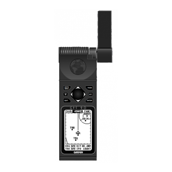
- Page 1 Owner’s Manual & Reference GOTO PAGE NRST GPS90 QUIT ENTER Personal Navigator ®...
- Page 3 GARMIN. I n f o rmation in this document is subject to change without notice. GARMIN reserves the right to change or improve their products and to make changes in the content without obligation to notify any person or organization of such changes or improvements.
- Page 4 90 is a precision device, any NAVAID can be misused or misinterpreted, and therefore become unsafe. Use the GPS 90 at your own risk. To reduce the risk of unsafe operation, carefully review and understand all aspects of this Owner’s Manual and thoroughly practice operation using the simulator mode prior to actual use.
- Page 5 Welcome to the smallest, easiest-to-use GPS navigator in the skies! The G A R M I N GPS 90 re p resents GARMIN’ s continuing commitment to pro v i d e aviators with quality navigation information in a versatile, accurate and user- friendly design you’ll enjoy for years to come.
- Page 6 Introduction Capabilities Designed for easy operation, the GARMIN GPS 90 offers powerful features that help make aviation navigation come alive in the palm of your hand. Precision Performance • MultiTrac-8 receiver tracks and uses up to 8 satellites simultaneously for fast, accurate positioning •...
- Page 7 Before getting started with your new GPS, check to see that your GPS 90 package includes the following items. If you are missing any parts, please see your dealer immediately. Standard Package: • GPS 90 Receiver • Carrying Case and Wrist Strap •...
-
Page 9: Table Of Contents
Table of Contents SECTION ONE Takeoff Tour GPS Overview ...2 Basic Definitions...3 Keypad Usage...4 GPS 90 Takeoff Tour...5-15 SECTION TWO Reference Waypoints & Database...17-26 Route & GOTO Navigation...27-33 Status Page ...34-35 Position Page ...36 Moving Map Plotting...37-41 Main Menu Page...42 Setup Menu...43-50... -
Page 10: Gps Overview
How Does GPS Work? GPS navigation uses satellite ranging to determine your position in relation to a set of satellites orbiting the earth. The GPS constellation is made up of 24 satellites, which continuously send radio signals containing precise position and time infor- mation for each satellite back to earth. -
Page 11: Basic Definitions
The GPS 90 is a powerful navigation tool that can guide you anywhere in the world. To better understand its operation and capabilities, it may be help- ful to review the basic terms and concepts briefly explained below. Navigation is the process of traveling from one place to another and knowing where you are in relation to your desired course. -
Page 12: Keypad Usage
It also displays the message screen when a message alert appears. The WPT key provides access to the GPS 90’s internal database of airports, VORs and other waypoints and the AutoStore function. -
Page 13: Gps 90 Takeoff Tour
1. Press the key. The ‘Searching the Sky’ message informs you that the GPS 90 has not yet been initialized to a GPS position. Since our tour will use the simulator mode, we don’t need to worry about acquiring satellites just yet. - Page 14 To exit the Message page and return to the previous page: 1. Press the key. The GPS 90 features five main pages in a continuous loop: Satellite Status, Position, Map, Navigation and Main Menu. Try scrolling through the pages by pressing key. You can also scroll the opposite direction...
- Page 15 The field highlight will move to the Initial Position field, where we can now enter the starting position of our flight, Lockhart Municipal Airport (50R, the ICAO identifier), in Lockhart, Texas: 1. Press to begin initial position entry. 2. Use the key to scroll through and select ‘5’, the first number of the identifier.
- Page 16 Present position Time of day (local or Zulu) The GPS 90 Position page displays your present lati- tude, longitude and altitude, along with your curre n t track and speed over the ground. The top of the page also features a graphic heading indicator, which displays your cardinal heading as you’re moving.
- Page 17 Most of your in-flight navigation with the GPS 90 will center around the Navigation and Moving Map pages. Now that we’re on our way, let’ s move on to the Map page: 1. Press the key. The GPS 90’ s Moving Map page provides extensive...
- Page 18 Takeoff Tour Moving Map Basics Selecting an on- screen waypoint. Review any highlight- ed waypoint by press- ing the ENTER key. Zoom and pan- ning controls Speed, distance & angle fields The Moving Map page can be broken down into three parts: the zoom and pan fields, located at the top of the page;...
- Page 19 Airport page prompts In addition to the location page, each airport in the GPS 90’ s database feature separate communication and runway pages, which are accessible from the pro m p t s located in the bottom field of any airport page.
- Page 20 KAUS. Whenever you are within 2 nm of an SUA, projected to enter an SUA or inside an SUA, the GPS 90 will notify you with a message and supply detailed information on each SUA you are being alerted to.
- Page 21 For com- plete information and definitions on SUAs, see page 52. The GPS 90’ s nearest function will also provide you with a list of the nine nearest airports, VORs, NDBs, intersections and user waypoints to your present posi- tion.
- Page 22 2 nm). If the map is manually zoomed out beyond the AutoZoom scale, the Autozoom will be cancelled, and the GPS 90 will assume you want to stay at the scale you have manually selected. For more information on the AutoZoom feature, please see page 41.
- Page 23 Congratulations! You’ve now mastered some of the basic features of the GPS 90, and are ready to take to the skies with a powerful tool that can help make all your flights a little smoother and a lot more efficient. Be sure...
-
Page 25: Waypoints & Database
Up to 250 user waypoints may also be created and stored in memory. Waypoint information is available through the GPS 90’ s WPT key. Waypoints are divided into five categories for your convenience. Each category provides different types of detailed information for a selected facility: •... - Page 26 4. Enter the name of the facility or city with the arrow keypad. 5. The GPS 90’s Spell’N Find feature will scroll through the available database, displaying any waypoints with the same letters you have entered to that point.
- Page 27 Once a waypoint category and identifier have been selected, the GPS 90 will provide extensive information t h rough various waypoint review pages. The following waypoint information is available: AIRPORT INFORMATION The GPS 90 features three airport pages: • Airport location— allows entry of desired airport by identifier, facility name or city and displays lati-...
- Page 28 City/State (selectable) Available fuel types The GPS 90’s airport location page displays the latitude, longitude and elevation of the selected airport, as well as fuel availability. From the airport location page, you can enter a desired airport by identifier, facility name or city as described on page 18.
- Page 29 The last airport page is the runway page, which fea- tures a diagram of available runways, along with desig- nations, length, surface and lighting information for the selected airport. Runway Diagrams Runway Designator Field (selectable) The runway diagram provides a north-up graphic of available runways, with length, surface and lighting data listed below the runway designation.
- Page 30 NDB INFORMATION The next waypoint category in the GPS 90’ s intern a l database is NDB facilities. The NDB waypoint page allows you to select a desired NDB by entering the identifier, facility name or city (see page 18).
- Page 31 VOR INFORMATION The GPS 90’s VOR waypoint page allows you to enter a desired VOR by identifier, facility name, or city name and displays the selected facility’ s position, fre q u e n c y and other information. To view waypoint information for a VOR: 1.
- Page 32 Waypoints & Database Creating User Waypoints Entering a new user waypoint’s name. Entering a new user waypoint’s position. The user waypoint page allows you to create new way- points three ways: • Enter the exact position of the new waypoint •...
- Page 33 The GPS 90 will calcu- late the coordinates of the waypoint and store it in memory. Once a new user waypoint is saved, the GPS 90 will assign a default user comment (the date and time of cre- ation) to the new waypoint.
-
Page 34: Waypoints & Database
5. Press to accept the new name, or The WPT key is also used to save new waypoints using the GPS 90’s AutoStore function. AutoStore allows you to quickly store your present position and add the new waypoint to a selected route if desired. -
Page 35: Route & Goto Navigation
’ waypoint (SGF). The line between the ‘active to’ and the ‘active from’ waypoint is called the ‘active leg’. When you activate a route with the GPS 90, it will automatically select the route leg closest to your position as the active leg, and provide navigation guidance direct- ly to the ‘active to’... - Page 36 4. Once you’ve found the desired waypoint, press Once a GOTO is activated, the GPS 90 will pro v i d e navigation guidance to the selected waypoint until the GOTO is cancelled. To cancel a GOTO: 1.
- Page 37 The GPS 90 lets you create and store up to 20 routes of 30 waypoints each. Routes are created, copied and edited through the route definition page, which is accessed through the Main Menu Page. To select the route definition page: 1.
- Page 38 Highlight the ‘COPY’ prompt and press ENTER to copy a route to another storage position. To create a route in the GPS 90: 1. Press to begin route number selection. 2. Use the key to enter a route number. 3. Press the key to confirm the route number.
- Page 39 2. Press to return to the Menu page. After a route has been entered in the GPS 90, it can be activated in its defined sequence or inverted (in reverse o rder). The process of activating or inverting a store d route takes a storage route (routes 1-19) and copies it into the active route (route 0) for navigation.
- Page 40 Once a route has been created and stored in the GPS 90, it can be edited at any time, even if it is the active route. To edit a route from the Active Route Page or the route submenu page: 1.
- Page 41 At the beginning of the route section, we mentioned that the GPS 90 will automatically select the route leg closest to your position as the active leg. This will give you steering guidance to the ‘active to’ waypoint of that leg, based on the desired track of the active leg.
-
Page 42: Status Page
Battery level indicator Satellite numbers The GPS 90 Status page displays the status of various receiver functions. The status information will help you understand what the GPS is doing at any given time. The sky view and signal strength bars give you an... - Page 43 N E E D A LT— the receiver needs altitude to start and/or continue 2D navigation. Enter your altitude on the Position page (see page 36). S E A R C H SKY— the GPS 90 is collecting new almanac data or AutoLocate ed. This process can take 7.5-15 minutes.
-
Page 44: Position Page
Entering a position manually. Entering an altitude manually. The GPS 90 Position page displays your current posi- tion’s latitude, longitude, altitude and time numerically. It also displays your track (compass direction) and speed whenever you’re moving. The Position page also lets you enter a position’ s lati- tude and longitude manually. -
Page 45: Moving Map Plotting
The GPS 90 features a powerful moving map display that can do much more than just plot your course and route. The Map page also provides you with a moving map cursor that will let you pan ahead and review nearby waypoints, determine the distance and bearing to any map position and mark new waypoints. - Page 46 Map Page Zooming & Panning The GPS 90 has 12 map scales from 0.2 to 320 nm. Whenever the pan function is active, a target crosshair will appear. To stop pan- ning, press QUIT. There are three main functions you can perform from the Map page—...
- Page 47 To review the definition page for a waypoint highlighted in the map field: 1. Press the key. 2. To return to the Map Page, press To GOTO a waypoint highlighted in the map field: 1. Press the key. 2. Press the key to confirm the destination.
- Page 48 Map Page Advanced Zooming & Panning Zooming out to a higher map scale lets you pan and review large areas quickly. Creating a new waypoint as a GOTO destination with the target crosshair. One of the benefits of a moving map display is being able to pan to diff e rent map areas and see what’...
- Page 49 The GPS 90’ s Map page also features an AutoZoom mode that automatically changes the map scale to keep your present position and destination on the display at all times. Whenever a GOTO or route is activated, AutoZoom will default to the largest map scale that will fit your present position and ‘active to’...
-
Page 50: Main Menu Page
Nearest Apt. Selecting a Main Menu option. The GPS 90 Main Menu page provides access to submenus and functions that are used to select and customize operation and navigation setup. The listings are divided into categories by function. The route management features are discussed on pages 27-33. -
Page 51: Setup Menu
. When the GPS 90 is in simulator mode, you may select a known waypoint as your starting position, or define a distance and bearing from a known waypoint to calcu- late your starting latitude and longitude. - Page 52 2. Use the arrow keypad to enter the identifier of the reference position waypoint and press If the GPS 90 is in simulator mode, the field highlight will advance to the ‘Brg’ field, where you may define your position in reference to the selected waypoint (the GPS 90 will calculate the position coordinates for you).
- Page 53 The GPS 90’ s heading information can be displayed referencing magnetic north (automatic or user-defined), true north or calculated grid headings. The default set- ting is automatic magnetic north, which is suitable for most applications. To select a heading preference: 1.
- Page 54 Setup Menu Backlighting, Tones & Time Offset Selecting a tones setting. Entering a time offset. The screen backlight timer is adjustable for 0, 15, 30, 60, 120 and 240 seconds. The ‘0’ setting will keep the screen backlighting on as long as the unit is on. Whenever screen backlighting is on, a bulb icon will appear on the Status Page.
- Page 55 The fifth listing on the Main Menu page is the Track Log submenu, which lets you manage and erase the GPS 90’ s tracking data. From the Track Log page, you can select whether or not to re c o rd a track and defin e how it is recorded.
- Page 56 field to clear the track log memo- ry. Stored track logs may also be downloaded to a PC with the GPS 90’ s optional PC Kit, available from your local dealer or directly from GARMIN.
- Page 57 The RTCM/NONE format will allow connection to any manually tuned beacon receiver with the proper interface, with the baud rate selectable from the GPS 90. The RTCM/NMEA selection controls the GARMIN GBR- 21 beacon re c e i v e r. Once a RTCM setting has been...
-
Page 58: Setup Menu
• If a beacon signal cannot be tuned, a ‘no status’ message will be displayed. The last listing on the GPS 90’s setup menu is the near- est airport function, which allows you to define the type and minimum length of runway used to calculate the nearest airports. -
Page 59: Map Configuration Menu
The third section of the configuration page contro l s the map’ s route and track log features. The ‘ROUTES’ field lets you select whether or not the GPS 90 will dis- play the straight leg lines between the waypoints of an active route and display all route waypoint names. -
Page 60: Alarms/Cdi Menu
GPS altitude, track and speed. The third option available on the GPS 90’s Main Menu page is the Alarms/CDI submenu, which is used to con- trol SUA alarms, set arrival and CDI alarms and define the course deviation indicator scale. - Page 61 200 feet. The value of the altitude buffer is added to an estimat- ed altitude error calculated by the GPS 90. This value is then added or subtracted from your present GPS alti- tude. If the final adjusted altitude falls within an SUA, you’ll receive a message.
-
Page 62: Alarms/Cdi Menu
Alarms/CDI Menu Arrival & CDI Alarms Setting the arrival alarm. Setting the CDI alarm. To enter an altitude buffer: 1. Highlight the ‘ALT BUF’ field and press 2. Use the arrow keypad to enter a buffer value and press The next function available from the alarms/CDI page is the waypoint arrival alarm, which will activate an alarm message once you’ve come within a set distance to a destination waypoint. -
Page 63: E6-B Menu
The calculated density altitude and true airspeed will be displayed at the bottom of the page. The GPS 90 winds aloft function will calculate the wind direction, speed and head/tail wind conditions for you from by entering your true air speed and curre n t heading. - Page 64 Selecting a route for trip and fuel planning. The GPS 90’ s trip and fuel planning function w i l l calculate the desired track, distance, estimated time e n route and fuel re q u i rements between any two way- points or for any programmed route.
- Page 65 flow. 9. Enter the fuel flow for the route or leg and press The GPS 90 will display the distance, fuel requirement and the estimated time enroute for the route or route leg, and provide the desired track for each leg.
- Page 66 Selecting a VNAV waypoint reference. The last option featured on the GPS 90’s E6-B menu is the v e rtical navigation (VNAV) function, which lets you create a rate of descent profile from your pre s e n t position and altitude to a final altitude at a specified loca-...
-
Page 67: E6-B Menu
To activate the VNAV function: 1. Review the calculated vertical speed. If the calculated speed does not fit within the performance guidelines of your aircraft, manually enter the appropriate speed in the ‘At’ field and press 2. Highlight the ‘Vnav’ field. 3. -
Page 68: User Waypoints List & Messages
27-33. The user waypoint list provides you with a complete list of all user waypoints stored in the GPS 90. The total number of used and free waypoints is indicated at the top of the page. -
Page 69: Simulator
The GPS 90’ s simulator mode lets you practice all aspects of its operation without active satellite acquisi- tion. You can also plan and practice trips, enter new waypoints and routes and save them for use during nor- mal operation. The simulator mode is activated from the Menu page, with aircraft speed and heading contro l l e d from the Position or Navigation pages. - Page 70 5. Highlight the ‘position’ field and press 6. Enter a position and press the The GPS 90 does not track satellites in simulator mode. Although you can create and save waypoints and routes while using the simulator mode, never attempt to use the simulator mode for actual navigation.
-
Page 71: Appendix A-Initialization
The first time you power up your new GPS 90 is an i m p o rtant step in getting the best possible GPS perf o r- mance. The receiver must be given an opportunity to collect satellite almanac data and establish its present position. -
Page 72: Appendix B-Installation
The GPS 90 includes an adjustable yoke mounting bracket that may be attached to the control yoke for easy access without blocking the view of the instrument panel. The standard yoke clamp is designed to fit 90% of general aviation aircraft. -
Page 73: Appendix B—Installation
6. Check to make sure that yoke travel is not limited or hin- dered in any way by the yoke mount. ANTENNA INSTALLATION The GPS 90’ s portable antenna should be used with the suction cup adapter and extension cable and mount- ed to the inside of your windscreen. Remember to attach... -
Page 74: Appendix C-Batteries & Electrical Wiring
& Electrical Wiring The GPS 90 may be powered by four AA b a t t e r i e s , wired directly to 8-40 volt DC power, or by an optional c i g a rette lighter plug adapter. The internal AA batteries... -
Page 75: Appendix C—Batteries & Electrical Wiring
The GPS 90 Power/Data Cable allows you run the unit off 8-40 volts DC power and connect to external devices. Always use the power cable with a 2 amp fuse (included). To connect the power/data cable: 1. Connect the red lead to the positive side of a 8-40 VDC source. -
Page 76: Appendix D-Troubleshooting
See pages 5, 66 and 67 for more information. Why does my GPS 90 come on in Searching the Sky mode with an ‘All Stored Data Lost’ message? When a GPS 90 loses all waypoint and satellite data, a ‘Searching the Sky’... - Page 77 & satellite data. A rechargeable lithium battery will retain memory while batteries are being changed for a few months. • Always store your GPS 90 in a position where it’s not possible for multi- ple keys to be pressed simultaneously by accident.
- Page 78 Selecting the wrong operating mode can make it impossible for your GPS to calculate a position. When the GPS 90 is powered up, it begins searching for a set of satellites based upon the receiver’s last known position, the time of day, and satellite almanac data stored in memory.
-
Page 79: Appendix D—Troubleshooting
Is there any way to completely reset my unit? The GPS 90 is designed to provide years of reliable service without any rou- tine maintenance or adjustments. If the unit has been stored without batteries, or you have encountered a problem that was not solved by the troubleshooting tips, you may find it necessary to perform a master reset on your unit. -
Page 80: Appendix E-Glossary
Desired Track (DTK)—The compass course between the ‘from’ and ‘to’ way- points. D i ff e rential GPS (DGPS)—An extension of the GPS system that uses land- based radio beacons to transmit position corrections to GPS receivers. Estimated Time of Arrival (ETA)—The time of day of your arrival at a desti- nation. -
Page 81: Appendix E—Glossary
Velocity Made Good (VMG)—The speed you are clos- ing in on a destination along a desired course. The diagram below illustrates some of the basic navigation terms used with the GPS 90. Appendix E Glossary... -
Page 82: Appendix F-Messages
Appendix F Messages Accuracy has been Degraded—The accuracy of the GPS 90 has been degraded beyond 500 meters due to poor satellite geometry or data quality. You should check other navigational sources to verify the position indicated. Already Exists—The waypoint name you are entering already exists in the GPS 90’... - Page 83 No RTCM Input—Beacon receiver is not properly connected or baud rates do not match. Poor GPS C o v e r a g e —The GPS 90 cannot acquire the necessary number of satellites to compute a position. Power Down and Re-init—The GPS 90 is not able to calculate a position due to abnormal satellite conditions.
-
Page 84: Appendix F—Messages
RTCM Input has Failed—DGPS data being received has been lost. You are no longer receiving the beacon signal. Searching the Sky—The GPS 90 is in searching the sky for almanac data or the unit is in AutoLocateTM mode. S t a rt Altitude Change—The altitude change entered on the VNAV page is about to begin. -
Page 85: Appendix G-Time Offsets
The chart below gives the UTC time offset for the various longitudinal zones. If you are in daylight savings time, add one hour to the offset. Longitudinal Zone Offset W180.0º to W172.5º W172.5º to W157.5º W157.5º to W142.5º W142.5º to W127.5º W127.5º... -
Page 86: Appendix H-Map Datums
Corrego Alegre- Brazil Djakarta Djakarta (Batavia)- Sumatra Island (Indonesia) The following list shows the 104 map datums available for the GPS 90. Menu Page abbreviations are listed first, followed by the corresponding map datum name and area. Adindan- Ethiopia, Mali, Dos 1968... -
Page 87: Appendix H—Map Datums
Luzon Philippine Luzon- (excluding Mindanao Island) Mahe 1971 Mahe 1971- Mahe Island Marco Astro Marco Astro- Salvage Island Massawa Massawa- Eritrea (Ethiopia) Merchich Merchich- Morocco Midway Ast ‘61 Midway Astro ‘61- Midway Minna Minna- Nigeria NAD27 Alaska North American 1927- Alaska NAD27 Bahamas North American... -
Page 89: Appendix I-Index
Desired Track (DTK) ...72 DGPS Setup...49-50 E6-B Menu...55-59 Estimated Time of Arrival (ETA)...72 Estimated Time Enroute (ETE) ...72 Glossary ...72-73 GOTO Function ...28 GPS Overview ...2 Ground Speed ...72 Heading Reference...45 Initialization ...63 Initial Position Reference ...44 Installation (wiring) ...67 Installation (bracket) ...64-65 Interface Formats...67... -
Page 90: Appendix I—Index
Appendix I Index N (continued) Nearest Airport Setup ...50 Nearest Waypoint Page...13 NMEA Selection ...49 NMEA Output Formats ...67 Normal Mode ...43 Offset, local time ...46,77 Operating Mode Setup...43 Output Setup ...48-49 Packing List ...v Page Sequence ...6 Panning ...38,40 Position Entry...36,44 Position Page ...36 Power Off ...15... - Page 92 © 1995 GARMIN INTERNATIONAL 9875 Widmer Road, Lenexa, KS 66215, USA GARMIN/Europe LTD Robert House, Station Approach Romsey, Hampshire SO51 8DU UK Part Number 190-00084-00 Rev. A...