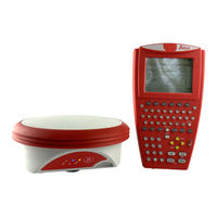
Sign In
Upload
Manuals
Brands
Leica Manuals
Receiver
GPS900 Series
Leica GPS900 Series Manuals
Manuals and User Guides for Leica GPS900 Series. We have
2
Leica GPS900 Series manuals available for free PDF download: Technical Reference Manual, User Manual
Leica GPS900 Series Technical Reference Manual (287 pages)
Brand:
Leica
| Category:
Receiver
| Size: 2.54 MB
Table of Contents
Table of Contents
3
PART 1 - the System
10
1 Managing, Creating, Editing Jobs
11
Accessing Job Management
11
Creating a New Job
13
Editing an Existing Job
14
2 Managing, Creating, Editing Points/Data
16
Accessing Data Management
16
Creating a New Point
18
Editing an Existing Point
21
Viewing the Data Log
25
Point Sorting
27
Terminology
29
3 Managing, Creating, Editing Codes/Codelists
38
Overview of Codelists
38
Accessing Codelist Management
40
Creating/Editing a Codelist
41
Accessing Code Management
42
Creating/Editing a Code
44
Managing Job Codes
46
Terminology
48
4 Managing, Creating, Editing Coord Systems
54
Overview of Coordinate Systems
54
Accessing Coordinate System Management
57
Creating/Editing a Coordinate System
59
Transformations
61
Accessing Transformation Management
61
Creating/Editing a Transformation
63
Ellipsoids
65
Accessing Ellipsoid Management
65
Creating/Editing a Ellipsoid
67
Projections
68
Accessing Projection Management
68
Creating/Editing a Projection
71
Geoid Models
72
Overview of Geoid Models
72
Accessing Geoid Model Management
73
Creating a Geoid Model from the Internal Memory
75
CSCS Models
76
Terminology
77
5 Converting Data - Copy, Export, Import
80
Copying Points between Jobs
80
Exporting Data from a Job
82
Importing Data to a Job
85
6 Configuring the Antenna
89
7 Configuring the Codes and Their Attributes
91
8 Configuring the Coordinate Quality Control
93
9 Configuring the Display Mask
95
10 Configuring the HOT Keys and the USER Menu
98
11 Configuring the Instrument Identification
100
12 Configuring the Language
101
13 Configuring the Local Time Zone
102
14 Configuring the Point Occupation Settings
103
15 Configuring the Radio Channel
105
16 Configuring the Satellite Cut off Angle
107
17 Configuring the Screen Display
108
18 Configuring the Units and Formats
111
19 Using the Tools - Activating Licence Keys
118
20 Using the Tools - Calculating with Calculator
121
Overview of Calculator
121
Using the Calculator in RPN Mode
122
Using the Calculator in Standard Mode
124
Description of Softkeys
126
Configuring the Calculator
130
21 Using the Tools - Formating Objects
132
22 Using the Tools - Transferring Objects
133
23 Using the Tools - Uploading Software
135
24 Using the Tools - Viewing Data
138
25 Understanding Mapview
141
Overview of Mapview
141
Configuring Mapview
143
Mapview Components - the Softkeys
146
Mapview Components - the Screen Area
147
Mapview Components - the Toolbar
148
Mapview Components - the Point Symbols
149
26 Understanding HOT Keys, USER Key, STATUS Key
150
The HOT Keys
150
The USER Key
151
The STATUS Key
152
The Status Menu
152
Status Satellite Information
153
Status Real-Time Data Input
155
Status Current Antenna Position
159
Status Battery Level and Memory Usage
161
Status System Information
163
Status Radio Information
164
PART 2 - the Applications
165
27 Working with COGO
166
An Overview of the Program
166
Starting the Program
167
Calculating with Inverse
170
Calculating with Intersections
172
Calculating with Lines
177
Calculating with Arcs
180
Configuring the Program
184
28 Working with Determine Coord System
185
An Overview of the Program
185
Starting the Program
190
Determining a New Coord System Using the Normal Method
192
Updating an Existing Coord System Using the Normal Method
200
Determining a New Coord System Using the One Pt. Local. Method
201
Configuring the Program
208
29 Working with GPS Resection
209
An Overview of the Program
209
Starting the Program
210
Using the Program
211
30 Working with Reference Line
215
An Overview of the Program
215
Starting the Program
217
Measuring to a Reference Line/Arc
220
Staking to a Reference Line/Arc
225
Configuring the Program
231
31 Working with Setup Reference
234
An Overview of the Program
234
Starting the Program
235
Using the Program
236
32 Working with Stakeout
240
An Overview of the Program
240
Starting the Program
242
Staking the Points
245
Staking the Digital Terrain Model (DTM)
249
Understanding the Stakeout Icons in Mapview
252
Configuring the Program
254
33 Working with Survey
258
Starting the Program
258
Surveying the Points
260
Surveying the Auto Points
261
Configuring the Program - Setting the Logging Method
263
Configuring the Program - Setting the Display Mask
265
Appendix A Menu Tree
267
Appendix B Memory Types
270
Appendix C Directory Structure of the Memory Device
271
Appendix D Pin Assignments and Sockets
273
Rx900
273
Atx900
274
Advertisement
Leica GPS900 Series User Manual (20 pages)
Brand:
Leica
| Category:
Measuring Instruments
| Size: 0.4 MB
Advertisement
Related Products
Leica iCON gps 70
Leica GRX1200 series
Leica GS10
Leica GS16
Leica GG03
Leica GS18
Leica GM30
Leica GR50
Leica GR30
Leica GMX902 GNSS
Leica Categories
Digital Camera
Microscope
Measuring Instruments
Laboratory Equipment
Laser Level
More Leica Manuals
Login
Sign In
OR
Sign in with Facebook
Sign in with Google
Upload manual
Upload from disk
Upload from URL