Sign In
Upload
Manuals
Brands
Kolida Manuals
Measuring Instruments
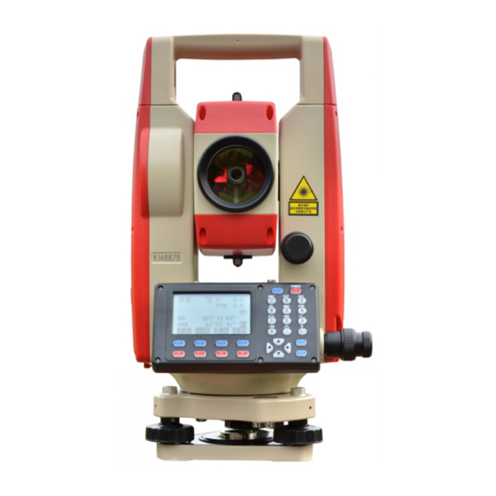
KTS-442UT Series
Kolida KTS-442UT Series Manuals
Manuals and User Guides for Kolida KTS-442UT Series. We have
1
Kolida KTS-442UT Series manual available for free PDF download: Manual
Kolida KTS-442UT Series Manual (199 pages)
Brand:
Kolida
| Category:
Measuring Instruments
| Size: 5 MB
Table of Contents
Table of Contents
1
Foreword
6
Features
6
Precautions
7
Nomenclature
9
Key Functions
11
Character Entry
14
Display Symbol
15
Mode Configuration
15
Part 1 Preparation for Measurement
19
Unpacking and Store of the Instrument
19
Setting the Instrument up
19
Battery Dismounting, Information, Recharging
21
Reflector Prisms
22
Mounting and Dismounting the Instrument from Tribrach
22
Eyepiece Adjustment and Object Setting
23
Power On/Off and Preparation for Measurement
24
Power On/Off
24
Vertical Angle Tilt Correction
24
Display Illumination
26
Setting the Instrument Options
26
Setting Instrument Constant
29
Setting LCD Contrast
30
Setting Date and Time
31
Explanations
32
Part 2 Basic Measurements
33
Angle Measurement
33
Measuring the Horizontal Angle between Two Points(Horizontal Angle 0
33
Example Measuring the Horizontal Angle between Two Points
34
Setting the Horizontal Circle to a Required Value
35
Use HSET Function to Set a Required Direction Value
35
2Use HOLD to Set a Required Direction Value
35
Horizontal Angle Display Selection(Right /Left
36
Horizontal Angle Repetition
37
Slope in
39
Distance Measurement
39
Settings for Distance Measurement
40
Laser Direction and Laser Plummet
42
Distance and Angle Measurement
43
Review of Measured Data
44
Output Data to a Computer
45
Coordinate Measurement
47
Entering Instrument Station Data
49
Reading in Registered Coordinate Data
49
Azimuth Angle Setting
50
Set Backsight Point by Angle
51
Set Backsight Point by Coordinate
51
Coordinate Measurement
52
Part 3 Advanced Measurement
55
Setting-Out Measurement
55
Distance Setting-Out Measurement
56
REM Setting-Out Measurement
59
Coordinates Setting-Out Measurement
61
Distance Measurement Parameters Setting
63
Offset Measurement
65
Single-Distance Offset Measurement
66
Angle Offset Measurement
68
Two-Distance Offset Measurement
71
Missing Line Measurement
73
Measuring the Distance between Multiple Targets
74
Slope in between 2 Points
75
Changing the Starting Point
76
Rem Measurement
77
Resection Measurement
79
Re-Observing
82
Add Known Points
82
Area Calculation
83
Setting out Line
86
Defining Baseline
87
Set-Out Line (Point)
89
Seting out Line (Line)
90
Point Projection
92
Defining Baseline
92
Point Projection
93
Road Design and Setting-Out
95
Define Horizontal Alignment (Maximum Data Quantity: 30)
95
Edit Alignment
100
Define Vertical Curve (Maximum 30 Data)
102
Edit Vertical Curve
103
Inport Horizontal Alignment
105
Import Vertical Curve
106
Receiving Horizontal Alignment Data
107
Receiving Vertical Curve Data
109
Deleting Horizontal Alignment Data
110
Deleting Vertical Curve
110
Road Setting-Out
111
Set Station Point
112
Setting Backsight Point
113
Setting out
116
Slope Setout
120
Setting-Out Arc
122
Part 4 Data Recording
126
Setting in Memory Mode
127
JOB Selection
127
Current JOB Selection
127
Check Memory Status
128
3Create New Working Job
129
Change the Job Name
130
Delect Job
131
Coordinate Selection
132
Job Export
132
Coordinate Import
134
Comms Output
135
Comms Input
136
Transfer Coord Data to Job
137
Import Known Point Data
138
Input Known Point Coordinate
138
Known Coordinate Data Import
139
Known Coordinate Data Export
140
Entering Coordinate Data from an Computer
140
Sending Known Point Data to Computer
141
Clearing Coordinate Data from Memory
142
Input Codes
142
1Code Import
143
Receive Code
143
All Clear
144
U Disk Mode
144
Initialization
146
All Files
147
Setting for Grid Factor
148
Data Recording in Record Mode
149
Recording Instrument Station Data
149
Recording Backsight Data
151
Set Backsight Point by Angle
151
Set Backsight Point by Coordinate
152
Recording Angle Measurement Data
152
Recording Distance Measurement Data
154
Recording Coordinates Data
156
Recording Distance and Coordinate Data
157
Recording Notes
158
Reviewing JOB Data
159
Part 5 Measurement Options Selection
161
Key Function Allocation
161
Allocation and Registration
162
Allocating Functions
163
Registering an Allocation
165
Recalling an Allocation
166
Instrument Parameters Setting
166
Changing Instrument Parameters
166
Part 6 Checking and Adjustment
170
Plate Vial
170
Circular Level
170
Inclination of Reticle
171
Perpendicularity of Collimation Line to Horizontal Axis (2C)
171
Vertical Index Difference Compensation
173
Adjustment of Vertical Index Difference ( I Angle) and Vertical Angle 0 Datum
173
The Adjustment of Horizontal Axis Error Correction
175
Optical Plummet
175
Instrument Constant(K
176
Parallel between Collimation Line and Emitting Photoelectric Axis
177
Reflectorless EDM
178
Tribrach Leveling Screw
178
Related Parts for Reflector
178
Specification
179
Error Displays
181
Accessories
182
Appendix A Bidirectional Communication
183
Outputting Commands
183
Entering Command
190
Set Command
192
Appendix-B Calculate Road Alignment
193
Road Alignment Elements
193
Calculation of Road Alignment Elements
195
Advertisement
Advertisement
Related Products
Kolida KTS-470 R Series
Kolida Total Station KTS-462R10L
Kolida KTS440 R Series
Kolida KTS440 L Series
Kolida KTS440 Series
Kolida KTS440 RC Series
Kolida KTS440 LC Series
Kolida K20s
Kolida K3 IMU
Kolida KL-15
Kolida Categories
Measuring Instruments
Receiver
Marine Equipment
More Kolida Manuals
Login
Sign In
OR
Sign in with Facebook
Sign in with Google
Upload manual
Upload from disk
Upload from URL