Sign In
Upload
Manuals
Brands
Koden Manuals
GPS
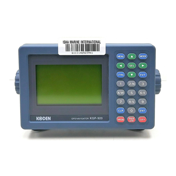
KGP-920
Koden KGP-920 Manuals
Manuals and User Guides for Koden KGP-920. We have
1
Koden KGP-920 manual available for free PDF download: Operation Manual
Koden KGP-920 Operation Manual (132 pages)
GPS Navigation
Brand:
Koden
| Category:
GPS
| Size: 3 MB
Table of Contents
Table of Contents
15
About GPS
5
Positioning by GPS
9
Outline of the Equipment
10
General Information
11
Chapter 3 Specifications
16
Gps Receiver
16
Display Section
16
Data Input/Output
16
Power Requirements
17
Compass Safe Distance
17
Environmental Conditions
17
External Dimensions and Weight
17
Table of Contents
20
Chapter 4 Installation
21
Display Unit Installation
21
Flush Mounting
23
Inspection of the Goods
21
Installation Consideration
21
Siting the Units
21
Unpacking of the Goods
21
Antenna Unit Installation
24
Selecting the Best Site of GPS / Beacon Antenna
24
Extension of an Antenna Cable
25
Fixing the Antenna Unit
25
Waterproofing on the Connector Jointing Section
26
Cable Connections to the KGP-920
27
Connector Pin Outs
29
Inspection after Installation
30
Table of Contents
31
Chapter 5 Basic Operation
32
The Name and Function of each Part
32
Control Panel
32
Adjusting Display Contrast and Brightness
33
Power On/Off
33
Selecting the Screen
34
A (NAV1) Screen
34
B (NAV2) Screen
35
C (NAV3) Screen
36
D (PLOT) Screen
36
Changing the Event Symbols
38
Manual
38
Using MOB (man Over-Board) Key
39
Recalling Event or MOB Position
40
Displaying Average Speed, Average Bearing and Elapsed Time
41
Table of Contents
42
Chapter 6
44
Storing a New Position or Updating an Existing One
44
Writing Comment
44
Copying a Position
45
Changing Comment I.D
46
Erasing a Single Waypoint
46
Setup of Waypoint Navigation
47
Quick Waypoint Setup
47
Setting Waypoint Navigation
47
B (NAV2) Screen During Waypoint Navigation
48
Canceling Waypoint Navigation
48
Reentering the Starting Point in Waypoint Navigation
48
C (NAV3) Screen During Waypoint Navigation
49
D (Plot) Screen During Waypoint Navigation
49
Cross Track Error and Course Deviation Angle
50
Navigation Graph of (NAV2) Screen
50
Electronic Fairway (NAV3) Screen
51
Storing and Erasing Routes
53
Storing Your Route
53
Automatic Switching of Waypoints
54
Erasing Point Data
54
Erasing a Single Route
55
Route Setup
56
Reentering the Origin of Route Navigation
56
Selecting Route Navigation
56
B (Nav2) Screen During Route Navigation
59
C (Nav3) Screen During Route Navigation
59
D (PLOT) Screen During Route Navigation
60
Setting an Anchor Position
61
Recalling Anchor Position
61
String an Anchor Position
61
Canceling Anchor Position
62
Reentering an Anchor Position
62
Removing the Anchor Position Symbol on PLOT Screen
62
B (NAV2) Screen During Anchor Position Setup
63
C (NAV3) Screen During Anchor Position Setup
63
D (PLOT) Screen During Anchor Position Setup
63
Track Display
64
Display a Cross Cursor on PLOT Screen
64
Screen Scrolling
64
Changing the Setup Contents
65
Scaling the PLOT Screen
65
Table of Contents
67
Chapter 7 Alarms
68
Kinds of Alarms
68
Anchor Watch Alarm (ANCW)
68
Proximity Alarm (PROX)
68
Course Deviation Angle Alarm (CDI)
69
Cross Track Error Alarm (XTE)
69
Alarm Explanation
69
Setting and Canceling
70
Table of Contents
71
Chapter 8 Setup Procedure
73
Menu Options
73
Menu 3: Gps
74
Monitoring Gps Satellite Signal Reception
74
Selecting a Geodetic Datum
74
Selecting a Measuring System Mode
74
Masking DOP
75
Masking Satellite Elevation Angle
75
Setting Antenna Height (above Sea Level)
75
Selecting RAIM Accuracy
76
Setting RAIM Function
76
Menu 4: Differential GPS (DGPS)
77
DGPS Measurement
77
Displaying DGPS
77
Selecting a Style of DGPS
77
Selecting a Beacon Station (Beacon DGPS Only)
78
Setting a DGPS Timeout
78
String a Beacon Station (Internal Beacon Receiver System Only)
80
DGPS Monitor (Beacon DGPS Only)
81
Selecting the DGPS Input Signal Baud Rate
81
Message Monitor (Beacon DGPS Only)
82
Menu 5: Compensation
83
Correcting Your Position
83
Checking the Correction Offset
84
Compensating the Compass
84
Disable Position Crrection
84
Displaying Local Time
85
Menu 8: Initial Setting
87
Changing the Antenna Height Unit
87
Changing the Distance or Speed Unit
87
Setting Average Constants
87
Changing Sail Mode
88
Changing the Latitude and Longitudinal Display Digits
88
Displaying Position Data in LAT/LONG Mode
88
Specifying the Chain and Secondary Stations for Loran C, Loran a or Decca
88
Menu 9: Interface
89
Editing the IEC 61162-1 Output Data Format of DATA Port
89
Selecting an Output Data Format of DATA Port
89
Explanation of Output Data (Sentence)
90
Selecting an Output Format of Waypoint Data
90
Selecting an Output Data Format of DATA2 Port
91
Initialization
92
Changing a Storing Method for Present Position (EVENT)
92
Erasing Entire Data from Memory
92
Switching between Loran C Lops, Loran a Lops and Decca Lops
92
Selecting an Initial Value (North, South, East, West) of Latitude/Longitude
93
Technical Reference
112
Chapter 11 Technical Reference
113
Digital Interface (Iec 61162-1 Second Edition)
113
Input Data Format (Data 2 Port)
113
Output Data Format (Data / Data 2 Port)
113
Output Data Specification
113
Output Sentence
113
Input / Output Circuit
120
Changing to the EXTERNAL Mode
124
Complete Route Transfer
125
Route Data Transfer
125
Selecting Route Navigation
126
Working(Active) Route Transfer
126
Error Message
127
Chapter 12 Communication with External Navigation System
124
Advertisement
Advertisement
Related Products
Koden KGP-913D
Koden KGP-913
Koden KGP-913MK II
Koden KGP-925
Koden KGP-915
Koden KGP-922
Koden KGC-1
Koden KGC-222
Koden KRD-10
Koden KSD-1210
Koden Categories
Marine Radar
Marine Equipment
GPS
Sonar
Monitor
More Koden Manuals
Login
Sign In
OR
Sign in with Facebook
Sign in with Google
Upload manual
Upload from disk
Upload from URL