Sign In
Upload
Manuals
Brands
Koden Manuals
GPS
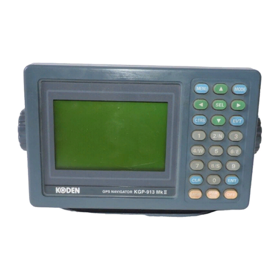
KGP-913MK II
Koden KGP-913MK II Manuals
Manuals and User Guides for Koden KGP-913MK II. We have
1
Koden KGP-913MK II manual available for free PDF download: Operation Manual
Koden KGP-913MK II Operation Manual (83 pages)
GPS/DGPS NAVIGATOR
Brand:
Koden
| Category:
GPS
| Size: 18 MB
Table of Contents
Important Notice
3
Pictorials
3
Installation Cautions
4
Maintenance Cautions
4
Operation Notes
4
Table of Contents
5
Understanding GPS
7
Arrangement of GPS Satellites
7
How Your Position Is Obtained?
7
Structure of GPS
7
For Proper Operation
8
GPS Signal Reception
8
Sbas
8
Mounting GPS Receiver and Notes on LCD
8
Display Unit
9
Getting Started
10
DIM/Bright the Display
10
Change the Contrast
10
Power of
10
Switching Screens
11
Switching the Navigation Data
11
How to Find out Your Position
13
Storing Present Position
13
Using MOB Key
14
Recalling Event or MOB Position
15
Displaying Various Information of Navigation
15
How to Get Distance and Bearing to WPT
16
Navigation to WPT
16
Storing Waypoints Data
17
Storing a New Position or Updating an Existing One
17
Wiring a Comment
17
Copying a Position
18
Changing the Comment I.D.
18
Erasing a Single Waypoint
18
Setup of Waypoint Navigation
19
Setting Waypoint Navigation
19
Recalling a Waypoint
19
Quick WPT Setup
20
Reentering the Starting Point in Waypoint Navigation
20
Canceling Waypoint Naviagtion
20
B Screen During Waypoint Navigation
21
C Screen During Waypoint Navigation
21
D Screen During Waypoint Navigation
21
Cross Track Error and Course Deviation Angle
22
Navigation Graph of B Screen
22
Changing the Range of Navigation Graph
22
Electronic Fairway Screen
23
Nearing to the WPT
24
Storing and Erasing Routes
25
Automatic Switching of Waypoints
25
Erasing Point Data
26
Erasing a Single Route
26
Route Setup
27
Selecting Route Navigation
27
Reentering the Origin of Route Navigation
27
Checking a Route Point Position
28
Skipping a Route Point in Route Navigation
28
Canceling Route Navigation
28
Switching between Distance and Time to Go
29
B (NAV2) Screen During Route Navigation
30
Setting an Anchor Position
31
Storing an Anchor Position
31
Recalling the Anchor Position
31
Reentering an Anchor Position
31
Canceling the Anchor Position
32
Alarms
33
Kinds of Alarm
33
What Is a GPS Fix Alarm?
33
What Is a DGPS Fix Alarm?
33
What Is an XTE?
34
What Is a CDI?
34
Alarm Explanation
34
Setting and Canceling
35
How to Use Menus
35
Setting Alarm
35
Changing Alarm Range
35
Track Display
36
Displaying a Cross Cursor on PLOT Screen
36
Screen Scrolling
36
Scaling the PLOT Screen
37
Changing the Setup Contents
37
Changing the Event Symbol
37
Adjusting the Track Recording Interval
37
How to Use Lops
38
Initial Setup for Lops Display
38
Selecting LOP
38
Automatic Chain Selecting in Decca Lops Mode
39
Manual Chain Selecting in Decca Lops Mode
39
Registering a Position in Lops
39
Storing Waypoints
40
Correcting Your Position
41
Direct Entry of Actual Position Data
41
Entry of Correction Amount
43
Correction by Loran a Lops Data Entry
43
Calculating Lops Based on LAT/LONG Data
45
Setup Procedure
48
Menu Options
48
Monitoring GPS Satellite Signal Reception
49
Selecting a Measuring System Mode
49
Selecting a Geodetic Datum
49
Setting Antenna Height
50
Masking DOP
50
Masking Satellite Elevation Angle
50
GPS Navigator
51
Selecting a Style of DGPS
51
DGPS Measurement
51
Selecting the DGPS Input Signal Baud Rate
52
Setting a DGPS Timeout
52
Selecting a Beacon Station
52
Selecting a Station in the Manual Mode
53
DGPS Monitor
53
DGPS Navigator
54
Calculating the Distance and Bearing between Two Points
61
Initial Settings
64
Changing the Distance or Speed Unit
64
Changing Sail Mode
64
Displaying Position Data in Lat/Long Mode
64
Selecting an Output Data Format
65
Editing the NMEA-0183 Output Data Format
65
Explanation of Output Data
65
Outputting Waypoint Data During Route Navigation
66
Selecting an Output Format of Waypoint Data
66
Operation of Built-In Simulator
66
Initial Menu
67
Troubleshooting Guide
68
The Display Does Not Change
68
Error Message Appears as Your Power on
68
Unstable Signal Reception
69
Unstable Beacon Signal Reception
69
Specifications
70
Standard Equipment List
71
Options
71
Outline and Dimensions
72
Interconnecting Diagram
73
Connection Using Magnetic Field Type
75
Installing Antenna
76
Selecting the Best Site for GPS Antenna
76
Cable Connections
77
Antenna Installation
77
Selecting the Best Site for Beacon Antenna with Its Coupler
78
Installation Site
78
RF Ground
79
Grounding Method
79
Grounding to Another Equipment
79
Receiving Antenna and Antenna Coupler Installation
80
Reducing the Noise from Dynamo
80
Checking the Ovreall Function
80
Advertisement
Advertisement
Related Products
Koden KGP-913D
Koden KGP-913
Koden KGP-920
Koden KGP-925
Koden KGP-915
Koden KGP-922
Koden KGC-1
Koden KGC-222
Koden KAT-330
Koden KDS-8000BB
Koden Categories
Marine Radar
Marine Equipment
GPS
Sonar
Monitor
More Koden Manuals
Login
Sign In
OR
Sign in with Facebook
Sign in with Google
Upload manual
Upload from disk
Upload from URL