Sign In
Upload
Manuals
Brands
Garmin Manuals
Bicycle Accessories
GPSMAP 1000 Series
Garmin GPSMAP 1000 Series Manuals
Manuals and User Guides for Garmin GPSMAP 1000 Series. We have
9
Garmin GPSMAP 1000 Series manuals available for free PDF download: Owner's Manual, Installation Instructions Manual, Quick Start Manual
Garmin GPSMAP 1000 Series Owner's Manual (70 pages)
Brand:
Garmin
| Category:
GPS
| Size: 3 MB
Table of Contents
Table of Contents
3
Introduction
9
Device Overview
9
Keys
9
Tips and Shortcuts
9
Accessing Owner's Manuals on the Chartplotter
9
Downloading the Manuals
9
Garmin Support Center
9
Inserting Memory Cards
9
Acquiring GPS Satellite Signals
10
Selecting the GPS Source
10
Customizing the Chartplotter
10
Home Screen
10
Adding an Item to the Favorites Screen
10
Customizing the Favorites Screen
10
Customizing Pages
10
Customizing the Layout of a Smartmode or Combination Page
10
Adding a Smartmode Layout
10
Creating a New Combination Page
11
Deleting a Combination Page
11
Customizing the Data Overlays
11
Resetting the Station Layouts
11
Assigning a Shortcut Key
11
Presets
11
Saving a New Preset
11
Managing Presets
11
Setting the Vessel Type
11
Adjusting the Backlight
11
Adjusting the Color Mode
12
Customizing the Startup Screen
12
Turning on the Chartplotter Automatically
12
Automatically Turning off the System
12
Activecaptain App
12
Activecaptain Roles
12
Getting Started with the Activecaptain App
12
Enabling Smart Notifications
12
Receiving Notifications
12
Managing Notifications
13
Updating Software with the Activecaptain App
13
Updating Charts with Activecaptain
13
Communication with Wireless Devices
13
Wi-Fi Network
13
Setting up the Wi-Fi Wireless Network
13
Connecting a Wireless Device to the Chartplotter
13
Changing the Wireless Channel
14
Changing the Wi-Fi Host
14
Wireless Remote Control
14
Pairing the Wireless Remote Control with the Chartplotter
14
Turning on and off the Remote Backlight
14
Disconnecting the Remote from All Chartplotters
14
Wireless Wind Sensor
14
Connecting a Wireless Sensor to the Chartplotter
14
Adjusting the Wind Sensor Orientation
14
Viewing Boat Data on a Garmin Watch
14
Navigation Chart and Fishing Chart
15
Chart Symbols
15
Selecting an Item on the Map Using the Device Keys
15
Measuring a Distance on the Chart
15
Creating a Waypoint on the Chart
15
Viewing Location and Object Information on a Chart
15
Viewing Details about Navaids
15
Navigating to a Point on the Chart
15
Premium Charts
16
Viewing Tide Station Information
16
Animated Tide and Current Indicators
16
Showing Tides and Current Indicators
16
Showing Satellite Imagery on the Navigation Chart
16
Viewing Aerial Photos of Landmarks
16
Automatic Identification System
17
AIS Targeting Symbols
17
Heading and Projected Course of Activated AIS Targets
17
Activating a Target for an AIS Vessel
17
Viewing Information about a Targeted AIS Vessel
17
Deactivating a Target for an AIS Vessel
17
Viewing a List of AIS and MARPA Threats
17
Setting the Safe-Zone Collision Alarm
17
AIS Distress Signals
18
Navigating to a Distress Signal Transmission
18
AIS Distress Signal Device Targeting Symbols
18
Enabling AIS Transmission Test Alerts
18
Turning off AIS Reception
18
Chart Menu
18
Chart Layers
18
Chart Layer Settings
18
Depth Layer Settings
18
My Vessel Layer Settings
19
Laylines Settings
19
User Data Layer Settings
19
Other Vessels Layer Settings
19
Water Layer Settings
19
Weather Layer Settings
19
Radar Overlay Settings
19
Chart Settings
20
Fish Eye 3D Settings
20
Supported Maps
20
Garmin Quickdraw Contours Mapping
20
Mapping a Body of Water Using the Garmin Quickdraw Contours Feature
20
Adding a Label to a Garmin Quickdraw Contours Map
20
Garmin Quickdraw Community
20
Connecting to the Garmin Quickdraw Community with Activecaptain
20
Downloading Garmin Quickdraw Community Maps Using Activecaptain
20
Sharing Your Garmin Quickdraw Contours Maps with the Garmin Quickdraw Community Using Activecaptain
20
Connecting to the Garmin Quickdraw Community with Garmin Connect
21
Sharing Your Garmin Quickdraw Contours Maps with the Garmin Quickdraw Community Using Garmin Connect
21
Downloading Garmin Quickdraw Community Maps Using Garmin Connect
21
Garmin Quickdraw Contours Settings
21
Depth Range Shading
21
Navigation with a Chartplotter
22
Basic Navigation Questions
22
Destinations
22
Searching for a Destination by Name
22
Selecting a Destination Using the Navigation Chart
22
Searching for a Marine Services Destination
22
Setting and Following a Direct Course Using Go to
22
Stopping Navigation
23
Waypoints
23
Marking Your Present Location as a Waypoint
23
Creating a Waypoint at a Different Location
23
Marking an SOS Location
23
Projecting a Waypoint
23
Viewing a List of All Waypoints
23
Editing a Saved Waypoint
23
Moving a Saved Waypoint
23
Browsing for and Navigating to a Saved Waypoint
23
Deleting a Waypoint or an MOB
24
Deleting All Waypoints
24
Routes
24
Creating and Navigating a Route from Your Present Location
24
Creating and Saving a Route
24
Viewing a List of Routes and Auto Guidance Paths
24
Editing a Saved Route
24
Browsing for and Navigating a Saved Route
24
Browsing for and Navigating Parallel to a Saved Route
24
Deleting a Saved Route
25
Deleting All Saved Routes
25
Auto Guidance
25
Setting and Following an Auto Guidance Path
25
Creating and Saving an Auto Guidance Path
25
Adjusting a Saved Auto Guidance Path
25
Canceling an Auto Guidance Calculation in Progress
25
Setting a Timed Arrival
25
Auto Guidance Path Configurations
25
Adjusting the Distance from Shore
25
Tracks
26
Showing Tracks
26
Setting the Color of the Active Track
26
Saving the Active Track
26
Viewing a List of Saved Tracks
26
Editing a Saved Track
26
Saving a Track as a Route
26
Browsing for and Navigating a Recorded Track
26
Deleting a Saved Track
26
Deleting All Saved Tracks
26
Clearing the Active Track
27
Managing the Track Log Memory During Recording
27
Configuring the Recording Interval of the Track Log
27
Boundaries
27
Creating a Boundary
27
Converting a Route to a Boundary
27
Converting a Track to a Boundary
27
Editing a Boundary
27
Linking a Boundary to a Smartmode Layout
27
Setting a Boundary Alarm
27
Starting Line Guidance
28
Setting the Starting Line
28
Using the Starting Line Guidance
28
Starting the Race Timer
28
Stopping the Race Timer
28
Setting the Distance between the Bow and the GPS Antenna
28
Laylines Settings
28
Setting the Keel Offset
28
Sailboat Autopilot Operation
29
Wind Hold
29
Setting the Wind Hold Type
29
Engaging Wind Hold
29
Engaging Wind Hold from Heading Hold
29
Adjusting the Wind Hold Angle with the Autopilot
29
Tack and Gybe
29
Tacking and Gybing from Heading Hold
29
Tacking and Gybing from Wind Hold
29
Setting a Tack and Gybe Delay
29
Sonar Fishfinder
30
Stopping the Transmission of Sonar Signals
30
Changing the Sonar View
30
Traditional Sonar View
30
Split-Frequency Sonar View
30
Split-Zoom Sonar View
30
Garmin Clearvü Sonar View
30
Sidevü Sonar View
30
Sidevü Scanning Technology
31
Measuring Distance on the Sonar Screen
31
Panoptix Sonar Views
31
Livevü down Sonar View
31
Livevü Forward Sonar View
31
Realvü 3D Forward Sonar View
31
Realvü 3D down Sonar View
32
Realvü 3D Historical Sonar View
32
Frontvü Sonar View
32
Panoptix Livescope™ Sonar View
32
Selecting the Transducer Type
32
Selecting a Sonar Source
32
Renaming a Sonar Source
32
Creating a Waypoint on the Sonar Screen
32
Pausing the Sonar Display
32
Viewing Sonar History
32
Adjusting the Level of Detail
33
Adjusting the Range, Gain, and Brightness with the Knob
33
Adjusting the Color Intensity
33
Sonar Recordings
33
Recording the Sonar Display
33
Stopping the Sonar Recording
33
Deleting a Sonar Recording
33
Playing Sonar Recordings
33
Traditional, Garmin Clearvü, and Sidevü Sonar Setup
33
Setting the Zoom Level on the Sonar Screen
34
Setting the Scroll Speed
34
Adjusting the Range of the Depth or Width Scale
34
Sonar Noise Rejection Settings
34
Sonar Appearance Settings
34
Sonar Alarms
35
Advanced Sonar Settings
35
Traditional, Garmin Clearvü, and Sidevü Transducer Installation Settings
35
Sonar Frequencies
35
Selecting Frequencies
35
Creating a Frequency Preset
36
Turning on the A-Scope
36
Advertisement
Garmin GPSMAP 1000 Series Owner's Manual (40 pages)
Brand:
Garmin
| Category:
GPS
| Size: 5 MB
Table of Contents
Table of Contents
3
Introduction
7
Device Front View
7
Device Keys
7
Downloading the Manuals
7
Manual Conventions
7
Getting more Information
7
Inserting Memory Cards
7
Loading the New Software on a Memory Card
7
Updating the Device Software
7
GPS Satellite Signals
8
Setting the Vessel Type
8
Adjusting the Backlight
8
Adjusting the Color Mode
8
Customizing the Home Screen
8
Charts and 3D Chart Views
8
Navigation Chart and Offshore Fishing Chart
8
Zooming in and out of the Chart
8
Panning the Chart with the Keys
8
Selecting an Item on the Map Using the Device Keys
8
Chart Symbols
9
Viewing Location and Object Information on a Chart
9
Navigating to a Point on the Chart
9
Viewing Details about Navaids
9
Premium Charts
9
Viewing Tide Station Information
10
Showing Satellite Imagery on the Navigation Chart
10
Viewing Aerial Photos of Landmarks
10
Automatic Identification System
10
AIS Targeting Symbols
10
Heading and Projected Course of Activated AIS Targets
11
Showing AIS Vessels on a Chart or 3D Chart View
11
Activating a Target for an AIS Vessel
11
Viewing Information about a Targeted AIS Vessel
11
Deactivating a Target for an AIS Vessel
11
Viewing a List of AIS Threats
11
Setting the Safe-Zone Collision Alarm
11
AIS Distress Signals
11
Navigating to a Distress Signal Transmission
11
AIS Distress Signal Device Targeting Symbols
11
Turning off AIS Reception
12
Chart and 3D Chart View Settings
12
Laylines Settings
12
Navigation and Fishing Chart Setup
12
Overlay Numbers Settings
12
Chart Appearance Settings
13
Other Vessels Settings on the Charts and Chart Views
12
AIS Display Settings
12
Waypoints and Tracks Settings on the Charts and Chart Views
12
Fish Eye 3D Settings
13
Navigation with a Chartplotter
13
Basic Navigation Questions
13
Destinations
14
Searching for a Destination by Name
14
Selecting a Destination Using the Navigation Chart
14
Searching for a Destination Using Nav Info
14
Searching for a Marine Services Destination
14
Courses
14
Setting and Following a Direct Course Using Go to
14
Setting and Following a Course Using Auto Guidance
14
Autopilot Navigation
14
Stopping Navigation
14
Waypoints
15
Marking Your Present Location as a Waypoint
15
Creating a Waypoint at a Different Location
15
Marking and Starting Navigation to an MOB Location
15
Viewing a List of All Waypoints
15
Editing a Saved Waypoint
15
Moving a Saved Waypoint
15
Browsing for and Navigating to a Saved Waypoint
15
Deleting a Waypoint or an MOB
15
Deleting All Waypoints
15
Viewing a List of Routes
16
Editing a Saved Route
16
Browsing for and Navigating a Saved Route
16
Browsing for and Navigating Parallel to a Saved Route
16
Deleting a Saved Route
16
Deleting All Saved Routes
16
Tracks
16
Showing Tracks
16
Setting the Color of the Active Track
16
Saving the Active Track
16
Deleting a Saved Track
17
Deleting All Saved Tracks
17
Retracing the Active Track
17
Clearing the Active Track
17
Managing the Track Log Memory During Recording
17
Configuring the Recording Interval of the Track Log
17
Deleting All Saved Waypoints, Routes, and Tracks
17
Combinations
17
Selecting a Combination
17
Customizing a Combination Screen
17
Viewing Engine and Fuel Gauges
18
Customizing Engine Gauge and Fuel Gauge Limits
18
Enabling Status Alarms for Engine Gauges
18
Enabling some Engine Gauge Status Alarms
18
Selecting the Number of Engines Shown in Gauges
18
Customizing the Engines Shown in Gauges
18
Configuring the Fuel Gauges Display
18
Setting the Fuel Capacity of the Vessel
18
Synchronizing the Fuel Data with the Actual Vessel Fuel
18
Setting the Fuel Alarm
18
Selecting the Range of the Close-Hauled Wind Gauge
19
Viewing the Environment Gauges
19
Configuring the Alignment of the Wind Gauge
19
Configuring the Heading Source of the Environment Gauge
19
Setting the Barometer Reference Time
19
Tide, Current, and Celestial Information
19
Tide Station Information
19
Current Station Information
19
Celestial Information
19
Viewing Tide Station, Current Station, or Celestial Information for a Different Date
19
Downvü Sonar View
20
Sidevü Sonar View
20
Sidevü/Downvü Scanning Technology
20
Split-Zoom Sonar View
20
Split-Frequency Sonar View
20
Pausing the Sonar Display
20
Creating a Waypoint on the Sonar Screen
20
Viewing Sonar History
20
Adjusting the Level of Detail
20
Adjusting the Color Intensity
20
Adjusting the Range of the Depth or Width Scale
21
Setting the Zoom Level on the Sonar Screen
21
Sonar Frequencies
21
Selecting Frequencies
21
Creating a Frequency Preset
21
Turning on the A-Scope
21
Selecting the Transducer Type
21
Sonar Setup
22
Sonar Settings
22
Sonar Appearance Settings
22
Advanced Sonar Settings
22
Sonar Installation Settings
22
Sonar Alarm Settings
22
Sonar Recordings
22
Recording the Sonar Display
22
Stopping the Sonar Recording
22
Deleting a Sonar Recording
22
Depth and Water Temperature Graphs
23
Setting the Depth and Water Temperature Graph Range and Time Scales
23
Radar
23
Radar Display Modes
23
Transmitting Radar Signals
23
Adjusting the Zoom Scale on the Radar Screen
23
Tips for Selecting a Radar Zoom Scale
23
Sentry Mode
23
Enabling Timed Transmit
23
Setting the Standby and Transmit Times
24
Enabling a Guard Zone
24
Defining a Circular Guard Zone
24
Defining a Partial Guard Zone
24
Marking a Waypoint on the Radar Screen
24
Viewing a List of AIS Threats
24
Showing AIS Vessels on the Radar Screen
24
VRM and EBL
24
Showing the VRM and the EBL
24
Adjusting the VRM and the EBL
24
Stopping the Transmission of Radar Signals
25
Optimizing the Radar Display
25
Range of Radar Signals
25
Radar Gain and Clutter
25
Adjusting Gain on the Radar Screen Automatically
25
Adjusting Gain on the Radar Screen Manually
25
Minimizing Nearby Large-Object Interference
25
Minimizing Side-Lobe Interference on the Radar Screen
25
Adjusting Sea Clutter on the Radar Screen Automatically
25
Adjusting Rain Clutter on the Radar Screen
25
Reducing Cross Talk Clutter on the Radar Screen
26
Radar Display Settings
26
Radar Appearance Settings
26
Front-Of-Boat Offset
26
Measuring the Potential Front-Of-Boat Offset
26
Setting the Front-Of-Boat Offset
26
Digital Selective Calling
26
Networked Chartplotter and VHF Radio Functionality
26
Turning on DSC
26
DSC List
26
Navigating to a Vessel in Distress
27
Man-Overboard Distress Calls Initiated from a VHF Radio
27
Man-Overboard Distress Calls Initiated from the Chartplotter
27
Position Tracking
27
Viewing a Position Report
27
Navigating to a Tracked Vessel
27
Creating a Waypoint at the Position of a Tracked Vessel
27
Editing Information in a Position Report
27
Deleting a Position-Report Call
27
Viewing Vessel Trails on the Chart
27
Siriusxm
28
Siriusxm Equipment and Subscription Requirements
28
Weather Data Broadcasts
28
Viewing Precipitation Information
28
Precipitation Views
28
Storm Cell and Lightning Information
28
Hurricane Information
28
Weather Warnings and Weather Bulletins
28
Forecast Information
29
Viewing Forecast Information for Another Time Period
29
Viewing a Marine Forecast or an Offshore Forecast
29
Weather Fronts and Pressure Centers
29
City Forecasts
29
Viewing Sea Conditions
29
Surface Winds
29
Wave Height, Wave Period, and Wave Direction
29
Viewing Forecast Sea Conditions Information for Another Time Period
29
Viewing Fishing Information
29
Forecasting Fish Locations
30
Visibility Information
30
Viewing Forecast Visibility Information for Another Time Period
30
Viewing Buoy Reports
30
Viewing Local Weather Information Near a Buoy
30
Creating a Waypoint on a Weather Chart
30
Weather Overlay
30
Turning on the Weather Overlay on a Chart
30
Weather Overlay Settings on the Navigation Chart
30
Weather Overlay Settings on the Fishing Chart
30
Saving a Siriusxm Channel to the Presets List
31
Adjusting Siriusxm Satellite Radio Volume
31
Device Configuration
31
Turning on the Chartplotter Automatically
31
System Settings
31
GPS Settings
31
Viewing the Event Log
31
Viewing System Software Information
31
My Vessel Settings
31
Setting the Keel Offset
31
Setting the Water Temperature Offset
32
Calibrating a Water Speed Device
32
Communications Settings
32
Nmea 0183
32
NMEA 0183 Settings
32
Viewing a List of NMEA 2000 Network Devices
32
Setting up the Wireless Network
33
Connecting a Wireless Device to the Chartplotter
33
Changing the Wireless Channel
33
Setting Alarms
33
Navigation Alarms
33
System Alarms
33
Setting the Fuel Alarm
33
Setting Weather Alarms
33
Units Settings
33
Navigation Settings
33
Adjusting the Distance from Shore
34
Other Vessel Settings
34
Chartplotter Data Management
34
Copying Waypoints, Routes, and Tracks to a Chartplotter
34
Copying Data from a Memory Card
34
Copying Waypoints, Routes, and Tracks to a Memory Card
35
Copying Waypoints, Routes, and Tracks to or from All Chartplotters on the Network
35
Copying Built-In Maps to a Memory Card
35
Backing up Data to a Computer
35
Restoring Backup Data to a Chartplotter
35
Saving System Information to a Memory Card
35
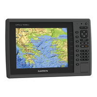
Garmin GPSMAP 1000 Series Owner's Manual (46 pages)
Brand:
Garmin
| Category:
Boating Equipment
| Size: 4 MB
Table of Contents
Table of Contents
3
Introduction
7
Device Front View
7
Device Keys
7
Downloading the Manuals
7
Manual Conventions
7
Getting more Information
7
Inserting Memory Cards
7
Software Update
7
Loading the New Software on a Memory Card
7
Updating the Device Software
7
GPS Satellite Signals
8
Selecting the GPS Source
8
Customizing the Chartplotter
8
Customizing the Home Screen
8
Setting the Vessel Type
8
Adjusting the Backlight
8
Adjusting the Color Mode
8
Enabling AIS Transmission Test Alerts
8
Communication with Wireless Devices
8
Setting up the Wi-Fi Wireless Network
8
Disconnecting a Bluetooth Wireless Device
9
Charts and 3D Chart Views
9
Navigation Chart and Offshore Fishing Chart
9
Zooming in and out of the Chart
9
Selecting an Item on the Map Using the Device Keys
9
Measuring a Distance on the Chart
9
Chart Symbols
9
Navigating to a Point on the Chart
9
Viewing Location and Object Information on a Chart
10
Viewing Details about Navaids
10
Selecting a Map
10
Premium Charts
10
Viewing Tide Station Information
10
Showing Satellite Imagery on the Navigation Chart
11
Viewing Aerial Photos of Landmarks
11
Automatic Identification System
11
AIS Targeting Symbols
11
Heading and Projected Course of Activated AIS Targets
11
Showing AIS Vessels on a Chart or 3D Chart View
12
Activating a Target for an AIS Vessel
12
Viewing a List of AIS Threats
12
Setting the Safe-Zone Collision Alarm
12
AIS Distress Signals
12
Turning off AIS Reception
12
Chart and 3D Chart View Settings
12
Navigation and Fishing Chart Setup
13
Waypoints and Tracks Settings on the Charts and Chart Views
13
Laylines Settings
13
Overlay Numbers Settings
13
Showing a Navigation Inset
13
Chart Appearance Settings
13
Setting the Heading and Course over Ground Lines
14
Other Vessels Settings on the Charts and Chart Views
14
Fish Eye 3D Settings
14
Navigation with a Chartplotter
14
Basic Navigation Questions
15
Destinations
15
Searching for a Destination by Name
15
Selecting a Destination Using the Navigation Chart
15
Searching for a Marine Services Destination
15
Stopping Navigation
15
Waypoints
15
Marking Your Present Location as a Waypoint
15
Creating a Waypoint at a Different Location
15
Marking and Starting Navigation to an MOB Location
15
Deleting a Waypoint or an MOB
16
Deleting All Waypoints
16
Setting and Following a Direct Course Using Go to
16
Routes
16
Creating and Navigating a Route from Your Present Location
16
Creating and Saving a Route
16
Viewing a List of Routes and Auto Guidance Paths
16
Editing a Saved Route
16
Browsing for and Navigating a Saved Route
16
Browsing for and Navigating Parallel to a Saved Route
17
Deleting a Saved Route
17
Deleting All Saved Routes
17
Auto Guidance
17
Setting and Following an Auto Guidance Path
17
Creating and Saving an Auto Guidance Path
17
Adjusting an Auto Guidance Path
17
Canceling an Auto Guidance Calculation in Progress
17
Setting a Timed Arrival
17
Auto Guidance Line Configurations
17
Tracks
18
Showing Tracks
18
Setting the Color of the Active Track
18
Saving the Active Track
18
Viewing a List of Saved Tracks
18
Editing a Saved Track
18
Saving a Track as a Route
18
Browsing for and Navigating a Recorded Track
18
Deleting a Saved Track
18
Deleting All Saved Tracks
19
Retracing the Active Track
19
Clearing the Active Track
19
Managing the Track Log Memory During Recording
19
Configuring the Recording Interval of the Track Log
19
Stopping Navigation
19
Synchronizing User Data Across the Garmin Marine Network
19
Deleting All Saved Waypoints, Routes, and Tracks
19
Combinations
19
Selecting a Combination
19
Sonar Views
20
Traditional Sonar View
20
Downvü Sonar View
20
Sidevü Sonar View
20
Split-Screen Sonar Views
20
Split-Zoom Sonar View
20
Split-Frequency Sonar View
20
Panoptix™ Sonar Views
20
Changing the Sonar View
21
Creating a Waypoint on the Sonar Screen
21
Measuring Distance on the Sonar Screen
21
Pausing the Sonar Display
22
Viewing Sonar History
22
Sonar Sharing
22
Selecting a Sonar Source
22
Renaming a Sonar Source
22
Customizing the Overlay Numbers
22
Adjusting the Level of Detail
22
Adjusting the Color Intensity
22
Adjusting the Range of the Depth or Width Scale
22
Setting the Zoom Level on the Sonar Screen
23
Setting the Scroll Speed
23
Sonar Frequencies
23
Selecting Frequencies
23
Creating a Frequency Preset
23
Customizing the Panoptix Sonar Views
23
Adjusting the Appearance of the Livevü Sonar Views
23
Setting the Livevü Transducer Transmit Angle
23
Adjusting the Realvü Viewing Angle and Zoom Level
23
Adjusting the Appearance of the Realvü Sonar Views
24
Adjusting the Realvü Sweep Speed
24
Turning on the A-Scope
24
Selecting the Transducer Type
24
Sonar Setup
24
Sonar Settings
24
Realvü Sonar Settings
24
Livevü Sonar Settings
24
Sonar Appearance Settings
24
Sonar Alarm Settings
25
Advanced Sonar Settings
25
Transducer Installation Settings
25
Sonar Recordings
25
Recording the Sonar Display
25
Stopping the Sonar Recording
25
Deleting a Sonar Recording
25
Playing Sonar Recordings
25
Depth and Water Temperature Graphs
25
Setting the Depth and Water Temperature Graph Range and Time Scales
25
Radar
26
Radar Display Modes
26
Transmitting Radar Signals
26
Adjusting the Radar Range
26
Tips for Selecting a Radar Range
26
Adjusting the Zoom Scale on the Radar Screen
26
Marking a Waypoint on the Radar Screen
26
Sentry Mode
26
Enabling Timed Transmit
26
Setting the Standby and Transmit Times
26
Enabling a Guard Zone
27
Defining a Circular Guard Zone
27
Defining a Partial Guard Zone
27
Viewing a List of AIS Threats
27
Showing AIS Vessels on the Radar Screen
27
VRM and EBL
27
Showing the VRM and the EBL
27
Adjusting the VRM and the EBL
27
Measuring the Range and Bearing to a Target Object
27
Radar Overlay
27
Showing the Radar Overlay
28
Setting a Custom Park Position
28
Enabling and Adjusting a Radar no Transmit Zone
28
Stopping the Transmission of Radar Signals
28
Optimizing the Radar Display
28
Radar Gain and Clutter
28
Echo Trails
29
Radar Display Settings
29
Radar Appearance Settings
29
Front-Of-Boat Offset
29
Gauges and Almanac Information
30
Viewing the Compass
30
Viewing Trip Gauges
30
Resetting Trip Gauges
30
Viewing Engine and Fuel Gauges
30
Customizing Engine Gauge and Fuel Gauge Limits
30
Enabling Status Alarms for Engine Gauges
30
Enabling some Engine Gauge Status Alarms
30
Selecting the Number of Engines Shown in Gauges
30
Customizing the Engines Shown in Gauges
30
Viewing the Wind Gauges
31
Configuring the Sailing Wind Gauge
31
Configuring the Speed Source
31
Configuring the Heading Source of the Wind Gauge
31
Customizing the Close-Hauled Wind Gauge
31
Viewing the Environment Gauges
31
Configuring the Alignment of the Wind Gauge
31
Configuring the Heading Source of the Environment Gauge
31
Setting the Barometer Reference Time
31
Tide, Current, and Celestial Information
31
Viewing Almanac Information from the Navigation Chart
32
Digital Selective Calling
32
Networked Chartplotter and VHF Radio Functionality
32
Turning on DSC
32
DSC List
32
Viewing the DSC List
32
Adding a DSC Contact
32
Incoming Distress Calls
32
Navigating to a Vessel in Distress
32
Man-Overboard Distress Calls Initiated from a VHF Radio
32
Editing Information in a Position Report
33
Deleting a Position-Report Call
33
Viewing Vessel Trails on the Chart
33
Individual Routine Calls
33
Selecting a DSC Channel
33
Making an Individual Routine Call
33
Making an Individual Routine Call to an AIS Target
33
Advertisement
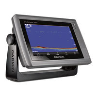
Garmin GPSMAP 1000 Series Owner's Manual (22 pages)
Brand:
Garmin
| Category:
Bicycle Accessories
| Size: 3 MB
Table of Contents
Table of Contents
3
Introduction
5
Getting Started
5
Charging the Device
5
About the Battery
5
Installing the Out-Front Mount
5
Installing the Standard Mount
5
Releasing the Edge
6
Turning on the Device
6
Keys
6
Navigation
6
Going for a Ride
6
Acquiring Satellite Signals
7
Courses
7
Following a Course from the Web
7
Creating and Riding a Course
7
Creating and Riding a Round-Trip Course
7
Creating a Course from a Recent Ride
8
Navigating Back to Start
8
Stopping a Course
8
Displaying a Course on the Map
8
Viewing Course Details
8
Course Options
8
Deleting a Course
8
Locations
8
Saving Your Location
8
Saving a Location from the Map
8
Setting the Search Location
9
Navigating to Known Coordinates
9
Projecting a Location
9
Editing Locations
9
Deleting a Location
9
Incident Detection
9
Setting up Incident Detection
9
Setting up Rider Information and Emergency Contacts
9
Turning Incident Detection on and off
9
Viewing Your Emergency Contacts
9
History
10
Viewing Your Ride
10
Using the Calendar
10
Deleting Rides
10
Personal Records
10
Deleting a Personal Record
10
Restoring a Personal Record
10
Viewing Data Totals
10
Deleting Data Totals
10
Sending Your Ride to Garmin Connect
10
Wi-Fi Connected Features
11
Transferring Files to Another Edge Device
11
Changing the Data Storage Location
11
Installing a Memory Card
11
Data Management
11
Connecting the Device to Your Computer
11
Transferring Files to Your Device
11
Deleting Files
12
Disconnecting the USB Cable
12
ANT+ Sensors
12
Pairing Your ANT+ Sensors
12
Situational Awareness
12
Training with Power Meters
12
Calibrating Your Power Meter
12
Wireless Remote Control
12
Device Overview
12
Status LED
12
Customizing the Action Key
13
Using the Mounts
13
Replacing the Battery
13
Customizing Your Device
13
Setting up Your User Profile
13
About Lifetime Athletes
13
Training Zones
13
Setting Your Heart Rate Zones
13
Setting Your Power Zones
14
Bluetooth Settings
14
Wi-Fi Settings
14
Updating Your Activity Settings
14
Customizing the Data Screens
14
Map Settings
14
Route Settings
15
Alerts
15
Auto Lap
15
Using Auto Pause
15
Using Auto Sleep
15
Using Auto Scroll
15
Changing the Start Notice
16
System Settings
16
GPS Settings
16
Changing the Accent Color
16
Display Settings
16
Changing the Units of Measure
16
Setting the Device Tones
16
Changing the Device Language
16
Changing the Configuration Settings
16
Time Zones
16
Device Care
17
Cleaning the Device
17
Troubleshooting
17
Resetting the Device
17
Clearing User Data
17
Saving Energy While Charging the Device
17
Maximizing Battery Life
17
Updating the Software
17
Support and Updates
17
Getting more Information
17
Garmin GPSMAP 1000 Series Installation Instructions Manual (34 pages)
Flat-Mount Kit
Brand:
Garmin
| Category:
Racks & Stands
| Size: 4 MB
Table of Contents
Table of Contents
1
GPSMAP ® 500/700/800/1000 Series and Echomap™ 50/70 Series Flat-Mount Kit Installation Instructions
2
Echomap™ 50/70
4
GPSMAP ® 500/700/800/1000-Serie und Echomap™ 50/70-Serie - Installationsanweisungen für den Einbausatz zur Flachen Montage
8
Instrucciones de Instalación del Kit de Montaje al Ras de GPSMAP ® Serie 500/700/800/1000 y Echomap™ Serie 50/70
11
GPSMAP ® Instruções de Instalação Do Kit de Montagem Plana para as Séries 500/700/800/1000 E Echomap™ 50/70
13
GPSMAP ® 500/700/800/1000 Serie en Echomap™ 50/70 Serie Installatie-Instructies Bij Pakket Voor Vlakke Montage
15
GPSMAP ® 500/700/800/1000-Serien Og Echomap™ 50/70-Serien - Installationsvejledning Til Planmonteringssæt
17
GPSMAP ® 500/700/800/1000 Ja Echomap™ 50/70 Sarjan Kiinnityssarjan Asennusohjeet
19
Installeringsinstruksjoner for Flatmonteringssett for GPSMAP 500/700/800/1000-Serien Og Echomap™ 50/70-Serien
21
Gpsmap
23
500/700/800/1000 Och Echomap™ 50/70
23
Instrukcja Instalacji Zestawu Do Montażu Płaskiego Dla Urządzeń GPSMAP ® Serii 500/700/800/1000 I Echomap™ Serii 50/70
25
Řady 50/70
27
GPSMAP ® 500/700/800/1000 系列和 Echomap™ 50/70 系列平直安装套件安装说明
29
GPSMAP ® Serije 500/700/800/1000 I Echomap™ Serije 50/70 - Upute Za Montažu Kompleta Za Ležeću Montažu
31
Garmin GPSMAP 1000 Series Installation Instructions Manual (9 pages)
Brand:
Garmin
| Category:
GPS
| Size: 0 MB
Table of Contents
Important Safety Information
1
Registering Your Device
1
Software Update
1
Loading the New Software on a Memory Card
1
Updating the Device Software
1
Tools Needed
1
Mounting Considerations
1
Bail Mounting the Device
2
Flush Mounting the Device
2
Cable and Connection Considerations
3
Additional Grounding Consideration
3
Garmin Marine Network Considerations
3
NMEA 2000 Considerations
3
Connecting the Wiring Harness to Power
3
NMEA 0183 Connection Considerations
4
NMEA 0183 Device Connections
4
Single-Ended NMEA 0183 Device Connections
4
Lamp and Horn Connections
5
Composite Video Considerations
5
Specifications
5
NMEA 0183 Device Connected with a Single Receive Wire
5
NMEA 0183 Device Connected with a Single Transmit Wire
5
NMEA 0183 Information
6
NMEA 2000 PGN Information
6
Garmin GPSMAP 1000 Series Installation Instructions Manual (6 pages)
Brand:
Garmin
| Category:
GPS
| Size: 0 MB
Table of Contents
Important Safety Information
1
Registering Your Device
1
Tools Needed
1
Mounting Considerations
1
Bail Mounting the Device
1
Flush Mounting the Device
2
Connection Considerations
2
Power/Nmea® 0183 Cable
2
Connecting the Wiring Harness to Power
2
Connecting the Device to a Transducer
3
NMEA 0183 Connection Considerations
3
NMEA 0183 Connection Diagram
3
Lamp and Horn Connections
3
Connecting the Device to an External Garmin Sounder Module
3
Connecting the Device to a Garmin Marine Radar
3
Radar, Sonar, and Map Sharing Considerations
3
NMEA 2000 Considerations
4
Software Update
4
Connecting the Device to a Remote GPS Antenna
4
Loading the New Software on a Memory Card
4
Updating the Device Software
5
Physical Specifications
5
Electrical Specifications
5
NMEA 0183 Information
5
Specifications
5
NMEA 2000 PGN Information
5
Garmin GPSMAP 1000 Series Quick Start Manual (4 pages)
Brand:
Garmin
| Category:
GPS
| Size: 3 MB
Table of Contents
Introduction
2
Device Front View
2
Device Keys
2
Inserting Memory Cards
2
Downloading the Manuals
2
Getting more Information
2
Loading the New Software on a Memory Card
2
Updating the Device Software
2
GPS Satellite Signals
2
Navigation with a Chartplotter
3
Customizing the Home Screen
3
Waypoints
3
Marking Your Present Location as a Waypoint
3
Creating a Waypoint at a Different Location
3
Marking and Starting Navigation to an MOB Location
3
Navigating to a Point on the Chart
3
Creating and Navigating a Route from Your Present Location
3
Garmin GPSMAP 1000 Series Installation Instructions Manual (6 pages)
Brand:
Garmin
| Category:
Fish Finder
| Size: 0 MB
Table of Contents
Installation Instructions
1
Important Safety Information
1
About the Wiring Harness
2
Connection Considerations
2
Connecting the Device to a Transducer
3
Connecting the Device to an External Garmin Sounder Module
3
Radar, Sonar, and Map Sharing Considerations
3
Loading the New Software on a Memory Card
4
Updating the Device Software
4
Specifications
4
Physical Specifications
4
Advertisement
Related Products
Garmin Fishfinder 100
Garmin echo 100Series
Garmin Fishfinder 100 Blue
Garmin Alpha 100/TT
Garmin ALPHA 100F
Garmin ATEMOS 100 WITH K5
Garmin 101
Garmin Mobile 10x
Garmin AQUAMAP 10x2 Series
Garmin CAMPER 1095
Garmin Categories
GPS
Watch
Car Navigation system
Avionics Display
Marine Equipment
More Garmin Manuals
Login
Sign In
OR
Sign in with Facebook
Sign in with Google
Upload manual
Upload from disk
Upload from URL