Garmin GPSMAP 800 series Owner's Manual
Hide thumbs
Also See for GPSMAP 800 series:
- Owner's manual (76 pages) ,
- Operator's manual (32 pages) ,
- Pilot's manual addendum (22 pages)

Related Manuals for Garmin GPSMAP 800 series


Summary of Contents for Garmin GPSMAP 800 series
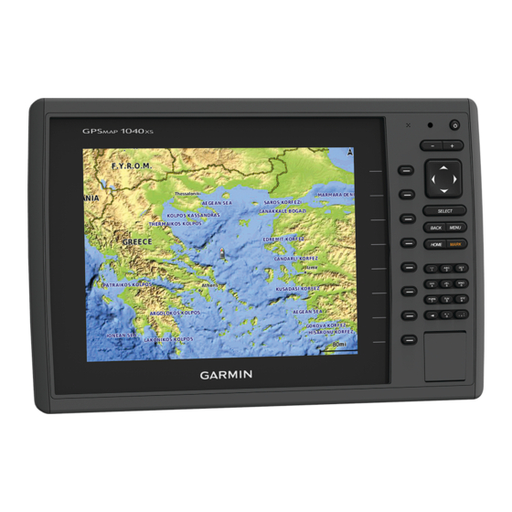
- Page 1 GPSMAP 800/1000 Series ® Owner’s Manual January 2014 190-01658-00_0A Printed in Taiwan...
- Page 2 Garmin ® , the Garmin logo, BlueChart ® , g2 Vision ® , and MapSource ® are trademarks of Garmin Ltd. or its subsidiaries, registered in the USA and other countries.
-
Page 3: Table Of Contents
Table of Contents Waypoints .................. 9 Marking Your Present Location as a Waypoint ..... 9 Creating a Waypoint at a Different Location ......9 Introduction..............1 Marking and Starting Navigation to an MOB Location ..9 Device Front View ..............1 Viewing a List of all Waypoints .......... - Page 4 Current Station Information ..........13 Minimizing Nearby Large-Object Interference ....19 Celestial Information ............13 Minimizing Side-Lobe Interference on the Radar Viewing Tide Station, Current Station, or Celestial Screen ................19 Information for a Different Date ........... 13 Adjusting Sea Clutter on the Radar Screen Viewing Information for a Different Tide or Current Station 13 Automatically ..............
- Page 5 Viewing Weather Subscription Information ......24 SiriusXM Radio ................ 24 Customizing the Channel Guide ......... 24 Saving a SiriusXM Channel to the Presets List ....25 Adjusting SiriusXM Satellite Radio Volume ......25 Device Configuration ........... 25 Turning On the Chartplotter Automatically ....... 25 System Settings ...............
-
Page 7: Introduction
Power key sonar data and transfer data such as waypoints, routes, and Device keys tracks to another compatible Garmin chartplotter or a computer. Number pad (available on 10 inch models only) Open the access door on the front of the chartplotter. -
Page 8: Gps Satellite Signals
Fishing Chart: Provides a detailed view of the bottom contours For more information about GPS, go to www.garmin.com and depth soundings on the chart. This chart removes /aboutGPS. navigational data from the chart, provides detailed... -
Page 9: Chart Symbols
Select SELECT. Select Navigate To. Select an option: Chart Symbols • To navigate directly to the location, select Go To. This table contains some of the common symbols you might see on the detailed charts. • To create a route to the location, including turns, select Route To. -
Page 10: Viewing Tide Station Information
Viewing Tide Station Information • Select Land Only to show standard chart information on on the chart indicates a tide station. You can view a detailed the water, with photos overlaying the land. graph for a tide station to help predict the tide level at different •... -
Page 11: Heading And Projected Course Of Activated Ais Targets
Heading and Projected Course of Activated AIS Viewing a List of AIS Threats Targets From a chart or 3D chart view, select MENU > Other Vessels > AIS List. When heading and course over ground information are provided by an activated AIS target, the heading of the target appears on Setting the Safe-Zone Collision Alarm a chart as a solid line attached to the AIS target symbol. -
Page 12: Turning Off Ais Reception
Turning Off AIS Reception From a chart or 3D chart view, select MENU > Other Vessels > AIS Display Setup. AIS signal reception is turned on by default. AIS Dis. Range: Indicates the distance from your location within Select Settings > Other Vessels > AIS > Off. which AIS vessels appear. -
Page 13: Chart Appearance Settings
If necessary, select Chart Setup. NOTE: This setting affects only the appearance of hazard colors in Mariner’s Eye 3D. It does not affect the safe water Select Overlay Numbers > Edit Layout. depth Auto Guidance setting or the sonar shallow water Select a layout. -
Page 14: Destinations
When you start navigation (Go To, Route To, or Guide To), if you are connected through a NMEA 2000 ® network to a Courses compatible Garmin autopilot, you are prompted to engage the autopilot. CAUTION The Auto Guidance feature is based on electronic chart Stopping Navigation information. -
Page 15: Waypoints
Waypoints Select a waypoint. Select Navigate To. Waypoints are locations you record and store in the device. Select an option: Marking Your Present Location as a Waypoint • To navigate directly to the location, select Go To. From any screen, select MARK. •... -
Page 16: Viewing A List Of Routes
Viewing a List of Routes A magenta line appears. In the center of the magenta line is a thinner purple line that represents the corrected course Select Nav Info > Routes. from your present location to the destination. The corrected Editing a Saved Route course is dynamic, and it moves with your boat when you are You can change the name of a route or change the turns the... -
Page 17: Deleting A Saved Track
Combinations Select an option: • To navigate the track from the starting point used when The Combination screen shows a combination of different the track was created, select Forward. screens at the same time. The number of options available on •... -
Page 18: Viewing Engine And Fuel Gauges
Select an option: Select First Engine. • To set all the readings for the present trip to zero, select Select the engine to display in the first gauge. Reset Trip. Repeat for the remaining engine bars. • To set the maximum speed reading to zero, select Reset Configuring the Fuel Gauges Display Maximum Speed. -
Page 19: Selecting The Range Of The Close-Hauled Wind Gauge
Sonar Select GPS Hdg or Magnetic. Setting the Barometer Reference Time When properly connected to an optional Garmin sounder module and a transducer, your compatible chartplotter can be You can specify the reference time used to calculate the used as a fishfinder. There are different sonar views to help you barometer trend. -
Page 20: Downvü Sonar View
along the right side of the screen shows the depth of detected objects as the screen scrolls from the right to the left. Depth information Suspended targets or fish Bottom of the body of water Split-Zoom Sonar View DownVü Sonar View The split-zoom sonar view shows a full-view graph of sonar NOTE: Not all models support DownVü... -
Page 21: Adjusting The Range Of The Depth Or Width Scale
traditional transducers or the contrast for DownVü and SideVü/ definition and thermocline definition can be better when using a DownVü transducers. This setting works best after you have higher frequency. adjusted the level of detail shown on the screen using the gain Lower frequencies use wider beam widths, which can let the or brightness settings. -
Page 22: Sonar Setup
• If you have a 200/50 kHz, dual-frequency transducer, The lowest interference setting that achieves the desired select Dual Frequency. improvement should be used to remove interference from the screen. Correcting installation issues that cause noise is the • If you have another type of transducer, select it from the best way to eliminate interference. -
Page 23: Depth And Water Temperature Graphs
When you connect your compatible chartplotter to an optional screen. Garmin marine radar, such as a GMR™ 1206 xHD or a GMR 24 HD, you can view more information about your surroundings. For example, do you need information about nearby weather... -
Page 24: Setting The Standby And Transmit Times
Radar Overlay Marking a Waypoint on the Radar Screen When you connect your chartplotter to an optional Garmin From a Radar screen or the Radar overlay, select a location. marine radar, you can use the Radar overlay to overlay radar Select New Waypoint. -
Page 25: Stopping The Transmission Of Radar Signals
If the boat heading is based on data from a magnetic heading Data on the Radar screen is refreshed every few seconds. sensor or an automatic pilot, the heading data could be As a result, the effects of manually adjusting the gain may compromised due to incorrect setup, mechanical malfunction, not appear instantly. -
Page 26: Reducing Cross Talk Clutter On The Radar Screen
Radar Setup. position reports. Orientation: Sets the perspective of the radar display. The If you have a Garmin NMEA 2000 VHF radio connected to your orientation setting applies to every radar mode. This setting chartplotter, these features are also enabled. -
Page 27: Navigating To A Vessel In Distress
For information on placing distress calls from your radio, see the Individual Routine Calls VHF radio owner’s manual. For information about marking an When you connect the chartplotter to a Garmin VHF radio over MOB, see Marking and Starting Navigation to an MOB Location. -
Page 28: Siriusxm
, a tropical storm, or a tropical depression. A receives satellite weather data and shows it on various Garmin red line stemming from a hurricane icon indicates the projected devices, including the Navigation chart on a compatible path of the hurricane. -
Page 29: Forecast Information
Color Marine Weather Weather Subcategories Symbol Weather Symbol Weather Group Partly cloudy Fair (sunny, hot, clear) Dark Visibility Dense Fog, Dense Smoke, Dust Storm, Cloudy Rain (drizzle, sleet, showers) Gray Smog White Winter Arctic Outflow, Avalanche, Blizzard, Windy Foggy Blowing Snow, Cold Wave, Extreme Cold, Flash Freeze, Freeze, Freezing Thunderstorms Snow (snow showers, flurries,... -
Page 30: Forecasting Fish Locations
You can select an area near a buoy to view forecast information. When you have a Garmin SiriusXM receiver connected to the From a weather chart, select a location on the chart. chartplotter, you may have access to SiriusXM satellite radio, depending on your subscription. -
Page 31: Saving A Siriusxm Channel To The Presets List
(if applicable), the software You can save your favorite channels to the presets list. version for an optional Garmin radar (if applicable), and the unit Select Media. ID number. You may need this information to update the system software or to purchase additional map data information. -
Page 32: Setting The Water Temperature Offset
Viewing a List of NMEA 2000 Network Devices If the wheel turns freely, check the cable connections. You can view the devices connected to the NMEA 2000 If you continue to get the message, contact Garmin product network. support. Select Settings > Communications > NMEA 2000 Setup >... -
Page 33: Setting Up The Wireless Network
Setting Up the Wireless Network Units Settings The chartplotters can create a Wi‑Fi network to which you can Select Settings > Units. connect wireless devices. The first time you access the wireless System Units: Sets the unit format for the device. network settings, you are prompted to set up the network. -
Page 34: Adjusting The Distance From Shore
NOTE: Auto Guidance is available with premium charts, in reposition the Auto Guidance line, unless the destination some areas. selected requires navigation through a narrow waterway. You can set the parameters the chartplotter uses when Select an option: calculating an Auto Guidance line. •... -
Page 35: Copying Waypoints, Routes, And Tracks To A Memory Card
Select Nav Info > Manage Data > Data Transfer > Card > Settings. Replace from Card. Viewing System Software Information You can view the software version, the basemap version, any supplemental map information (if applicable), the software version for an optional Garmin radar (if applicable), and the unit Appendix... -
Page 36: Nmea 0183 Information
AIS VHF data-link message the product. Title, ownership rights, and intellectual property You can purchase complete information about National Marine rights in and to the Software remain in Garmin and/or its third- Electronics Association (NMEA) format and sentences from: NMEA, party providers. - Page 37 derivative works based on the Software. You agree not to export or re-export the Software to any country in violation of the export control laws of the United States of America or the export control laws of any other applicable country. Appendix...
-
Page 38: Index
4, 6 Garmin Marine Network 26 radar 17, 19 appearance 7 Garmin product support, contact information 1 AIS 18 details 3 gauges clutter 19, 20 heading, line 7 engine 12 color scheme 20 navigation 3, 4 environment 13 field of view 20 panning 2... - Page 39 screenshots 29 showing 18 capturing 29 sentry mode 17 WAAS 25 guard zone 18 water timed transmit 17, 18 speed 26 settings 25, 27 temperature offset 26 radar display 20 water temperature log 17 system information 25, 29 waypoints 9 shoreline distance 28 copying 29 SideVü 14 creating 9, 24 SiriusXM 22 deleting 9 SiriusXM Satellite Radio 24, 25 editing 9 software, updating 1 overboard 9 software license...
- Page 40 1200 East 151st Street Olathe, Kansas 66062, USA Garmin (Europe) Ltd. Liberty House, Hounsdown Business Park Southampton, Hampshire, SO40 9LR UK Garmin Corporation No. 68, Zhangshu 2nd Road, Xizhi Dist. New Taipei City, 221, Taiwan (R.O.C.) © 2014 Garmin Ltd. or its subsidiaries...
Need help?
Do you have a question about the GPSMAP 800 series and is the answer not in the manual?
Questions and answers