Sign In
Upload
Manuals
Brands
FLYTEC Manuals
GPS
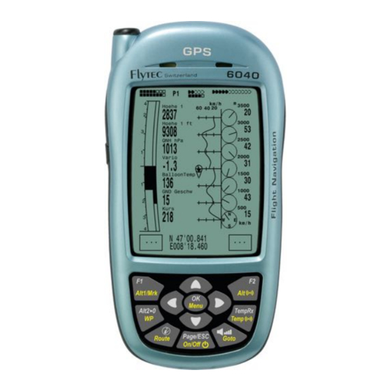
6040
FLYTEC 6040 GPS Altimeter Variometer Manuals
Manuals and User Guides for FLYTEC 6040 GPS Altimeter Variometer. We have
2
FLYTEC 6040 GPS Altimeter Variometer manuals available for free PDF download: Operation Manual
FLYTEC 6040 Operation Manual (57 pages)
GPS / TT34
Brand:
FLYTEC
| Category:
GPS
| Size: 1 MB
Table of Contents
Table of Contents
3
1 Operation
5
Instrument Overview
5
6040-GPS -Switch-On and Switch-Off
6
Switch on
6
Instrument Switch- off
6
Operation Philosophy
7
Keypad
7
Function Related Key F1 and F2
7
Display Screen
8
Main Display Screen
8
Shift Page of Data Fields
9
Map Display Screen
10
Windlayer" Display Screen
11
Shift Page of Data Fields
11
Windlayer Page
12
User Defined Data Fields
13
The Setting Menus
14
Menu Navigation Overview
14
User Settings
15
Manage Memory
15
Instrument Settings
16
Factory Settings
16
Flight Memory and Data Analysis
17
Entering Text
17
First Steps
18
Before First Balloon Flight Seite
18
At Start Site
18
Handling During the Balloon Flight
18
Data Analysis after the Balloon Flight
18
2 Functions
19
Altimeter and Air Pressure
19
How Does an Altimeter Work
19
Altimeter Alt1 (Absolute Altitude)
20
Setting Altimeter A1
20
User Fields Related to Alt1
20
Altimeter Alt2, Relative Altitude (User Field)
21
Setting Altimeter Alt2
21
Cumulated Altimeter Display (User Field Alt Sum)
21
FL Flightlevel Altimeter Display (User Field FL Ft)
21
GPS Altitude Display (User Field Altitude GPS)
21
Altitude Alert / Alarm
22
Setting of the Altitude Alert
22
Variometer Functions
23
Analogue Vario
23
Basic Filter
23
Digital-Vario (Average Vario)
23
Variometer Acoustics and Volume Level (Sound)
23
Audio Level
24
Variometer Acoustic Settings
24
Speed
25
Wind Vane Sensor
25
GPS Speed
25
Time of Day and Date
25
Temperature
26
Envelope Temperature
26
Personal Temperature Alarm
26
Maximum Temperature Alarm
27
Temperature Sensor Failure
27
Temprx Empfang On/Off
27
Temperature Transmitter FLYTEC TT34
27
3 Navigation
28
Assesment of GPS Reception Quality
28
Compass and Flight Direction
29
Track and Bearing
29
Waypoints and Coordinates
30
Alter, Delete or Insert Waypoints
30
Display of Actual Coordinates
31
Memorising the Actual Position
31
Go-To - Function
32
Distance to Waypoint (User Datafield)
32
Routes
32
Creating a Route
33
Altering a Route
33
Deleting a Route
33
Flying Routes
34
Distance to Start Site
34
XT Error, Crosstrack Error
35
Flight Duration
35
4 Map of Flight Obstacles (Restricted Areas)
36
Flight Obstacles - Edit Manually
36
Map of Flight Obstacles - Edit with Flychart
38
Air Space in Openair Format *.Txt or *.Fas
38
Calling the Function Air Space in Flychart
38
Downloading Air Spaces
39
User Air Spaces Ending with *.Fa5
39
Selection of Air Spaces
39
Editing Air Spaces
40
5 Flight-Memory and Flight-Analysis
42
Flight Logbook and Flight-Analysis Page
42
Graphic Display of Flights in Map Format
43
6 Data Transfer
44
Data Exchange Via PC
44
Waypoints and Routes
45
Air Spaces
45
7 Simulation
45
8 Battery- Management
46
9 Transferring New Software-(-Firmware)To the Flytec 6040-GPS
47
10 Miscellaneous
48
Optional Software (Additional Software)
48
11 Additional Information
49
Altimeter
49
Navigation
49
Reception Quality of GPS
49
Accuracy of GPS Altitude
50
Flight Memory and IGC File
52
Content of IGC File
52
Evidence of Flights - Security against Manipulation
54
Digital Signature
54
12 Maintenance
55
Exposure to Water
55
13 Warranty
55
14 Technical Data
56
15 Approval / Conformity
56
16 Attachment
57
Mounting Instruction for the Radio Temperatur Transmission Unit Funksensor TT34
57
Advertisement
Flytec 6040 Operation Manual (64 pages)
Brand:
Flytec
| Category:
GPS
| Size: 7 MB
Table of Contents
General Operation
6
Instrument Overview
6
Switching the Instrument On/Off
7
Entering Text
8
Windlayer Page
12
User-Fields
13
Simulation Mode
18
Instrument Setup
19
Setting up the Instrument
22
Prior to Take-Off
22
Altimeter and Air Pressure
23
Digital Vario
27
Wind Speed
27
Time and Date
28
Ambient Temperature
28
Envelope Temperature
28
Battery Status
30
Sensor Failure
30
Installation
31
Gps (Global Positioning System)
31
Assessment of GPS Reception Quality
32
Compass and Flight Direction
32
Distance to Take-Off
33
Flight Duration
33
Waypoints and Coordinates
34
Saving the Current Position
34
Goto Function
36
Flying Routes
37
Competition Route
38
Track Map
41
Digital Signature
42
Downloading Flights
51
Instrument Settings
51
Optional Software
56
Batteries and Charging
59
Maintenance and Warranty
60
Exposure to Water
60
Warranty
61
Approval / Conformity
61
Advertisement
Related Products
Flytec 6020
Flytec 6015
Flytec 6030
Flytec 6005
Flytec 6010
Flytec 5020
Flytec 5030 GPS
FLYTEC ELEMENT
Flytec SensBox
FLYTEC Categories
GPS
Measuring Instruments
Fishing Equipment
Toy
Motorized Toy Car
More FLYTEC Manuals
Login
Sign In
OR
Sign in with Facebook
Sign in with Google
Upload manual
Upload from disk
Upload from URL