
Related Manuals for Garmin Alpha 100 T5


Summary of Contents for Garmin Alpha 100 T5
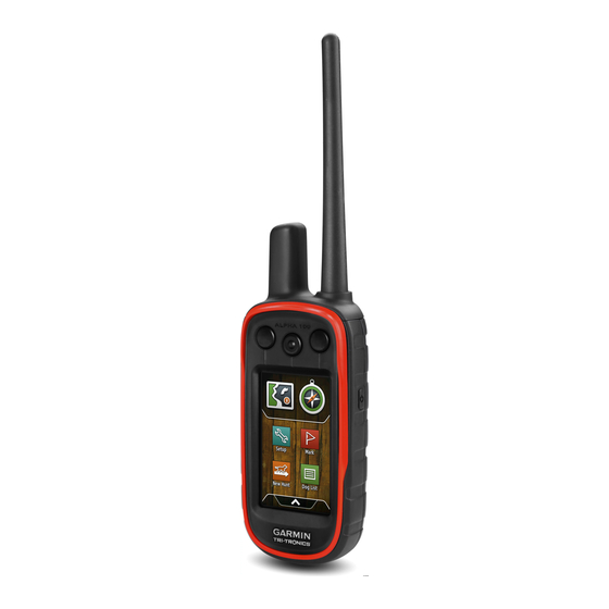
- Page 1 Alpha 100 with T5/T5 mini ® Owner’s Manual July 2015 Printed in Taiwan 190-01771-00_0B...
- Page 2 All rights reserved. Under the copyright laws, this manual may not be copied, in whole or in part, without the written consent of Garmin. Garmin reserves the right to change or improve its products and to make changes in the content of this manual without obligation to notify any person or organization of such changes or improvements.
-
Page 3: Table Of Contents
Table of Contents Hunting with the Alpha System........7 Marking Your Truck Location ............7 Marking a Covey ................. 7 Getting Started............... 1 Turning On the Collar Light ............7 Setting Up the Alpha System ............1 Turning On Rescue Mode ............7 Device Overviews ............... - Page 4 VIRB® Remote ................. 11 Controlling a VIRB Action Camera with Your Handheld Device .................. 11 Controlling a VIRB Action Camera with Your Dog Collar Device .................. 11 Customizing Your Device..........11 Customizing the Main Menu ............. 11 Customizing the Data Fields ............. 11 Enabling the Map Data Fields ..........
-
Page 5: Getting Started
(Charging the Handheld Device, page Getting More Information Charge the dog collar device (Charging the Dog Collar You can find more information about this product on the Garmin ® Device, page website. Turn on the devices (Turning On the Devices, page •... -
Page 6: Charging The Dog Collar Device
You should fully charge the battery before you use the device for Turning Off the Devices the first time. Charging a fully depleted battery takes about 2 • On the handheld device, hold the power key until the hours. LCD screen turns off. NOTE: The device does not charge when it is outside the •... -
Page 7: Vhf Radio Information
You must not use the You might want to clear the dog statistics and track before a device with a third party antenna or an antenna not approved by new hunt. Garmin. Go to www.garmin.com/tracking-legal for details about Select Dog List. -
Page 8: Setting Dog Alerts
If you are experiencing interference from other collars or Enabling Bark Detection handheld devices in the area, you might need to change the ID NOTE: This feature is not available in all areas. for the dog. Select Setup > Dogs > Bark Detection. Select Dog List. -
Page 9: Tracking And Training One Dog At A Time
™ Before you can track your dogs and contacts using BaseCamp, you must download BaseCamp to your computer (www.garmin.com/basecamp). If necessary select to zoom in and out of the map. The BaseStation feature of BaseCamp allows you to track your dogs and contacts in real-time on a computer. -
Page 10: Editing Location Alerts
Editing Location Alerts You can assign a specific dog training method to each training key. You can add multiple pages of training key settings. This Select Setup > Location Alerts. mode is most useful when training multiple dogs. Select an alert. Select Setup >... -
Page 11: Sending A Message To Your Contacts
You can use an emergency alert when you need immediate • Turn on the collar light (Turning On the Collar Light, assistance and you are away from your group. page Select > Contacts > > Yes. • Put the collar into rescue mode to save battery power (Turning On Rescue Mode, page When your contact accepts your emergency alert request, the device displays a message indicating that your contact... -
Page 12: Editing A Waypoint
Select > OK. Select a category. Select the first point on the route. Editing a Waypoint Select Use > Select Next Point. Before you can edit a waypoint, you must create a waypoint. Select a point. Select > Waypoint Manager. Repeat steps 3 through 6 to add all the points in the route. -
Page 13: Viewing Details About The Track
Before you can share data wirelessly, you must be within 10 feet The beginning and the end of the track are marked by flags. (3 m) of a compatible Garmin device. Select the information bar along the top of the screen. -
Page 14: Navigating With The Bearing Pointer
You should calibrate the compass after moving long distances, To open the elevation plot, select > Elevation Plot. experiencing temperature changes, or removing the battery. Calibrating the Barometric Altimeter Select > Compass > > Calibrate Compass > Start. You can manually calibrate the barometric altimeter if you know Follow the on-screen instructions. -
Page 15: Viewing The Calendar And Almanacs
Data Field Options, The VIRB remote function allows you to control your VIRB page action camera using your device. Go to www.garmin.com/VIRB to purchase a VIRB action camera. Enabling the Map Data Fields Controlling a VIRB Action Camera with Your Select >... -
Page 16: Contact Settings
Dog Track On Map: Sets the length (duration in minutes or Automotive Mode shows an automotive perspective with the hours) of the dog track on the map. Reducing the duration of direction of travel at the top. the track shown can reduce the clutter on the map. Guidance Text: Sets when the guidance text on the map is Zoom Map To Dogs: Automatically zooms the map to show all shown. -
Page 17: Time Settings
Support and Updates You can customize the compass settings. Garmin Express (www.garmin.com/express) provides easy Select Setup > Heading. access to these services for Garmin devices. Display: Sets the type of directional heading shown on the • Product registration compass. • Product manuals North Reference: Sets the north reference used on the •... -
Page 18: Cleaning The Touchscreen
Extensive use of screen backlighting can significantly reduce *The device withstands pressure equivalent to a depth of 10 m. battery life. You can adjust the backlight brightness to maximize For more information, go to www.garmin.com/waterrating. the battery life. T5 mini Dog Collar Device Specifications NOTE: The backlight brightness may be limited when the battery is low. -
Page 19: Saving Energy While Charging The Device
• GPX geocache files. Go to www.geocaching.com/play. You can connect the collar to your computer to use with • GPI custom POI files from the Garmin POI Loader. Go to programs like BaseCamp. The collar is not a mass storage www.garmin.com/products/poiloader. -
Page 20: Deleting Files
10 m (32.9 ft.) away from other ANT+ Open BaseCamp. accessories. BaseCamp recognizes and transfers the collar's internal track • Bring the Garmin device within range 3 m (10 ft.) of the ANT+ log. accessory. Deleting Files • After you pair the first time, your Garmin device automatically recognizes the ANT+ accessory each time it is activated. -
Page 21: Replacing The Dog Collar Device Battery
Installing the New Battery Before you replace the battery, you must remove the old battery (Removing the Old Battery, page 16). You also must have a small Phillips screwdriver. You may need a small flat screwdriver. Install the new battery using the same orientation as the old battery. -
Page 22: Changing The Fuse In The Vehicle Power Cable
Ascent - Total: The total elevation distance ascended since the last reset. Barometer: The calibrated current pressure. Battery Level: The remaining battery power. Bearing: The direction from your current location to a destination. You must be navigating for this data to appear. Cadence: The number of revolutions of the crank arm or number of strides per minute. - Page 23 Speed - Overall Avg.: The average speed while moving and stopped since the last reset. Sunrise: The time of sunrise based on your GPS position. Sunset: The time of sunset based on your GPS position. Time of Day: The current time of day based on your current location and time settings (format, time zone, daylight saving time).
-
Page 24: Index
6 Sight 'N Go 10 files, transferring 15 almanac 11 software fuse, changing 18 altimeter 13 updates 13 calibrating 10 updating 13 ANT+ sensors 16 specifications 14 Garmin Express 13 pairing 16 stopwatch 11 registering the device 13 area calculation 10 sunrise and sunset times 11 updating software 13 geofences 5, 6 GPS 11 backlight 12, 14, 15 tempe 16 settings 11... - Page 26 +34 93 275 44 97 +27 (0)11 251 9999 + 46 7744 52020 +886 2 2642-9199 ext 2 +49 (0) 89 858364880 0808 238 0000 zum Ortstarif - Mobilfunk +44 (0) 870 8501242 kann abweichen 913-397-8200 1-800-800-1020 © 2014 Garmin Ltd. or its subsidiaries...
Need help?
Do you have a question about the Alpha 100 T5 and is the answer not in the manual?
Questions and answers