Table of Contents
Advertisement
Quick Links
Download this manual
See also:
Service Manual
Advertisement
Table of Contents

Related Manuals for Kenwood KNA-DV2200


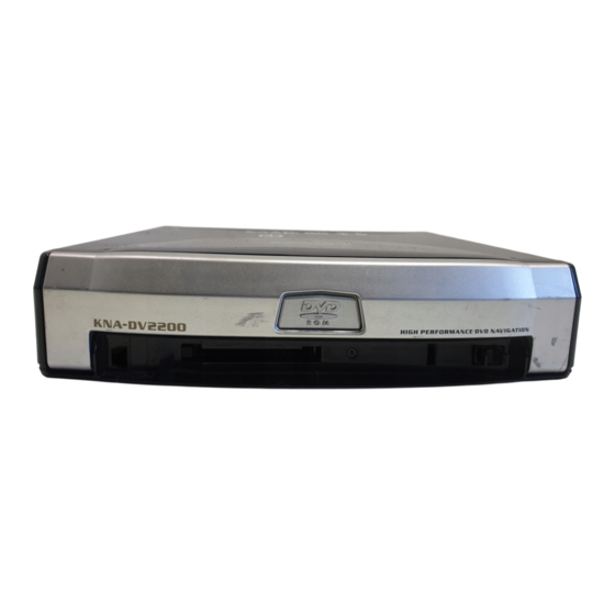
Summary of Contents for Kenwood KNA-DV2200
- Page 1 DVD NAVIGATION SYSTEM KNA-DV2200 INSTRUCTION MANUAL © PRINTED IN JAPAN B64-2503-00/00 (E) (+) 03/12 11 10 9 8 7 6 5 4 3 2 1 02/12 11 10 9 8 7 6...
-
Page 2: Warning Messages
For safe usage please observe the following !!! READ THIS MANUAL FIRST. Read this manual carefully before starting to operate the Kenwood Car Navigation System and follow the manual's instructions. Kenwood are not liable for problems or accidents resulting from failure to observe the instructions in this manual. -
Page 3: Table Of Contents
Before Use ________________________________ 2 Precautions when Handling Map Discs ______ 3 Replacing Map Discs_______________________ 4 Inserting a Map Disc ______________________ 4 Removing the Map Disc __________________ 4 Touch Screen Operation ___________________ 5 Starting Up Navigation __________________ 6 Language Selection ______________________ 7 Markers (and Switches) Displayed on Maps Screens Before Setting Route ____________ 8 Screens During Route Guidance ___________ 9... -
Page 4: Before Use
Before Use Start the car engine before use This mobile navigation system can be used when the ignition key is turned to ON or ACC. However, to preserve the battery, it should be used with the engine running whenever possible. Using the navigation system for a long time with the engine switched off can cause the battery to run down. -
Page 5: Precautions When Handling Map Discs
Precautions when Handling Map Discs • Data recorded on a disc is read by laser beam, so there is no wearing of the disc due to friction from a needle. You should handle discs carefully, however, as excessive warping or scratches on the disc surface or label can lead to reading errors. •... -
Page 6: Replacing Map Discs
Replacing Map Discs Inserting a Map Disc Press the right side of the button marked DVD and open the lid. Insert the map disc and close the lid. NOTE : Insert the map disc with the label facing upwards. Removing the Map Disc Press the right side of the button marked DVD and open the lid. -
Page 7: Touch Screen Operation
Touch Screen Operation The switches displayed on the screen can be selected by actually touching the screen. [Example] Here are the steps to display the screen by touching Touch Menu Menu is selected and the Menu screen appears. Menu... -
Page 8: Starting Up Navigation
Starting Up Navigation Start up navigation and display the map of the area around your vehicle. Turn on the car engine. The opening screen appears on the display. The CAUTION screen appears. Most functions are inhibited whilst the vehicle is in motion. Please read the handbook for operating instructions. -
Page 9: Language Selection
Language Selection You can change the language of the menu and the voice guidance. Select Menu Select (Language Selection). Select the language you prefer by touching the appropriate switch. -
Page 10: Markers (And Switches) Displayed On Maps
Markers (and Switches) Displayed on Maps Here we introduce the markers that are displayed on the map. Screens Before Setting Route <Current Position screen> Current Position switch Selecting this switch shows the current position of your vehicle. GPS (Global Positioning System) marker This shows the status of the signal from the GPS satellite. -
Page 11: Screens During Route Guidance
Screens During Route Guidance Distance and Time to Destination display This shows the driving distance and the estimated time required to the destination. It also shows the direct distance from the current position to the destination if the vehicle has left the route. Route display This shows the provided route as a thick green line. -
Page 12: Menu Screen Change Chart
Menu Screen Change Chart <Current Position screen> Menu Destination Entry Route Options Navigation Set Up Language Selection Guidance Options Stored Locations User Settings Address Memory Point Home Point of Interest Previous Destination Postcode Select from Map Motorway Entrance/Exit (page 16) Detour (page 25) Route Preferences... -
Page 13: Map Operations
Map Operations Changing the Orientation of the Map Either the direction in which you are headed or north can be shown as upwards on the map. Select (North Up) The orientation of the map will change. • Selecting below. Heading up The direction in which your vehicle is heading is always shown as upwards on the... -
Page 14: Changing The Scale Of The Map
Changing the Scale of the Map You can increase or decrease the scale of the map. Touch scale. • Selecting Detailed • You can keep touching • By touching the right of the scale bar after can directly change between 5 scale levels. (See below) NOTE : •... -
Page 15: Map Display
Map Display Showing Current Position This shows the current position of your vehicle. Touch the switch. The current position of your vehicle will be shown. Scrolling the Map Touching the screen scrolls the map. Touch the screen. Touch the map. NOTE : The screen can scroll up, down, left, right and diagonally in a total of eight directions. -
Page 16: Set Route
Set Route Route Searching Here we explain how to set the route. Follow the example below. CAUTION! The mobile navigation system provides maps and voice guidance for your reference when driving. In unusual situations, however, this guidance might be in appropriate. When driving along the route provided, always comply with local traffic regulations (one-way streets, etc.). -
Page 17: Setting Destination
Setting Destination Setting Destination by Scrolling the Map [Example] Full address not known. Touch the screen to scroll the map until the at the destination point and select (Enter Destination). Select (Destination). Dest. Way Pt. (Way Point) ····Sets the way point. A map of the whole route appears. - Page 18 [Example] Here are the steps to set the destination using the Address function from the Navigation menu. Select Menu Select (Destination Entry). Select (Address). If you cannot select wanted address check search area is correctly selected. Memory Point)· · · · · · · · · · · · · · · · · · · · · · · · · · See page 18 Home)·...
- Page 19 If the same street name exists in more than one town, a list of those towns is shown. Select the right town from the list. NOTE : If the house number data is not stored on the map disc, the system may display the wrong location.
- Page 20 Memor y Point Memor y Point If a marked point is stored, you can make it the destination. Menu Select (Memory Point). Select the required Memory Point. See page 17, part 6 to 8 for the route search method. NOTE : You cannot use this function if no Memory Point is stored.
- Page 21 Point of Inter Point of Inter This finds a name from the list of points of interest and makes it the destination. Menu (Destination Entry) Select (Point of Interest). Enter the name of the point and select Select the required point of interest from the list. See page 17, part 6 to 8 for the route search method.
- Page 22 Postcode Postcode This finds a location by its postcode and makes it the destination. Menu Select (Postcode). Enter the postcode and select See page 17, part 6 to 8 for the route search method. ··········This deletes the last character entered. Selecting it continuously deletes all of the characters entered.
- Page 23 Motor way Entrance/Exit Motor way Entrance/Exit This finds the name of a motorway entrance or exit and makes it the destination. Menu (Destination Entry) Select (Next Page) and then (Motorway Ent/Exit). Enter the name of the motorway and select List Select the name of the motorway you want.
- Page 24 Change (Change Sear Change (Change Sear This designates the area in which the destination can be set. Menu Select Change Select the Search Area and then See page 16 for the destination setting method. • You can switch between screens by selecting NOTE : The SEARCH AREA screen above is the imaged screen.
-
Page 25: Route Guidance
Route Guidance Whilst driving along during route guidance, the directions for the next junction where you have to turn are shown as a Turn Arrow or Turn List. To change the display, see page 33. <Turn Arrow> Directions are indicated by an arrow. - Page 26 During route guidance, an enlarged diagram of the motorway automatically appears in a second screen as you approach a fork on the motorway. This is to make route guidance even clearer. During route guidance along a motorway, a diagram of an approaching fork or exit appears.
-
Page 27: Route Options
Route Options During route guidance you can change the route options, stop or check the route. Select and then Menu The Route Options screen appears. Detour ······································This calculates an alternative route from your current position Route Preferences ···················Allows you to alter the route search conditions and recalculate. Display Whole Route ··············Allows you to confirm the route information during guidance. - Page 28 You can specify the distance from your current position and the mobile navigation system calculates an alternative route. Menu Select (Detour). Select the distances for both Residential and Motorway. Select Detour ······Recalculates a route to detour the guidance route. Detour New Route ······Calculates another detour.
-
Page 29: Display Whole Route
This function allows you to display the entire route when the destination is set and the guidance route shown. You can also display the map around the destination and other route information (street names). Menu (Route Options) Select (Display Whole Route). The Entire Route screen appears. -
Page 30: Navigation Set Up
Navigation Set Up This function is for altering the map display conditions and the route guidance conditions and showing the system information. Select Menu and then Up). The Navigation Set Up screen appears. Average Speed Settings ························Allows you to set the predicted average speed for each Quick POI Selection ································Allows you to select the categories on the menu Restore System Defaults ·······················Allows you to return all the settings in the navigation Vehicle Signal··········································Allows you to check the condition of signals that are... - Page 31 This function allows you to set the categories on the menu displayed when (Point of Interest) is selected on the map. (See page 42 for how to display markers on the map and search for nearby points of interest) Menu (Navigation Set Up) Select (Quick POI Selection).
- Page 32 In this screen you can check the navigation connections. The Reverse (REV) and Speed-pulse (SPD) connections are necessary for accurate calibration and functionality. Menu Select (Vehicle Signal). REV. : With the reverse signal wire connected and with reverse gear selected, the REV indicator will change to ‘ON’.
- Page 33 Distance Distance This function automatically corrects any error in the display of the current position that might occur after tyre replacement. Menu (Navigation Set Up) Select (Calibration). Select Distance NOTE : You will have to drive about 10km (6 miles) before distance correction is complete. This function enables you to check the version of the map disc and the software you are currently using.
- Page 34 You can switch between a 2D and 3D display screen. You can also change the viewing angle of the 3D display. Map Dimension Map Dimension Menu Select (2D/3D View). Select Map Dimension Select a 2D or 3D display for the Map Screen and the Guidance Screen.
-
Page 35: Guidance Options
Guidance Options This allows you to set the route guidance display and method. Select Menu Select (Guidance Options). Select the item you require and then Time to Destination···········This sets whether the estimated required time to the destination is displayed or not during route guidance. You can also display a more accurate estimation of the time required by carrying out Average Speed setting. - Page 36 Arrow··································The Guidance screen that appears whilst driving along the road Turn List ·····························The Guidance screen that appears whilst driving along the road during guidance gives directions with an arrow. When selected, however, the mobile navigation system switches to a mini- arrow display.
-
Page 37: Stored Locations
Stored Locations You can store, edit or delete any destinations, way points or marked point. [Example] Here are the steps to add a location to Memory Point. Select Menu Select (Stored Locations). Select the item you require. Select (Memory Points). Memory Points ····································This places a marker on the map. - Page 38 • Select the editing method you require from (Delete All). ·········This is for storing a new location. List ·········This is for displaying the list of stored locations. Delete ········· This is for deleting stored locations. Del. All ·········This is for deleting all stored locations. The switches displayed vary according to the item.
-
Page 39: Editing Stored Locations
Editing Stored Locations Menu (Stored Locations) Select (Memory Points) and then Select the location you want to edit. • You can display the Memory Points in the desired order by selecting Dist. (Distance) or The Edit Point screen appears. Icon ·····························This is the icon of the memory point that appears on the map. -
Page 40: Edit Position
Edit Name Edit Name Menu Select the location you want to edit and then Name ··········Selecting this deletes the character that was last entered. Selecting it continuously deletes all the characters that have been entered. Enter the name and select NOTE : It may be necessary to delete information before entering new details. - Page 41 (Stored Locations) Menu Select (Home) and then Move the to the Home position and select Menu (Stored Locations) Select (Avoid Area) and then Select the Avoid Area item to be edited. A map including the Avoid Area appears. Move to the desired point and specify the area to be avoided using Reduce Select...
-
Page 42: Deleting Stored Locations
Chg. (Change Order) ························You can change the order of the destination (or way Order Undo ·····················································This restores the previous order before it was Chg. (Change Location) ···················This lets you edit the location of the destination or way Loc. Deleting Stored Locations [Example] Here are the steps to delete a location from Memory Point. -
Page 43: User Settings
User Settings These are the settings for the screen display and sound. Select Menu Select (User Settings). Select the required item. Select Colour scheme ············You can set one of the four screen colours, Default, Olive, Marine or Umber. Map Mode ···················You can set the display to the Day screen or Night screen. •... -
Page 44: Other Functions
Other Functions Displaying POI’s on a Map You can select one of the six categories on the menu or List Categories and then select the POI(s) to be displayed on the map. Touch the screen. Select map. Select one of the six categories on the menu or List Categories displayed on the map. -
Page 45: Deleting Poi Markers
Deleting POI Markers This function deletes any POI markers shown. Touch the screen. Select POI Off (Points of Interest Off). The POI markers disappear. Showing POI Data You can display POI (Point of Interest) data, such as name, address and telephone number. -
Page 46: Checking The Route By A Simulation Run
Checking the Route by a Simulation Run The mobile navigation system can show you a simulation of the calculated course automatically. After the route has been calculated, touch Start for at least 5 seconds. A simulation run of the set route begins. ···············This finishes the simulation run. -
Page 47: General Information
General Information Mechanism of Detecting the Vehicle’s Position Detecting the vehicle’s position through the GPS * GPS stands for the “Global Positioning System”; it is a system for detecting the position through the use of the satellites of the Defence Department of the United States. Radiowave signals from three or more satellites are received by the system, which utilizes the principle of triangulation, in order to detect the position in which the radiowave signals are received. - Page 48 * The vehicle’s mark could deviate from the actual position when the vehicle is being driven under the conditions listed below or due to the conditions of the GPS satellites. If the vehicle travels on a road whose actual shape differs from that in the map data, the vehicle’s mark could deviate from the actual position.
-
Page 49: Accuracy Of The Route Guidance
Accuracy of the Route Guidance The conditions listed below do not indicate a malfunction. (1 ) If the vehicle proceeds to the destination without passing through the transit point, a route to return to the transit point could appear on the screen if a search is repeated. (2) The guidance might prompt the driver to drive straight even though the vehicle is being driven on a straight road. -
Page 50: Troubleshooting
Troubleshooting See the table below to confirm whether any problem is due to a minor operational error or a malfunction. A problem might be due to a minor operational error rather than a malfunction. Check the table below before contacting your local dealer for any repair service. General problems on the navigation system Problem The power does not... -
Page 51: Terminology
Terminology Here is an explanation of the terms displayed on the screens. All Local POI’s ·············All Local Points of Interest ·························A to Z Chg. ························Change Location Loc. Chg. ························Change Order Order Chg.Route ·················Change Route/Alter Priorities Del. All ·························Delete All Dest. ····················Destination Dist ····················Distance...
Need help?
Do you have a question about the KNA-DV2200 and is the answer not in the manual?
Questions and answers