
Related Manuals for Geneq SXBlue II

Summary of Contents for Geneq SXBlue II
- Page 1 SXBlue II GPS Series Technical Reference Manual Revision Date: July 2012 (rev 2.3)
-
Page 2: Copyright Notice
Copyright Notice © Copyright 2010 Geneq inc. All rights reserved. No part of this manual may be stored in a retrieval system, transmitted, or reproduced by any means, including, but not limited to photocopy, photograph, digitizing, or otherwise, without the prior written permission from Geneq inc. - Page 3 Geneq does not warrant claims asserted after the end of the warranty period. Geneq does not warrant or guarantee the precision or accuracy of positions obtained when using Products. Products are not intended for primary navigation or for use in safety of life applications.
-
Page 4: Limitation Of Liability
Obtaining Warranty Service In order to obtain warranty service, the end purchaser must bring the Product to a Geneq approved dealer, along with the end purchaser’s proof of purchase. For any questions regarding warranty service or to obtain information regarding the location of any of Geneq’s... -
Page 5: Table Of Contents
Notes, Cautions, and Warnings ........................ xv Getting Started............................1 1.1 Unpacking Your SXBlue II GPS Receiver ..................1 1.2 Getting Familiar with your SXBlue II GPS ..................1 1.2.1 System Overview ......................1 1.2.2 Battery Pack ........................3 1.2.3 Precision Antennae ......................4 1.3 Getting Ready for the Field........................ - Page 6 3.4.1.3 Database Mode ....................48 3.4.1.4 Evaluating Performance..................49 3.4.2 Activating an OmniSTAR VBS Service (SXBlue II-L GPS) ..........50 3.4.3 RTCM Input Correction in the SBAS Application............... 50 3.4.4 Auto-Dif in Autonomous and Base Station Operations ............51 3.4.4.1 Start-up ......................
- Page 7 4.4.1 $JWAASPRN........................73 4.4.2 $JGEO ........................... 74 4.4.3 $JRD1 ..........................74 4.4.4 $JASC,RTCM ......................... 75 4.5 DGPS Beacon Commands (SXBlue II-B GPS)................. 75 4.5.1 $GPMSK ........................76 4.5.2 $PCSI,1 and $PCSI,2...................... 77 4.5.3 $PCSI,3,2 ........................78 4.5.4 $PCSI,3,3 ........................78 4.5.5 $PCSI,0..........................
- Page 8 6.5 GPS Reception and Performance....................118 6.6 SBAS Reception and Performance....................118 6.7 Auto-Dif ............................119 6.8 External Corrections ........................120 6.9 Installation .............................120 Troubleshooting...........................121 7.1 Troubleshooting Checklist ......................121 7.2 Using the LEDs to Troubleshoot .....................121 SXBlue II GPS Series Technical Reference Manual viii...
- Page 9 Appendix A - Specifications ........................124 Appendix B - Interface ..........................125 Appendix C - Introduction to GPS and DGPS Services................128 Appendix D - Resources..........................140 Index ................................143 SXBlue II GPS Series Technical Reference Manual...
-
Page 10: List Of Figures
List of Figures Figure 1-1 SXBlue II GPS Main Components....................2 Figure 1-2 Battery contacts ..........................3 Figure 1-3 Precision Antenna ........................... 4 Figure 1-4 Carrying Case ..........................19 Figure 1-5 SXBlue II GPS Front Panel......................20 Figure 2-1 Sample Extrapolated Ionospheric Grids ..................25 Figure 2-2 Auto-Dif Error Drift......................... - Page 11 Table 5-9 Bin 97 Message ..........................111 Table 5-10 Bin 98 Message...........................112 Table 5-11 Bin 99 Message...........................113 Table 7-1 Troubleshooting ..........................121 Table 7-2 LED Functions..........................122 Table A-1 SXBlue II GPS Receiver Specifications..................124 Table C-1 Worldwide SBAS Constellation (January 2011)................138 SXBlue II GPS Series Technical Reference Manual...
- Page 12 RTK applications. It also features independent Bluetooth, USB and serial communications. This document is meant to assist a customer in becoming familiar with the SXBlue II GPS ® functionality and system operation, but also with GPS / SBAS / OmniSTAR / Radio Beacon / RTK concepts.
-
Page 13: Organization
Chapter 1: Getting Started - provides information to help you get your system running quickly. Chapter 2: Features and Performance - introduces you to the SXBlue II GPS and some of its main features. Chapter 3: Advanced Operations - provides details on the fundamental operating modes of the SXBlue II GPS receiver and describes how to configure and operate the SXBlue II GPS receiver. -
Page 14: Customer Service
In the event that your equipment requires service, we recommend that you contact your dealer directly. However, if this is not possible, you must contact Geneq Customer Service to obtain a Return Merchandise form before returning any product to Geneq. If you are returning a product for repair, you must also provide a fault description. -
Page 15: Notes, Cautions, And Warnings
Notes, Cautions, and Warnings Notes, Cautions, and Warnings stress important information regarding the installation, configuration, and operation of the SXBlue II GPS receiver. Note - Notes outline important information of a general nature. Cautions - Cautions inform of possible sources of difficulty or situations that may cause damage to the product. -
Page 16: Getting Started
1. Getting Started The purpose of this chapter is to help you get your SXBlue II GPS receiver running quickly. This chapter is not intended to replace the balance of this reference manual and it assumes that you have a reasonable amount of knowledge with installation and operation of GPS navigation systems. -
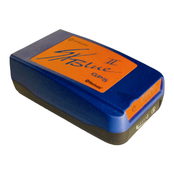
Page 17: Figure 1-1 Sxblue Ii Gps Main Components
Charger Jack Pack Serial Number RS-232 Port ON/OFF Button USB Port GPS LED Indicators GPS Antenna Battery Gauge Connector Battery Gauge Button Indicator Battery Thumb Screws (x4) Figure 1-1 SXBlue II GPS Main Components SXBlue II GPS Series Technical Reference Manual... -
Page 18: Battery Pack
80%. Figure 1-2 Battery contacts Since the SXBlue II GPS uses Li-Ion battery chemistry, there is no memory effect as for NiMH or NiCad batteries; therefore it is not necessary to discharge the pack before recharging it. Only proper Li-Ion battery charger must be used with the SXBlue II GPS battery. Using any other type of charger might result in explosion and injuries. -
Page 19: Precision Antennae
Using different antennae than the ones supplied, might degrade the submeter performance of the SXBlue II GPS. Shall a different antenna be used, a maximum of 29dB gain is recommended. When using longer antenna cable, it is important to take into account the cable loss (dB/m) to allow at least 21dB at the RF input of the receiver. -
Page 20: Getting Ready For The Field
GPS antenna that doesn’t support a 5 VDC input could damage the antenna. 1.3 Getting Ready for the Field The SXBlue II GPS is one component of a modular system that normally includes two other parts: a computer and data collection software. A modular approach has huge advantages:... -
Page 21: Table 1-2 Default Port Settings
Because of the unique technology used on-board the SXBlue II GPS, the maximum DGPS age can be set to 3600 seconds. Once the SXBlue II GPS loses its differential correction source, the output will remain submeter for the next 40-45 minutes. See chapter 2 for more information. -
Page 22: Configuring Bluetooth Communication
In this section, we will give some examples of setting up Bluetooth communication with various PDA and computer drivers. One key element to remember is that the SXBlue II GPS does not require any password (often called pairing, secure connection, authentication, passkey, passcode, etc). - Page 23 From the desktop, tap the Bluetooth Icon and select “Menu/Bluetooth Settings”. In the “Devices” tab, tap “Add new device…”. Once the SXBlue II GPS has been found, select it then tap “Next”. The driver will ask for a “Passcode”; at this point do not enter any value and simply hit “Next”.
- Page 24 On the following screen, select “Serial Port” and the SXBlue II GPS will be added to the list of discovered devices. The next step is to assign a COM port number. Tap the “Com Ports” tab then select “New Outgoing Port”.
-
Page 25: Windows Mobile With Socket Communication Driver
The SXBlue II GPS will be shown in the list along with its assigned COM port number. This is the port number that should be selected in the data collection software. Tap “Ok” on the top right corner. Windows Mobile 6.0 will eventually show a “Cannot Connect” window. Tap on “Ok” in this window to bypass it and finally on “Done”... - Page 26 By default, the “Any Bluetooth device” option will be selected. Hit “Next”. After the search, the SXBlue II GPS will be displayed in the list. Check the box next to it, hit “Next” then “Finish”. The SXBlue II GPS will appear with an icon in the Bluetooth Devices window.
-
Page 27: Windows Mobile With Widcomm Driver
The last step is to set the SXBlue II GPS as a favourite device for the serial Com port. In the bottom menu, select “Tools”, “My Favorites…”. Select “Use the favorite selected above” and in the pull-down menu for “My favorite COM port device:”, select the SXBlue II GPS. Tap on “Ok”... - Page 28 In the “Security” section of the following screen, “Use a secure, encrypted connection” should be unchecked. Tap next. The SXBlue II GPS shortcut will be created and in this example, will be available as COM 8. SXBlue II GPS Series Technical Reference Manual...
-
Page 29: Microsoft Windows With Ivt Corporation's Bluesoleil Driver
GPS as a Serial Port Service. Right-click on the SXBlue II GPS icon and select “Connect Bluetooth Serial Port”. The assigned COM port number will be displayed in the taskbar once communication is established. SXBlue II GPS Series Technical Reference Manual... -
Page 30: Microsoft Windows With Widcomm's My Bluetooth Places Driver
In the “Bluetooth Service Selection” window select the “Bluetooth Serial Port” service then click “Next”. In the “Bluetooth Device Selection” window, from the pull-down menu, select “Show all devices”. After the search, the SXBlue II GPS should appear in the list. SXBlue II GPS Series Technical Reference Manual... - Page 31 “Bluetooth Setup Wizard Completion Page”, click on the “Configure Button and uncheck the “Secure Connection” option. The COM port number that is assigned to the SXBlue II GPS will be shown (in this example: COM8). Click “Ok” to close the “Bluetooth Properties”...
-
Page 32: Installing The Usb Drivers For Microsoft Windows
The software will install two subsets of the driver: The Serial Converter and the USB Serial Port emulation. In the “SXBlue II GPS – USB Driver Setup”, the default location for the driver installation will be “C:\Program Files\Geneq\SXBlueIIGPS USB Drivers”. Click on “Install”. The driver files will be uncompressed to the specified location and the Installer window will be displayed. - Page 33 In order to find the COM port number that Windows has assigned to the SXBlue II GPS, the receiver must be connected to the USB port and powered on. In Windows, go to “Start”, “Settings” and “Control Panel”. Double click on “System” to open the “System Properties”...
-
Page 34: In The Field
The SXBlue II GPS features diagnostic LEDs that provide a quick indication of the receiver’s status. These LEDs are visible on the front panel display. The five diagnostic LEDs visible on the front panel display of the SXBlue II GPS provide the following information:... -
Page 35: Figure 1-5 Sxblue Ii Gps Front Panel
Power – when the SXBlue II GPS is powered, this LED will illuminate. When battery is low, the Power indicator will start blinking for 20 minutes prior to auto shut-down. GPS Lock – once the SXBlue II GPS achieves a solid GPS lock, this LED will remain illuminated. If this Green LED continues to blink, it could be an indication of a receiver hardware failure. -
Page 36: Gis Field Data Collection And Datum Considerations
(Bluetooth, USB and Serial). Refer to chapters 3 and 4 for more information on the NMEA messages format. To communicate with the SXBlue II GPS via its Serial or USB port, a baud rate of 9600 •... - Page 37 When the SXBlue II GPS is first powered in a data collection session, it is preferable to • allow it to track GPS and SBAS satellites for a minimum of 5 minutes (ideally 10 minutes) before recording any data. Here are a few reasons for doing this:...
-
Page 38: Features And Performance
OmniStar corrections, we recommend that you consult Appendix C for further information on these services and technologies. When powered for the first time, the SXBlue II GPS will perform a ‘cold start’, which involves acquiring the available GPS satellites in view and the default differential service. -
Page 39: Update Rates
2.1.3 Update Rates By default, the SXBlue II GPS is supplied with a 1 Hz update rate. Higher update rate options can be purchased via your dealer and a code will be used to unlock the feature. Other available update rates are 10 Hz and 20Hz. -
Page 40: Dgps Radiobeacon
Space-Based Augmentation Systems broadcast an ionospheric map on a periodic basis that may take up to 5 minutes to receive upon startup. The SXBlue II GPS uses the GPS broadcast ionospheric model until it has downloaded the SBAS map, which can result in lower performance as compared to when the map has been downloaded. -
Page 41: Radiobeacon Range
Choose a location that is at least three feet away from all forms of transmitting antennas, • communications, and electrical equipment, including the SXBlue II-B GPS receiver. This will reduce the amount of noise present at the antenna, improving beacon receiver performance. -
Page 42: Omnistar Services
The OmniSTAR L-band signal is a line-of-sight UHF signal that is similar to GPS. There must be a line of sight between the SXBlue II-L GPS’s antenna and the geostationary communications satellite in order for the L-band differential receiver inside the SXBlue II-L GPS to acquire the signal. -
Page 43: Automatic Tracking And Performance
SXBlue II-L GPS. 2.4.3 Automatic Tracking and Performance The SXBlue II-L GPS features an automatic mode that allows tracking of the best spot beam if more than one is available in a particular region. The L-band DGPS receiver’s frequency does not need to be adjusted with this function. -
Page 44: The "Waas" Application
Auto-Dif (for autonomous DGPS positioning and standard base station RTCM output) is installed but not activated. The SXBlue II-L GPS comes with both the WAAS and the L-Band applications activated and user can switch from one to the other. -
Page 45: Figure 2-2 Auto-Dif Error Drift
South America, Africa, Australia, and Asia. Since Auto-Dif is an option, it will either come pre-installed inside your SXBlue II GPS, or you may order the option at a later time. It can be easily installed in the field using a PC computer and some simple software if not pre-installed. -
Page 46: Local Differential Options
Please contact Geneq for more information on this feature. 2.6.4 Local Differential options Local differential is a specialized message type that can only be sent between two SXBlue II GPS receivers. One receiver is used as the base station and must remain stationary. It is extremely useful to know the coordinates of the base station position, but averaging the position will also suffice. -
Page 47: Evaluating The Sxblue Ii Gps Performance
2.8 Evaluating the SXBlue II GPS Performance The SXBlue II GPS receiver performance has been evaluated with the objective of determining best-case performance in a real-world environment. Static testing has shown that the SXBlue II GPS achieves a performance better than 60cm 95% of the time when using WAAS, EGNOS or MSAS. -
Page 48: Communication
• It is important to locate any transmitting antennas away from the GPS antenna by several feet or more. This will help to ensure that tracking performance of the SXBlue II GPS is not compromised, giving you the best performance possible. -
Page 49: Bluetooth, Usb And Serial Ports
• computer in order to emulate a serial port. See section 1.3.3 for driver installation. There is one Serial Port on the SXBlue II GPS and it is compatible with the RS-232C • interface level to communicate with external data loggers, navigation systems, PC computers, PDAs and other devices. -
Page 50: Environmental Requirements
The SXBlue II GPS receiver is designed to be stored between -40°C and +85°C. The operating temperature range is -40°C and +85°C. Note that Li-Ion battery performance degrades below - 20°C. -
Page 51: Advanced Operations
3.1 Firmware Architecture The software that runs the SXBlue II GPS is often referred to as firmware since it operates at a low level. There are two types of firmware within the SXBlue II GPS for the on-board Digital Signal Processor (DSP) and the ARM processor. -
Page 52: Nmea 0183 Interface
SXBlue II GPS. You may configure a selection of NMEA 0183 data messages on one port at various update rates (each message has a maximum update rate) and a different selection of NMEA 0183 messages with different rates on the other port. -
Page 53: Configuring The Sxblue Ii Gps
The RTCM SC-104 data output by the SXBlue II GPS is converted from the RTCA SC-159 data broadcast by SBAS networks. Appendix D - Resources contains the contact information should you wish to purchase a copy of the RTCM SC-104 specification. -
Page 54: Using Hyperterminal
3.3.1.1 HyperTerminal Setup When you launch HyperTerminal for the first time, it will prompt for some configuration information. Start by entering a name for the Connection Description; in the example above: “SXBlue II GPS”. SXBlue II GPS Series Technical Reference Manual... - Page 55 (COM5 in this example). In the next “COMx Properties”, enter the following parameters: 9600 bits per seconds, 8 Data bits, Parity None, 1 Stop bit, Flow control None. Click on OK and the communication with the SXBlue II GPS should start immediately. The flow of data should look like the following screenshot: If you do not see any data streaming out the receiver’s port, it might be caused by either one of...
-
Page 56: Sending Individual Commands
“THIS”. ‘PORTC’ must be used for the USB port when configuring it from the Serial or the Bluetooth port. For example, if you are communicating with the SXBlue II GPS Serial Port, and wish to turn the GPGGA message on at an update rate of 10 Hz on the Bluetooth Port, the following command would be used. -
Page 57: Sending Configuration Files To The Receiver
Each time that you change the configuration of the SXBlue II GPS, you may wish to save the new configuration so the receiver does not have to be reconfigured again for the next power cycle. -
Page 58: Subscribing To An Application
3.3.1.1). If a $JSAVE command is included at the end of the file, the last reply will be “Save Complete”. 3.3.2 Subscribing to an Application Once an Application is installed in the SXBlue II GPS (see sections 2.6 and 3.1), it needs to be activated with a subscription code. 3.3.2.1 Available Applications... - Page 59 2. The Auto-Dif application is pre-installed in the Application 2 memory of the SXBlue II GPS and SXBlue II-B GPS but is not activated and requires a subscription. The Auto-Dif application offers the following features: Autonomous differential correction mode (with “calibration”) •...
-
Page 60: Activating An Application Or Option
3.3.2.2 Activating an Application or Option These instructions explain how to activate an application code on an SXBlue II GPS receiver. 1. Requirements • You must establish a communication between the SXBlue II GPS receiver and your computer, and use a generic terminal program such as Microsoft Windows HyperTerminal •... -
Page 61: Interpreting Subscription Date Codes
10Hz / SBAS / Auto-Dif / L-RTK 3014 10Hz / SBAS / Auto-Dif / L-RTK / L-Dif 3007 20Hz / SBAS / Auto-Dif / L-RTK 3015 20Hz / SBAS / Auto-Dif / L-RTK / L-Dif SXBlue II GPS Series Technical Reference Manual... -
Page 62: Differential Correction Operations
DGPS broadcast, while the second channel continues searching in the background for superior beacon signals. If no signal is available, the SXBlue II-B GPS will initiate a fresh GS, continuing this cycle until it finds a valid beacon. -
Page 63: Manual Mode
3.4.1.3 Database Mode Operating Mode • This operating mode has been added to the SXBlue II-B GPS in order to be compliant with the specification IEC 61108-4 for ship borne DGPS maritime radio beacon receiver equipment. The basic operation is outlined below. -
Page 64: Evaluating Performance
Auto Mode. In some installations, Database Mode may not work as well as Auto Mode for the following reasons: 1. The closest station is not in the station database and the SXBlue II-B GPS has not yet received a Type7 Almanac message. Most stations now broadcast the Almanac message every 10 minutes. -
Page 65: Activating An Omnistar Vbs Service (Sxblue Ii-L Gps)
RTCM SC-104 protocol. To use the Serial port of the SXBlue II GPS for correction input you must set the SXBlue II GPS to operate in other differential mode using the following command while connected to the Serial port: $JDIFF,THIS<CR><LF>... -
Page 66: Auto-Dif In Autonomous And Base Station Operations
(up to 10 minutes may be required depending on your environment). You do not have to keep the SXBlue II GPS stationary for this process, but you should ensure that the SXBlue II GPS maintains acquisition on the satellites available. We refer to this process of gathering information for the Auto-Dif application as Calibration. -
Page 67: Local-Dif And Local-Rtk Operations
3.4.5 Local-Dif and Local-RTK Operations RTK and Local-Dif are two differential options for the SXBlue II GPS that provide the most precise accuracy. A local base station is required for both differential options. Most commonly, the base station is comprised of a GPS receiver, GPS antenna, radio transmitter and power source for the radio. -
Page 68: Guidelines For Rover Operation
The $JRTK command should be used to send the reference position to the receiver and the $JASC,DFX,1 message output should be activated on the port connected to the radio system. Also the baud rate must be set to 9600 on the SXBlue II GPS’ port and the radios. -
Page 69: Complete Nmea Interface
4.2 General Commands This section presents various commands relating to the general operation and configuration of the SXBlue II GPS. The following table provides a brief description of the general commands supported by the SXBlue II GPS receiver. SXBlue II GPS Series Technical Reference Manual... -
Page 70: Jasc,D1
SBAS signal more quickly upon start-up. This is not normally needed. $JQUERY,GUIDE This command is used to poll the SXBlue II GPS for its opinion on whether or not it is providing suitable accuracy after the both SBAS and GPS have been acquired (up to 5... -
Page 71: Jair
For example, if RTCM is input on Port B, this data will correct the SXBlue II GPS position and can also be SXBlue II GPS Series Technical Reference Manual... -
Page 72: Jalt
$JASC,VIRTUAL,r<CR><LF> To configure the SXBlue II GPS to output RTCM data on a specific port from RTCM data input on another port, issue the following command: $JASC,VIRTUAL,r,PORTy<CR><LF>... -
Page 73: Jlimit
4.2.6 $JAPP This command allows you to request the SXBlue II GPS for the currently installed applications and to choose which application to use. The SXBlue II GPS by default comes pre-installed with WAAS (SBAS) in Application Slot 1 and Auto-Dif in Application Slot 2, but Auto-Dif requires a subscription that must be purchased from Geneq or an authorized reseller. -
Page 74: Jbaud
Note – Other derivatives of the $JAPP command are the $JAPP,1<CR><LF> and $JAPP,2<CR><LF> commands that can be used to set the SXBlue II GPS to use the first and second application. It’s best to follow up the sending of these commands with a $JAPP query to see which application is 1 or 2. -
Page 75: Jconn
4.2.8 $JCONN This command is used to create a virtual circuit between the A and B port, if needed. This allows you to communicate through the SXBlue II GPS to the device on the opposite port. The virtual circuit command has the following form: $JCONN,p<CR><LF>... - Page 76 (valid for Port A and B) PORTy Specifying PORTy (where y is A, B or C) instructs the SXBlue II GPS to use external corrections input through the specified port (A = Bluetooth, B = RS-232, C = USB)
-
Page 77: Jpos
Note – This command is not normally required for operation of the SXBlue II GPS. 4.2.12 $JQUERY,GUIDE This command is used to poll the SXBlue II GPS for its opinion on whether or not it is providing suitable accuracy after the both SBAS and GPS have been acquired (up to 5 min). -
Page 78: Jsave
SXBlue II GPS receiver. This command has the following structure: $JSAVE<CR><LF> The SXBlue II GPS will reply with the following two messages. Ensure that the receiver indicates that the save process is complete before turning the receiver off or changing the configuration further. -
Page 79: Jshow
No data fields are required. The receiver will indicate that the configuration is being saved and will notify you when the save is complete. 4.2.15 $JSHOW This command is used to poll the SXBlue II GPS for its current operating. This command has the following structure: $JSHOW[,subset] <CR><LF>... - Page 80 4.2.16 $JT This command displays the revision of the receiver engine within the SXBlue II GPS: $JT<CR><LF> The receiver will return the following response, indicating that the receiver is an SX2g (‘g’...
-
Page 81: Jbin
When the ‘,PORTy’ data field is specified (without the square brackets and where ‘y’ is A, B or C), this command will enact a change on the Bluetooth, Serial or USB port. The SXBlue II GPS will reply with the following response: $>... -
Page 82: Gps Commands
Using this command, you may turn GPS data messages on at a particular update rate or off. When turning messages on, you have the choice of various update rates available, depending on what your requirements are. This command has the following layout: SXBlue II GPS Series Technical Reference Manual... -
Page 83: Jage
Using COAST technology, the SXBlue II GPS is able to use old correction data for extended periods of time. If you choose to use a maximum correction age older than... -
Page 84: Joff
When the ‘,PORTy’ data field is specified (without the square brackets and where ‘y’ is A, B or C), this command will turn on the four NMEA messages on the specified port. There are no variable data fields for this message. The SXBlue II GPS will reply with the following response: $>... -
Page 85: J4String
A, B or C), this command will turn on the four NMEA messages on the specified port. Remember that the Bluetooth port (A) is fixed at 57600 baud (9600 for serial number prior to 0808A100). The SXBlue II GPS will reply with the following response: $> 4.3.7 $JSMOOTH The $JSMOOTH command enables the user to change the carrier smoothing interval. -
Page 86: Jtau
(in seconds) = 10 / Maximum Acceleration (in m/s^2) SXBlue II GPS Series Technical Reference Manual... -
Page 87: Sbas Commands
This command is used to poll the SXBlue II GPS for SBAS diagnostic information $JASC,RTCM This feature allows you to configure the SXBlue II GPS to output RTCM data from the WAAS demodulator SXBlue II GPS Series Technical Reference Manual... -
Page 88: Jwaasprn
Where ‘sv1’ is the PRN number of the first SBAS satellite and ‘sv2’ is the PRN number of the second SBAS satellite. Either ‘sv1’ or both ‘sv1’ and ‘sv2’ may be specified. The SXBlue II GPS will reply with the following response: $>... -
Page 89: Jgeo
This message is used to display information related to the current frequency of SBAS, and its location in relation to the SXBlue II GPS’ antenna. To query the SXBlue II GPS for the currently used SBAS satellite information, use the following query: $JGEO<CR><LF>... -
Page 90: Jasc,Rtcm
This command allows you to configure the SXBlue II GPS to output RTCM corrections from SBAS through either of the SXBlue II GPS ports. The correction data output is RTCM SC-104 even though SBAS uses a different over-the-air protocol (RTCA). -
Page 91: Gpmsk
Period of output of performance status message 0 to 100 seconds ($CRMSS) When this message is acknowledged by the SXBlue II-B GPS, it will immediately tune to the frequency specified and demodulate at the rate specified. When the “n” field is set to a non-zero value, the SXBlue II-B GPS will output the $CRMSS message at that period through the communication port from which the SXBlue II-B GPS was tuned. -
Page 92: Pcsi,1 And $Pcsi,2
NMEA 0183 messages, causing the overall data to fail parity checking. When power to the SXBlue II-B GPS is removed and reapplied, the status output interval resets to zero (no output). 4.5.2 $PCSI,1 and $PCSI,2 This command is used to obtain beacon status data from channel 0 or channel 1 of the internal beacon demodulator. -
Page 93: Pcsi,3,2
$PCSI,3,2, 799,Penobscot ME,2900,0,207,0,0,-1,-1 $PCSI,3,2, 926,Rivière duLoupQC,3000,0,210,0,0,-1,-1 $PCSI,3,2, 772,Acushnet MA,3060,0,247,0,0,-1,-1 $PCSI,3,2, 839,Youngstown NY,3220,0,269,0,0,-1,-1 4.5.4 $PCSI,3,3 This command displays the contents of the station database. It has the following format: $PCSI,3,3<CR><LF> ($PCSI in Capital letters) SXBlue II GPS Series Technical Reference Manual... -
Page 94: Pcsi,0
$PCSI,3,3,0732,1024,0466,Kullen ,2930,20493,2266,1,0 $PCSI,3,3,0733,1024,0467,Hjortensudde ,3020,21343,2305,1,0 $PCSI,3,3,1024,1024,1024,St. Vito lo Capo,3065,13899,2317,1,1 4.5.5 $PCSI,0 This command queries the SXBlue II-B GPS for a list of available proprietary $PCSI beacon commands (must be entered in Capital letters): $PCSI,0<CR><LF> The response is : $PCSI,ACK,0 $PCSI,Pxxx-y,yyy (Beacon engine firmware version) $PCSI,0 ->HELP Msg... -
Page 95: Gpcrq,Msk ($Crmsk)
$PCSI,8,NITRAM,W: Enable weak signal tracking (WER of 50%) $PCSI,8,NITRAM,Q: Enable Legacy Q value output in place of WER 4.5.7 $GPCRQ,MSK ($CRMSK) This standard NMEA query prompts the SXBlue II-B GPS for its operational status. It has the following format: $GPCRQ,MSK<CR><LF>... -
Page 96: Omnistar Commands (Sxblue Ii-L Gps)
4.6 OmniSTAR Commands (SXBlue II-L GPS) This section details the commands accepted by the SXBlue II-L GPS to configure and monitor the OmniSTAR functionality of the receiver. Table 4-5 provides a brief description of the commands supported by the OmniSTAR built-in sensor for its configuration and control. -
Page 97: Jlxbeam
DDS Frequency long Longitude of the spot beam centroid (in degrees) Latitude of the spot beam centroid (in degrees) symbol Symbol rate used for that particular spot beam satlong Satellites longitude (in degrees) SXBlue II GPS Series Technical Reference Manual... -
Page 98: Jfreq
$> Beam:7,1537440000,1200,14,59,41,23,34,25,* $> Beam:7,1537440000,1200,11,28,17,24,0,25,* 4.6.3 $JFREQ This message allows the SXBlue II-L GPS to be either manually or automatically tuned to the OmniSTAR satellite frequency. This command has the following structure: $JFREQ,freq,symb<CR><LF> Where “freq” is the frequency in KHz and “symb” is the symbol rate (1200 or 2400 baud). -
Page 99: Joms
4.7 Auto-Dif Commands in Autonomous Mode This current section provides information related to the NMEA messages accepted by the SXBlue II GPS’ optional Auto-Dif application. The following table provides a brief description of the commands supported by the Auto-Dif application for its control and operation in Autonomous mode. -
Page 100: Jrad,1
The SXBlue II GPS will reply with a response similar to the following: $>JRAD,1,51.00233513,-114.08232345,1050.212 Upon startup of the SXBlue II GPS with the Auto-Dif application running (as opposed to the SBAS application), no reference position will be present in memory. If you attempt to... -
Page 101: Jrad,2
Example of ellipsoidal height calculation: $GPGGA,173309.00,5101.04028,N,11402.38289,W,2,07,1.4,1071.0,M,-17.8,M,6.0, 0122*48 (and ellipsoidal height = 1071.0 + (-17.8) = 1053.2 meters) The SXBlue II GPS will reply with the following response: $>JRAD,lat,lon,alt Note - Both latitude and longitude must be entered as decimal degrees. The receiver will not accept the command if there are no decimal places. -
Page 102: Auto-Dif Commands In Base Station Mode
The SXBlue II GPS will reply with a response similar to the following: $>JRAD,1,51.00233513,-114.08232345,1050.212 Upon startup of the SXBlue II GPS with the Auto-Dif application running (as opposed to the SBAS application), no reference position will be present in memory. If you attempt to query for the reference position, the receiver will respond with the following message: $>JRAD,1,FAILED,Present Location Not Stable... -
Page 103: Jrad,1,Lat,Lon,Alt
Example of ellipsoidal height calculation: $GPGGA,173309.00,5101.04028,N,11402.38289,W,2,07,1.4,1071.0,M,-17.8,M,6.0, 0122*48 ellipsoidal height = 1071.0 + (-17.8) = 1053.2 meters The SXBlue II GPS will reply with the following response: $>JRAD,lat,lon,alt Note - Both latitude and longitude must be entered as decimal degrees. The receiver will not accept the command if there are no decimal places. -
Page 104: Jrad,9
RTCM corrections. The other receiver (rover) must be set to use RTCM corrections coming in from one of its communication ports. If operating the SXBlue II GPS with the latest version of the Auto-Dif firmware, the $JMODE,BASE,YES command (followed by a $JSAVE) can be used to configure the receiver to automatically restart in Base Mode after a power cycle. -
Page 105: Local Differential Commands
$JRTK,18 Rover Display distance to base station Note – The SXBlue II GPS stores two different reference positions in distinct memory locations. The first is called Manual-Reference and the other is called Auto-Reference (that the receiver obtains automatically by averaging). -
Page 106: Jrtk,1
$JRTK,1,Other<CR><LF> for the auto-reference (auto averaged) position The SXBlue II GPS will reply with a response similar to the following: $>JRTK,1,51.00233513,-114.08232345,1050.212 4.9.2 $JRTK,1,P This command records the current computed position as the reference with which to compute Base Station corrections. -
Page 107: Jrtk,1,Lat,Lon,Alt
Example of ellipsoidal height calculation: $GPGGA,173309.00,5101.04028,N,11402.38289,W,2,07,1.4,1071.0,M,-17.8,M,6.0, 0122*48 Ellipsoidal height = 1071.0 + (-17.8) = 1053.2 meters The SXBlue II GPS will use this reference position immediately and reply with the following response: $>JRTK,lat,lon,alt Note - Both latitude and longitude must be entered as decimal degrees. The receiver will not accept the command if there are no decimal places. -
Page 108: Jrtk,6
This command is used to show the progress of the base station. This command has the following format: $JRTK,6<CR><LF> The SXBlue II GPS will respond with the following information: $>JRTK,6,TimeToGo, ReadyTransmit,Transmitting where, TimeToGo: Seconds left until ready to transmit RTK •... -
Page 109: Jasc,Dfx
$>JRTK,17,51.00233513,-114.08232345,1050.212 4.9.9 $JASC,DFX This command allows you to configure the SXBlue II GPS used as base station to output RTK corrections through either of the SXBlue II GPS ports. The correction data output is a proprietary RTCM format and can only be used with SXBlue GPS family of products. -
Page 110: Output Data Messages
The GPGNS message fixes data for GPS, GLONASS, possible future satellite systems and system combining these. The GPGNS data message is broken down into its components in the Table below. This message follows the following form: $GPGNS,hhmmss.ss,llll.ll,s,yyyy.yy,t,n,qq,pp.p,saaaaa.aa,M,±xxxx.xx,M,sss,aaaa*cc< CR><LF> SXBlue II GPS Series Technical Reference Manual... -
Page 111: Gga Data Message
Altitude units, M = meters Geoidal separation (needs geoidal height option) ±xxxx.xx Geoidal separation units, M = meters Age of differential corrections in seconds Reference station identification Checksum <CR><LF> Carriage return and line feed SXBlue II GPS Series Technical Reference Manual... -
Page 112: Gll Data Message
Position Dilution of Precision (PDOP) = 1.0 to 9.9 Horizontal Dilution of Precision (HDOP) = 1.0 to 9.9 Vertical Dilution of Precision (VDOP) = 1.0 to 9.9 Checksum <CR><LF> Carriage return and line feed SXBlue II GPS Series Technical Reference Manual... -
Page 113: Gst Data Message
Satellite number Elevation in degrees, ee = 0 to 90 Azimuth (true) in degrees, aaa = 0 to SNR (dB) + 30, ss = 0 to 99 Checksum <CR><LF> Carriage return and line feed SXBlue II GPS Series Technical Reference Manual... -
Page 114: Rmc Data Message
Number of satellites used in position computation Satellite number Range residual in meters hhh.h Horizontal position error estimate in meters vvv.v Vertical position error estimate in meters Checksum <CR><LF> Carriage return and line feed SXBlue II GPS Series Technical Reference Manual... -
Page 115: Vtg Data Message
GRS Data Message The GRS message supports the Receiver Autonomous Integrity Monitoring (RAIM).The GRS data message is broken down into its components in the table below. This message takes the following form: $--GRS.hhmmss.ss,y,x.x,x.x,x.x,x.x,x.x,x.x,x.x,x.x,x.x,x.x,x.x,x.x*hh<CR><LF> SXBlue II GPS Series Technical Reference Manual... -
Page 116: Rd1 Data Message
Field Description Carrier lock BER is ok on at least one SBAS satellite Frame synchronization has been achieved on the second satellite Frame synchronization has been achieved on the first satellite Carrier lock SXBlue II GPS Series Technical Reference Manual... -
Page 117: Raim Command And Message
The SXBlue II GPS uses RAIM to alert users when errors have exceeded a user specified tolerance. RAIM is available for the SBAS applications. -
Page 118: Psat,Gbs Data Message
Good (0), Warning (1), Bad or Fault (2), (based on horizontal radius) Checksum <CR><LF> Carriage return and line feed To start outputting the $PSAT,GBS message once per second (the only output rate available), enter the following: SXBlue II GPS Series Technical Reference Manual... - Page 119 $JASC,GPGBS,1<CR><LF> Or, to turn the $PSAT,GBS message off, send the following command. $JASC,GPGBS,0<CR><LF SXBlue II GPS Series Technical Reference Manual...
-
Page 120: Binary Data
5.1 Binary Message Structure The Binary messages supported by the SXBlue II GPS are in an Intel Little Endian format for direct read in a PC environment. You can find more information on this format at the following Web site. -
Page 121: Bin 80
If bit 7 is set (left-most bit), then this is a manual mark position Unsigned 0 to 65536 Extended Extended age of differential, short econds. If 0, use 1 byte AgeOfDiff listed above SXBlue II GPS Series Technical Reference Manual... -
Page 122: Bin 93
• Bit 05-09 Value used to find PRN of first WAAS satellite (This value +120 = PRN) • Bit 10-14 Value used to find PRN of second WAAS satellite (This value + 120 = PRN) • Bit 15 Unused SXBlue II GPS Series Technical Reference Manual... -
Page 123: Bin 94
Consult the ICD-GPS-200 for short definition in Appendix D – Resources Bit 0 = 1 sec Long Bit 0 = 0.08 m Long Bit 0 = 0.08 m Long Bit 0 = 0.4 m Long SXBlue II GPS Series Technical Reference Manual... -
Page 124: Bin 96
Day of week (1-7) when dtlsf Unsigned becomes effective short Cumulative past leap Short dtls Scheduled future leap Short dtlsf Not used at this time Unsigned Future use Spare short SXBlue II GPS Series Technical Reference Manual... -
Page 125: Bin 97
UICS_TT_SNR_PRN[12] long UIDoppler_FL[12] See below Unsigned 4 x 12 = 48 long PseudoRange[12] Pseudoranges Double 8 x 12 = 96 Phase[12] Phase (m) L1 wave = Double 8 x 12 = 96 0.190293672798365m SXBlue II GPS Series Technical Reference Manual... -
Page 126: Bin 99
Unsigned Future use Spare 3 Not used at this time long Future use Spare 4 Not used at this time Future use Spare 5 Future use Not used at this time Unsigned short SXBlue II GPS Series Technical Reference Manual... -
Page 127: Table 5-10 Bin 98 Message
Almanac health from sub Byte See ICD-GPS-200 AlmHealth frame 4 of the GPS message Elevation angle in degrees Char -90 to 90 Elev Byte 0 to 180 Azimuth ½ the azimuth in degrees represents 360 degrees SXBlue II GPS Series Technical Reference Manual... -
Page 128: Table 5-11 Bin 99 Message
Status bit frame) 1 = carrier lock 2 = bit lock 3 = frame sync 4 = frame sync and new epoch 5 = channel reset 6 = phase lock 7 = spare SXBlue II GPS Series Technical Reference Manual... - Page 129 VelResid 10 times the velocity residual Short from the GPS solution for this channel DoppHZ Expected Doppler for this Short channel in Hz NCOHz Carrier track offset for this Short channel in Hz SXBlue II GPS Series Technical Reference Manual...
-
Page 130: Frequently Asked Questions
Q – How does the SXBlue II GPS compare to competitor’s products? A – The SXBlue II GPS is a unique solution in that it is very compact, yet offers a high degree of performance. There are a number of DGPS products on the marketplace, however, very few of these are suitable for commercial use in applications such as GIS &... -
Page 131: Support And Repairs
6.3 Troubleshooting Q - What do I do initially if I have a problem with the operation of the SXBlue II GPS module? A - Try to isolate the source of the problem. Problems are likely to fall within one of the following categories. -
Page 132: Power, Communication, And Configuration
4. If using the USB connection, make sure drivers are installed on the computer. 5. If the SXBlue II GPS is connected to a custom or special device, ensure that the serial connection to it does not have any incompatible signal lines present that may not allow either to communicate properly. -
Page 133: Gps Reception And Performance
Additionally, the SXBlue II GPS module has LEDs that give indication of receiver status. Q - Do I have to be careful when using the SXBlue II GPS to ensure that it tracks properly? A – For best performance, you have to be careful such that the hemisphere above the SXBlue II GPS’s antenna is unobstructed for satellite tracking. -
Page 134: Auto-Dif
PocketMAX utility is a useful tool that provides this information without needing to use NMEA commands. Q - Does it matter much if the SXBlue II GPS is frequently losing lock on SBAS due to obstructions and the low satellite elevation angles at my geographic location? A - No, provided that the receiver is receiving a full set of corrections relatively often. -
Page 135: External Corrections
• Make sure that the differential source is set to receive RTCM by issuing a $JDIFF,THIS<cr><lf> on the RS-232 Serial port. • Check to see that the baud rates of the port used by the SXBlue II GPS matches that of the external correction source •... -
Page 136: Troubleshooting
(you may issue a $JSHOW command with a terminal software to verify this) Verify that SXBlue II GPS is locked to a valid DGPS signal (this can often be done on the • receiving device or with the use of HyperTerminal running on a PC) Verify that SXBlue II GPS is locked to GPS satellites (this can often be done on the •... -
Page 137: Table 7-2 Led Functions
If the LED is continually blinking and you have been programming your SXBlue II GPS, it is possible it is still in programming mode. The SXBlue II GPS will not communicate while in this state. Simply power cycle the SXBlue II GPS to restore normal communications. - Page 138 Appendices SXBlue II GPS Series Technical Reference Manual...
-
Page 139: Appendix A - Specifications
Appendix A - Specifications This appendix provides the operational, mechanical, electrical, physical, and environmental specifications of the SXBlue II GPS receiver. Table A-1 SXBlue II GPS Receiver Specifications Internal GPS Engine Operational Specifications Item Specification Frequency 1.575 GHz GPS + SBAS Channels... -
Page 140: Appendix B - Interface
(RX) of the data logging or navigation device. • Connect Pin-3 - receive (RX) of the SXBlue II GPS Serial cable to transmit pin (TX) of the other device if it is able to configure the SXBlue II GPS. Otherwise, this connection is optional. -
Page 141: Figure B-2 Rtcm Data Output From Serial Port
To configure external correction input on the Serial port you must: • Communicate with the SXBlue II GPS on the Serial Port. Ensure that the baud rate of the Serial Port and the external correction source match by issuing the appropriate $JBAUD command. -
Page 142: Figure B-3 Rtcm Data Input To Serial Port
RX RTCM Figure B-3 RTCM Data Input to Serial Port Note - For successful communications, the baud rate of the SXBlue II GPS differential port must be set to match that of the external correction source. The correction source must support an RS-232 interface level and the baud rates between each device must match. -
Page 143: Appendix C - Introduction To Gps And Dgps Services
C/A code. The DoD provides the SPS free of charge, worldwide, to all civilian users. In order to maintain a strategic advantage, the US DoD used to artificially degrade the performance of the SPS so that the positioning accuracy was limited to 100 meters 95% SXBlue II GPS Series Technical Reference Manual... -
Page 144: Differential Gps
C code snippets to aid in integrating the binary format itself into your own application. The SXBlue II GPS also uses an RTK solution option in two versions: fixed and floating- only solution. This allows for cm level field data collection, precise guidance and stake- out applications. -
Page 145: Dgps Format
DGPS standard associated with conventional DGPS, designated RTCM SC-104 V2.2. This correction standard is used by many correction services, including many private reference stations and DGPS beacon systems. The SXBlue II GPS supports this correction protocol via either of its communication ports. - Page 146 Japanese MT-SAT Satellite-based Augmentation System (MSAS) and the Indian Space Research Organization’s GPS Aided Geo-Augmented Navigation system (GAGAN) system (still in test mode at the time of print) use this data format. The SXBlue II GPS receiver is compatible with each of these differential services.
- Page 147 SA was turned to zero in year 2000. Latency is a function of the following: • The time it takes the base station to calculate corrections SXBlue II GPS Series Technical Reference Manual...
- Page 148 The effect of latency is mitigated by the COAST technology within the SXBlue II GPS. This technology is especially valuable in conditions of DGPS signal loss where the age of corrections increases for each second of signal loss. See Section 2.3 for further information on COAST.
- Page 149 China has a similar program for a SBAS and the service is named the Chinese Satellite Navigation Augmentation System (SNAS). The SXBlue II GPS is capable of receiving correction data from all compatible SBAS. Warning – Use of non-commissioned SBAS signals is entirely at your risk and discretion.
-
Page 150: Figure C-1 Waas Ground Segment (End Of 2007)
• The Space Segment includes geostationary satellites (For example, EGNOS uses Inmarsat transponders). • The user segment consists of the user equipment, such as a SXBlue II GPS receiver and antenna A SBAS uses a state-based approach in their software architecture. This means that a separate correction is made available for each error source rather than the sum effect of errors on the user equipment’s range measurements. -
Page 151: Figure C-2 Egnos Ground Segment (End Of 2007)
60 km. There must be sufficient ionospheric map coverage beyond your location in order to have ionospheric correctors for all satellites. To enhance the information provided by SBAS, the SXBlue II GPS has a unique ability to extrapolate the ionospheric information beyond the broadcast information. This feature increases the usable geographic coverage area of a SBAS system. -
Page 152: Figure C-3 Worldwide Sbas Coverage
SBAS signal loss occurs for extended periods of time. More information on COAST is provided in Section 2.5. When using SBAS correction data, the SXBlue II GPS is able to provide you with the azimuth and elevation of the SBAS available satellites via a NMEA command to aid in determining their position with respect to the built-in antenna. -
Page 153: Figure C-4 Worldwide Sbas Ionospheric Coverage
Figure C-4 shows the ionospheric coverage for each of the SBAS constellations. For WAAS, EGNOS and MSAS, the grids shown are actual grids with no extrapolation. The grid shown for GAGAN was recorded by an SXBlue II GPS and is not an official grid from the Indian authorities. -
Page 154: Figure C-5 Broadcast And Extrapolated Ionospheric Correction Map
SBAS and the SXBlue II GPS. SBAS Ionospheric Map Extrapolation To improve upon the ionospheric map provided by SBAS, the SXBlue II GPS receiver extrapolates a larger ionospheric map from the broadcast coverage map, extending its effective coverage. -
Page 155: Appendix D - Resources
NAVSTAR GPS Joint Program Office: http://www.losangeles.af.mil/library/factsheets/factsheet.asp?id=5311 US Coast Guard Navigation Center: http://www.navcen.uscg.gov FAA WAAS Web Site This site offers general information on the WAAS service provided by the U.S. FAA. http://www.faa.gov/airports_airtraffic/technology/waas/ GNNS Services: http://www.faa.gov/about/office_org/headquarters_offices/ato/service_units/techops/navs ervices/gnss/ SXBlue II GPS Series Technical Reference Manual... - Page 156 WAAS PRN 138: http://www.lyngsat.com/tracker/anikf1r.html EGNOS PRN 120: http://www.lyngsat.com/tracker/inmar3f2.html EGNOS PRN 126: http://www.lyngsat.com/tracker/inmar3f5.html (same location as...) EGNOS PRN 124: http://www.lyngsat.com/tracker/artemis.html MSAS PRN 129: http://www.lyngsat.com/tracker/mtsat1r.html MSAS PRN 137: http://www.lyngsat.com/tracker/mtsat2.html GAGAN PRN 128: http://www.lyngsat.com/tracker/in4a.html (same location as...) SXBlue II GPS Series Technical Reference Manual...
- Page 157 The following sites are useful in providing details regarding solar and ionospheric activity: http://iono.jpl.nasa.gov//index.html http://www.spaceweather.com http://www.n3kl.org/sun/noaa.html GPS, GIS and Survey Related Magazines GPSWorld Magazine: http://www.gpsworld.com/ GPSWorld Survey/Construction News: http://sc.gpsworld.com/gpssc/ GIM International: http://www.gim-international.com/ POB Magazine: http://www.pobonline.com/ Direction Magazine: http://www.directionsmag.com/ GeoWorld: http://www.geoplace.com Geoconnexion International Magazine: http://www.geoconnexion.com/ SXBlue II GPS Series Technical Reference Manual...
-
Page 158: Index
GAGAN, 133 fuel gauge, 3 GPS, 129 pack, 3 GPS Performance, 32 Baud Rate, 35, 124, 125, 126 Binary, 34, 37, 104 Bit Error Rate (WAAS), 24 Bluetooth, 34 Bluetooth Communication, 7 Humidity, 35 SXBlue II GPS Series Technical Reference Manual... - Page 159 NMEA 0183, 33, 37, 54, 95 USB, 34 NMEA 0183 messages, 54 USB Drivers, 17 Output Data Messages, 95 WAAS, 133 Bit Error Rate, 24 Receiver Performance, 24 WGS-84, 127 Performance, 23, 118 SXBlue II GPS Series Technical Reference Manual...
-
Page 160: Revision History
Add EGNOS user support link (Update EGNOS web site AppD): http://194.224.177.81/Webportal/Egnos/Pages/Home.page Rev 2.0 December 2010 SXBlue II-B GPS and SXBlue II-L GPS receivers added SBAS information updated in Appendix Rev 2.1 October 2011 Page 83, OmniSTAR frequency table shows frequencies in KHz Added 90 days clause warranty for Li-Ion battery Rev 2.2 January 2012...
Need help?
Do you have a question about the SXBlue II and is the answer not in the manual?
Questions and answers