Table of Contents
Advertisement
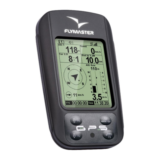
Quick Links
Advertisement
Table of Contents

Related Manuals for Flymaster GPS Navigator


Summary of Contents for Flymaster GPS Navigator
- Page 1 GPS User manual Document version 2.0...
- Page 2 All rights reserved. Except as expressly provided herein, no part of this manual may be reproduced, copied, transmitted, disseminated, downloaded or stored in any storage medium, for any purpose without the express prior written consent of FLYMASTER Avionics Lda. herein FLYMASTER avionics. FLYMASTER Avionics hereby grants...
- Page 3 Flymaster GPS. Flight safety is the sole responsibility of the pilot. It is unsafe to operate the Flymaster GPS while in the air. Failure by the pilot equipped with a Flymaster GPS to pay full attention to the aircraft and flying conditions while flying could result in accident with property damage and/or personal injury.
-
Page 4: Table Of Contents
Table of Contents 1 Introduction............................6 2 Overview............................6 3 Getting started..........................7 3.1 Charging the Battery.........................7 3.2 GPS Keys..........................8 3.3 Using keys Inside Menu......................8 3.4 Switching GPS On and Off.......................9 3.5 Resetting the GPS........................9 4 Flight Mode............................10 5 GPS Elements..........................11 5.1 Graphical Elements.........................11 5.1.1 Battery..........................11 5.1.2 Sound..........................12 5.1.3 GPS..........................13... - Page 5 11.4.2 Cadence.........................39 11.4.3 Dynamic Frequency......................40 11.4.4 Buzzer...........................40 11.4.5 Auto Silent........................41 11.4.6 Start Speed........................41 11.5 Screen............................42 11.5.1 Screen Contrast......................42 11.5.2 Disable Triggers......................42 11.6 Language/Units........................43 11.7 Device Settings........................44 11.8 RF Probes..........................44 11.9 FS Keys..........................45 11.10 Airspace settings.........................45 12 Firmware............................46 Document version: 2.0 Page 5...
-
Page 6: Introduction
1 Introduction Thank you for choosing FLYMASTER GPS. If you have any questions or comments regarding the use of our equipment you can visit our website or contact our Support Department (support@flymaster-avionics.com). This manual covers Firmware versions up to 1.01v. If you have a more recent version of firmware some of the features may not be covered. -
Page 7: Getting Started
To charge the Flymaster GPS battery you can use the wall charger, the Usb cable, or the car charger. Flymaster accessories are recommended in order to avoid damage the power management module. -
Page 8: Gps Keys
Information about the charging process can be seen in the shutdown page, or in the center of the display when the device is turned off. In both cases information displayed includes: the charging mode, slow or quick; the current battery level in percentage; and the remaining charging time in hh:mm format. -
Page 9: Switching Gps On And Off
options list. Once the desired option is selected, the option is highlighted, and the ENTER key should be used to access the option. Depending on the menu option, either appears a new menu options list, or a data fields list appears. Going back from a menu can be achieved using the MENU key. -
Page 10: Flight Mode
4 Flight Mode The Flymaster GPS has two main working modes, namely Flight mode, and Menu mode. Flight mode is used during flight, and this allows the user to see information such as Altitude, Speed, or Vario. The GPS has up to 16 different pages (see Figure. 4) in memory. -
Page 11: Gps Elements
the same thing on the GPS screen.There are several elements available for the GPS which are presented in the following section. 5 GPS Elements The main objective of an element is to provide information to the user. Elements can be Graphical, or Data Field type. -
Page 12: Sound
5.1.2 Sound The Sound Element provides graphical representation on the current volume level. Table 2 Shows the relationship between what is shown and the sound level. This element has fixed dimensions. Table 2 - Sound Element description Symbol Description •Sound Level 6 (maximum sound level) •Sound Level 5 •Sound Level 4 •Sound Level 3... -
Page 13: Gps
Note that FAI rules require 3D tracklog data, which includes GPS altitude. Therefore the GPS will only start recording a tracklog when 3D information is available. The GPS has an high sensitivity 50 channel GPS receiver which offers unmatched tracking performance in harsh signal environments (-160 dBm sensitivity), and very short acquisition times. -
Page 14: Big Analog Vario
Figure. 6 - Analog Big Vario Element This Element graphically represents the rate of climb, scaled from 0 m/s to +/-10 m/s depending if you are climbing or sinking. In this Element a black bar starts from the middle of the scale and grows at 0,1 m/s increments, up to 5 m/s at the top of the scale. -
Page 15: Navigation Arrows
Navigation information is shown within the inner most circle. The external circle contains the cardinal points. The current traveling direction (bearing) corresponds to the point indicated in the top of the navigation circle. For example, in the case shown in Figure. 7, the bearing is around 200º. -
Page 16: Thermal Core Map
Airspace information can loaded to the instrument using the Flymaster Designer software (see Designer user manual for more information). The Live only accepts data in the “Open Air” format, and it has a limitation of 3000 polygons points. - Page 17 orientation. The first time the map is drawn, it is centered on the last gps position the Live has in its memory. The map is re-centered once the flight starts i.e. when a valid gps signal exists, and the “start speed” (see section 11.4.6 ) is reached. Once the flight starts, the map is redrawn with an arrow (pilot) which will move around the map, indicating the relative position of the pilot to each of the airspace areas.
-
Page 18: Altitude Graph
whereas a negative distance indicates that you are inside the airspace. Additionally, the “CTR status” field will indicate if an airspace is being violated by displaying “Violating”. If the pilot is not violating the airspace but it is inside a predefined margin then the messages “Altitude Imminent”, or “Position Imminent”... -
Page 19: Wind Arrow
Figure. 13 Altitude plot 5.1.9 Wind Arrow Figure. 14 Wind Arrow element The “Wind Arrow” element (see Figure. 14) is an re-sizable graphical element. When used in a layout a type of arrow is draw showing the wind direction relative to the pilot direction (wind coming from direction). -
Page 20: Data Field Elements
5.2 Data field Elements Data field elements can be used to shown numerical information like speed, altitude, glide ration, amongst others. These elements have configurable size, and position, although the text within has only 3 possible sizes. Table 4 explains the available data fields. As the GPS firmware evolves this list will likely grow. - Page 21 Flight Duration. Duration of the current flight. Flight Level Current altitude in hundreds of feet. Fuel Level Fuel level in liters (available when connected with Flymaster M1). G.R.M.G Glide ratio made good. The actual glide ratio towards the active turn point. It is calculated using the integrated vario, and the VMG.
- Page 22 Speed Indicates ground speed in km/h. The speed is only available when the GPS receiver has a valid signal. Time Current Time. This value is automatic revised when the device gets a valid Gps Signal. (see Note 2) Trans.G.R. Glide ratio during transition.
-
Page 23: Menu Mode
section 11.1 ). 6 Menu mode When in flight mode, pushing the menu (S1) button accesses the menu mode. When in menu mode pushing the menu(S1) button will go back to flight mode. Figure. 16 - Main Menu Screen To access the different items on the menu you can use the UP(S3) and DOWN(S4) keys. Once a menu item is selected pushing the ENTER (S2) executes the selected function. -
Page 24: Waypoints/Route
Table 5 - Main Menu Options Menu item Description Waypoints/Route Accesses GPS's waypoints and Route definitions. (see section 7 ) Near Airfields Displays airfields page. This page constantly shows the glide ratios, and distances to the nearest landing fields, sorted by easiest glide. (see section 8 ) Flight log Accesses the stored flights list. - Page 25 Figure. 17 - Waypoints and Task page Pushing the ENTER key when a waypoint is selected activates the waypoint actions menu (WAM). A list with will the available actions is shown in the DO area (see Figure. 18). Document version: 2.0 Page 25...
-
Page 26: Waypoint Actions Menu
7.1 Waypoint Actions Menu Figure. 18 - Waypoints actions list On entering the waypoint actions menu the selected waypoint becomes grayed indicating that waypoint specific actions will be carried out using the selected waypoint. Once the WAM is active a list of options appears in the DO area. A short description of each option is show in Table 6. -
Page 27: Edit Route
Edit Route Starts editing Route. If no waypoints have been added to the route this option is disabled. (see section 7.2 ) The option list can be scrolled using UP and DOWN keys. 7.2 Edit Route The GPS will only store one route. This is done to prevent flying an incorrect one. A route can be edited selecting the “Edit Route”... -
Page 28: Edit Route Point
Figure. 19 - Edit task Each waypoint in the route is defined as having a particular type. The GPS only allows three types, namely the Take Off, Cylinder, and Landing. Route waypoints can be “Edit” (see section 7.2.1 ), “Move” (see section 7.2.2 ), and “Remove”(see section 7.2.3 ). The entire route can also be “Deleted”(see section 7.2.4 ). -
Page 29: Move Route Point
Table 7 - Waypoint Types Type Time field usage Take off This first route waypoint is automatic defined as Take-Off. This waypoint however, is only a place marker for calculating the entire route length. LIVE will ignore it for navigation purposes. Cylinder The cylinder type is defined by a coordinate and a radius. -
Page 30: Route Definition
activate the actions menu list. Select the “Delete Route” option from the menu, and push the ENTER button to confirm. The route will be deleted and the WL area activated. 7.3 Route Definition Consider the route represented in Figure. 20, were “T01” is the take-off, followed by 3 waypoints, “W06”, “W03”... -
Page 31: Near Airfields
Figure. 21 - Route Screen After the above procedure the route is set. Going back into the “Flight Mode Screen”, by pressing MENU bottom will automatically activates the route, and starts navigation. 8 Near Airfields It is possible to define waypoints as “Landing”, allowing the pilot to quickly check for landing options. -
Page 32: Flight Log
The Near Airfields page can be used to make a “Go To” by using the UP, and DOWN buttons to select the desired waypoint. Pushing the ENTER button will immediately activate navigation to the selected waypoint. On the example of Figure. 22 the closest airfield is 12.48 Km from our present location, and the necessary glide ratio to reach it is 9.6. -
Page 33: Gps Status
Figure. 23 - Flight Log 10 GPS status In the main menu the GPS provides a detailed view of the GPS status,the current “position dilution of precision” (pdop) value ,and the current GPS coordinates of the pilot. Figure. 24 - Satellite status Figure. -
Page 34: Settings Menu
9 satellites are visible, and 7 are being used to provide the position fix. Each bar shows the signal strength for each individual satellite. A filled bar indicates the GPS has a “lock” on that satellite. The “position dilution of precision” (pdop) shown gives an indication of how reliable the GPS altitude is at the moment. -
Page 35: Set Altimeter
11.1 Set Altimeter The “Set Altimeter” page allows the user to adjusts the barometric altimeter. A barometric altimeter calculates altitude based on atmospheric pressure. Since atmospheric pressure can vary substantially with meteorological conditions it should be calibrated prior to takeoff. Calibrating the altimeter can be achieved by entering the know altitude of the location. -
Page 36: Vario Integrator
and the Universal Coordinated Time ((UTC) offset). (see Figure. 27) Figure. 27 - Timing Parameters The current firmware version supports two interval related parameters the “Vario Integrator” and “Track Interval”. 11.2.1 Vario Integrator The Integrated Vario is calculated by integrating the vertical speed during a period of X seconds defined by this value. -
Page 37: Sinking/Climbing Threshold
11.3.1 Sinking/Climbing Threshold The sinking threshold is set to -2 m/s by default. The value can be changed by pressing the ENTER key when the “Acoustic Thresholds” option is highlighted on the settings menu. This action will highlight the “Sink TH” threshold which can be changed using UP and DOWN keys, respectively to increase and decrease the value. -
Page 38: Volume
is 10 Hz.I Considering an “Increments” value of 10, and “Base Frq” of 700 Hz, the vario frequency at 1 m/s is 800 Hz. 11.3.5 Volume The final option allows the user to adjust the sound volume. The current volume level can be seen using the sound element (see chapter 5.1.2 for more details). -
Page 39: Damper
Using these features the user can turn the vario sound more or less responsive, and can also turn on, and off, the buzzer functionality. There are four advanced features: 11.4.1 Damper The GPS's vertical speed calculation is based on air pressure variations. It is very seldom to have air pressure absolutely stable. -
Page 40: Dynamic Frequency
11.4.3 Dynamic Frequency The GPS beeps at a specified pitch(frequency) when a certain rate of climb is encountered. When dynamic frequency is off the pitch(frequency) of that beep will remain constant if the rate of climb changes. With dynamic frequency on the pitch of the beep may vary if the rate of climb varies during the individual beep. -
Page 41: Auto Silent
In this example both pilots are sinking at -1.0 m/s. The orange paraglider has a GPS for which the climbing threshold is set to 0.1 m/s and the Buzzer parameter is set to 3 (0,3 m/s). The green paraglider has usual vario for which the climbing threshold is set to 0.1 m/s. -
Page 42: Screen
11.5 Screen The screen menu option allows the user to set the Screen contrast and to Enable/Disable the pages triggers. 11.5.1 Screen Contrast Contrast may be adjusted to the pilot's needs. Beware of adjusting a very low value may cause the display to be totally blank. With a blank screen it is difficult to readjust since nothing is visible. -
Page 43: Language/Units
Table 8 - Page Triggers Events Event Description Airspace Warning This event occurs when the horizontal, or vertical distance to an airspace is less then the respective thresholds. In Thermal This event occurs when the pilot enters in a thermal. Transition This event occurs when the pilot enters leaves a thermal and starts a transition. -
Page 44: Device Settings
key will undo changes. Table 9 - Language/Units Menu Options Function Description Language Allows to define the interface language. Alti. Units Altitude Units. Altitude can be show in Meters, or Feets. Roc. Units Rate of Climb Units. ROC can be show in m/s, or 100xFeets/s Dist. -
Page 45: Fs Keys
The ID corresponds to the last for digits of the serial number of the probe you wish to connect. For example consider the M1 with the serial number S/N 1034 00024. In this case the M1 ID should be set to 0024 (see Figure. 34). Note: The serial number of the M1 can be found in the back of the module, or in the start screen. -
Page 46: Firmware
In this case all other airspaces are drawn in Grey. 12 Firmware Flymaster follows a policy of continuous improvement of its products. This means that a new version of firmware can be uploaded from our website periodically. The update process is simple. - Page 47 Once the driver and the update tool are correctly installed do the following procedure. 1. Double click the firmware file, this will start the Flymaster Firmware installer, with the firmware path already inserted. Alternatively, open the Firmware installer, and insert the path to the firmware file.
Need help?
Do you have a question about the GPS Navigator and is the answer not in the manual?
Questions and answers