
Related Manuals for Globalsat BR-355S4


Summary of Contents for Globalsat BR-355S4
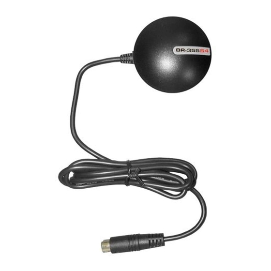
- Page 1 GPS Mouse User’s Guide V1.0 (WIN) USB GPS Receiver : BU-353S4(SiRF IV) RS-232 GPS Receiver: BR-355S4(SiRF IV)
- Page 2 DOCUMENT REVISIONS REV NO. DATE DESCRIPTION APPROVED V1.0 2011/9/13 Initial document © 2011 Globalsat Technology Corporation/USGlobalsat, Inc. All rights reserved. The Globalsat logo is a trademark of Globalsat Corporation. Windows is a register trademark of Microsoft Corporation. Acrobat is a registered trademark of Adobe Systems Incorporated.
-
Page 3: Table Of Contents
8. CONTACT INFORMATION ..................9 9. SAFETY AND LEGAL NOTICES ................10 10. LIMITED WARRANTY ....................11 11. BU-353S4 SPECIFICATIONS .................. 12 12. BR-355S4 SPECIFICATIONS .................. 13 13. BU-353S4 / BR-355S4 Product Pin Description ............14... -
Page 4: Package Contents
PACKAGE CONTENTS - USB GPS Receiver - Driver CD-ROM with User’s Guide and test utility for WIN and Mac O/S* • WIN Users please refer to the root directory on the included CD-ROM for installation instructions and drivers. NOTE: Your can also download WIN driver and Installation Guides at: www.usglobalsat.com/ SYSTEM REQUIREMENTS The Globalsat USB GPS receivers requires a Windows, or Macintosh laptop computer, with a CD-... -
Page 5: Installing The Usb Driver To Your Laptop
2. INSTALLING THE USB DRIVER TO YOUR LAPTOP 1. Place the product CD-ROM into your CD-ROM drive. 2. Auto-run should detect the CD bring up the following screen below. 3. Click on the button titled “WINDOWS USB Driver” from the main screen as shown above. 4. -
Page 6: Initializing Your Gps Receiver
2. Your USB GPS MUST be plugged into your USB port at this time. 3. Using Window’s Control Panel, select System > Hardware > Device Manager 4. Then look under the heading of: PORTS (Com & LPT) 5. There should be a listing for: Prolific Serial-to-USB Comm Port (COM x) (“x”... - Page 7 LED Status indicator on the USB GPS” LED OFF: GPS receiver is off (no power). LED ON (solid): No fix, searching for GPS signals. LED FLASHING: Position fix established and GPS signals are being received. Always select an area in the vehicle where the GPS unit will be secure and not obstruct normal driving, visibility and safety, but still maintaining a “view to the sky”...
-
Page 8: Un-Install The Usb Driver
NOTE: Configuration (or selection) of an assigned COM port for the GPS device from within your mapping or charting software must be completed whenever using a software for the first time. 6. UN-INSTALL THE USB DRIVER Run the file the PL-2303 Driver Installer.exe to uninstall the USB GPS driver. -
Page 9: Contact Information
resellers, these units are WAAS/EGNOS enabled unless otherwise stated. Accuracy can be up to 5 meters 3D RMS with WAAS enabled and 10-15 meters 2D RMS WAAS disabled What is ideal GPS environment? The GPS requires an open, clear view of the sky. Buildings, covered parking areas, tunnels and dense foliage can cause the GPS receiver to be unable to get a location fix. -
Page 10: Safety And Legal Notices
9. SAFETY AND LEGAL NOTICES Please read this section carefully before using the GPS receiver Globalsat Technology Corporation / USGlobalsat, Inc. will not accept any responsibility whatsoever for accidents resulting from failure to observe common sense precautions. Your personal judgment, traffic regulations, and common sense must always take precedence over any directions produced by GPS receiver or the mapping software WARNING: Make sure that the GPS receiver is secure and does not interfere with driving visibility and safety. -
Page 11: Limited Warranty
10. LIMITED WARRANTY Globalsat/USGlobalsat warrants product hardware against manufacturing defects in material and workmanship under normal use for a period of one (1) year from the original date of purchase (unless the product states otherwise), and only when purchased from a recognized “authorized dealer”. Products purchased from any unauthorized source, such as unauthorized e-Bay resellers, will not qualify for free warranty service/support and may require the end-user to pre-pay fees associated with, but not limited to the support, repair, replacement and shipping of the product to and from the service center. -
Page 12: Bu-353S4 Specifications
11. BU-353S4 SPECIFICATIONS Electrical Characteristics (Receiver) GPS Chipset SiRF STAR IV GSD4e Frequency L1, 1575.42 MHZ C/A Code 1.023 MHz chip rate Channels Sensitivity -163dBm Accuracy Position Horizontal <2.5m 2D RMS SBAS Enable Velocity 0.1m/sec 95% (SA off), Time 1 micro-second synchronized to GPS time WAAS Enabled for North America product s (USGlobalSat, Inc) Datum... -
Page 13: Br-355S4 Specifications
12. BR-355S4 SPECIFICATIONS Electrical Characteristics (Receiver) GPS Chipset SiRF STAR IV GSD4e Frequency L1, 1575.42 MHZ C/A Code 1.023 MHz chip rate Channels Sensitivity -163dBm Accuracy Position Horizontal <2.5m 2D RMS SBAS Enable Velocity 0.1m/sec 95% (SA off), Time 1 micro-second synchronized to GPS time... -
Page 14: Bu-353S4 / Br-355S4 Product Pin Description
13. BU-353S4 / BR-355S4 Product Pin Description BU-355S4 PIN Number(s) Name Type Description Main power supply to the BU-5353. USB IF to transmits channel for outputting USB IF navigation and measurement data to user’s navigation software or user written software. - Page 15 BR-355S4 PIN Number(s) Name Type Description Ground. Main power supply to the BR-355. Reverse PIN This is the main receive channel for receiving software commands to the engine board from SiRFdemo software or from user written software. This is the main transmits channel for outputting navigation and measurement data to user’s...
Need help?
Do you have a question about the BR-355S4 and is the answer not in the manual?
Questions and answers