Table of Contents
Advertisement
Quick Links
Advertisement
Table of Contents
Troubleshooting

Related Manuals for Garmin rino130


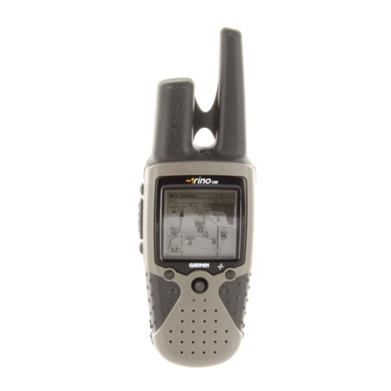
Summary of Contents for Garmin rino130
- Page 1 ® 2-way radio & personal navigator owner’s manual...
- Page 2 Information in this document is subject to change without notice. Garmin reserves the right to change or improve its products and to make changes in the content without obligation to notify any person or organization of such changes or improvements.
- Page 3 NTRODUCTION Thank you for choosing the Garmin Integrated with Navigation for the Outdoors). To get the most from your new Rino 130, read through the Quick Start Guide first, then this Owner’s Manual to understand all of the operating features.
-
Page 4: Table Of Contents
Introduction ...i Getting to Know Your Rino 130 ...1 Front of the Rino 130 ... 2 Back of the Rino 130 ... 3 Main Display Pages ... 4 Operating the Rino 130 ... 5 Status Bar Overview ... 6 Unit Operation ...7 Radio Page ... - Page 5 Programming Data Fields ... 41 Trip Computer Page ... 42 Trip Computer Page Options ... 42 Main Menu Page ... 43 Using the Main Menu ... 43 Main Menu Options ... 45 Shortcuts Menu ... 46 Waypoints ...47 Mark Waypoint Page ... 47 Creating Waypoints ...
- Page 6 Interface Information ... 112 FCC Compliance Information ... 113 FCC Licensing Information ... 114 Limited Warranty ... 115 Software License Agreement ... 117 Product Registration ... 117 Contact Garmin ... 117 Warnings and Cautions ... 118 Index ...121 Rino 130 Owner’s Manual ®...
-
Page 7: Getting To Know Your Rino 130
We currently offer several mapping options that are compatible with the Rino 130 including our MetroGuide, Topo, Fishing Hot Spots, and BlueChart data. Check your local dealer or the Garmin Web site (www.garmin.com) for a complete listing of MapSource products. -
Page 8: Front Of The Rino 130
Front of the Rino 130 Power button: • Press and hold to turn the unit On/Off • Press to adjust contrast and backlighting Call button: • Press to send out Call Tone • Sends position when released (if enabled) Talk button: •... -
Page 9: Back Of The Rino 130
Back of the Rino 130 2-way FRS/GMRS Antenna Belt Clip Connector Mount Headset Connector with Weather cap Mount Alignment Notches Rino 130 Owner’s Manual ® GPS Antenna External Power And Data Connector with Weather cap Battery Compartment D-Ring Battery Compartment Cover... -
Page 10: Main Display Pages
> ETTING TARTED ISPLAY AGES Main Display Pages All of the information you need to operate the Rino 130 can be found on six default main pages (or display screens). Simply press and release the Page button to cycle through the Radio Page, Map Page, Navigation Page, Altimeter Page, Trip Computer, and Main Menu Page. -
Page 11: Operating The Rino 130
Operating the Rino 130 For best results, you should initialize the GPS receiver in your Rino 130 unit before you use it the first time. See page 7 for instructions on initializing the unit. For most accurate results, the compass and altimeter should also be calibrated. -
Page 12: Status Bar Overview
Status Bar Overview The Status Bar at the top of the screen displays on all the available Main Pages. As you move around any of the Main Pages, the current page’s title briefly displays (3 seconds) and then is replaced by the Status Bar. The current settings and operational icons on the Status Bar are displayed as you operate the unit. -
Page 13: Unit Operation
The Radio Page is the first of the default Main Pages. This page provides the user interface for FRS (Family Radio Service) and GMRS (General Mobile Radio Service) radio operations. Garmin Rino units work with 3rd party FRS/GMRS radios, provided the other radios use standard FRS/GMRS frequencies. To take full advantage of the Rino features, communicate with other Rino users. -
Page 14: Using My Id And Symbol Fields
To initialize the unit: 1. Take the Rino 130 outside where it has an unobstructed view of the sky and turn it on. 2. The unit begins to search for satellite signals. “Tracking Satellites” is displayed while the unit is initializing. - Page 15 Entering a name with the on-screen keyboard 4. When you have entered your new ID, use the Thumb Stick to highlight OK and then press the Thumb Stick In. To change the user symbol: 1. Using the Thumb Stick, highlight the face symbol to the right of the My ID field.
-
Page 16: Setting The Channel And Squelch Code
To communicate with other Rino and FRS/GMRS users, you must be on the same channel and squelch code. Garmin Rino units work with 3rd party FRS/GMRS radios, provided the other radios use standard FRS/ GMRS frequencies. A chart of Rino frequencies may be found in the “Appendix.”... - Page 17 Setting the squelch code to 0 (squelch code off) allows you to hear all activity on the selected channel, but you must be set to the same squelch code as the other person(s) to transmit back. See the “Appendix” for a table listing all of the 38 Squelch Codes and their frequencies.
-
Page 18: Scanning And Monitoring
Scanning and Monitoring The Scan option allows you to scan through the available channels for voice activity. As the unit scans and receives a signal (or if you transmit), it stops on that channel/squelch code for a few seconds, then continues scanning. - Page 19 The Code field is blank when the unit is scanning or monitoring channels. To setup a Scanlist: 1. Using the Thumb Stick, highlight the Option Menu on-screen button and press In. Highlight Setup Scanlist and press the Thumb Stick In. 2.
-
Page 20: Radio Page Option Menu
Radio Page Option Menu The Radio Page Option Menu allows you to customize aspects of your Rino 130, such as setting up the radio, programming call and ring tones, and setting up a scanlist. Setup Radio The Setup Radio option displays the Radio Setup Page. This page determines how the radio functions and enables you to adjust the radio operation to your needs. - Page 21 NOTE: When Scramble is set to On, in order for peer-to-peer and Send Location features to work, the receiving radio must have Scramble enabled also. GMRS Radio—(U.S. versions only) Use this option to turn On/Off GMRS channels 15–22. GMRS channels are enabled by default in Rino units sold in Canada.
-
Page 22: Setup Tones
Setup Tones Call Tone—When the Call button is pressed, an attention tone is transmitted. This option allows you to choose one of ten tones. Roger Tone—When the Talk button is released, a tone is sent to signify the end of the transmission. This option allows you to choose one of four tones, or set the tone to Off. -
Page 23: Use Weather Radio
Use Weather Radio The Weather Radio provides a constant update of the weather conditions, which is helpful while outdoors or planning a road trip. The Weather Alert further enhances the Weather Radio by automatically broadcasting any weather alerts if you are not actively transmitting or receiving on the radio. -
Page 24: Turn Radio/Gps On/Off
Informational Picture The Informational Picture on the bottom half of the Radio Page features Garmin’s Mr. Mark Waypoint showing current GPS and radio status, and radio actions. As you operate the unit, the graphics change depending on what actions you are taking and the unit settings. -
Page 25: Mark Waypoint's Indicators
Mark Waypoint’s Indicators The Mark Waypoint figure displays several different icons, depending on what you are doing. See the following illustrations for more information. GPS and FRS/GMRS Radio On; Ready to transmit Position GPS and Weather Radio On (FRS/GMRS Radio Off) GPS and FRS/GMRS Radio On;... -
Page 26: Using The Rino 130 Radio Features
Using the Rino 130 Radio Features Your Rino 130 unit provides many features to enhance your radio experience, such as transmitting your location or any location and receiving contact information. This section reviews some of the advanced radio features. Refer to the “Features” section for information on all of the features of the Rino 130. - Page 27 The Rino 130 can manage up to 50 contacts at any time. Each time that you receive a signal from a contact, your map is updated showing their new position. A Track Log of their movement is created and shown on your map (see the “Track Logs”...
- Page 28 To review a contact and contact details: 1. From the Map Page, highlight the desired contact on the Contact Bar and press the Thumb Stick In. As you highlight the contacts on the Contact Bar, the Map page centers the map on that contact and display its name, direction and distance near the top of the screen.
-
Page 29: Sending A Location
Sending a Location Another feature is the ability to send a specific location to other Rino users. This comes in handy when you are trying to round-up the group or you just want to meet at a specific location. You may send any point found from the Find ‘N Go menu. -
Page 30: Map Page
The map can display a higher level of detail than the basemap provided with the unit (i.e. residential streets, parks, etc.), if Garmin MapSource data has been downloaded to the unit using a CD-ROM mapping program. When using MapSource data, the word “mapsource”... - Page 31 To view a Contact from the Map Page: 1. Highlight the Contact icon using the Thumb Stick. As you highlight the contacts on the Contact Bar, the Map page centers the map on that contact and displays its name, direction, and distance near the top of the screen.
-
Page 32: Map Page Options
Map Page Options Map Page options allow a variety of operating and custom features for your Rino 130. The Map Page options are: Highlight an option then press the Thumb Stick In to select. Map Page Option Menu Pan Map—Allows you to move the Panning Arrow (Map Pointer) about on the map. -
Page 33: Using The Pan Map Option
Using the Pan Map Option The Map Page pan function allows you to display an arrow used to point at and identify items on the map, and to move the map in order to view areas beyond the current viewing area on the display. The map panning function is activated from the Option Menu on the Map Page. -
Page 34: Programming The Data Fields
Programming the Data Fields Select Show... Data Fields to view four optional Data Fields on the right side of the screen that can be programmed to provide a variety of travel and navigation information. A list of the choices is shown to the right. Not all data types are available on every page. -
Page 35: Setting Up The Map
Setting up the Map The Setup Map option displays the five Map Setup Pages, each accessed by an on-screen button. Sub-Page Buttons Setup Items General Setup Lines Setup Points Setup Text Setup Map Data Setup Options To use Map Setup options: 1. -
Page 36: Map Features Setup
General Setup Orientation—Track Up or North Up; fixes the top of the map display to the current track heading or to a north heading. Auto Zoom—On or Off; automatically scales the map to display both your current location and the next point to which you are navigating. -
Page 37: Text Setup
Text Setup Points of Interest, Waypoints, Street Label, and Land Cover—None, Small, Medium, or Large; control the screen size of the name. Map Data Setup Show—Check box; check mark determines if map data is used or not. Option Menu allows you to choose to show all, show none, or show specific MapSource Data. -
Page 38: Navigation Page
Navigation Page The Navigation Page provides active guidance with a rotating compass ring that shows your course (track) while you are moving and a bearing pointer to indicate the current direction to your destination (bearing) relative to the course. The Data Field at the top of the page, by default shows you the name of your destination. - Page 39 While you are navigating a route, the pointer indicates the direction (a bent arrow) of the turn to the next point in the route as well as the direction to the current point when you get within 15 seconds Estimated Time of Arrival of the current point.
-
Page 40: Navigation Page Options
Navigation Page Options Sight ‘N Go—Use the Sight ‘N Go feature to locate a landmark visually and then lock in a magnetic heading to it. Stop Navigation—Cancels navigation (“Grayed out” or disabled unless you are navigating on a Goto, Track, or Route.) Bearing Pointer/Course Pointer—Toggles between Bearing (always directed at destination) and Course... -
Page 41: Using Sight 'N Go
Using Sight ‘N Go To use Sight ‘N Go to navigate: 1. Use the Page button to access the Navigation Page and then use the Thumb Stick to access the Option Menu 2. Use the Thumb Stick to highlight Sight ‘N Go and press In. - Page 42 To calibrate the Electronic Compass: 1. Use the Page button to access the Navigation Page. 2. Use the Thumb Stick to highlight the Option Menu on-screen button 3. Highlight the Calibrate Compass option and press the Thumb Stick In. 4. Press the Thumb Stick to activate the Start button and then follow on-screen directions for holding and turning the unit.
-
Page 43: Altimeter Page
Altimeter Page The Altimeter Page provides the current elevation, rate of ascent/descent, a profile of elevation changes over distance or time, or a profile of pressure changes over time. The Altimeter Page’s Option Menu to select from a variety of display options such as plotting over time, plotting over distance, displaying the zoom ranges of measurement, viewing elevation or pressure points, and resetting data displays. -
Page 44: Altimeter Page Options
Altimeter Page Options The Altimeter Page Option Menu the type of information and how it is to be displayed. Altimeter Page Options include: Plot Over Time/Distance—Plots the changes in elevation or pressure over a length of time or over a distance. -
Page 45: Viewing Pressure/Elevation Plots
Viewing Pressure/Elevation Plots When selecting the View Elevation Plot option, you can plot a profile of elevation changes that occur as you navigate over a set distance or period of time. When you select View Pressure Plot, you can view a record of changes in barometric pressure for a set period of time. -
Page 46: Viewing Points
Viewing Points The View Points option allows you to scroll through the stored elevation profile and to view a single point along the profile. When the pointer is stopped at a location along the profile, the display shows the elevation, time of day and date the point was created. -
Page 47: Calibrating The Altimeter
Calibrating the Altimeter You must calibrate the altimeter to ensure that the altimeter displays the most accurate elevation data. To calibrate the altimeter, you must know the elevation or barometric pressure at your current location. You can get elevation information from a map or other reliable source. You can learn the current barometric pressure (pressure calibrated to sea level) by listening to NOAA weather forecasts or a reliable local weather forecast on your... -
Page 48: Trip Computer Page
Trip Computer Page The Trip Computer Page by default displays up to seven different types of navigation data. Choosing Big Numbers will display 2 large data fields. Trip Computer Page, Trip Computer Page, Small Numbers Big Numbers Each data field is selectable and can contain one of many data information options. -
Page 49: Main Menu Page
Main Menu Page The Main Menu provides access to additional Rino 130 feature pages. The pages listed below provide enhancements to Rino 130 operation. Press the Page button repeatedly to cycle to the Main Menu or select it from the Main Page Menu at the top of each main page. Main Menu Page Using the Main Menu The Main Menu allows access to many features and... - Page 50 Setup Page—Allows tailoring of items such as time format, units of measure, display backlighting timeout and contrast adjustment, heading selection, interface setups, and system software information. Calendar Page—Provides you with a monthly calendar with programmable reference notes. Alarm Clock—Provides a 24-hour alarm clock. Calculator—Provides a calculator feature available in two forms: Standard or Scientific.
-
Page 51: Main Menu Options
Main Menu Options Through the Main Menu you can establish the sequence of pages. Page Sequence Setup You may add, remove, or reorder any of the Main Pages, plus additional pages. The default Main pages are Radio, Map, Navigation, Altimeter, Trip Computer, and Main Menu. -
Page 52: Shortcuts Menu
Shortcuts Menu The Shortcuts Menu is accessed by pressing the Thumb Stick In until the menu pops up on the middle of the display. The Shortcuts Menu can be accessed from most pages. Shortcuts Menu Mark Waypoint—Marks your current location as a waypoint. -
Page 53: Waypoints
Waypoints There are numerous ways to create, edit, and use waypoints. Using the Mark Waypoint Page and the Find ‘N Go Menu are two common pages for creating and editing waypoint. You can also create a waypoint using the Map Page. The Rino 130 holds up to 500 waypoints. Mark Waypoint Page The Mark Waypoint Page allows you to mark and record your current location as a waypoint and appears with... -
Page 54: Creating Waypoints
Creating Waypoints To create a waypoint for a map feature: 1. With the Pan Map feature active, move the panning arrow (map pointer) to the map item you want and highlight it. 2. Press In and release the Thumb Stick to display the item information page. -
Page 55: Projecting A Waypoint
Projecting a Waypoint Projecting a waypoint from any map item (another waypoint, etc.) allows you to establish a new waypoint on a bearing and distance projected from that map item. To project a waypoint: 1. Select a map item from the Find ‘N Go Menu. 2. - Page 56 To delete a waypoint or contact: 1. Use the Find ‘N Go feature to display the point. 2. Highlight the Delete button and then press the Thumb Stick In. Confirm the deletion. Deleting a waypoint To move a waypoint by dragging it: 1.
-
Page 57: Find 'N Go
Find ‘N Go The Find ‘N Go Menu allows you to find stored locations (waypoints) and map items (cities, exits, etc.). They can be found by name or by those nearest to your current location. If you are using certain MapSource data, the list of find locations is expanded to include categories for Points of Interest, Street Addresses, and Intersections. -
Page 58: Finding A Waypoint
Finding a Waypoint Waypoints that you have created and stored in the Rino 130 can be found by selecting the Waypoint option from the Find ‘N Go Menu. You can find a waypoint from the list of waypoints using the By Name or Nearest options as explained on the previous page. - Page 59 To find a waypoint by name: 1. Use the Thumb Stick to select Waypoint from the Find ‘N Go Menu. Press the Thumb Stick In to select By Name from the pop-up menu. Press the Thumb Stick In to display the Waypoints List. Find ‘N Go Menu 2.
-
Page 60: Finding A Contact
Finding a Contact Contacts that you have received in the Rino 130 can be found by selecting the ‘Contacts’ option from the Find ‘N Go Menu. Contact List To find a contact: 1. From the Find ‘N Go Menu, highlight Contacts and press the Thumb Stick In. -
Page 61: Finding A City
Finding a City Cities can be found by selecting the Cities option of the Find ‘N Go Menu, selecting the city from the list of Nearest or By Name, and then displaying the City Information Page. The City Information for the selected city displays, including the city name, the size by population, and distance from your location. -
Page 62: Finding An Exit
Finding an Exit You can use the Find Exit option to locate a nearby exit on an interstate highway. Exits are listed only by Nearest. Exit information pages provide a variety of information about services near each exit, such as rest stops, lodging, restaurants, and service stations. -
Page 63: Finding A Point Of Interest
Finding a Point of Interest You can use the Find Points of Interest option to locate a nearby restaurant, lodging, landmark, public building, park, etc. However, you must have transferred a MapSource MetroGuide map to the unit map database. Otherwise, this option, plus Address and Intersection options, are grayed out and are not functional. - Page 64 To find a point of interest: 1. Use the Thumb Stick to highlight Points of Interest and then press it In to display the Points of Interest Categories List. 2. Use the Thumb Stick to select the desired category and then press it In to display the Types List.
-
Page 65: Finding An Address Or Intersection
Finding an Address or Intersection You can enter a street number, choose a street name from a list and find an address within the area of map data coverage or enter two street names and locate the intersection. To use these options, however, you must be using a MapSource product that provides this type of map data. - Page 66 To locate an intersection: 1. Display the Find ‘N Go Menu and use the Thumb Stick to highlight the Intersection category and press it In to display the Find Intersection page. 2. Highlight the first Street field and then press the Thumb Stick In to display the Street list.
-
Page 67: Finding A Last Found Place
Finding a Last Found Place You can use the Recently Found Places option to locate Points of Interest, Cities, Waypoints or Contacts and Intersections and other locations you have recently retrieved. The process for finding recent points from the Find ‘N Go list is the same as finding a regular waypoint. To find a Last Found Place: 1. -
Page 68: Weather Radio
Weather Radio The Weather Radio can be turned on and off through the Shortcuts Menu or the Option Menu in the Radio Page. You may also enable Weather Alerts from the Radio Page. Refer to the “Radio Page” section for complete information about the Weather Radio and Weather Alert. -
Page 69: Sending A Note
Sending a Note You may send a note to other Rino 130 users. When you send a note, it appears along the bottom of the display on every Rino 130 user who is using the same Channel and Squelch Code that you are using. The Send Note feature is great when you are trying to get the group to meet at a certain location or tell everyone in the group something in a silent manner. -
Page 70: Using A Goto
Using a Goto The Goto function allows you to create a direct route to a destination, (waypoint, city, or point of interest). Once you have accessed the Information Page for an item, use the Goto button at the bottom of the page to initiate travel, using the Map and Navigation Pages for guidance. -
Page 71: Routes Page
Routes Page Route navigation allows you to create a sequence of intermediate waypoints that leads you to your final destination. The Rino 130 stores 20 routes, each with up to 50 waypoints. A route can be created and modified from the Route Page, and waypoints can be added to a route from the Find ‘N Go Menu. -
Page 72: Editing A Route
To add a Find ‘N Go Menu item to a route: 1. Select an item from the Find ‘N Go Menu and display its Information Page. If a contact is used in a route, the route changes as the contact’s position is updated, or it may be saved as a Waypoint to serve as a stationary point. - Page 73 To copy the route: 1. From the Route Page, select the on-screen page Option Menu button and press the Thumb Stick In to access the Option Menu. 2. Highlight the Copy Route option and then press the Thumb Stick In to copy. The copied route displays on the Routes Page and is named the same but followed by the numeral 1 (one).
- Page 74 3. With the new point highlighted, press the Thumb Stick In to display the Information Page for the new point and then select the on-screen OK button to add it the route. Route point review options To remove a point from the route list: 1.
-
Page 75: Adding Or Editing From The Route Map Page
Adding or Editing from the Route Map Page You can use the panning arrow with the Route Map Page displayed to add or edit route waypoints. To add a point at either end of a route: 1. Select the Route from the Routes List. Press the Thumb Stick In to display the Route Page. -
Page 76: Navigating A Route
To review or remove a route point: 1. Select the Route from the Routes List. Press the Thumb Stick In to display the Route Page. 2. Use the Thumb Stick to highlight the desired route and press In to display the Route Page. 3. -
Page 77: Stopping Navigation
Stopping Navigation To stop navigation, highlight the Stop Navigation option on either the Navigation or Map page’s Option Menu or select the Stop button on the Route Page. Data Fields for the Route Page When navigating a Route, the data displayed in the data fields on the Route Page may be customized to provide useful navigation information. -
Page 78: Tracks Page
Tracks Page The Rino 130 draws an electronic bread crumb trail on the Map Page as you travel along. This bread crumb trail is the Track Log. The Track Log contains information about points along its path, including time, and position. The Rino 130 uses this information to allow you to navigate using the saved track. -
Page 79: Using The Tracback Feature
Using the TracBack Feature The TracBack feature allows you to return along a traveled path (or another Rino user’s path) without marking any waypoints. When you are ready to return to where you started, the Rino 130 takes you back by following the Track Log that you left behind. -
Page 80: Setting Up The Track Log
To use the TracBack feature: 1. Highlight the Tracback button on the Tracks page and press the Thumb Stick In. The Tracback Menu options (To Beginning and To End) are displayed. 2. Highlight the desired option and press the Thumb Stick In to enable. -
Page 81: Proximity Page
Proximity Page The Proximity Page lets you define an alarm circle around a stored waypoint/contact position, and can be used to help you avoid dangerous areas or to alert you when you have strayed too far away from other Rino users. Up to ten waypoints may be listed, with a maximum alarm radius of 99.99 nautical or statute miles or kilometers. -
Page 82: Satellite Page
Satellite Page The Satellite Page provides a picture of satellite signal tracking, tells you when the unit is ready for navigation, and shows your location coordinates. To access the Satellite Page: 1. Press the Page button or the Menu icon open the Main Menu. -
Page 83: Waas
WAAS The Wide Area Augmentation System (WAAS) capability produces a more accurate position fix. When enabled (GPS set to Normal and WAAS set to Enabled through the System Setup Page, also the interface must be set to something other than RTCM mode), this feature searches for WAAS satellites near your location and then receives data for correcting differentials in the GPS satellite signals. -
Page 84: Satellite Page Options
New Location—Select this option if you have moved more than 600 hundred miles (from where you last used the unit). Restart Search—Select this option if today is not (date provided). Continue Acquiring—Select this option if no other option applies. The unit will attempt to gather GPS signals. - Page 85 o select the Use With GPS Off option: 1. Use the Thumb Stick to highlight the Option Menu button at the top of the page and then press it In. 2. Use the Thumb Stick to highlight the Use With GPS Off option and then press it In.
-
Page 86: Setup Pages
Setup Pages The Setup Pages allow you to customize the Rino 130 to your personal preferences. You can choose time settings, units of measure, display backlighting and contrast settings, heading measurement, interface options and system operating mode. By highlighting the icons on the Setup Menu and then pressing the Thumb Stick In, you can display the Setup Page for each of the menu items. -
Page 87: Units Setup Page
Time Zone—Can be set to one of the eight US Time Zones, or 24 International Time Zones (nearest city or geographical region). Select Other so you can enter the UTC Time Offset. Daylight Savings Time—Can be turned On or Off or set to Automatic. -
Page 88: Loran Td Format
fields, highlight the field, press the Thumb Stick In. When done, highlight Save and press In. For more information on Loran TDs, you may download Garmin’s Loran TD Position Format Handbook from the Garmin web site at http://www.garmin.com/support/ userManual.jsp. -
Page 89: Display Setup Page
Map Datum—Offers a selection of nearly all map datums in common use. Every map is based on a map datum (a reference model of the earth’s shape) and is usually listed in the title block of the map. If you are comparing GPS coordinates to a paper map, chart, or other reference, the map datum in this field must match the horizontal map datum used to generate the map or... -
Page 90: To Adjust The Contrast
Contrast Adjustment—Can be adjusted from light to dark using the slider adjacent to the contrast bar. To access the Display Setup page: 1. Press the Page button or the Menu icon open the Main Menu. 2. In the Main Menu, scroll down and select Setup. 3. -
Page 91: Interface Setup Page
Display—Allows you to choose from Cardinal Letters, Degrees or Mils. North Reference—You can choose from True, Magnetic, Grid or User options. If ‘User’ is chosen, you must correct for the Magnetic Variation. The Electronic or GPS compass uses the North Reference setting to create a bearing. - Page 92 RTCM SC-104 format and simple ASCII text output of location and velocity information. None—Provides no interfacing capabilities. If Garmin DGPS or RTCM In/NMEA Out format is selected, additional fields are provided to control a Garmin differential beacon receiver (e.g. GBR 23) directly from your unit.
-
Page 93: System Setup Page
Unit I.D. Number. Software updates and instructions for downloading are available from the Garmin Web site (www.garmin.com). Rino 130 Owner’s Manual ® Choose one of the four GPS options other than Normal to significantly save battery power. -
Page 94: Calendar
Calendar This feature provides you with a monthly calendar with programmable reference notes. You can display one monthly calendar at a time and add reference notes using the data entry keypad. Days that are shaded have notes added. You can create reference notes for multiple months and for months in years yet to come. - Page 95 To edit or delete a note: 1. To edit or delete a note previously created, highlight the date and press the Thumb Stick In. 2. Select Edit Note, or Delete Note, from the pop-up menu. To complete the deletion of the note, press the Thumb Stick In when Yes is highlighted in the pop-up window.
-
Page 96: Alarm Clock
Alarm Clock This feature provides an alarm for the system clock. Enter a time in the time field and turn the alarm on and off from the control field menu. Remember to enter alarm times in the same time format (UTC or local) you are using for your system. -
Page 97: Calculator
Calculator This feature provides you with all the basic functions of both of standard or scientific calculator. You can perform most calculations identified by the function symbols along the sides of the keypad and can save the results temporarily in the memory. The memory is cleared either manually or when you turn off the Rino 130. -
Page 98: Stopwatch
Stopwatch This feature allows you to use the unit as a stopwatch, including using it as a lap timer. You may also have the unit record the lap time based on distance. For example, if you set the lap distance to one mile, the unit records the time it takes you to travel one mile. -
Page 99: Sun & Moon
Sun & Moon This feature provides you with a graphic display of both sun and moon positioning for a certain date, time and location with times for sunrise, sunset, moonrise, and moonset. To access the Sun & Moon Page: 1. Press the Page button or the Menu icon open the Main Menu. -
Page 100: Hunt & Fish
Hunt & Fish This feature provides you with a listing of best times for hunting and fishing for a chosen location and date. To access the Hunt & Fish Page: 1. Press the Page button or the Menu icon open the Main Menu. 2. -
Page 101: Area Calculator
Area Calculator This feature provides you an area calculation as you move about a location or view a saved track. The area calculation displays in acres, hectares, and square feet, square yards, square meters, square kilometers, and square miles. To access the Area Calculator: 1. -
Page 102: Games
Games The Games Page includes Memory Race, Waypoint Bomber, Clothesline, Assimilation and Beast Hunt. Highlight the appropriate icon and then press the Thumb Stick In to play the desired game. Brief instructions are displayed when you start each game. All players must be on the same channel/squelch code to play. -
Page 103: Waypoint Bomber
Waypoint Bomber In this game, it is good to stay on the move! Two or more players attempt to “bomb” each other. Move your cursor around on the map page using your Thumb Stick. When you think an opponent is close to your cursor, drop a bomb. -
Page 104: Clothesline
Clothesline Team members select the same user symbol and then attempt to “hit” or “clothesline” other players by pressing the Talk button when an opposing team member is between them. You may also mark a point and assign it a symbol to be used as a stationary team member. -
Page 105: Appendix
What is FRS? FRS, or Family Radio Service, is a UHF radio frequency band allocated by the FCC for general public use. The operating frequency ranges from 462.5625 to 467.7125 MHz, with a maximum transmitting power of one half watt. FRS radios are small and lightweight, making them ideally suited for outdoor activities. -
Page 106: Frs Limitations
Channel scan allows your FRS radio to scan all FRS frequencies for signals. After scanning briefly to see what channels other users are on, simply set your FRS radios to an unused channel and enjoy less interference. For greater privacy, some FRS radios have a voice scramble feature. This feature causes your message to sound garbled to other FRS users that are not part of your group. -
Page 107: Specifications
Specifications Physical Case: Fully-gasketed, high-impact plastic alloy, waterproof to IPX7 standards (waterproof to one meter for 30 minutes) Size: 4.5” H x 2.3” W x 1.6” D; 7” H with antenna (11.4 x 5.8 x 4.1; 17.8 cm) Weight: Approx. 7.6 ounces (236 g) with batteries Temperature Range: -4°... -
Page 108: Radio
Alkaline batteries can rupture at high temperatures. External power can only be applied using the Garmin Auto Power Adapter or PC Interface Cable with Auto Power Adapter. These cables contain a 12 VDC to 4.5 VDC voltage regulator. -
Page 109: Accessories
Accessories To obtain accessories, see your local dealer or visit the Garmin web site at www.garmin.com. 12-Volt Adapter Cable—Provides unit power from an automobile cigarette lighter. 2.5 to 3.5 mm Jack Adapter—Allows you to use 3rd party headsets with your Rino unit. -
Page 110: Transferring Mapsource Data
6. U.S. Topo 7. Roads and Recreation 8. WorldMap Map data transfer requires the use of a PC, a Garmin MapSource CD-ROM, and the PC Interface Cable with RS-232 serial port connector supplied with this unit. Follow detailed instructions for data transfer in the MapSource User’s Manual. - Page 111 To setup for data transfer: 1. Remove the Power/Data Port cover on the back of the unit by lifting up on the protective cover on the back of the unit. 2. Connect the serial port connection on the cable to the PC serial port.
-
Page 112: Gps Troubleshooting Guide
GPS Troubleshooting Guide Symptom Unit does not turn on. Unit does not turn on, even with new batteries. The unit turns on, then turns off. It takes more than ten minutes to get a location fix Cannot access a WAAS system satellite after 2 to 5 minutes. -
Page 113: Radio Troubleshooting Guide
Radio Troubleshooting Guide Symbol Radio not transmitting Messages not being received by others. Limited talk range. You can hear others, but they cannot hear you, or you see an incoming transmission, but nothing is heard. Message garbled. Too many unwanted conversations being heard. Interference or static. -
Page 114: Frs Frequency Chart
FRS Frequency Chart Channel # Transmit Frequency (MHz) Receive Frequency (MHz) Channel Description 462.5625 462.5875 462.6125 462.6375 462.6625 462.6875 462.7125 467.5625 467.5875 467.6125 467.6375 467.6625 467.6875 467.7125 Weather Radio Frequency Chart Channel # Transmit Frequency (MHz) Receive Frequency (MHz) Channel Description WX 1 WX 2 WX 3... -
Page 115: Gmrs Frequency Chart
GMRS Frequency Chart Channel # Transmit Frequency (MHz) 462.5500 462.5750 462.6000 462.6250 462.6500 462.6750 462.7000 462.7250 467.5500 467.5750 467.6000 467.6250 467.6500 467.6750 467.7000 467.7250 Rino 130 Owner’s Manual ® Receive Frequency (MHz) Channel Description 462.5500 GMRS Primary 1 462.5750 GMRS Primary 2 462.6000 GMRS Primary 3 462.6250... -
Page 116: Data Field Definitions
Data Field Definitions The following data field options are available on the Map, Navigation, Altimeter, and Trip Computer Pages. Ambient Pressure—Actual pressure at unit location. (Altimeter Page Only.) Average Ascent—The average vertical distance of ascents. (Altimeter Page Only.) Average Descent—The average vertical distance of descents. (Altimeter Page Only.) Barometer—The pressure at your current location calibrated to sea level. - Page 117 Maximum Elevation—The highest elevation reached. (Altimeter Page Only.) Maximum Speed—The maximum speed the unit has moved. Minimum Elevation—The lowest elevation reached. (Altimeter Page Only.) Moving Avg. Speed—Average speed of the unit while moving. Odometer—A running tally of distance travelled, based upon the distance between second-by-second position readings.
-
Page 118: Interface Information
DGPS (Differential GPS) corrections are accepted in RTCM-SC-104 version 2.0 format through the ‘Data IN’ line. The Garmin GBR 21 and GBR 23 are the recommended beacon receivers for use with the Rino 130. Other beacon receivers with the correct RTCM format may be used, but may not correctly display status or allow tuning control from the GPS unit. -
Page 119: Fcc Compliance Information
• Consult the dealer or an experienced radio/TV technician for help. The Rino 130 does not contain any user-serviceable parts. Repairs should only be made by an authorized Garmin service center. Unauthorized repairs or modifications could result in permanent damage to the equipment and void your warranty and your authority to operate this device. -
Page 120: Fcc Licensing Information
FCC Licensing Information The Rino 130 two-way radio operates on General Mobile Radio Service (GMRS) frequencies regulated by the Federal Communications Commission (FCC) in the United States. Operation on the GMRS frequencies is subject to additional rules as specified in 47 CFR Part 95. -
Page 121: Limited Warranty
Limited Warranty This Garmin product is warranted to be free from defects in materials or workmanship for one year from the date of purchase. Within this period, Garmin will at its sole option repair or replace any components that fail in normal use. - Page 122 The Garmin Rino 130 has no user-serviceable parts. Should you ever encounter a problem with your unit, please take it to an authorized Garmin dealer for repairs. The Rino 130 is fastened shut with screws. Any attempt to open the case to change or modify the unit in any way will void your warranty and may result in permanent damage to the equipment.
-
Page 123: Software License Agreement
Contact Garmin If you should encounter any difficulty while using your Rino 130, or if you have any questions, in the U.S.A. contact Garmin Product Support by phone: 913/397.8200 or 800/800.1020, Monday–Friday, 8 AM–5 PM Central Time; or by e-mail at sales@garmin.com. -
Page 124: Warnings And Cautions
The system is subject to changes which could affect the accuracy and performance of all GPS equipment. Although the Garmin Rino 130 is a precision electronic NAVigation AID (NAVAID), any NAVAID can be misused or misinterpreted and, therefore, become unsafe. - Page 125 safety standards previously set by both U.S. and international standards bodies: American National Standards Institute (ANSI) IEEE. C95.1-1992; National Council on Radiation Protection and Measurements (NCRP) Report 86; International Commission on Non-Ionizing Radiation Protection (ICNIRP) 1996. Those standards were based on comprehensive and periodic evaluations of the relevant scientific literature.
- Page 126 Blasting Areas—To avoid interfering with blasting operations, turn your radio OFF when in a “blasting area” or in areas posted: “Turn off two-way radio.” Obey all signs and instructions. Potentially Explosive Atmospheres—Turn your radio OFF and do not remove your battery when you are in any area with a potentially explosive atmosphere.
-
Page 127: Index
Exit Intersection 59, 60 Point of Interest Find ‘N Go 50, 51, 64, 66 1, 7, 10, 99, 108 Games Garmin sentences General Mobile Radio Service 37, 38, 39 GMRS 1, 7, 10, 15, 99 37, 39 Goto 52, 53, 54, 55, 56,... - Page 128 Headset MapSource Hunt & Fish 52, 53, 55, 56, 58, 94 Setup Map Data Map Detail Informational Picture Map Page Initialize Options Interface formats Pan Map Intersection 59, 60 Restore Defaults Setup Map Map Pointer Keylock 5, 46 Mark Waypoint Measure Distance Message Tone Last Found Place...
- Page 129 5, 46 Page 34, 35 Points Setup Track Up 30, 78, 79 Transmit Location 10, 99 Trip Computer Page Two-way Radio 26, 34 52, 53, 55, 56, 58 Units Page 8, 9 Unlock Buttons Vibrate 2, 5 Voice Operated Transmis-...
- Page 132 For the latest free software updates (excluding map data) throughout the life of your Garmin products, visit the Garmin web site at www.garmin.com. © Copyright 2003–2006 Garmin Ltd. or its subsidiaries Garmin International, Inc. 1200 East 151 Street, Olathe, Kansas 66062, U.S.A.
Need help?
Do you have a question about the rino130 and is the answer not in the manual?
Questions and answers