Table of Contents
Advertisement
User Guide
SAFETY INSTRUCTIONS
needs safe navigation then must use an official chart that has been approved by
government agencies also operator is fully responsible for using this device.
Please read through this manual before the first operation. If you have any
questions, please contact the customer service or your local dealer or distributor
Extensive exposure to heat may result in damage to the chart plotter.
Connection to the power source with reversed polarity will damage the chart
plotter severely. This damage is not covered by the warranty.
Do not disassemble. The chart plotter contains dangerous high voltage circuits
which only experienced technicians must handle
Exposure of the display to UV rays may shorten the life of the liquid crystals used
in you plotter. This limitation is due to the current technology of the LCD display.
Avoid overheating which may cause loss of contrast and, in extreme case, a
darkening of the screen. Problems which occur from over heating are reversible
when temperature decreases.
Screen Cleaning Precautions
Cleaning your chart plotter screen is a very important operation and must be done
carefully. The following is the cleaning procedure.
You use a tissue or lens tissue and a cleaning spray containing Isopropanol (a
normal spray cleaner sold for PC screens. Fold the tissue or lens tissue into a
triangular shape, moisten the tip and use the index finger behind a corner to
move the tissue across the surface, in overlapping side to side strokes. If the
tissue is too wet, a noticeable wet film will be left in its path and you will need to
repeat the process. If too dry, the tissue won't glide easily, and may damage the
surface.
If you require technical advice or assistance, contact your nearest Samyung ENC
office or visit our website, www.samyungenc.com.
1
2
This device's electronic chat system(ECS) is developed for the
navigational aid only and chart itself does not obtain any approvals;
has not been certified from the government authorities. If operator
User Guide
Advertisement
Table of Contents

Related Manuals for Samyung NF500


Summarization of Contents
Safety Instructions
Screen Cleaning Precautions
Proper cleaning procedures for the chart plotter screen to prevent damage and ensure clarity.
Introduction
General Information
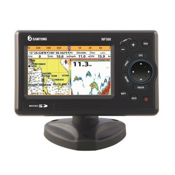
Overview of the GPS chart plotter, its capabilities, and required optional devices.
Specification
Detailed technical specifications of the chart plotter, including dimensions, power, and environmental ratings.
Packing and Accessories
Packing List
List of items included in the chart plotter package.
Optional Accessories
List of optional accessories available for the chart plotter.
Getting Started
Mounting the Unit
Instructions for mounting the chart plotter unit using bracket or flush mounting methods.
Key Functions
Explanation of the functions and operations of each button on the chart plotter.
Navionics MicroSD Card
Instructions for inserting and removing the NAVIONICS MicroSD card.
Chart Selection
Procedure for selecting between NAVIONICS and S-MAP charts.
Simulate Mode
How to use simulate mode for practicing chart plotter functions without GPS signal.
Data Bar
How to display and set up the data bar for navigation information.
Compass
How to turn the compass feature on or off and its display.
Multi Window Displays
How to display up to four windows simultaneously and manage their sizes.
Man Overboard (MOB)
Using the MOB feature to store a location and navigate back to it.
General Operation
Manual Power Control
Instructions for powering the unit on and off manually.
Display Settings
How to adjust brightness, night mode, and background color for optimal viewing.
Page Window Navigation
How to access and navigate through the different function pages.
Chart Operation
Overview of the chart window and its display elements.
Chart Window Basics
Understanding the elements displayed in a typical chart window.
Latitude and Longitude Display
How latitude and longitude coordinates are defined and displayed.
Chart Scale Adjustment
How to change the chart scale to view more or less detail.
Finding Chart Symbols
How to search for specific chart symbols like ports and services.
S-Map Search Function
Using S-MAP search to find ports and services.
Chart Symbols and Information
Displaying and accessing information about chart symbols.
Introduction to Navigation
Basic principles of navigating using the chart plotter.
Navigating to Waypoints/Points
Steps to navigate directly to a waypoint or a point on the chart.
Following a Route
How to create, start, and manage routes for navigation.
Goto Key Function
Using the Goto key to start navigation to a destination point.
Distance and Bearing Calculator
Calculating distances and bearings between points for navigation.
Projected Course
Displaying the projected course to avoid collisions with other vessels.
Finding Chart Symbols
Using the chart window to find specific chart symbols.
Sonar Functions
Interpreting Sonar Display
Understanding the elements and symbols displayed on the sonar screen.
Sonar Modes
Selecting between Auto and Manual modes for sonar operation.
Fish Finding Frequencies
Selecting dual or single frequencies for optimal fish finding.
Sonar Range Settings
Adjusting the sonar range for manual or automatic depth display.
Sonar Gain Control
Adjusting gain and threshold settings for optimal sonar signal reception.
Sonar Window Display Options
Choosing from five different sonar display window configurations.
No Split Display
Displaying sonar history at a given frequency without splitting the screen.
Split Zoom and Full Screen Zoom
Using split zoom to focus on specific areas and full screen zoom for detailed views.
Split Bottom Display
Displaying sonar history with a zoomed bottom trace focus.
Split 50/200 Display
Displaying 50 kHz and 200 kHz sonar frequencies side-by-side for comparison.
Split A-Scope Display
Displaying sonar history with echo strength for estimating fish and bottom nature.
Highway Display
Highway Window Overview
Understanding the 3D view of vessel travel and its displayed navigation elements.
Gauges Display
Selecting Gauge Layouts
Choosing from seven different gauge layouts for displaying vital information.
Waypoint Management
Creating New Waypoints
Methods for creating new waypoints from the chart or waypoint window.
Moving Waypoints
Instructions for moving existing waypoints on the chart or in the waypoint list.
Editing Waypoints
How to edit existing waypoint data, including name, icons, and position.
Deleting Waypoints
Procedures for deleting individual waypoints from the chart or waypoint list.
Finding Waypoints
Methods for searching and locating specific waypoints.
Sorting Waypoints
How to change the order of waypoints displayed in the list.
Deleting All Waypoints
How to clear all stored waypoints from the unit.
Route Management
Managing Routes from Chart
Creating, editing, and deleting routes directly from the chart window.
Managing Routes from Route Window
Creating, editing, and deleting routes using the dedicated route window.
Satellite Information
Satellite Information Display
Understanding the satellite window display and signal strength.
Tide Information
Displaying Tide Data
How to display tide information from the chart or tide window.
Choosing Tide Date
Selecting the date for which tide information is displayed.
AIS System
Viewing AIS Vessels
How to check other vessels equipped with AIS and view their information.
AIS Window Options
Displaying AIS vessels or messages in dedicated windows.
DSC Communications
Distress Calls
Handling DSC distress calls, including display and navigation to the source.
Poll Calls
Requesting and displaying vessel positions via DSC poll calls.
NAVTEX Service
NAVTEX Message Handling
Receiving, displaying, and deleting NAVTEX navigational and meteorological warnings.
Engine Faults
Engine Faults Display
Viewing real-time engine errors and malfunctions when connected.
Advanced Settings
System Configuration Settings
Accessing and configuring system settings like language and display options.
Language Settings
Changing the display language for menus and data screens.
Chart Selection
Selecting the preferred chart type (S-MAP or NAVIONICS).
Beep Volume
Adjusting the audible beep volume for alerts and confirmations.
Auto Power Function
Information regarding the auto power feature.
External Device Features
Setting up options for connected external devices.
Factory Reset
Restoring all unit settings to their default factory values.
About Information
Displaying software version, release date, and NAVIONICS version.
Chart Settings
Chart Rotation Options
Configuring chart display orientation: North up, Heading up, or Course up.
Chart Palette Options
Selecting color palettes (Normal, NOAA, Sunlight, Night) for display visibility.
General NAVIONICS Settings
Settings for NAVIONICS charts like plotter mode, boundaries, text size, and nav-aids.
General S-MAP Settings
Settings for S-MAP charts including lat/lon grid, depth digit, and buoy display.
Land & Sea NAVIONICS Settings
Configuring display of water features, object depths, and land features on NAVIONICS charts.
Land & Sea S-MAP Settings
Displaying sea color and land features on S-MAP charts.
Map Datum Selection
Choosing the map datum for chart compatibility and accuracy.
NMEA Datum Offset
Applying datum offset for NMEA data consistency with external devices.
Map Shift Function
Correcting position errors by applying a map shift to align with chart data.
Restore Chart Settings
Restoring all chart settings to their default values.
Sonar Settings
Sonar Frequency
Selecting sonar frequency (200 kHz, 50 kHz, or Mixed) for optimal detection.
Sonar Palette
Choosing display palettes (black, blue, white) for visibility in different lighting.
Sonar Scroll Speed
Setting the scroll speed for vertical scan lines on the sonar display.
Sonar Digit Size
Adjusting the size of depth information displayed in the sonar window.
Sonar Fish Symbol Settings
Enabling/disabling fish symbols, depth labels, and filtering fish size.
Sonar Advanced Settings
Configuring interference, noise, clutter filters, and pulse length/power.
Restore Sonar Settings
Restoring all sonar settings to their default values.
GPS Settings
GPS Signal Source
Selecting the GPS signal source (Internal, NMEA0183/2000).
DGPS Source
Selecting WAAS/EGNOS for utilizing DGPS for enhanced accuracy.
Static Navigation Mode
Using static navigation for slow boat movements to maintain accurate position.
Speed and Course Filters
Applying filters to stabilize boat speed and course information.
Lat/Lon Precision
Setting the precision of latitude/longitude sent to other marine electronics.
Ship Speed Setting
Selecting ship speed for more precise boat speed and course information.
Magnetic Variation
Compensating for the difference between true and magnetic north.
Track and Log Settings
Track Recording and Display
Setting up track recording, display options, and record color/thickness.
Trip Distance Reset
Resetting trip distance and total trip distance logs.
Memory Settings
Saving Data
Saving waypoints, routes, or tracks to the user card (MicroSD).
Loading Data
Loading data from the user card into the unit.
Deleting Data
Deleting saved data files (waypoints, routes, tracks) from the user card.
Formatting User Card
Erasing all data from the user card to prepare it for use.
Screen Snapshot
Taking and saving screenshots of the current display.
AIS Settings
AIS Display Filters
Filtering AIS vessels by type, distance, or speed, and showing only dangerous targets.
AIS Alarm Options
Configuring alarms for dangerous vessels, TCPA, CPA, and proximity.
AIS Display Options
Setting display options for projected course and range rings.
AIS Track Settings
Registering and customizing tracks for AIS-equipped vessels.
Restore AIS Defaults
Restoring all AIS settings to their default factory values.
AIS-50B Interfacing
Interfacing with AIS-50B for displaying AIS information without a PC.
Alarms
Fish Alarm
Triggering an alarm based on fish profile matching.
Deep Water Alarm
Alarm when depth value exceeds a set deep water limit.
Shallow Water Alarm
Alarm when depth value is less than a set shallow water limit.
Temperature Alarm
Alarm when reported temperature matches a set value.
Temperature Rate Alarm
Alarm when the rate of temperature change meets a set threshold.
Low Battery Alarm
Alarm triggered when battery voltage drops below a specified level.
Navigation Alarms
Alarms for arrival radius, anchor, XTE, and danger proximity.
AIS Alarm
Referencing AIS settings for relevant alarm configurations.
DGPS Alarm
Alarm triggered if DGPS signal is not received.
Restore Alarm Defaults
Restoring all alarm settings to their default values.
Other Settings
Simulate Mode Control
Turning simulate mode on/off, setting speed, course, and route.
Waypoint Display Options
Selecting how waypoints are displayed on the unit.
GPS Settings Reference
Reference to the main GPS settings section for configuration.
Unit Measurement Settings
Selecting preferred units for various measurements.
Communication Settings
Configuring NMEA communication with external marine electronics.
Calibration Settings
Calibrating speed and temperature sensors for accurate readings.
Time Settings
Adjusting time and date formats, including local offsets.
Restore Other Settings
Restoring all 'Other' settings to their default values.
Calendar Function
Providing access to a built-in calendar function.
Installation Guide
Options and Accessories
Overview of optional sensors, instruments, and accessories for installation.
Connections Overview
Diagram and explanation of power, NMEA, and sonar connections.
Power and Data Cable
Wiring instructions for the display unit's basic power connection.
GPS Antenna Installation
Selecting a GPS Antenna
Guidance on choosing between internal and external GPS antennas.
External Antenna Installation
Instructions for installing an external GPS antenna and its cable.
Antenna and NMEA Connection
Connecting the GPS antenna and setting DGPS options (None or WAAS/EGNOS).
NMEA 0183 Connectivity
NMEA 0183 Input/Output
Connecting to external devices like DSC VHF, GPS antennas, and AIS receivers.
DSC VHF Radio Connection
Fitting and setting up the optional DSC VHF radio for NMEA input.
Other NMEA Instruments
Connecting other NMEA instruments for data exchange and display.
Sonar Transducers
Transducer Installation
Instructions for fitting the sonar transducer and connecting it to the plotter.
Setup and Testing
Initial Setup and Testing
Finalizing setup, connecting components, and verifying GPS satellite acquisition.
System Maintenance
Maintenance Items and Contents
Regular checks for connectors, cables, earth terminals, and cleaning the LCD screen.
Troubleshooting and Diagnosis
Common Symptoms and Solutions
Identifying common equipment breakdowns and their corresponding solutions.
Warranty Information
Samyung ENC 1 Year Warranty
Details of the product warranty, covering defects in materials and workmanship.
Items Not Covered Under Warranty
List of items and conditions that are excluded from the warranty coverage.
Need help?
Do you have a question about the NF500 and is the answer not in the manual?
Questions and answers