Table of Contents
Advertisement
Quick Links
Advertisement
Table of Contents

Related Manuals for Garmin GPSMAP 585 Plus


Summary of Contents for Garmin GPSMAP 585 Plus
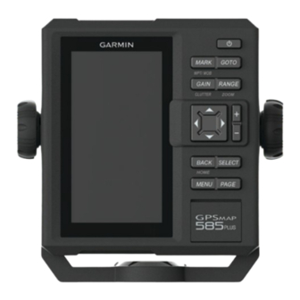
- Page 1 GPSMAP 585 Plus ® Owner’s Manual...
- Page 2 © 2017 Garmin Ltd. or its subsidiaries All rights reserved. Under the copyright laws, this manual may not be copied, in whole or in part, without the written consent of Garmin. Garmin reserves the right to change or improve its products and to make changes in the content of this manual without obligation to notify any person or organization of such changes or improvements.
-
Page 3: Table Of Contents
Changing the Color Mode ............2 Contours Feature ............12 Configuring the Display Colors ........... 2 Adding a Label to a Garmin Quickdraw Contours Map ... 12 Setting the Beeper ..............2 Garmin Quickdraw Community ........12 GPS Satellite Signal Acquisition ..........2 Garmin Quickdraw Contours Settings ...... - Page 4 Celestial Information ..............19 Viewing Information for a Different Tide Station ....... 19 Lunar Calendar ................. 19 Device Configuration ........... 19 GPSMAP 585 Plus Settings Menu Tree ........19 System Settings ................ 20 System Information .............. 20 My Vessel Settings ..............20 Setting the Keel Offset ............
-
Page 5: Introduction
You can use blank memory cards to record sonar data and transfer data such as waypoints, routes, and tracks to another compatible Garmin chartplotter or a computer. Open the access flap or door on the front of the chartplotter. -
Page 6: Software Update
• Select to zoom in. Setting the Beeper Panning on the GPSMAP 585 Plus You can set when the device makes sounds. Select Settings > System > Beeper. You can move the chart to view an area other than your present location. -
Page 7: Home Screen
Select Customize Home > Add > Add New Layout. Speed Data Graph Select the first and second screens to include in the layout. GPSMAP 585 Plus Navigation Chart Select an option: Available Shortcuts • To change the orientation of the windows, select Split. -
Page 8: Numbers
Data Fields Garmin ClearVü Sonar View Data fields display multiple types of information in one area, NOTE: To receive Garmin ClearVü scanning sonar, you need a such as depth, heading, and bearing. Some data fields require compatible transducer. you to be navigating or require a connection to sensors to Garmin ClearVü... -
Page 9: Split-Screen Frequency
Depth indicator as the sonar data screen scrolls from right to left Bottom echo Traditional transducers emit a conical beam. The Garmin ClearVü scanning sonar technology emits two narrow beams, similar to the shape of the beam in a copying machine. These beams provide a clearer, picture-like image of what is around the boat. -
Page 10: Reducing The Clutter
You can indicate which frequencies appear on the sonar screen. From a sonar view, select MENU > Frequency. Reducing the Clutter You can quickly change the settings to reduce noise and clutter Select a frequency suited to your needs and water depth. on the sonar screen. -
Page 11: Setting The Gain Manually
Setting the Gain Manually Select MENU. From a sonar screen, select GAIN. To adjust the Depth Line, select Setting the Scroll Speed You can set the rate at which the sonar image moves across the screen. A higher scroll speed shows more detail, especially while moving or trolling. -
Page 12: Turning On The A-Scope
Pic. Advance: Allows the sonar picture to advance faster by drawing more than one column of data on the screen for each column of sounder data received. This is especially helpful when you are using the sounder in deep water, because the sonar signal takes longer to travel to the water bottom and back to the transducer. -
Page 13: Depth And Water Temperature Graphs
Fish Eye 3D: Provides an underwater view that visually represents the sea floor according to the chart information. When a sonar transducer is connected, suspended targets (such as fish) are indicated by red, green, and yellow spheres. Red indicates the largest targets and green indicates the smallest. -
Page 14: Navigating To A Point On The Chart
• To view the distance and bearing of the object from your Quickdraw Contours: Turns on bottom contour drawing, and current location, select Measure Distance. allows you to create fishing map labels. • To view tide, current, celestial, chart notes, or local Chart Setup: Adjusts the appearance of the different charts and services information near the cursor, select Information. -
Page 15: Overlay Numbers
Select Overlay Numbers > Navigation Inset > Auto. The Garmin Quickdraw Contours mapping feature allows users Select Navigation Inset Setup. to generate maps. Garmin makes no representations about the Complete an action: accuracy, reliability, completeness or timeliness of the maps generated by third parties. -
Page 16: Mapping A Body Of Water Using The Garmin Quickdraw Contours Feature
Adding a Label to a Garmin Quickdraw Contours Map Remove the memory card from your computer. You can add labels to a Garmin Quickdraw Contours map to mark hazards or points of interest. Insert the memory card in the chartplotter. -
Page 17: Creating A Mark Or Waypoint On A Sonar Screen Using Your Present Location
hidden in the Waypoints and Marks list by default. When you Select Navigate To > Go To. transfer a mark to another device, the mark is converted to a waypoint. Measuring Distance on the Waypoint Map You can save a maximum of 12,000 waypoints and marks. You can measure the distance between two locations. -
Page 18: Creating And Navigating A Route Using The Waypoint Map
Creating and Navigating a Route Using the Browsing for and Navigating a Saved Route Waypoint Map Before you can browse a list of routes and navigate to one of them, you must create and save at least one route. The starting point can be your present location or another Select User Data >... -
Page 19: Deleting All Saved Waypoints, Routes, And Tracks
Viewing a List of AIS Threats Select User Data > Tracks > Active Track Options > Record Interval > Interval. From the AIS Radar screen, you can view and customize the Select an option: appearance of a list of AIS threats. •... -
Page 20: Vrm And Ebl
Highway Page For example, to be notified of a pending intersection 10 minutes before it will likely occur, set Time To to 10, and the The highway page provides steering guidance as you navigate alarm will sound 10 minutes before the vessel intersects the to your destination. - Page 21 Auto Guidance assess the placement of the Auto Guidance line using one or more familiar destinations that require navigation through a narrow waterway. CAUTION The Auto Guidance feature is based on electronic chart Dock your vessel or drop the anchor. information.
- Page 22 Individual Routine Calls DSC distress call. Select Navigation Info > Other Vessels > DSC List. When you connect the chartplotter to a Garmin VHF radio, you can use the chartplotter interface to set up an individual routine Select a position-report call.
- Page 23 Device Configuration On your Garmin VHF radio, select Call. Making an Individual Routine Call to an AIS Target GPSMAP 585 Plus Settings Menu Tree From a chart or 3D chart view, select an AIS target. • System Select AIS Vessel > Call With Radio.
- Page 24 ◦ AIS-SART Test Software Information: Provides information about the device • Units and the software version. ◦ System Units Garmin Devices: Provides information about connected Garmin devices. ◦ Variance Factory Settings: Restores the device to factory settings. ◦ North Reference NOTE: This deletes any setting information you have ◦...
- Page 25 If the message appears again, stop the boat, and ensure the speed-sensor wheel is not stuck. If the wheel turns freely, check the cable connections. If you continue to get the message, contact Garmin product support. Shallow Water: Sounds when the water depth is shallower than Alarms Settings the specified depth.
- Page 26 System: Enables NMEA 0183 output sentences for system capable transducer to use this alarm. information. Fish: Sets an alarm to sound when the device detects a Garmin: Enables NMEA 0183 output sentences for Garmin suspended target. proprietary sentences. • sets the alarm to sound when fish of all sizes are Posn Precision: Adjusts the number of digits to the right of the detected.
- Page 27 My device is not creating waypoints in the correct location You can manually enter a waypoint location to transfer and GPSMAP 585 Plus Specifications share data from one device to the next. If you have manually entered a waypoint using coordinates, and the location of the...
- Page 28 Index scroll speed 7 settings 2, 12, 13, 19, 20, 22 Garmin ClearVü 4 system information 20 Garmin product support, contact information 1 shoreline distance 17 GLONASS 20 AIS 10, 15 software alarm 15 updates 2 Beidou 20 color scheme 16 updating 2 GLONASS 20 display 15 sonar 4–6 settings 20 group 15 a-scope 7, 8 signals 2 measuring 16 alarms 21 accuracy 21...
- Page 30 February 2017 190-02144-02_0B...
Need help?
Do you have a question about the GPSMAP 585 Plus and is the answer not in the manual?
Questions and answers