Sign In
Upload
Download
Table of Contents
Contents
Add to my manuals
Delete from my manuals
Share
URL of this page:
HTML Link:
Bookmark this page
Add
Manual will be automatically added to "My Manuals"
Print this page
×
Bookmark added
×
Added to my manuals
Manuals
Brands
Garmin Manuals
Fish Finder
GPSMAP 580
Owner's manual
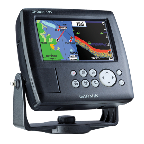
Garmin GPSMAP 580 Owner's Manual
Chartplotter/combo fishfinder
Hide thumbs
1
2
3
4
5
6
7
8
9
10
11
12
13
14
15
16
17
18
19
20
21
22
23
24
25
26
27
28
29
30
31
32
33
34
35
36
37
38
39
40
41
42
43
44
45
46
47
48
49
50
51
52
53
54
55
56
57
58
59
60
61
62
63
64
65
66
67
68
69
70
71
72
73
74
75
76
77
78
79
80
81
82
83
84
85
86
87
88
89
90
91
92
93
94
95
96
97
98
99
100
101
102
103
104
105
106
107
108
109
110
111
112
113
114
115
116
117
118
119
120
121
122
123
124
page
of
124
Go
/
124
Contents
Table of Contents
Bookmarks
Table of Contents
English
About this Manual
Product Registration
Contact Garmin
Table of Contents
Introduction
Caring for the GPSMAP 580/585
Cleaning the Screen
Warnings
Important Information
Getting Started
Unit Overview
Turning Your GPSMAP 580/585 on or off
Adjusting the Backlight
Acquiring GPS Satellite Signals
Using the GPSMAP 580/585
Using the Main Menu
Using Simulator Mode
Operation Mode
Main Pages
Navigating to a Destination
Finding an Item
Creating and Using Routes
Editing a Route
Creating and Using Waypoints
Editing a Waypoint
Creating a Route as a Marking Line
Managing Your Tracks
Saved Tracks
Operation Mode
Map Orientation
Compass Page
Navigation Page
Active Route Page
Position Data Page
Main Menu
Main Menu Tabs
GPSMAP 580/585 Owner's Manual
GPS Tab
Route Tab
Points Tab
Track Tab
DSC Tab
Sonar Tab
Alarms Tab
Calendar Tab
Celestial Tab
Message Tab
Display Tab
Sound Tab
Setup Tab
Setting up and Using Sonar
Showing Sonar on the Map Page
Using the Sonar Page
Setting up Sonar
Appendix
Specifications
Optional Accessories
Install the Wiring Harness
Satellite Information
Digital Selective Calling
Messages
Data Field Options
Software License Agreement
Limited Warranty
Declaration of Conformity (Doc)
汉语
入门指南
设备概述
产品概观
按键说明
调节背光
各主要页面说明
主菜单及其子页面说明
第一章 Gps 页面
第二章 航线页面
第三章 航点页面
第四章 航迹页面
第五章 Ais 页面
第六章 Dsc 页面
第七章 声纳页面
第八章 报警页面
第九章 日历页面
第十章 天文页面
第十一章 信息页面
第十三章 声音页面
第十二章 显示页面
第十五章 设置页面
技术规格
第十四章 用户数据页面
Advertisement
Quick Links
1
About this Manual
2
Unit Overview
3
Specifications
4
Install the Wiring Harness
Download this manual
®
GPSMAP
580/585
Chartplotter/Combo Fishfinder
Owner's Manual
Table of
Contents
Previous
Page
Next
Page
1
2
3
4
5
Advertisement
Chapters
English
5
汉语
101
Table of Contents
Need help?
Do you have a question about the GPSMAP 580 and is the answer not in the manual?
Ask a question
Questions and answers
Related Manuals for Garmin GPSMAP 580
Fish Finder Garmin GWS 10 Marine Wind Sensor Important Safety Information
Important safety and product information (48 pages)
Fish Finder Garmin echo 550c Owner's Manual
Garmin fish finder user manual (28 pages)
Fish Finder Garmin echo 550c Installation Instructions Manual
(6 pages)
Fish Finder Garmin echo 200 Important Safety And Product Information
Important safety and product information (28 pages)
Fish Finder Garmin GPSMAP 585 Owner's Manual
Chartplotter/combo fishfinder (124 pages)
Fish Finder Garmin echo 101 Installation Instructions
(4 pages)
Fish Finder Garmin GPSMAP 585 Plus Owner's Manual
(30 pages)
Fish Finder Garmin STRIKER VIVID 5cv Owner's Manual
(41 pages)
Garmin STRIKER VIVID / 5cv / 4 / 7 / 9 - Fish Finder Manual
(article)
Garmin Striker 4 Manual
(article)
Fish Finder Garmin Fishfinder 240 Owner's Manual
(50 pages)
Fish Finder Garmin striker 4 Owner's Manual
Striker series (11 pages)
Fish Finder Garmin STRIKER VIVID 7sv Owner's Manual
(41 pages)
Fish Finder Garmin STRIKER Vivid 4 Owner's Manual
(41 pages)
Fish Finder Garmin 350C Owner's Manual
(13 pages)
Fish Finder Garmin STRIKER 4 Quick Start Manual
(2 pages)
This manual is also suitable for:
Gpsmap 585
Table of Contents
Save PDF
Print
Rename the bookmark
Delete bookmark?
Delete from my manuals?
Login
Sign In
OR
Sign in with Facebook
Sign in with Google
Upload manual
Upload from disk
Upload from URL


Need help?
Do you have a question about the GPSMAP 580 and is the answer not in the manual?
Questions and answers