Sign In
Upload
Download
Table of Contents
Contents
Add to my manuals
Delete from my manuals
Share
URL of this page:
HTML Link:
Bookmark this page
Add
Manual will be automatically added to "My Manuals"
Print this page
×
Bookmark added
×
Added to my manuals
Manuals
Brands
Clarion Manuals
Car Navigation system
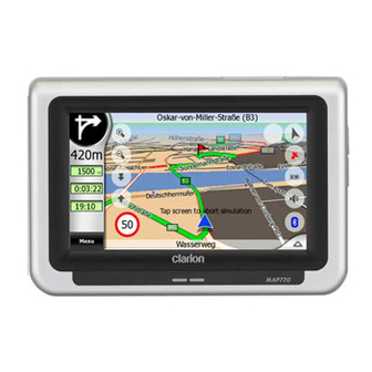
MAP670
Owner's manual
Clarion MAP670 Owner's Manual
Clarion navigation owner's manual
Hide thumbs
1
2
3
Table Of Contents
4
5
6
7
8
9
10
11
12
13
14
15
16
17
18
19
20
21
22
23
24
25
26
27
28
29
30
31
32
33
34
35
36
37
38
39
40
41
42
43
44
45
46
47
48
49
50
51
52
53
54
55
56
57
58
59
60
61
62
63
64
65
66
67
68
69
70
71
72
73
74
75
76
77
78
79
80
81
82
83
84
85
86
87
88
89
90
91
92
93
94
page
of
94
Go
/
94
Contents
Table of Contents
Troubleshooting
Bookmarks
Table of Contents
Copyright Note
Table of Contents
1 Warnings and Safety Information
2 General Information
3 Operating Clarion (Controls)
Hardware Buttons
Power On/Off
Toggling between the Map and Cockpit Screens
Screen Buttons and Controls
Direct Selectors
List Selectors
Sliders
Switches
Special Switches
Switches in the Quick Menu
Virtual Keyboards
ABC-Type Keyboards
QWERTY-Type Keyboards
The Numeric Keyboard
4 Discovering the Program through the Screens
Main Menu (Navigation Menu)
About Screen
The Map
And 3D Map Views
Zoom Levels
Daylight and Night Colour Schemes
Streets and Roads
Other Objects
Current Position and Lock-On-Road
Selected Map Point, also Known as the Cursor
Marked Map Points (Pin)
Visible Pois (Points of Interest)
Road Safety Cameras
Elements of the Active Route
The Start Point, Via Points and the Destination
Animated Turn Guidance
The Active Leg of the Route
Inactive Legs of the Route
Roads in the Route Excluded by Your Preferences
GPS Data Screen
GPS Data Displayed
GPS Connection Indicator
GPS Data Quality Indicator
Time Synchronization
Screens with Map
Turn Preview (No. 1)
Zoom in and out (No. 2 & 3)
Tilt up and down (No. 4 & 5)
Follow Mode - Lock to GPS Position and Heading (No. 6)
Cursor (No. 7)
Map Scale (No. 8)
Menu (No. 9)
Map Orientation and Overview (No. 10)
GPS Position Quality (No. 11)
Battery Status (No. 12)
Sound Muting (No. 13)
Track Log Recording/Playback Indicator (No. 14)
Cursor Menu (No. 15)
Current Street (No. 16)
Travel and Route Data (No. 17)
Distance to Next Turn (No. 18)
Next Street / Next Settlement (No. 19)
Approaching Next Turn (No. 20)
Current Speed Limit (No. 21)
Bluetooth or Phone Call Status (No. 22)
Route Information Screen
Route Data Displayed (for Destination and Via Points)
Route Line
Distance Left
Method
Time Left
Estimated Arrival
Destination / Via Point
Warning Icons
Fit to Screen
Parameters
Menu
Find Tab
Quick Tab
Map (Switch)
Zoom & Tilt (Switch)
Night Mode (Switch)
Manage POI (Points of Interest)
Popup Information (Switch)
Manage Track Logs
Route Tab
Recalculate
Delete
Itinerary
Fly over
Edit
Info
Main Button
TMC (Traffic Message Channel)
List of TMC Messages
TMC Control Centre
Selected FM Radio Station
Exclude Selected Station
Show Excluded Stations
Sorts Events by Distance / Type
Use Traffic Information
Recalculate to Avoid Traffic
Road Safety Cameras
Camera Types
Fixed Cameras
Mobile Cameras
Built-In Cameras
Section Control Cameras
Red Light Cameras
Controlled Traffic Direction
Speed Limit Checked
Add a New Camera or Edit an Existing One
Change the Settings of the Camera Warning
5 Settings
General Settings
Safety Mode
Set Favourite Destinations
Automatic Night Colours
Alerts
Warn When Speeding
Speeding Tolerance
Alternative Speed Limit
Alternative Speeding Tolerance
Enable Safety Cameras
Audible Warning
Route Recalculation
Automatic
Ask First
Disabled
Map Settings
Daylight / Night Colour Profile
Alternative Road Names
Show Street Labels
Textured Polygons
Sound Settings
Master Sound Volume/Switch
Voice Guidance Volume/Switch
Key Sound Volume/Switch
Dynamic Volume
Attention Tone
Route Parameter Settings
Method
Route
Short
Fast
Economical
Vehicle
Road Types to Include/Exclude
Unpaved Roads
Motorways
Ferries
U-Turns
Permit Needed
Toll Roads
Language & Units
Program Language
Voice Language
Units
Set Date & Time Format
Advanced Settings
Display Options
In Map Mode (and North-Up Orientation)
In Cockpit Mode (and Track-Up Orientation)
Zoom in after Find
Coordinate Display Format
Cockpit Screen Layout
Backlight Settings
Power Management
Smart Zoom
Smart Zoom Settings
Enable Overview Mode
Restore Lock-To-Position and Smart Zoom
Route Options
U-Turn Penalty
Cross-Border Planning
Keep Position on Road (Lock-On-Road)
User Data Management
Backup Data
Restore Data
Remove Pins
Clear Data
Reset Advanced Settings
6 Find
Destination (Main Menu)
Selection by Tapping the Map
Using the Main Menu
Find an Address, Street, Intersection or City
Selecting the City and Country to Search in
Selecting a Street or the Centre of the Settlement
Selecting a House Number or the Midpoint of the Street
How to Select an Intersection Instead of a House Number
An Example for a Full Address Search
Find in History
Find Coordinates
Find a POI
Find One of the Favourites (Home/Work)
7 Troubleshooting Guide
8 Glossary
Advertisement
Quick Links
1
Operating Clarion (Controls)
2
Hardware Buttons
3
Bluetooth or Phone Call Status (No. 22)
4
Language & Units
5
Program Language
Download this manual
Owner's manual
Navigation
Table of
Contents
Previous
Page
Next
Page
1
2
3
4
5
Advertisement
Table of Contents
Need help?
Do you have a question about the MAP670 and is the answer not in the manual?
Ask a question
Questions and answers
Related Manuals for Clarion MAP670
Car Navigation system Clarion MAP770 Owner's Manual
Clarion navigation owner's manual (94 pages)
Car Navigation system Clarion MAX983HD Owner's Manual
Hdd navigation system (187 pages)
Car Navigation system Clarion MAX983HD Service Manual
Hdd navigation system (6 pages)
Car Navigation system Clarion MAX973HD Owner's Manual
Clarion hdd navigation & dvd multimedia station owner's manual (187 pages)
Car Navigation system Clarion NP401 Owner's Manual & Installation Manual
Flash memory navigation system (81 pages)
Car Navigation system Clarion NX706 Owner's Manual
(157 pages)
Car Navigation system Clarion QY-8400 Series Manual
(33 pages)
Car Navigation system Clarion NX504E Owner's Manual
(99 pages)
Car Navigation system Clarion QY-8200 Series Manual
(33 pages)
Car Navigation system Clarion N.I.C.E. P200 User Manual
(216 pages)
Car Navigation system Clarion N.I.C.E. 430 Owner's Manual
Clarion mp3/wav/wma owner manual (158 pages)
Car Navigation system Clarion NX501E Owner's Manual & Installation Manual
2-din dvd multimedia station with built-in navigation & 6.2” touch panel control (123 pages)
Car Navigation system Clarion NX503E Owner's Manual
(107 pages)
Car Navigation system Clarion Navigation In-Car Entertainment User Manual
N.i.c.e. navigation in-car entertainment (147 pages)
Car Navigation system Clarion NVS613 Service Manual
Din-size navigation system built-in monitor (28 pages)
Car Navigation system Clarion NAX963HD Service Manual
Hdd navigation system (44 pages)
This manual is also suitable for:
Map770
Table of Contents
Save PDF
Print
Rename the bookmark
Delete bookmark?
Delete from my manuals?
Login
Sign In
OR
Sign in with Facebook
Sign in with Google
Upload manual
Upload from disk
Upload from URL


Need help?
Do you have a question about the MAP670 and is the answer not in the manual?
Questions and answers