Garmin GPSMAP 66i In-Depth Manual
Hide thumbs
Also See for GPSMAP 66i In-Depth:
- Owner's manual (12 pages) ,
- Owner's manual (25 pages) ,
- Owner's manual (58 pages)
Table of Contents
Advertisement
Advertisement
Table of Contents

Related Manuals for Garmin GPSMAP 66i In-Depth


Summary of Contents for Garmin GPSMAP 66i In-Depth
- Page 1 NOTICE: An active satellite subscription is required. Some jurisdictions regulate or prohibit the use of satellite communications devices. It is your responsibility to know and follow all applicable laws in the jurisdictions where the satellite communication device is intended to be used.
- Page 2 GPSMAP 66i In-Depth ® inReach Field Experience Webinar inReach Field Experience Webinar ®...
- Page 3 INTRODUCTION Chip Noble • Product Manager, Garmin • Avid Outdoorsman • GPSMAP 66i User...
-
Page 4: Device Overview
DEVICE OVERVIEW... - Page 5 Large 3” color display – sunlight-readable for easy viewing Premium GPS features – waypoint averaging, area calculation, sun/moon info, hunt/fish calendar Garmin maps – preloaded Garmin TopoActive maps; direct-to-device BirdsEye Satellite Imagery Automatic routing – turn-by-turn routing on roads for outdoor activities ...
- Page 6 INREACH TECHNOLOGY 100% global Iridium satellite network – messages, ® SOS alerts and tracking are transferred via satellite Two-way messaging – exchange text messages with cell phones or other inReach devices SOS – in case of emergency, trigger an SOS to a professional emergency response coordination center ...
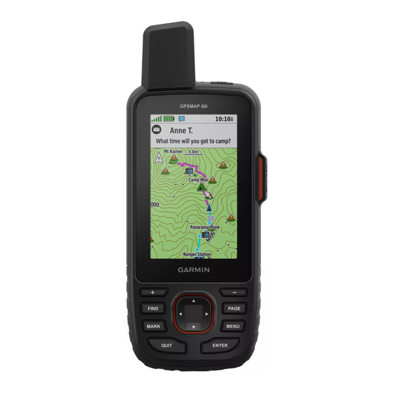
- Page 7 DEVICE OVERVIEW Micro-USB port Power key Iridium & (under weather cap) GNSS antenna Flashlight Must have a clear view of the sky to transmit microSD ® card slot SOS button (under weather (under protective cap) cap) Mounting spine Buttons (details on next slide)
- Page 8 DEVICE OVERVIEW Zoom out on map Zoom in on map PAGE – scroll through main FIND – Open search menu pages MARK – Save current MENU – open the options location as waypoint menu for open page; select twice to open main menu QUIT –...
-
Page 9: Device Icons
DEVICE ICONS ANT + technology status ® GPS signal strength Charging battery Charging complete technology status Bluetooth ® Wi-fi status ® Sending inReach messages Unread inReach messages... -
Page 10: Status Led
STATUS LED Double flashing green: Unread message Flashing green: Device is in expedition mode Flashing red: Device does not have a clear view of the sky or is below 10% battery power Alternating red and green: Device is in SOS mode... - Page 11 BATTERY Select settings to extend battery life Tracking Setting Battery Life 10-min tracking Up to 35 hours • Expedition Mode: screen shuts off, device (Default) 30-minute tracking enters low power mode, and collects fewer Up to 200 hours (Expedition Mode) GPS track points •...
- Page 12 OVERVIEW OF KEY PAGES & MENUS...
- Page 13 MAIN PAGES AND MENU Main Menu – access to tools and setup screens for waypoints, activities, routes and more • From any page, select MENU twice Ribbon Menu / Main Pages – quickly scroll through favorite tools • Use PAGE and QUIT buttons to scroll •...
-
Page 14: Setup Menu
SETUP MENU Select MENU twice, and select Setup. System Units – settings, satellite types – units of measure Display – backlight and display Time – time settings Bluetooth – pair to smartphone Tracking – auto track, intervals ... - Page 15 Iridium satellite network Contacts – view contacts saved on your device; add and edit contacts on your device (located in Setup Menu) SOS – view and respond to SOS messages from the Garmin IERCC, cancel an SOS...
- Page 16 WEATHER PAGES inReach Weather – request an inReach weather forecast for your location or another location (requires inReach subscription) Active Weather – displays temperature, temperature forecast, weather forecast, weather radar, cloud cover and wind (must be connected to a smartphone or Wi-Fi network with internet access, no inReach subscription required)
- Page 17 INREACH UTILITIES PAGE Test Service – ensure your subscription is active and your device is sending and receiving messages; five free test messages per month are included on all inReach subscription plans Plan Usage – view a breakdown of types of messages sent, number of track points sent and plan details ...
- Page 18 MAPPING & SENSOR PAGES Map – shows your location on the map, waypoints, and courses (if navigating) BirdsEye Direct – download BirdsEye Satellite Imagery to your device Compass – when navigating, points to your destination, regardless of the direction you are moving ...
- Page 19 Course Planner – saved courses, create courses Route Planner – saved routes, create routes Collections Manager – collections synced from your Garmin Explore™ account Tracking – share and view details of your tracks through MapShare (requires inReach subscription) ...
- Page 20 OTHER PAGES Notifications – alerts you to incoming calls, texts and more, based on your smartphone notification setting Proximity Alarms – set alerts to sound within range of particular locations Area Calculation – calculate the size of an area ...
- Page 21 GARMIN EXPLORE WEBSITE...
- Page 22 Trip review – review your trip activity and track line Import routes and waypoints – import GPX, KML or KMZ files or Courses from your Garmin Connect account; you can also export files to share with others...
- Page 23 • Emergency contacts and emergency notes are shared with the Garmin IERCC in the event of an SOS Manage your inReach device Update your inReach subscription plan Note: You can also find directions to sync and...
- Page 24 GARMIN EXPLORE APP Note: GPSMAP 66i pairs to the Garmin Explore app. It is not compatible with the Earthmate app. ® Screenshots show Android interface. iOS interface may vary slightly.
- Page 25 Planning – create courses on the app and send to your GPSMAP 66i Navigating – use your mobile device for outdoor navigation, with or without Wi-Fi or cellular service inReach syncing – sync data with the Garmin Explore website and your GPSMAP 66i...
- Page 26 9. Select Pair Mobile Device or Continue. 10.In the Garmin Explore app, select the GPSMAP 10.In the Garmin Explore app, select the GPSMAP handheld handheld and follow the prompts to complete setup. and follow the prompts to complete the setup.
- Page 27 SYNCING AND FIRMWARE UPDATES...
- Page 28 • From the Garmin Explore app, select the devices page to make sure you are connected and synced To sync with Garmin Explore website changes, a cellular data or Wi-Fi connection is required and the GPSMAP 66i must be powered on and paired ...
-
Page 29: Firmware Updates
Firmware updates are released periodically, we recommend updating your device firmware on a regular basis Updates are free and sent to the GPSMAP 66i via Garmin Express 1. Connect the device to your computer using a USB cable 2. Go to garmin.com/express... - Page 30 MESSAGING...
-
Page 31: Message Types
MESSAGE TYPES Text messages are sent to and from the GPSMAP 66i using the Iridium satellite network. Custom Messages – compose messages and select or enter contacts at the time of sending Predefined messages – preformatted messages for faster and easier messaging ... - Page 32 MANAGING PRESET AND QUICK TEXT MESSAGES Presets and Quick Texts are managed from the Messages tab on your Garmin Explore account. Make sure to sync your GPSMAP 66i after making changes. Editing Preset messages: 1. Click Edit next to the preset message 2.
- Page 33 MANAGING PERSONAL CONTACTS Contacts are managed through the Garmin Explore app and website. Contacts are added to your GPSMAP 66i by syncing. Managing Contacts on the Explore app: 1. Select account page > Explore Contacts 2. Select + to add new contact or import...
- Page 34 SENDING PRESET MESSAGES – GPSMAP 66i Preset Messages You can send Preset messages from your GPSMAP 66i or paired Garmin Explore app. Sending a preset from GPSMAP 66i: 1. Select the Messages page 2. Select Send Preset 3. Choose a preset and press ENTER 4.
- Page 35 SENDING PRESET MESSAGES – GARMIN EXPLORE APP Preset Messages You can send Preset messages from your GPSMAP 66i or paired Garmin Explore app. Sending a preset from the Explore app: 1. Select the Messages page 2. Select the Preset icon 3.
- Page 36 SENDING QUICK TEXT MESSAGES – GPSMAP 66i Quick Text Messages You can send Quick Texts from your GPSMAP 66i or paired Garmin Explore app. Sending a Quick Text from GPSMAP 66i: 1. Select the Messages page 2. Select New Message or select a message to reply to >...
- Page 37 SENDING QUICK TEXT MESSAGES – GARMIN EXPLORE APP Sending a Quick Text from the Explore app: 1. Select the Messages page 2. Select the new message icon or an existing conversation • For new conversations add contacts • Enter info or select from system contacts 3.
- Page 38 SENDING CUSTOM MESSAGES – GPSMAP 66i Custom Messages You can send custom messages from your GPSMAP 66i or paired Garmin Explore app. Sending Custom Message from GPSMAP 66i: 1. Select the Messages page 2. Select New Message or select a message to reply to >...
- Page 39 GPSMAP 66i MESSAGING TIPS Use Keyboard Shortcuts Use Autocomplete FIND: select first autocomplete option, 1. Begin typing a message Page (once): change character case, 2. A list of suggested words will appear Page (twice): turn on caps lock 3.
- Page 40 SENDING CUSTOM MESSAGES – GARMIN EXPLORE APP Sending a Custom Message from the Explore app: 1. Select the Messages page 2. Select the new message icon or select an existing conversation 3. For new messages: Add contacts • Enter info or select from system contacts 4.
- Page 41 MAPS...
- Page 42 MAP PAGE – GPSMAP 66i Preloaded TopoActive maps show you contours, elevations, summits, parks, coastlines, rivers, lakes, geographical points, roads and trails. • represents your location on the map, moves and displays your path as you travel • Zoom in on the map to see more detail •...
- Page 43 ADDING MAPS – GPSMAP 66i Additional Garmin maps (such as TOPO U.S. 24K, Trailhead Series, Garmin HuntView™ Plus) can be added to the GPSMAP 66i. You can view compatible map options on the Maps tab on the Garmin.com GPSMAP 66i product page.
- Page 44 ADDING MAPS – GPSMAP 66i Additional Garmin maps (such as TOPO U.S. 24K, Trailhead Series, Garmin HuntView™ Plus) can be added to the GPSMAP 66i. You can view compatible map options on the Maps tab on the Garmin.com GPSMAP 66i product page.
- Page 45 ADDING MAPS – GPSMAP 66i – BIRDSEYE SATELLITE IMAGERY Download high-resolution, photo-realistic maps directly to your device (no subscription required) Adding Birdseye imagery to GPSMAP 66i: 1. Connect device to a Wi-Fi network 2. Select BirdsEye Direct 3. Select Download Imagery 4.
- Page 46 ADDING MAPS – GARMIN EXPLORE APP Detailed topographic maps of North America, color aerial imagery (US only), and detailed maps of the rest of the world can be downloaded for viewing and use in the Garmin Explore app. Adding Maps to the Explore app: Note: A data connection is required for downloading maps.
- Page 47 MAPSHARE...
- Page 48 Configure MapShare on the Social tab on the Garmin Explore website: • Enable/disable MapShare • Edit MapShare url • Use settings and filters to update trip...
- Page 49 SHARING YOUR MAPSHARE LINK From the Garmin Explore website: You can share the url for your MapShare page prior to your trip from Social tab From the Explore app: 1. Select Tracking from the Devices page 2. Select inReach Message or Share under “Share Your Track with MapShare”...
- Page 50 TRACKING, RECORDING AND NAVIGATION TERMINOLOGY...
- Page 51 • You can convert saved activities and routes to courses Routes: • Used by the Garmin Explore website; compatible with GPSMAP 66i, Garmin Explore app • Recalculates if you leave original route Tracking (inReach subscription required) •...
- Page 52 TRACKING & RECORDING...
- Page 53 TRACKING Use Tracking to record track points and transmit them over the Iridium satellite network. Track points appear on your Garmin Explore website account and MapShare page (if enabled) Start and stop tracking on GPSMAP 66i: Note: Tracking also starts/pauses recording controls 1.
- Page 54 Activities will also appear on your Garmin Explore website account. Recording can only be controlled on the GPSMAP 66i device and not from the Garmin Explore app. Resume and stop recording on GPSMAP 66i: 1. Main menu > Recording Controls > Resume 2.
- Page 55 TRACBACK While recording, you can navigate back to the beginning of your activity. This can be helpful when finding your way back to camp or the trailhead. Using TracBack on GPSMAP 66i: 1. Select Recording Controls 2. Select the Map tab 3.
-
Page 56: Activity Profiles
ACTIVITY PROFILES Profiles are a collection of settings that optimize your GPSMAP 66i based on activity. When you are using a profile and you change settings, such as data fields or units of measurement, the changes are saved automatically as part of the profile. Selecting a Profile on GPSMAP 66i: 1. - Page 57 NAVIGATION...
- Page 58 CREATING WAYPOINTS – GARMIN EXPLORE WEBSITE Waypoints are used to mark locations with names and icons and can be created on the GPSMAP 66i, Garmin Explore app or Garmin Explore website. Remember to sync waypoints to your device. Creating a Waypoint on Garmin Explore: 1.
- Page 59 CREATING WAYPOINTS – GARMIN EXPLORE APP Waypoints are used to mark locations with names and icons and can be created on the GPSMAP 66i, Garmin Explore app or Garmin Explore website. Remember to sync waypoints to your device. Creating a Waypoint on the Explore app: 1.
- Page 60 CREATING WAYPOINTS – GPSMAP 66i Waypoints are used to mark locations with names and icons and can be created on the GPSMAP 66i, Garmin Explore app or Garmin Explore website. Creating a Waypoint on GPSMAP 66i: 1. Select MARK to add a waypoint for your current location 2.
-
Page 61: Navigating To A Waypoint
NAVIGATING TO A WAYPOINT You can navigate to a waypoint on your GPSMAP 66i or paired Garmin Explore app. Navigating to a Waypoint on GPSMAP 66i: 1. Select FIND > Waypoints or Waypoint Manager 2. Select a waypoint 3. Select View Map 4. - Page 62 CREATING COURSES – GARMIN EXPLORE APP A course can have multiple destinations, and can be navigated point to point or on routable roads. Created on GPSMAP 66i and Garmin Explore app. Creating a Course on the Explore app: 1. Select the Map page 2.
- Page 63 CREATING COURSES – GPSMAP 66i Creating a Course using GPSMAP 66i map: 1. Select Course Planner > Create Course 2. Select a course creation method 1. Direct Path: point to point with no map adjustments or recalculations 2. Roads & Trails: adjusts to follow map data and recalculates as needed (screenshots shown) 3.
- Page 64 NAVIGATING A COURSE You can navigate on a course on your GPSMAP 66i or paired Garmin Explore app. Navigating a Course on GPSMAP 66i: 1. Select FIND > Courses or Course Planner 2. Select a course 3. Select Go Navigating a Course on the Explore app: 1.
- Page 65 CREATING ROUTES – GARMIN EXPLORE Routes are created on the Garmin Explore website. They are used for navigation on your GPSMAP 66i. Remember to sync routes to your device. Creating a Route on Garmin Explore: 1. Select the Map tab 2.
-
Page 66: Navigating A Route
NAVIGATING A ROUTE You can navigate on a route on your GPSMAP 66i or paired Garmin Explore app. Navigating a Route on GPSMAP 66i: 1. Select FIND > Routes or Route Planner 2. Select a route • If needed, select View Map or the Map tab 3. - Page 67 You can organize navigation data in Collections. Collections allow for syncing only some data to compatible devices and showing on MapShare. Garmin Explore Website: 1. Select the Map tab 2. Select an existing Collection to update or select + to create a new Collection Garmin Explore App: 1.
-
Page 68: Navigation Tips
NAVIGATION TIPS View the Elevation of a Course Elevation Plot on GPSMAP 66i: 1. Select Course Planner 2. Select a course 3. Select the elevation plot tab Profile on the Explore app: 1. Select the Library page 2. Select Courses > select a course 3. - Page 69 NAVIGATION TIPS Import GPX files to the Garmin Explore app and sync to your GPSMAP 66i 1. Save the GPX file to your mobile device 2. Open the Garmin Explore app 3. Select the Map page 4. Select + > Import GPX File 5.
-
Page 70: Weather Forecasts
WEATHER FORECASTS... - Page 71 You can request forecasts from your GPSMAP 66i or paired Garmin Explore app for your current location, a waypoint or GPS coordinates. Choose from 3 types of forecasts: Basic land forecast (counted as text message) ...
- Page 72 INREACH WEATHER FORECASTS Weather forecasts on GPSMAP 66i: 1. Select Weather > New Forecast 2. Choose forecast type (basic, premium, marine) 3. Select your current location or a new location 4. Select Get Forecast Weather forecasts on the Explore app: 1.
- Page 73 ACTIVE WEATHER FORECASTS While your GPSMAP 66i device is connected to your smartphone or to a Wi-Fi network and has an active internet connection, it can receive detailed weather information from the internet. This feature provides a four-day forecast and live graphical weather maps.
- Page 75 Can cancel an SOS if help is no longer needed *Messaging allows you to provide additional details to the Garmin IERCC to help aid in the response. Messaging is not required for the Garmin IERCC to move forward with initiating a response.
- Page 76 1. Lift the protective cover 2. Press and hold the SOS Button 3. Wait for the SOS countdown 4. A message is sent to the Garmin IERCC 5. Message with the Garmin IERCC if possible 6. Select Cancel SOS if help is no longer...
- Page 77 5. A confirmation message is sent to your device 6. Message with the Garmin IERCC if possible 7. Select Cancel SOS if help is no longer needed Note: The Garmin Explore app must be paired to a compatible inReach device active on an inReach subscription plan.
- Page 78 SOS MESSAGING TIP The Garmin IERCC may send you a phone number to contact local SAR directly To respond to a provided phone number: 1. Select the message that includes the phone number 2. Select the yellow bar with “Send Message to…”...
-
Page 79: Additional Resources
ADDITIONAL RESOURCES Garmin Explore inReach plan and account management explore.garmin.com Garmin Support View help documents, manuals, product videos, and prior webinars support.garmin.com Garmin Blog Read the latest inReach adventures and SOS stories www.garmin.com/blog... - Page 80 ® The Bluetooth word mark and logos are registered trademarks owned by Bluetooth SIG, Inc. and any use of such marks by Garmin is under license. An active satellite subscription is required. Notice: Some jurisdictions regulate or prohibit the use of satellite communications devices.
Need help?
Do you have a question about the GPSMAP 66i In-Depth and is the answer not in the manual?
Questions and answers