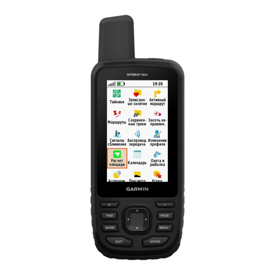
Garmin GPSMAP 66 Owner's Manual
Hide thumbs
Also See for GPSMAP 66:
- Owner's manual (64 pages) ,
- Owner's manual (64 pages) ,
- Owner's manual (52 pages)
Table of Contents

Subscribe to Our Youtube Channel
Related Manuals for Garmin GPSMAP 66


Summary of Contents for Garmin GPSMAP 66
- Page 1 GPSMAP ® Owner’s Manual...
- Page 2 © 2018 Garmin Ltd. or its subsidiaries All rights reserved. Under the copyright laws, this manual may not be copied, in whole or in part, without the written consent of Garmin. Garmin reserves the right to change or improve its products and to make changes in the content of this manual without obligation to notify any person or organization of such changes or improvements.
-
Page 3: Table Of Contents
Downloading Geocaches Using a Computer ......5 tempe™ ................12 Navigating to a Geocache ............5 Using Optional Fitness Accessories ........12 chirp™ ..................5 Tips for Pairing ANT+ Accessories with Your Garmin Device .. 12 Sending and Receiving Data Wirelessly ........5 Table of Contents... - Page 4 Troubleshooting ................ 12 Resetting the Device ............12 Viewing Device Information ..........13 Restoring All Default Settings ..........13 Index ................14 Table of Contents...
-
Page 5: Introduction
Introduction NOTICE Alkaline batteries lose a significant amount of their capacity as WARNING the temperature decreases. Use lithium batteries when operating the device in below freezing conditions. See the Important Safety and Product Information guide in the product box for product warnings and other important Maximizing Battery Life information. -
Page 6: Acquiring Satellite Signals
Opening the Main Menu as cars, buildings, or overhead power lines. The main menu gives you access to setup screens including The device has a 3-axis electronic compass (GPSMAP 66 waypoints, tracks, and routes. See Main Menu Features and series devices only). You should calibrate the compass after Settings, page 5 for main menu settings pages. -
Page 7: Navigating With Sight 'N Go
Adjust Zoom Ranges: Adjusts the zoom ranges shown on the elevation plot page. NOTE: Sight 'N Go is available only with GPSMAP 66 series devices. Change Data Fields: Customizes the elevation plot data fields. -
Page 8: Navigating To A Waypoint
Navigating to a Waypoint From the home screen, select Route Planner. Select FIND > Waypoints. Select a route. Select a waypoint. Select View Map. Select Go. Deleting a Route Editing a Waypoint From the app drawer, select Route Planner. From the app drawer, select Waypoint Manager. From the home screen, select Route Planner. -
Page 9: Viewing The Current Activity
(Customizing the Main Menu, page 10). Sending and Receiving Data Wirelessly NOTE: This feature is available only for models that include a NOTE: This feature is available only with GPSMAP 66 series camera. devices. NOTE: Using the flashlight can reduce battery life. You can... -
Page 10: Setting A Proximity Alarm
See your operating system Select Use. documentation to learn how to map the drive. Enter a radius. Open the Garmin or memory card drive or volume. When you enter an area with a proximity alarm, the device Select an option: sounds a tone. -
Page 11: Waypoint Averaging
Data Fields real time. You can invite followers using email or social Some data fields require you to be navigating or require ANT+ media, allowing them to view your live data on a Garmin accessories to display data. Connect tracking page. -
Page 12: System Settings
Descent - Maximum: The maximum rate of descent in feet per Speed - Overall Avg.: The average speed while moving and minute or meters per minute since the last reset. stopped since the last reset. Descent - Total: The total elevation distance descended since Stopwatch Timer: The stopwatch time for the current activity. -
Page 13: Gps And Glonass
Select an alarm type. Select Setup > System > Interface. Select On. Garmin Spanner: Allows you to use the device USB port with Enter a distance, and select ENTER. most NMEA 0183-compliant mapping programs by creating a virtual serial port. -
Page 14: Removing A
The default coordinate system is WGS 84. active. Select Setup > Profiles. Altimeter Settings Select a profile. NOTE: The altimeter is available only with GPSMAP 66 series Select Delete. devices. Select Setup > Altimeter. Device Information Auto Calibration: Automatically calibrates the altimeter each time the device is turned on. -
Page 15: Setting Up Garmin Express
• GPX track files. • GPX geocache files. Go to www.garmin.com/geocache. • GGZ geocache files. Go to www.garmin.com/geocache. • JPEG photo files. • GPI custom POI files from the Garmin POI Loader. Go to www.garmin.com/products/poiloader. Installing a Memory Card WARNING Do not use a sharp object to remove user-replaceable batteries. -
Page 16: Transferring Files To Your Device
Hardware icon in the system tray, and select your device. accessories. • For Apple computers, select the device, and select File > • Bring the Garmin device within range 3 m (10 ft.) of the ANT+ Eject. accessory. Disconnect the cable from your computer. -
Page 17: Viewing Device Information
Viewing Device Information You can view the unit ID, software version, regulatory information, and license agreement. Select Setup > About. Restoring All Default Settings You can reset all settings back to the factory default settings. From the app drawer, select Setup > Reset > Reset All Settings >... -
Page 18: Index
8–10, 13 Garmin Connect 7 device 10 Garmin Express 11 sharing data 5 updating software 10 Sight N' Go 3 Garmin product support. See product support smartphone 5 gauges, trip 2 applications 7 geocaches 5, 11 pairing 7 downloading 5 software GLONASS 9 license 13 GPS 6, 9 updating 10 satellite page 6 version 13... - Page 20 June 2018 190-02336-00_0A...
Need help?
Do you have a question about the GPSMAP 66 and is the answer not in the manual?
Questions and answers