Garmin GPSMAP 66i Owner's Manual
Hide thumbs
Also See for GPSMAP 66i:
- Owner's manual (12 pages) ,
- Manual (80 pages) ,
- Owner's manual (58 pages)
Table of Contents
Advertisement
Quick Links
Advertisement
Table of Contents

Related Manuals for Garmin GPSMAP 66i


Summary of Contents for Garmin GPSMAP 66i
- Page 1 GPSMAP ® Owner’s Manual...
- Page 2 © 2019 Garmin Ltd. or its subsidiaries All rights reserved. Under the copyright laws, this manual may not be copied, in whole or in part, without the written consent of Garmin. Garmin reserves the right to change or improve its products and to make changes in the content of this manual without obligation to notify any person or organization of such changes or improvements.
-
Page 3: Getting Started
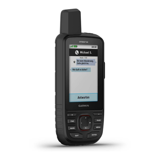
Getting Started Sending inReach messages ® Unread inReach messages WARNING See the Important Safety and Product Information guide in the Keys product box for product warnings and other important information. Device Overview FIND Select to open the search menu. MARK Select to save your current location as a waypoint. -
Page 4: Saving Energy While Charging The Device
Using Keyboard Shortcuts Activating the Device • To select the first autocomplete option, select FIND. Before you can use the inReach features of your GPSMAP 66i • To cycle through keyboards, select MARK. device, you must activate it. • To change character case, select PAGE once, and to turn on Create an account, and select a satellite subscription at caps lock, select PAGE twice. -
Page 5: Testing The Device
Lift the protective cap from the SOS button You can sync data from your Garmin Explore account to your device using the Garmin Explore app. After you make edits to your data, such as contacts, preset messages, or quick text messages, you must sync them to your device using the mobile app. -
Page 6: Using The Main Pages
Map Setup: Enables you to open additional map settings (Map routes, and tracks update automatically. Settings, page You can now sync your data to your GPSMAP 66i device. Measure Distance: Allows you to measure the distance between multiple locations (Measuring Distance on the Map,... - Page 7 The course pointer indicates your relationship to the course Trip Computer line leading to the destination. The course deviation indicator The trip computer displays your current speed, average speed, (CDI) provides the indication of drift (right or left) from the trip odometer, and other helpful statistics.
-
Page 8: Connected Feature Requirements
Garmin Explore app on your smartphone. Go to garmin.com /apps for more information. Log in to the Garmin Explore app using your Garmin Connect username and password. Bluetooth sensors: Allows you to connect Bluetooth compatible sensors, such as a heart rate monitor using the Select the device option to pair your device with the Garmin Garmin Connect app. -
Page 9: Connect Iq Features
Connect IQ Features • To zoom in and out of the map, select You can add Connect IQ features to your device from Garmin ® Navigating with the Compass and other providers using the Connect IQ Mobile app. You can... -
Page 10: Setting A Waypoint Proximity Alarm
Select a unit of measure. Select a point in the route to view additional details. Enter the distance, and select Done. Editing a Route Select Save. You can add, remove, or rearrange points on a route. Select Route Planner. Moving a Waypoint on the Map Select Waypoint Manager. - Page 11 Trip option resets the recording and trip data when you finish Active Weather: While your GPSMAP 66i device is connected the active recording. The Prompted option prompts you to to your smartphone or to a Wi‑Fi network and has an active select the data to reset.
-
Page 12: Data Use And History
same data charges or additional charges as requesting a Switching the Active Weather Location forecast. You can quickly switch between forecasts for active weather locations you have previously added. Select inReach Weather. While viewing an active weather forecast, select MENU > Select a location with an outdated weather forecast. -
Page 13: Birdseye Imagery
(Connecting to a Wireless Profile Change: Allows you to change the device profile to Network, page 6) or to the Garmin Connect app (Pairing a customize your settings and data fields for a particular activity Smartphone with Your Device, page... -
Page 14: Removing Your Device Registration From Geocaching.com
• To filter by the physical size of the geocache container, A chirp is a small Garmin accessory that is programmed and left select Cache Size. in a geocache. You can use your device to find a chirp in a geocache. -
Page 15: Customizing The Device
You can use this location to create routes or technology. You can share waypoints, geocaches, routes, and search for saved locations. tracks. AutoLocate Position: Calculates your GPS position using the Select Share Wirelessly. Garmin AutoLocate feature. ® Select an option: Satellite Setup: Sets the satellite system options (Satellite •... - Page 16 Recording: Allows you to customize activity recording settings Garmin Spanner: Allows you to use the device USB port with (Recording Settings, page most NMEA 0183-compliant mapping programs by creating a virtual serial port. Routing: Allows you to customize how the device calculates...
- Page 17 Off Route Recalculation: Sets recalculation preferences when navigating away from an active route. User: Sets your user profile information. The device uses this information to calculate accurate training data in Garmin Avoidance Setup: Sets the types of roads, terrain, and Connect.
-
Page 18: Device Information
On your computer, install Garmin Express ™ (www.garmin.com the time zone automatically based on your GPS position. /express). On your smartphone, you can install the Garmin Explore app to upload your waypoints, routes, tracks, and Profiles activities. Profiles are a collection of settings that optimize your device Garmin Express provides easy access to these services for based on how you are using it. -
Page 19: Getting More Information
• Files from Garmin Explore. • GPX route, track, and waypoint files. • GPX geocache files (Downloading Geocaches Using a Computer, page 11). • JPEG photo files. • GPI custom POI files from the Garmin POI Loader. Go to www.garmin.com/products/poiloader. Device Information... -
Page 20: Specifications
You must be navigating for this data to appear. be deleted. Average Cadence: Cycling. The average cadence for the Open the Garmin drive or volume. current activity. If necessary, open a folder or volume. Average HR %Max.: The average percentage of maximum heart rate for the current activity. - Page 21 Barometer: The calibrated current pressure. Heart Rate Zone: The performance zone of your current heart rate (1 to 5). The default zones are based on your user profile Battery Level: The remaining battery power. and maximum heart rate (220 minus your age). Bearing: The direction from your current location to a Lap Ascent: The vertical distance of ascent for the current lap.
-
Page 22: Optional Accessories
Time to Next: The estimated time remaining before you reach • Bring the Garmin device within range 3 m (10 ft.) of the ANT+ the next waypoint in the route. You must be navigating for accessory. this data to appear. - Page 24 January 2020 190-02336-10_0B...
Need help?
Do you have a question about the GPSMAP 66i and is the answer not in the manual?
Questions and answers