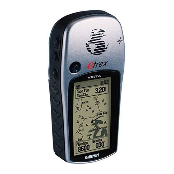
Garmin eTrex Vista Owner's Manual And Reference Manual
Personal navigator
Hide thumbs
Also See for eTrex Vista:
- Owner's manual and reference manual (76 pages) ,
- Quick start manual (2 pages) ,
- Specification sheet (2 pages)
Table of Contents
Advertisement
Advertisement
Table of Contents

Related Manuals for Garmin eTrex Vista


Summary of Contents for Garmin eTrex Vista
- Page 1 eTrexVista personal navigator ® owner’s manual reference guide...
- Page 2 GARMIN®, AutoLocate®, TracBack®, and Personal Navigator® are registered trademarks, eTrex Vista™, and MapSource™ are trademarks of GARMIN Ltd. or its subsidiaries and may not be used without the express permission of GARMIN. April 2005 Part Number 190-00219-00 Rev.
-
Page 3: About This Manual
Thank you for choosing the GARMIN eTrex Vista. To get the most from your new eTrex Vista, take time to read through this owner’ s manual in order to understand all of the operating features. This manual is organized into three sections. - Page 4 Introduction FCC Compliance Statement The eTrex Vista complies with Part 15 of the FCC interference limits for Class B digital devices FOR HOME OR OFFICE USE. These limits are designed to provide reasonable protection against harmful interference in a residential installation, and are more stringent than “outdoor”...
-
Page 5: Warnings And Precautions
Do not mount the eTrex Vista over air bag panels or in the field of air bag deployment. Air... -
Page 6: Software License Agreement
GPS equipment. Although the eTrex Vista is a precision electronic NAVigation AID (NAVAID), any NAVAID can be misused or misinter- preted and, therefore, become unsafe. -
Page 7: Maintenance
GARMIN and that the Software in source code form remains a valuable trade secret of GARMIN. You agree not to decompile, disassemble, modify, reverse assemble, reverse engineer or reduce to human readable form the Software or any part thereof or create any deriva- tive works based on the Software. -
Page 8: Limited Warranty
This GARMIN product is warranted to be free from defects in materials or work- manship for one year from the date of purchase. Within this period, GARMIN will at its sole option, repair or replace any components that fail in normal use. Such repairs or replacement will be made at no charge to the customer for parts or labor, provided that the customer shall be responsible for any transportation cost. - Page 9 Product Registration Help us to better support you by completing our on-line registration today! Have the serial number of your eTrex Vista handy and connect to our website (www.garmin.com). Look for the Product Registration link on the Home Page. Serial Number Use this area to record the external serial number (8-digit number located inside the battery compartment) in case it is lost, stolen, or needs service.
-
Page 10: Table Of Contents
The Main Pages Main Page Basics ...4 Satellite The Main Page ...5 Options ...6-7 Navigating Navigating with eTrex Vista ...8 The Main Page ...9-10 Options ...11-15 Using the Pan Map Option ...12 Stop Navigation ...13 Hide/Show Navigation Status ...13 Hide/Show Data Fields ...13 Setup ...14-15... -
Page 11: Getting Started
Before you begin to explore the eTrex Vista’ s operat- ing features, you should be familiar with the information contained in the Quick Start which includes instructions for installing batteries, how the buttons function, starting the eTrex Vista, adjusting the screen contrast, and basic navigation techniques to help you start enjoying your eTrex Vista immediately. -
Page 12: Features And Button Function
The FIND button: • Press to access the Find Menu NOTE: The eTrex Vista is designed to be held and operated in the left hand, but it can be held and operated using the right hand as well to suit your preference. -
Page 13: Battery Installation
Installing the Batteries The eTrex Vista operates on two “AA” batteries (not included), which are located in the back of the unit. Rechargeable Alkaline, NiMH, NiCad or Lithium batteries may also be used. Stored data is not lost when the batteries are removed. -
Page 14: Main Page Basics
Map Page Navigation Page Satellite Page All of the information you need to operate the eTrex Vista can be found on six main pages (or display screens). You can press and release the PAGE button to cycle through the Satellite Page, Map Page, Navigation Page, Altimeter Page, Trip Computer, and Main Menu Page. -
Page 15: Satellite
The Wide Area Augmentation System (WAAS) capability produces a more accurate position fix. When enabled (the GPS mode set to ‘Normal’ and the interface set to other than RTCM mode), this feature searches for a WAAS satellite near your location and then receives data for correcting differentials in the GPS satellite signals and the WAAS satellite numbers (beginning at No. -
Page 16: Options
& press in on the THUMB STICK. Because the eTrex Vista relies on satellite signals to provide you with navigational guidance, the unit’ s view of the sky determines how fast you achieve navigational status. -
Page 17: Options
2. Highlight ‘New Location’ and press in on the THUMB STICK to display choices of ‘Auto’ or ‘Use Map’. If you choose ‘Auto’ the eTrex Vista determines your new location automatically. If you choose ‘Use Map’ a map page displays with instructions stating, “Point to your approximate... -
Page 18: Navigating
There are four methods of navigating when using the eTrex Vista and each is graphically displayed on the Map Page. Goto - A direct path to a selected destination (waypoint, city, address, etc.). -
Page 19: Map
The map also displays geographic details such as rivers, lakes, highways, and towns. The map shown above displays a higher level of detail than the basemap provided with the unit (i.e. residential streets, parks, etc.), because GARMIN MapSource data has been downloaded to the unit using a CD-ROM mapping program. - Page 20 “overzoom” displays just below the map scale. In many instances the map displays an ‘Accuracy Circle’ surrounding the ‘Position Icon’. The eTrex Vista uses both map resolution and GPS accuracy in defining your location to a point within the circle. The smaller the circle, the more accurate your location.
-
Page 21: Options
Map Page options allow a variety of operating and custom features for your eTrex Vista. Not all of the Map Page options are available at the same time. Many are replaced by an opposite option when they are selected, such as Hide Data Fields/Show Data Fields. -
Page 22: Using The Pan Map Option
Options Map Page with Panning Arrow Highlighted Map Item Map Item Information Using the Pan Map option The Map Page pan function allows you to display an arrow used to point at and identify items on the map, and to move the map in order to view areas beyond the current viewing area on the display. -
Page 23: Stop Navigation
Hide/Show Navigation Status The ‘Hide Nav Status/Show Nav Status’ option allows you to view GPS navigation data in a window at the top of the page that lists the status of satellite tracking and accuracy of GPS positioning. When hidden, more map area is displayed. -
Page 24: Setup
Setup Options Page Setup Tracks Setup Map Features Setup Text Setup Map Data The ‘Setup Map’ option displays the five Map Setup Pages, each accessed by an on-screen button. A list of options displays for the features listed. Scale options indicate the point at which Tracks, Tracks Logs, Map Features, or Text Boxes display, allowing you to remove map clutter and define map features. -
Page 25: The Measure Distance Option
To use Setup Map options: 1. Select ‘Setup Map’ from the Options Menu and then press in on the THUMB STICK to display the Map Setup Page. 2. Highlight the desired sub-page button to display the features list for that sub-page. 3. -
Page 26: Navigation
Off) functions as a magnetic compass when you are stationary. Or, when the Compass is in the On mode and you are moving, the heading is controlled by the GPS receiver. The Compass switches to the GPS receiver when your rate of travel reaches a pre-set speed, and comes back on when you have stopped moving after a pre-set period of time. -
Page 27: Options
Navigation Page The options include: Sight ‘N Go - Use the Sight ‘N Go feature to locate a landmark visually and then lock in a magnetic head- ing to it. Stop Navigation - “Grayed out” unless you are navigating on a Goto, Track, or Route. Bearing Pointer/Course Pointer - Toggles between Bearing (always directed at destination) and Course (distinctive with dots across center of compass, shows... - Page 28 Note that the compass ring with pointer is in-line with the two sighting marks on the case. 3. Hold the eTrex Vista at eye level and line up the two sighting marks on the case with the distant object.
- Page 29 The Electronic Compass must be calibrated outdoors when you first use the eTrex Vista and after new batter- ies have been installed. The accuracy of the Electronic Compass is adversely affected if the unit is not held level or by nearby items that generate magnetic fields, such as...
-
Page 30: Options
Navigation Options Navigation Page Data Fields Options Menu (The slider at the side of the menu indicates a multi-page list of options.) To change data fields: 1. Use the THUMB STICK to highlight the desired data field and then press it in to display the list of data options. -
Page 31: Altimeter
Elevation Status Window Zoom Ranges allow the user to select the range of measure- ment over time or distance. The Altimeter Page provides the user with the current elevation, rate of ascent/ descent, a profile of elevation changes over distance or time, or a profile of pressure changes over time. -
Page 32: Plot Over Time/Distance
Altimeter The Main Page Altimeter Page with Elevation Plot Displayed Altimeter Page Options Menu The Altimeter Page provides you with a variety of elevation information: A Status Window that displays cur- rent elevation and current rate of ascent/descent, a profile of elevation changes over distance or time, a profile of pressure changes over time, and two user selectable data fields. -
Page 33: Options
View Pressure Plots/Elevation When selecting the ‘View Elevation Plot’ option you can plot a profile of elevation changes that occur as you navigate over a set distance or period of time. When you select ‘View Pressure Plot’ you can view a record of changes in barometric pressure for a set period of time. -
Page 34: View Points
3. Move to the ‘Apply’ button and press in on the THUMB STICK to reset the data fields. Calibrate Altimeter Because the eTrex Vista relies on the Barometric pres- sure to determine the elevation and the pressure at any given elevation can fluctuate, you can calibrate the altim-... -
Page 35: Data Fields
at your current location, information you can obtain from a map or other reliable source. To manually calibrate the altimeter: 1. Use the THUMB STICK to access the Options Menu. 2. Highlight the ‘Calibrate Altimeter’ option and press the THUMB STICK to display the Calibration Page. 3. -
Page 36: Trip Computer
Trip Computer The Main Page The Trip Computer Page displays up to eight different types of navigation data and are user programmable. Each data field is selectable and can contain one of many data information options. The default settings for these fields are shown in the illustration. By selecting the information options that you prefer and arranging them in a desired order on the page, you can customize the Trip Computer Page to meet your navigation needs. -
Page 37: Options
Trip Computer Page The Trip Computer provides a variety of data fields with read-outs of current information as you travel. The list of data field options and definitions is in Appendix C, pages 60-61. The Option Menu for this page provides the following options: Reset, Big Numbers, and Restore Defaults. -
Page 38: Main Menu
Main Menu The Main Page The Main Menu provides you with a directory of the eTrex Vista’ s advanced features. From the Main Menu page you can mark and create new waypoints; find map items such as cities, interstate exits, addresses, points of interest, etc.; create routes; save tracks;... -
Page 39: Using The Main Menu
The Main Menu provides access to additional eTrex Vista feature pages. The pages listed below provide enhancements to eTrex Vista operation. Press the PAGE button repeatedly to cycle to the Main Menu or select it from the page list at the top of each main page. - Page 40 Main Menu Mark Mark Waypoint Page Map Symbol List Marking a Waypoint with the Panning Arrow The Mark Waypoint Page The Mark Waypoint Page allows you to mark and record your current location as a waypoint and appears with a graphic name block (man with a flag) that displays the assigned number for that waypoint and a waypoint symbol.
-
Page 41: Mark Options
To create a waypoint using the panning arrow when a map item is not highlighted: 1. With the Pan Map feature active, move the panning arrow (map pointer) on the map to the location you want to mark and then, press the THUMB STICK. 2. -
Page 42: Projecting A Waypoint
Main Menu Mark Options Enter Distance and Bearing to Project a Waypoint Using the keyboard to edit Projecting a Waypoint Projecting a waypoint from any map item (another waypoint, etc.) allows you to establish a new waypoint on a bearing and distance projected from that map item. To project a waypoint: 1. -
Page 43: Find Options
To save Map or Find Menu items as waypoints: 1. Access the Information Page for the desired item (highlighted from the map or selected from the Find Menu). 2. Open the Options Menu at the top of the page, select ‘Save As Waypoint’ and press in on the THUMB STICK to save the item to the Waypoints List. -
Page 44: Finding A Waypoint
Finding a Waypoint Waypoints that you have created and stored in the eTrex Vista can be found by selecting the “Waypoint’ option from the Find Menu. You can find a waypoint from the list of waypoints using the ‘By Name’ or ‘Nearest’... -
Page 45: Finding A Favorite
Finding a Favorite Favorites are map items and waypoints designated as those you would like to give a special status, as they are frequently used or have other special significance. The process for finding favorite waypoints from the ‘Favorites’ list is the same as finding a regular waypoint. To find a ‘Favorite’: 1. -
Page 46: Finding An Exit
Main Menu Find Options List of Exit Types Exits List Exit Information Page Services Information To find a city: 1. Use the THUMB STICK to select the ‘Cities’ option, then press it in to display the find ‘By Name’ or find by ‘Nearest’... -
Page 47: Finding A Point Of Interest
5. Scroll through the list to highlight the desired exit. 6. Press in on the THUMB STICK to display the Infor- mation Page for that exit. This page contains the exit description with a list of available services near that exit along with the distance and bearing fields. 7. -
Page 48: Finding An Address Or Intersection
Main Menu Find Options Point of Interest Info Page Find Address Page Entering an Address Finding a Point of Interest - (Continued) Once you have selected an item, you can display the Information Page for that item. You can then use the on- screen buttons to ‘Goto’... - Page 49 2. Use the THUMB STICK to highlight ‘Address’ and press it in to display the ‘Find Address’ page. 3. Highlight the’ Number’ field and use the keyboard for entering numbers. 4. Move to the ‘Street’ field using the THUMB STICK. 5.
-
Page 50: Using A Goto
Main Menu Find Options Information Page Navigation Page A Map Page Goto Using a Goto to Navigate to a Destination The Goto function allows you to create a direct route to a destination, (waypoint, city, or point of interest). Once you have accessed the Information Page for an item, use the Goto button at the bottom of the page to initiate travel to a map item using the Map and Navigation Pages for guidance. -
Page 51: Routes Options
Route navigation allows you to create a sequence of intermediate waypoints which lead you to your final des- tination. The eTrex Vista stores 20 routes, each with up to 50 waypoints. A route can be created and modified from the Route Page, and waypoints can be added to a route from the Find Menu. -
Page 52: Editing A Route
Main Menu Routes Options A Route Options Menu Routes List With Two Copied Routes Copied Routes have a ‘1’ Suffix Delete Route Prompt Editing a Route To remove all waypoints: 1. Select the on-screen page options button from the Route Page and press the THUMB STICK in to access the Options Menu. - Page 53 2. Select ’Restore Defaults’ and then press in on the THUMB STICK to restore factory settings. To review a waypoint: 1. Select the waypoint from the Route Waypoints List and press the THUMB STICK in to access the Options Menu for the waypoint. 2.
- Page 54 Main Menu Routes Options Moving a Route Waypoint by THUMBing and dragging. Map Page Route Options Adding a Route Waypoint to an end point on the Route Map Page To move a route waypoint: 1. Select the waypoint from the Route Waypoints List and press the THUMB STICK in to access the Options Menu for the waypoint.
-
Page 55: Navigating A Route
press in on the THUMB STICK to place the new waypoint. A waypoint information page displays. Press the on-screen ‘OK’ button to save the new waypoint, then press it again after returning to the Route Map. To review or remove a route waypoint: 1. -
Page 56: Data Fields For The Route Page
Main Menu Routes Options Data Field Options Menu Distance to Point vs Leg Distance. To view Leg informa- tion, highlight the end waypoint on a leg. Navigating a Route (Continued) bottom of the page and then press in on the THUMB STICK to begin navigating the route. -
Page 57: Using Track Logs
Using Track Logs The eTrex Vista draws an electronic bread crumb trail on the Map Page as you travel along. This bread crumb trail is the ‘Track Log’. The Track Log contains informa- tion about points along its path, including time, and position. -
Page 58: Tracks Options
Main Menu Tracks Options Saved Track Page Save Track Options TracBack Options Track Log Setup Menu Record Method Options If you choose Auto-record, you can set the recording interval from More to Least Often. You can set recording intervals for Time or Distance as desired. -
Page 59: Time Page
The Setup Menu The Setup Pages allow you to customize your eTrex Vista to your personal preferences. You can choose time settings, units of measure, display backlighting and contrast settings, heading measurement, interface options and system operating mode. By highlighting the icons on the Setup Menu and then pressing in on the THUMB STICK, you can display the Setup Page for each of the menu items. -
Page 60: Setup Options
(a reference model of the earth’ s shape) and is usually listed in the title block of the map. If you are comparing GPS coordinates to a paper map, chart, or other reference, the map datum in this field must match the horizontal map datum used to generate the map or other reference. -
Page 61: Display Page
North Reference - You can choose from True, Magnetic, Grid or User options. If ‘User’ is chosen, you must correct for the Magnetic Variation. The Electronic or GPS compass uses the North Reference setting to create a bearing. To select either option: 1. -
Page 62: Interface Page
GARMIN - The proprietary format used to exchange waypoint, track, and map data with a PC. GARMIN DGPS - Allows DGPS input using a GARMIN beacon receiver and a standard RTCM SC-104 and DGPS tuning. -
Page 63: System Page
System Page The System Setup Page allows you to change: GPS - Choose one of the four GPS options other than ‘Normal’ to significantly save battery power. The ‘Battery Saver’ mode reduces the rate of satellite signal position updating and the ‘Use With GPS Off’ option stops satellite signal reception altogether. -
Page 64: Accessories
Main Menu Accessories Accessory Menu Sun & Moon Page Overhead Moon Phase Stop Animation Buttons Location Options List Accessories Menu The accessory pages (features which enhance the unit operation, but are not essential) include: sun and moon position relative to a location, a calendar, a hunting and fishing best times record, an area calculator, and a basic calculator. -
Page 65: Calendar Page
Calendar This feature provides you with a monthly calendar with programmable reference notes dates. You can display one monthly calendar of days at a time and mark days on each with reference notes using the data entry keypad. You can create reference notes for multiple months and for months in years yet to come. -
Page 66: Hunt And Fish Page
Main Menu Accessories Hunt & Fish Page ‘New Location’ Options Hunt and Fish This feature provides you with a listing of best times for hunting and fishing for a chosen location and date. To set the date: Highlight the date field and then press in on the THUMB STICK to begin data entry of individual characters. -
Page 67: Area Calculator Page
To calculate the area: 1. With the eTrex Vista “Ready to Navigate”, press ‘Start’ when you are ready to begin. 2. Begin walking or traveling the outskirts of the area you want to measure. As soon as you change direction, the eTrex Vista begins to display the area traversed thus far. -
Page 68: Appendix A: Specifications
With optional GARMIN Differential Beacon Receiver Input (such as GARMIN GBR 21 or 23). The temperature rating for the eTrex Vista may exceed the usable range of some batteries. Alkaline batteries can rupture at high temperatures. External power can only be applied using the GARMIN Auto Power Adapter or PC Interface Cable with Auto Power Adapter. -
Page 69: Appendix B: Accessories
(Included) PC Interface Cable and Cigarette Lighter Power Adapter: Allows transfer of waypoints and routes from a PC to the eTrex Vista and provides unit power from an automobile cigarette lighter. (Shown at right) Replacement Battery Cover: Replacement for lost or damaged battery compartment cover. -
Page 70: Appendix C: Data Field Definitions
Heading - Your moving direction. Location (lat/lon) - Your current GPS position. Location (selected) - The lat/lon of point defined on map. Odometer - A running tally of distance travelled, based upon the distance between second-by-second position readings. -
Page 71: Appendix C: Data Field Definitions
To Course - The compass direction you must go in order to get back to the original course. Trip Odometer - A running tally of distance travelled since last reset. Turn - The angle difference (in degrees) between the bearing to your destination and your current line of travel. -
Page 72: Appendix D: Mapsource Setup
CD-ROM. The eTrex Vista can accept up to 24 MB of data from any MapSource program loaded on a PC and connected to the eTrex Vista Data Port. For this function you need the eTrex PC Data Cable provided with your unit. -
Page 73: Appendix E: Troubleshooting
THUMB STICK to the left. The eTrex Vista is programmed to provide “pop-up” messages concerning operational characteristics and conditions. Press in on the THUMB STICK to acknowledge a message and return to the current feature. Probable Cause Batteries are exhausted. -
Page 74: Appendix F: Wiring Diagram
DGPS (Differential GPS) corrections are accepted in RTCM SC-104 version 2.0 format through the ‘Data In’ line. The GARMIN GBR 21 and GBR 23 are the recom- mended beacon receivers for use with the eTrex Vista. Other beacon receivers with the correct RTCM format may be used, but may not correctly display status or allow tuning control from the GPS unit. -
Page 75: Index
Accessories ... 59 Accessories Menu ... 54 Accessories Page ... 29 Accuracy Circle ... 10 Activate a route ... 40 Alignment Bar ... 2 Altimeter ... 4, 21–25, 53 Auto Calibration On 53 Calibrate 22 Main Page 21, 60 Altitude ... 21–25 Altitude Entry ... - Page 76 Final ETA ... 20, 60 Final ETE ... 20, 60 Finding Address 38 City 35 Exit 36 Favorite 35 Intersection 38 Point of Interest 37 Waypoint 34 FIND button ... 2, 33 Find Menu ... 29, 33 GARMIN ... 52 DGPS 52...
- Page 77 11 select a serial data format 52 select data field options 46 select either option 51 select Units Page options 50 Setup the Navigation Page 18 set Electronic Compass Switch 51 set GPS and Electronic Compass Switch 51 Index...
- Page 78 Index set GPS Switch 51 set the backlighting timeout 51 set the date 56 set the date and time 54 set the location 54, 56 set the month and year 55 set the time 49 show Data Fields 13 show Nav Status 13...
- Page 79 Setup Map ... 11, 14 Setup Map options ... 15 Setup Menu ... 49 Setup Page ... 28, 29 Setup the Navigation Page ... 18 Set course ... 16–20 Show Data Fields 11, 13 GPS Elevation 6, 7 Navigation Status 13 Nav Status 11...
- Page 80 Turning Electronic Compass On and Off ... 18 Turning GPS Receiver “off” ... 6 Units of Measure ... 10, 29, 49, 50 Units Page ... 50 Unit I.D. Number ... 53 Use With GPS Off ... 6, 7 Using Find Menu 54 Goto 40 Main Menu 29...
- Page 81 Marking 30 Naming 30 Symbols 30 WGS 84 (World Geodetic Survey 1984) ... 50 Wiring Diagram ... 64 www.GARMIN.com ... vii www.nima.mil ... 50 ZOOM IN ... 9, 10 ZOOM IN button ... 2 ZOOM OUT ... 9, 10 ZOOM OUT button ... 2 Zoom Ranges ...
- Page 82 Notes...
- Page 84 For the latest free software updates throughout the life of your GARMIN products, visit the GARMIN web site at © Copyright 2005 GARMIN Ltd. or its subsidiaries Unit 5, The Quadrangle, Abbey Park Industrial Estate Part Number: 190-00219-00 Rev. D www.garmin.com.
Need help?
Do you have a question about the eTrex Vista and is the answer not in the manual?
Questions and answers