Table of Contents
Advertisement
Quick Links
Advertisement
Table of Contents

Related Manuals for Samyung ENC N500


Summary of Contents for Samyung ENC N500
- Page 1 Installation and Operation Manual...
- Page 2 Samyung ENC dealer. Ensure that any holes made are in a safe position and move the tissue across the surface, in overlapping side to side strokes. If the will not weaken the boat’s structure.
-
Page 3: Table Of Contents
3-5-6 Sonar window display.................32 1 Introduction…………………………………………….9 3-5-7 No split .....................32 1-1 General Information ..............9 3-5-8 Split zoom and Full Screen zoom ............33 3-5-9 Split bottom ..................33 1-2 Specification................9 3-5-10 Split 50/200..................34 1-3 Packing List ................12 3-5-11 Split A-Scope ...................34 1-4 Optional Accessories ............. - Page 4 4-2-1 Rotation ....................48 4-8-7 Navigation alarms ................57 4-2-2 Palette ....................48 4-8-8 AIS....................57 4-2-3-1 General(NAVIONICS)...............48 4-8-9 DGPS....................57 4-2-3-2 General(S-MAP) ................49 4-8-10 Restore default ................57 4-2-4-1 Land & Sea (NAVIONICS) ..............49 4-2-4-2 Land & Sea (S-MAP)................49 4-9 Others ................58 4-2-5 Map datum..................49 4-9-1 Simulate ...................58 4-2-6 NMEA datum offset ................50 4-9-2 Waypoint ..................58...
-
Page 5: Introduction
Up to 10,000, with default or user defined alphanumeric names up to 1-2 Specification eight characters. Routes 100 Routes, with up to 100 points each [N500] Tracks By time or distance, 10 track of 15,000 points GENERAL Chart datums 216 Chart datums, One user-defined map shift. -
Page 6: Packing List
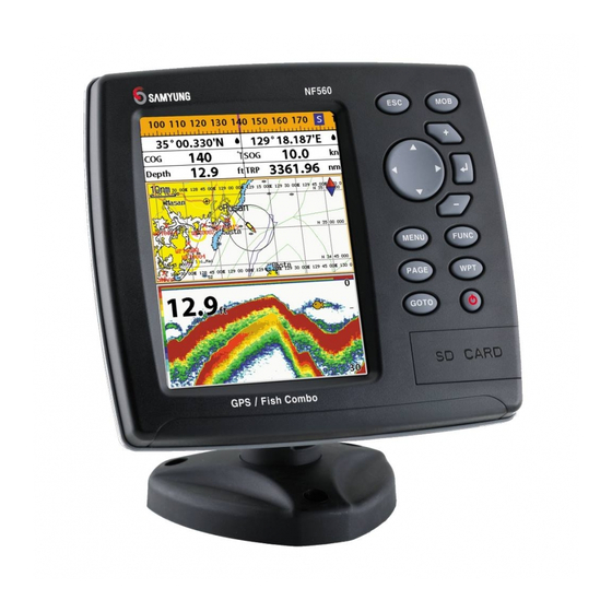
164 mm(H) x 183 mm(W) x 74 mm(D) Display 5.6” diagonal, TFT color, 480 x 640 pixels. Part Model Supply voltage 10 to 32 V DC Item List number N500 N560 NF560 Supply current 13.8 V 800mA min - no backlighting. Display Ο Ο Ο... -
Page 7: Getting Started
2 Getting Started 2-2 Keys 2-1 Mounting the Unit – Exit from menu and return to The chart plotter is supplied with bracket and flush mounting kit. You can choose a method of previous menu or window. In chart installation according to your preference. window, it places own ship at center. -
Page 8: Navionics Secure Digital (Sd) Card
Please 3 Select Chart then a chart you prefer. contact your nearest Tip: If you select None for all data fields, Samyung ENC office the data bar will disappear to save space for for purchasing the the chart. -
Page 9: Compass
2-7 Compass 2-8 Multi window displays The chart plotter computes compass direction To turn the compass off or on: The Chart plotter can display up to four and select Data bar. from the constellation of GPS satellites. For 1 Press windows at the same time. -
Page 10: Man Overboard (Mob)
2-9 Man overboard (MOB) The active window To distinguish an active window among windows, an orange border indicates the active During navigation, the “MOB” feature window. To change the active window to the next window, press and hold provides a one-touch method of storing a This might result in a location, such as point where a crew member sudden and dangerous turn. -
Page 11: General Operation
3 General Operation 3-3 The page window Press to show the page window and select a function icon you want to display. 3-1 Manual / Auto Power on and off Manual power on Manual power off Press and hold until the display shows Press and hold for 5 seconds. -
Page 12: Chart
3-4 Chart Highway Sonar Chart The Chart window mainly shows all relevant navigation data available on your preloaded maps, including buoys, lights, cables, depth soundings, marinas, and tide station in an overhead view. 3-4-1 Chart window To go to the Chart window: ①... -
Page 13: Latitude And Longitude
3-4-2 Latitude and longitude 3-4-5 S-Map search Latitude and longitude coordinates define a This function is available when NAVIONICS Info position on earth and can be displayed in SD card is inserted and NAVIONICS is data bar. Latitude: Angular distance North or South of selected. -
Page 14: Going To A Waypoint Or To A Point On The Chart
3-4-8 Going to a waypoint or to a point on the chart 3-4-11 Distance and bearing calculator A waypoint is a particular location on a voyage whether it is a starting, intermediate or The unit can show the bearing and the length Saving as a route destination point. -
Page 15: Sonar
3-5-3 Single and Dual frequency fish finding 3-5 Sonar Sonar frequencies The display is useful for comparing the same The unit has dual frequency, 200kHz and picture with two different frequencies. The NF560 proposes a sonar function when the unit is connected to an optional depth 50kHz to detect various bottom conditions. -
Page 16: Gain
[When the set depth is too low] [When the set depth is too high] 3-5-6 Sonar window display Five sonar display windows are available and Split A-Scope: Display Sonar history and each display window has unique echo strength (see section 3-5-11) characteristics. -
Page 17: Split Zoom And Full Screen Zoom
3-5-8 Split zoom and Full Screen zoom 3-5-10 Split 50/200 Split zoom Bottom lock The 50 kHz display appears on the left and Split zoom mode expands selected area of If Bottom lock is on, the zoom depth (the the 200 kHz appears on the right. This dual the single frequency by VRM(Variable Range depth of the zoom section) is adjusted frequency display is very useful for... -
Page 18: Highway
3-6 Highway 3-8 Waypoints The Highway window shows a 3D view of A waypoint is a particular location on a ① the vessel traveling through the water when voyage whether it is a starting, intermediate navigating to a destination point. or destination point. -
Page 19: Deleting A Waypoint
3-8-4 Deleting a waypoint 3-9 Routes To delete a waypoint from the chart Deleting a waypoint from the waypoints window window A trip from one place to another often 1 Move the cursor to the waypoint you want 1 Move cursor key to highlight a waypoint involves several course changes, requiring a to delete. -
Page 20: Managing A Route From The Route Window
3-9-2 Managing a route from the route window 3-10 Satellites Creating a rout from the route window Deleting a waypoint in the waypoint list 1 To go to the Route window, press 1 Highlight a waypoint you want to delete in the waypoint list. -
Page 21: Tides
⑥ Displaying a tide information from the chart window AIS functions require an optional AIS unit to be installed. Contact your nearest Samyung ENC 1 In the Chart window, press dealer for more details or visit at www.samyungenc.com. 2 Select Find and Tide station. -
Page 22: Dsc
3-13 DSC This feature requires connection to optional DSC VHF radio. [AIS Vessel Information -1] [AIS Vessel List] DSC window shows the distress and poll information received from other vessel through DSC VHF radio. To go to the DSC windows: 1 Press , select DSC icon. -
Page 23: Poll
3-13-2 Poll 3-14 NAVTEX Poll Deleting all poll and select Delete all. A compatible radio with the unit can request 1 Press Deleting a message NAVTEX is an international automated direct the position of other DSC VHF radio equipped printing service for delivery of navigational 1 Move the cursor to a message you want to vessels around its position. -
Page 24: Advanced Settings
4 Advanced Settings 4-2 Chart Settings To go to the chart settings: The system menu mainly consists of settings which do not require frequent adjustment. 1 Press and hold NAVIONICS To go to system menu, press and hold then select the icon you want. 2 Select the chart icon. - Page 25 Boundaries: Turns the displaying of chart Mark Attribute: Turns the displaying of 4-2-6 NMEA datum offset 4-2-7 Map shift boundaries on, off or auto mode which shows Mark Attribute on or off When you select other Map datum different Sometimes current position of own ship does the chart boundaries of the two charts below Sea Sector No: Turns the displaying of Sea from WGS84, latitude and longitude will be...
- Page 26 4-3 Sonar Settings 4-4 GPS Settings Sonar feature requires a connection to depth transducer. To go to the GPS settings: To go to the Sonar settings: 1 Press and hold 1 Press and hold 2 Select the GPS icon. 2 Select the Sonar icon. When the GPS device is connected properly, the GPS settings provide the access to GPS functions and features connected with the satellites information used for further navigation.
- Page 27 4-5 Track & Log Settings 4-6 Memory Settings To go to the tracking and long settings: To go to the memory settings: 1 Press and hold 1 Press and hold 2 Select the track & log icon. 2 Select the Memory icon. A user card is an option SD card which you need to purchase additionally.
- Page 28 4-7-1 Display filter There are a couple of methods to filter AIS vessel in this unit as below. 4-6-4 Format 4-6-5 Screen snap shot Filter by Type : The type of vessel which is Filter by speed : Vessels with speed below Erase all data in the user card.
- Page 29 4-9 Others 4-8 Alarms Press and then Others: Press and then Alarms: 4-9-1 Simulate Speed filter : Set this option when removing Simulate :Turn the simulate mode on or off. effects from waves and wind which affect the Mode : See 2-4 Simulate Mode. speed of boat by averaging.
- Page 30 Correct installation is important to the performance of the unit. It is vital to read the entire installation section of this manual and the documentation that comes with the antenna and any SPEED / TEMP. GND other units before starting installation. For further information, please contact Samyung ENC. SPEED / + SUPPLY TEMP.
- Page 31 Such a DGPS antenna has both a EGNOS DGPS corrections to any GPS GPS receiver and a beacon receiver, and it antenna. automatically applies the beacon correction to the GPS position. For more information, contact Samyung ENC. Installation and Operation Manual Installation and Operation Manual...
- Page 32 • The chart plotter can receive and display For information on sending NMEA data to the depth, paddlewheel boat speed and water instrument, contact Samyung ENC. temperature from an optional compatible instrument. During setup to send NMEA data to other •...
- Page 33 If you use Y-Cable, the chart plotter can provide more enhanced performance. display water temperature and water speed Contact Samyung ENC for more from the compatible devices and receive and information. display the depth from transducer.
- Page 34 Thank you for purchasing an SAMYUNG ENC product. This product has been thoroughly checked and is covered by the Samyung ENC’s warranty for defects in materials and workmanship under normal use from the date of purchase. This warranty provides for the free repair or replacement of defective parts from our Samyung ENC authorized dealer.
Need help?
Do you have a question about the N500 and is the answer not in the manual?
Questions and answers