Table of Contents
Advertisement
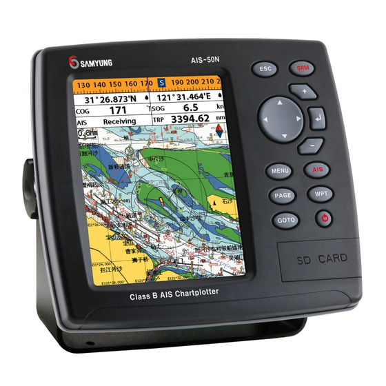
Quick Links
Advertisement
Table of Contents

Subscribe to Our Youtube Channel
Related Manuals for Samyung ENC AIS-50N


Summary of Contents for Samyung ENC AIS-50N
- Page 1 Installation and Operation Manual...
- Page 2 Installation: If installation is not correct, the unit can not perform at its designed potential. If in carefully. The following is the cleaning procedure. doubt, consult your Samyung ENC dealer. Ensure that any holes made are in a safe position and You use a tissue or lens tissue and a cleaning spray containing Isopropanol (a will not weaken the boat’s structure.
-
Page 3: Table Of Contents
4-7-7 Chart symbols and information ............30 1 Introduction 4-7-8 Introduction to navigating ..............30 4-7-9 Going to a waypoint or to a point on the chart ........31 1-1 Summary ................9 4-7-10 Following a route ................31 1-2 AIS Technology Summary ............9 4-7-11 Goto Key .................. - Page 4 5-2-3-2 General(S-MAP) ................47 5-9-6 Time ....................56 5-2-4-1 Land & Sea (NAVIONICS) ..............47 5-9-7 Restore default .................. 56 5-2-4-2 Land & Sea (S-MAP) ................ 47 5-9-8 Calendar ................... 56 5-2-5 Map datum ..................47 5-2-6 NMEA datum offset ................48 5-2-7 Map shift ...................
- Page 5 3min. Over speed 3 knots, in anchorage or moorage 10sec. AIS is a spearhead equipment to provide AIS-50N has high efficiency AIS Class B. It Under 14 knots in voyage 10sec. voyage information such as ship’s position, provides plotter functions, needed in voyage.
-
Page 6: Specification
1-3 Specification 1-4 Packing List [AIS-50N] GENERAL Item List Part number Category Detail Size 164 mm(H) x 183 mm(W) x 92.5 mm(D) Display AIS-50N-E 5.6” diagonal, TFT color, 480 x 640 pixels. Display Bracket N560-DB Supply voltage 10 to 34 V DC... -
Page 7: Getting Started
2 Getting Started 2-2 Keys – Exit from menu and return to 2-1 Mounting the Unit previous menu or window. In chart The chart plotter is supplied with bracket and flush mounting kit. You can choose a method of window, it places own ship at center. installation according to your preference. -
Page 8: Navionics Secure Digital (Sd) Card
NAVIONICS label. message is transmitted. 2 Open the door, gently push the SD card SRM function of AIS-50N is made to meet into the slot; push the SD card in as far as 62287-1 Message 14 standard of you hear click sound, then close door. -
Page 9: Ais Function Explanation
AIS is the system to discern vessel position & As the additional function of AIS-50N, this Opening screen is the vessel list of AIS-50N, which shows the distances & directions information. As the main function of AIS-50N, helps user to check easily, displaying other information from own vessel, utilizing received information from other vessels. -
Page 10: Own Vessel / Other Vessel Information
3-5-1 Message 3-4 Own vessel / other vessel information Receiving message Using own vessel / other vessel information, user can check the static Information, voyage You can check Safety Related Message, information, GNSS antenna information of own vessel or other vessels easily. Voyage Related Message, which AIS base Own vessel information station or other vessels transmit. -
Page 11: Initial Setup
2 Select the system setting icon. can be used. Please 3 Select Chart then a chart you prefer. contact your nearest Samyung ENC office 3-5-2 Initial setup for purchasing the Static information setup Antenna position setup NAVI01NICS ►... -
Page 12: Compass
Setting the data displayed in data bar [Large] 4-5 Multi window displays 1 Press and select Data bar. 2 Select Data bar then Data bar setup. The Chart plotter can display up to four 3 Move the cursor key to highlight the data windows at the same time. -
Page 13: The
The active window 4-6 The page window To distinguish an active window among windows, an orange border indicates the active window. To change the active window to the next window, press and hold Press to show the page window and select a function icon you want to display. Note 1 Some function icons require optional units and connected sensors. -
Page 14: Chart
4-7 Chart Highway Data Chart The Chart window mainly shows all relevant navigation data available on your preloaded maps, including buoys, lights, cables, depth soundings, marinas, and tide station in an overhead view. 4-7-1 Chart window To go to the Chart window: Data bar. -
Page 15: Latitude And Longitude
4-7-3 Latitude and longitude Latitude and longitude coordinates define a 4-7-6 S-Map search position on earth and can be displayed in Info This function is available when NAVI01NICS data bar. Latitude: Angular distance North or South of SD card is inserted and NAVI01NICS is In the data bar, own ship position is shown the equator measured by lines encircling the selected. -
Page 16: Going To A Waypoint Or To A Point On The Chart
4-7-9 Going to a waypoint or to a point on the chart 4-7-12 Distance and bearing calculator A waypoint is a particular location on a voyage whether it is a starting, intermediate or The unit can show the bearing and the length Saving as a route destination point. -
Page 17: Highway
4-8 Highway 4-10 Waypoints The Highway window shows a 3D view of A waypoint is a particular location on a the vessel traveling through the water when voyage whether it is a starting, intermediate ① navigating to a destination point. or destination point. -
Page 18: Deleting A Waypoint
4-10-4 Deleting a waypoint 4-11 Routes To delete a waypoint from the chart Deleting a waypoint from the waypoints window window A trip from one place to another often 1 Move the cursor to the waypoint you want 1 Move cursor key to highlight a waypoint involves several course changes, requiring a to delete. -
Page 19: Managing A Route From The Route Window
4-11-2 Managing a route from the route window 4-12 Satellites Creating a rout from the route window Deleting a waypoint in the waypoint list 1 To go to the Route window, press 1 Highlight a waypoint you want to delete in the waypoint list. -
Page 20: Tides
⑥ Displaying a tide information from the chart window AIS functions require an optional AIS unit to be installed. Contact your nearest Samyung ENC 1 In the Chart window, press dealer for more details or visit at www.samyungenc.com. 2 Select Find and Tide station. -
Page 21: Dsc
[AIS Vessel Information -1] [AIS Vessel List] 4-15 DSC This feature requires connection to optional DSC VHF radio. DSC window shows the distress and poll information received from other vessel through DSC VHF radio. To go to the DSC windows: 1 Press , select DSC icon. -
Page 22: Poll
4-15-2 Poll 4-16 NAVTEX Poll Deleting all poll A compatible radio with the unit can request 1 Press and select Delete all. NAVTEX is an international automated direct Deleting a message the position of other DSC VHF radio equipped printing service for delivery of navigational 1 Move the cursor to a message you want to vessels around its position. -
Page 23: System Configuration Settings
5-2 Chart Settings To go to the chart settings: The system menu mainly consists of settings which do not require frequent adjustment. 1 Press and hold NAVI01NIC To go to system menu, press and hold then select the icon you want. 2 Select the chart icon. - Page 24 Boundaries: Turns the displaying of chart Mark Attribute: Turns the displaying of Mark 5-2-6 NMEA datum offset 5-2-7 Map shift boundaries on, off or auto mode which shows Attribute on or off When you select other Map datum different Sometimes current position of own ship does the chart boundaries of the two charts below Sea Sector No: Turns the displaying of Sea from WGS84, latitude and longitude will be...
- Page 25 5-3 Communication setup 5-4 GPS Settings When this equipment is connected to marine communication equipments through compatible To go to the GPS settings: NMEA equipment, you can use this function. 1 Press and hold 2 Select the GPS icon. You can use as follows. long.
- Page 26 5-5 Track & Log Settings 5-6 Memory Settings To go to the tracking and long settings: To go to the memory settings: 1 Press and hold 1 Press and hold 2 Select the track & log icon. 2 Select the Memory icon. A user card is an option SD card which you need to purchase additionally.
- Page 27 Erase all data in the user card. Format the To take the snap shot of current screen, press Dangerous Vessel Alarm : When this Projected course : Set a time for projected user card before using it. twice. To save the captured image, press option is selected an alarm will activate.
- Page 28 5-8 Alarms 5-9 Others Press and then Alarms: Press and then Others: 5-9-1 Simulate 5-9-6 Time simulation: Start/end exercise mode. local time mode: Refer to exercise mode of 4-2. Change the sunrise & sunset time of chart in speed: Simulated boat speed order to read correct time, provided from GPS direction: Simulated course satellite.
- Page 29 • DSC VHF radio receive data from other instruments and send data to other instruments by NMEA. 6-2 Connections You can connect AIS-50N to power supply, GPS antenna, VHF antenna, automatic navigation device, digital device, etc. [Pin Number] VHF antenna(BNC) Power &...
- Page 30 6-3 Power/data cable 6-4 Alarm • Wire the chart plotter for any external alarm beepers or lights as below picture. • The output from the unit to external alarm is maximum 30V DC 200mA. It is needed to fit a Basic power •...
- Page 31 Such a DGPS antenna has both a EGNOS DGPS corrections to any GPS GPS receiver and a beacon receiver, and it antenna. automatically applies the beacon correction to the GPS position. For more information, contact Samyung ENC. Installation and Operation Manual Installation and Operation Manual...
- Page 32 • GPS antenna(NMEA 0183) NMEA 0183(1,2) ports work • Navtex individually. Please ask 6-8 NMEA 2000 Main functions of NMEA 0183 port in AIS-50N SAMYUNGENC for detailed are as follows. information. NMEA 2000 interface standard was If connected display unit, use the cable ►...
- Page 33 Thank you for purchasing an SAMYUNG ENC product. This product has been thoroughly checked and is covered by the Samyung ENC’s warranty for defects in materials and workmanship under normal use from the date of purchase. This warranty provides for the free repair or replacement of defective parts from our Samyung ENC authorized dealer.
- Page 34 Installation and Operation Manual Installation and Operation Manual...
Need help?
Do you have a question about the AIS-50N and is the answer not in the manual?
Questions and answers