Table of Contents
Advertisement
Advertisement
Table of Contents

Related Manuals for Garmin GPSMAP 79S


Summary of Contents for Garmin GPSMAP 79S
- Page 1 GPSMAP 79S/SC ® Owner’s Manual...
- Page 2 © 2021 Garmin Ltd. or its subsidiaries All rights reserved. Under the copyright laws, this manual may not be copied, in whole or in part, without the written consent of Garmin. Garmin reserves the right to change or improve its products and to make changes in the content of this manual without obligation to notify any person or organization of such changes or improvements. Go to www.garmin.com...
-
Page 3: Table Of Contents
Table of Contents Finding a Saved Waypoint....12 Editing a Waypoint......13 Deleting a Waypoint......13 Introduction........1 Changing the Photo for a Getting Started........1 Waypoint..........13 Device Overview........2 Increasing the Accuracy of a Waypoint Installing Batteries......3 Location.......... - Page 4 Device Information......30 Searching for a Geocache....22 Filtering the Geocache List....22 Product Updates........30 Saving a Custom Geocache Setting Up Garmin Express....30 Filter..........22 Getting More Information..... 31 Editing a Custom Geocache Attaching a Lanyard......31 Filter..........22 Device Care...........
-
Page 5: Introduction
Introduction WARNING See the Important Safety and Product Information guide in the product box for product warnings and other important information. Getting Started When using your device the first time, you should complete these tasks to set it up and get to know the basic features. -
Page 6: Device Overview
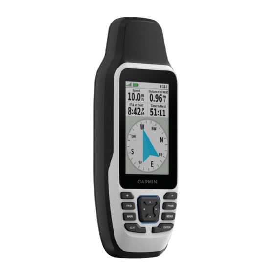
Device Overview GNSS antenna Power button Buttons Micro-USB port (under weather cap) Serial port (under weather cap) microSD card slot (under batteries) ® Battery compartment Mounting spine Battery cover D-ring Introduction... -
Page 7: Installing Batteries
Installing Batteries NOTICE To prevent damage, thoroughly wipe dry and air dry the device and battery compartment before installing the batteries or turning on the device. The handheld device operates using two AA batteries (not included). Use lithium batteries with 1.5 V nominal voltage for best results. -
Page 8: Connecting The Device To External Power
To prevent corrosion, thoroughly dry the USB port, the serial port, the weather cap, and the surrounding area before connecting to a computer or external cable. Before you can connect the device to external power using a USB cable, you must change the serial interface setting to Garmin Spanner (Serial Interface Settings, page 25). -
Page 9: Buttons
Buttons Press to open the search menu. FIND Hold to mark your current location as a man overboard (MOB) location and activate naviga tion. MARK Press to save your current location as a waypoint. Press to cancel or return to the previous menu or page. QUIT Press to scroll through the main pages. -
Page 10: Adjusting The Backlight
Adjusting the Backlight 1 Press to open the status page. 2 Use to adjust the brightness. TIP: You can select NV to reduce the backlight intensity for compatibility with night vision goggles. Acquiring Satellite Signals It may take 30 to 60 seconds to acquire satellite signals. 1 Go outdoors to an open area. -
Page 11: Measuring Distance On The Map
You can use additional maps with the device, such as BirdsEye satellite imagery, BlueChart ® g3, and City Navigator detailed maps. Detailed maps may contain additional points of interest, such as restaurants or ® marine services. For more information, go to buy.garmin.com or contact your Garmin dealer. Using the Main Pages... -
Page 12: Advanced Map Settings
Before you can calibrate the electronic compass, you must be outdoors, away from objects that influence magnetic fields, such as cars, buildings, or overhead power lines. The GPSMAP 79s/sc device has a 3-axis electronic compass. You should calibrate the compass after moving long distances, experiencing temperature changes, or changing the batteries. -
Page 13: Using The Course Pointer
Using the Course Pointer The course pointer is most useful when you are navigating to your destination in a straight line, such as when you are navigating on water. It can help you navigate back to the course line when you go off-course to avoid obstacles or hazards. -
Page 14: Projecting A Waypoint From Your Current Location
Projecting a Waypoint from Your Current Location You can save a new waypoint by projecting the distance from your current location. For example, if you would like to navigate to a location you observe on the other side of a river or stream, you can project a waypoint from your current location to the observed location, and then navigate to the new location after you cross the river or stream. -
Page 15: Trip Computer
Setting the North Reference You can set the directional reference used in calculating heading information. 1 Press PAGE to scroll to the compass page. 2 Press MENU. 3 Select Heading Setup > North Reference. 4 Select an option: • To set geographic north as the heading reference, select True. •... -
Page 16: Stopping Navigation
Stopping Navigation 1 Press FIND. 2 Select Stop Navigation. Finding a Location Near Another Location 1 Press FIND. 2 Press MENU. 3 Select Search Near, and select an option. 4 Select a location. Waypoints Waypoints are locations you record and store in the device. Waypoints can mark where you are, where you are going, or where you have been. -
Page 17: Editing A Waypoint
Editing a Waypoint 1 Press MENU twice to open the main menu. 2 Select Waypoint Manager. 3 Select a saved waypoint. 4 Select an item to edit, such as the name or location. 5 Enter the new information, and select Done. Deleting a Waypoint 1 Press MENU twice to open the main menu. -
Page 18: Projecting A Waypoint From A Saved Waypoint
Projecting a Waypoint from a Saved Waypoint You can save a new waypoint by projecting the distance and bearing from a saved waypoint to a new location. 1 Press MENU twice to open the main menu. 2 Select Waypoint Manager. 3 Select a waypoint. -
Page 19: Adding A Waypoint To A Route
Adding a Waypoint to a Route 1 Press MENU twice to open the main menu. 2 Select Waypoint Manager. 3 Select a waypoint. 4 Press MENU. 5 Select Add to Route. 6 Select a route. Repositioning a Waypoint to Your Current Location You can change the position of a waypoint. -
Page 20: Viewing The Active Route
Viewing the Active Route 1 Begin navigating a route (Navigating a Saved Route, page 15). 2 Press MENU twice to open the main menu. 3 Select Active Route. 4 Select a point in the route to view additional details. Editing a Route You can add, remove, or rearrange points on a route. -
Page 21: Recordings
Output Format: Sets the device to save the recording as a FIT or a GPX and FIT file (File Types, page 32). The FIT option records your activity with fitness information that is tailored for the Garmin Connect application ™... -
Page 22: Viewing The Current Activity
Viewing the Current Activity By default, the device automatically starts recording your path as an activity when it is turned on and has acquired satellite signals. You can pause and start recording manually. 1 Press MENU twice to open the main menu. 2 Select Recording Controls. -
Page 23: Stopping The Current Activity
Stopping the Current Activity 1 From the main pages, press ENTER. 2 Select Stop. 3 Select an option: • To resume recording, select Resume. • To save the activity, select TIP: You can view the saved activity by pressing MENU twice to view the main menu, and selecting Recorded Activities. -
Page 24: Reversing An Activity
Reversing an Activity You can switch the start and end points of your activity to navigate the activity in reverse. 1 Press MENU twice to open the main menu. 2 Select Recorded Activities. 3 Select an activity. 4 Press MENU. 5 Select Copy Reversed. -
Page 25: Main Menu Tools
Main Menu Tools Press MENU twice to open the main menu. Recording Controls: Allows you to view details about the current activity and control the current activity recording (Viewing the Current Activity, page 18). Waypoint Manager: Displays all waypoints saved to the device (Waypoints, page 12). -
Page 26: Searching For A Geocache
Searching for a Geocache You can search the geocaches loaded on your device. NOTE: You can download detailed information for a limited number of geocaches per day. You can purchase a premium subscription to download more. Go to www.geocaching.com for more information. 1 Press MENU twice to open the main menu. -
Page 27: Navigating To A Geocache
Navigating to a Geocache 1 Press MENU twice to open the main menu. 2 Select Geocaching. 3 Select a geocache. 4 Select Go. Using Hints and Clues to find a Geocache You can use hints or clues, such as a description or coordinates, to help you find a geocache. 1 While navigating to a geocache, select MENU >... -
Page 28: Selecting A Profile
Selecting a Profile When you change activities, you can change the setup of the device by changing the profile. 1 Press MENU twice to open the main menu. 2 Select Profile Change. 3 Select a profile. Calculating the Size of an Area 1 Press MENU twice to open the main menu. -
Page 29: System Settings
Garmin Spanner: Allows you to use the device USB port with most NMEA 0183-compliant mapping programs by creating a virtual serial port. Garmin Serial: Sets the device to use a Garmin proprietary format to exchange waypoint, route, and track data with a computer. -
Page 30: Turning On Battery Save Mode
Turning On Battery Save Mode You can use battery save mode to prolong the battery life. 1 Press MENU twice to open the main menu. 2 Select Setup > Display > Battery Save > On. In battery save mode, the screen shuts off when the backlight times out. You can press to turn on the screen. -
Page 31: Geocaching Settings
Geocaching Settings Press MENU twice to open the main menu. Select Setup > Geocaching. Geocache Style: Sets the device to display the geocache list using names or codes. Filter Setup: Allows you to create and save custom filters for geocaches (Saving a Custom Geocache Filter, page 22). -
Page 32: Changing The Page Sequence
Changing the Page Sequence 1 Press MENU twice to open the main menu. 2 Select Setup > Menus > Page Sequence > Edit Page Sequence. 3 Select a page. 4 Select an option: • To move the page up or down in the list, select Move. •... -
Page 33: Changing The Units Of Measure
Changing the Units of Measure 1 Press MENU twice to open the main menu. 2 Select Setup > Units. 3 Select an option: • To change the unit of measure for speed and distance, select Speed/Distance. • To change the unit of measure for vertical speed, select Vertical Speed. •... -
Page 34: Deleting A Profile
3 Select Restore Defaults. Device Information Product Updates On your computer, install Garmin Express ™ (www.garmin.com/express). This provides easy access to these services for Garmin devices: • Software updates • Map updates • Product registration Setting Up Garmin Express NOTICE To prevent corrosion, thoroughly dry the USB port, the serial port, the weather cap, and the surrounding area before connecting to a computer or external cable. -
Page 35: Getting More Information
• Go to support.garmin.com for additional manuals, articles, and software updates. • Go to buy.garmin.com, or contact your Garmin dealer for information about optional accessories and replacement parts. Attaching a Lanyard 1 Insert the loop of the lanyard through the slot in the device. -
Page 36: Data Management
(Downloading Geocaches Using a Computer, page 21). • JPEG photo files. • GPI custom POI files from the Garmin POI Loader. Go to www.garmin.com/products/poiloader. • FIT files for exporting to Garmin Connect. Installing a Memory Card in the GPSMAP 79s/sc Device WARNING Do not use a sharp object to remove user-replaceable batteries. -
Page 37: Transferring Files To Your Device
If you do not know the purpose of a file, do not delete it. Your device memory contains important system files that should not be deleted. 1 Open the Garmin drive or volume. 2 If necessary, open a folder or volume. -
Page 38: Specifications
1 Press MENU twice to open the main menu. 2 Select Setup. 3 Select About. The device withstands incidental exposure to water of up to 1 m for up to 30 min, and is protected against powerful jets of water. For more information, go to www.garmin.com/waterrating. Device Information... -
Page 39: Appendix
Appendix Data Fields Some data fields require you to be navigating to display data. Accuracy of GPS: The margin of error for your exact location. For example, your GPS location is accurate to within +/- 3.65 m (12 ft.). Activity Distance: The distance traveled for the current track or activity. Alarm Timer: The current time of the countdown timer. - Page 40 Last Lap Time: The stopwatch time for the last completed lap. Location (lat/lon): The current position in latitude and longitude, regardless of the selected position format setting. Location (selected): The current position using the selected position format setting. Location of Dest.: The position of your final destination. You must be navigating for this data to appear. None: This is a blank data field.
-
Page 41: Optional Accessories
Waypoint at Next: The next point on the route. You must be navigating for this data to appear. Optional Accessories Optional accessories, such as mounts, maps, fitness accessories, and replacement parts, are available at http://buy.garmin.com or from your Garmin dealer. Troubleshooting Maximizing Battery Life You can do several things to extend the life of the batteries. -
Page 42: Index
8, 10, 24–29 device 26 files, transferring 21, 32, 33 recording 17 sharing data 19 Sight N' Go 9 Garmin Connect, storing data 33 software, updating 30 Garmin Express 30 specifications 34 updating software 30 stopwatch 21 gauges, trip 6 storing data 32 geocaches 21–23, 32 sunrise and sunset times 21... - Page 44 October 2021 GUID-3B08322B-C8CA-4CA0-B113-48A7E387A983 v1...
Need help?
Do you have a question about the GPSMAP 79S and is the answer not in the manual?
Questions and answers