dji AGRAS T20 User Manual
Hide thumbs
Also See for AGRAS T20:
- Quick start manual (111 pages) ,
- User manual (34 pages) ,
- User manual (123 pages)
Table of Contents
Advertisement
Quick Links
Advertisement
Table of Contents

Subscribe to Our Youtube Channel
Related Manuals for dji AGRAS T20


Summary of Contents for dji AGRAS T20
- Page 1 AGRAS T20 User Manual v1.2 2020.11...
- Page 2 Searching for Keywords Search for keywords such as “battery” and “install” to find a topic. If you are using Adobe Acrobat Reader to read this document, press Ctrl+F on Windows or Command+F on Mac to begin a search. Navigating to a Topic View a complete list of topics in the table of contents.
-
Page 3: Information
4. User Manual Refer to the Agras T20 In the Box to check the listed parts and read the disclaimer and safety guidelines before flight. Refer to the quick start guide for more information on assembly and basic operation. Refer to the user manual for more comprehensive information. -
Page 4: Safety At A Glance
1. Pesticide Usage • Avoid the use of powder pesticides as much as possible as they may reduce the service life of the The Agras T20 aircraft is spraying system. not a toy and is not suitable for children under the age •... - Page 5 Otherwise, the aircraft may enter Failsafe RTH automatically due to remote controller signal loss. • Maintain full control of the aircraft at all times and do not rely on the DJI Agras app. The obstacle avoidance function is disabled in certain situations. Keep the aircraft within VLOS and pay close attention to its flight.
- Page 6 AGRAS T20 User Manual 30 m Fly in Open Areas Strong GNSS Signal VLOS Fly Below 30 m (98 ft) Avoid flying over or near crowds, high voltage power lines, or bodies of water. Strong electromagnetic sources such as power lines, base stations, and tall buildings may affect the onboard compass.
-
Page 7: Table Of Contents
Contents Information Using This Manual Legend Before Flight Downloading DJI Assistant 2 for MG Safety at a Glance Contents Product Profile Introduction Feature Highlights Preparing the Aircraft Preparing the Remote Controller Aircraft Overview Remote Controller Overview Aircraft Aircraft Profile Flight Modes... - Page 8 Discharging the Bubbles in the Hoses Calibrating the Compass Starting and Stopping the Motors Flight Test DJI Assistant 2 for MG Installation and Launching Using DJI Assistant 2 for MG Appendix Specifications Aircraft Status Indicators Description Updating the Firmware ©...
-
Page 9: Product Profile
, and supports Wi-Fi and Bluetooth functions. The remote controller is equipped with a 5.5-inch bright, dedicated screen that has the DJI Agras app built in, significantly improving smoothness and stability. When the RTK dongle is connected to the remote controller, users can plan operations to centimeter-level precision. -
Page 10: Preparing The Aircraft
Dongle, an RTK handheld mapping device, or by flying the aircraft to waypoints, according to the application scenarios. In scenarios with complicated terrain, use the Phantom 4 RTK and DJI Terra to plan 3D flight routes, and import the routes to DJI Agras for operation. -
Page 11: Preparing The Remote Controller
Before using the aircraft, make sure to mount the backup battery. Otherwise, the aircraft cannot take off. Mount and use the backup battery in strict accordance with the Agras T20 Backup Battery User Guide. - Page 12 AGRAS T20 User Manual Mounting the 4G Dongle and SIM Card Only use a DJI-approved dongle. The dongle supports various network standards. Use a SIM card that is compatible with the chosen mobile network provider, and select a mobile data plan according to the planned level of usage.
-
Page 13: Aircraft Overview
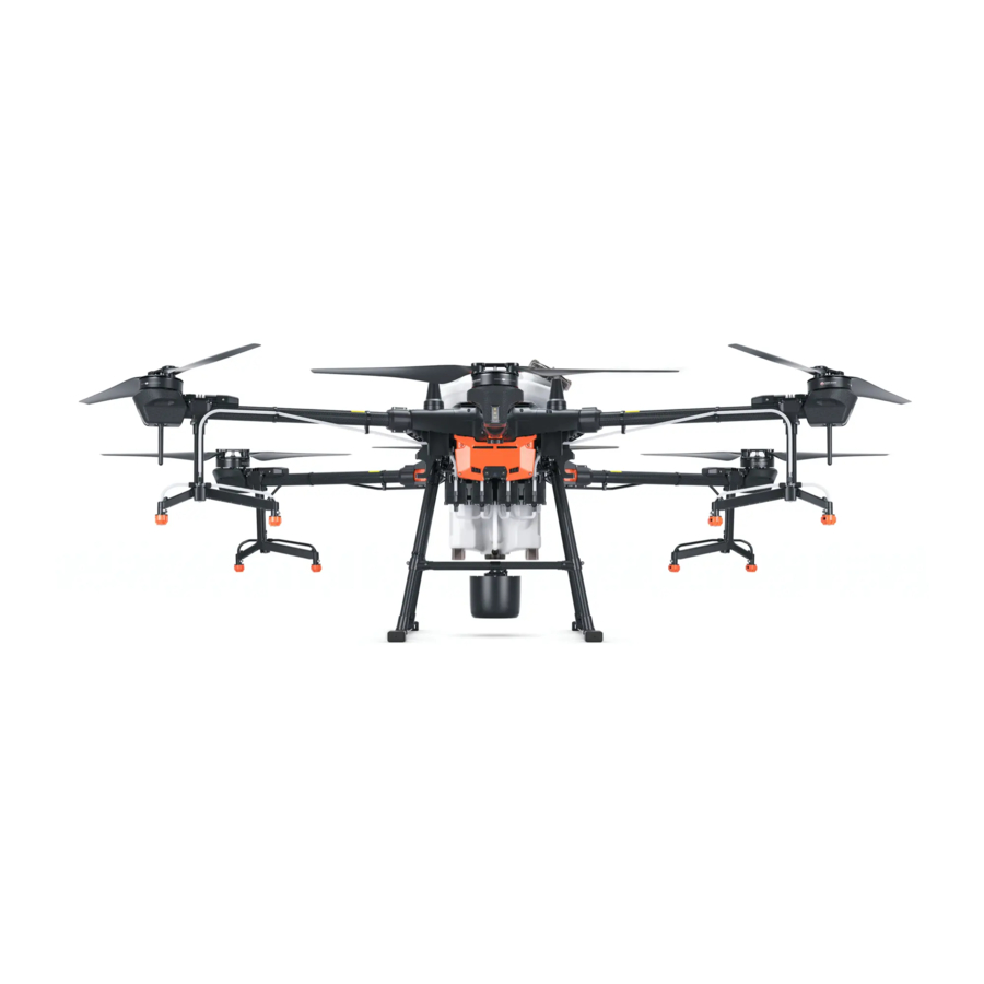
AGRAS T20 User Manual Aircraft Overview Aircraft Front Bottom View Right View Folded 1. Propellers 13. 4-Channel Electromagnetic Flow Meter 2. Motors 14. Delivery Pumps 3. ESCs 15. Omnidirectional Digital Radar 4. Frame Arms 16. Landing Gear 5. Aircraft Front Indicators (on the three 17. -
Page 14: Remote Controller Overview
AGRAS T20 User Manual Remote Controller Overview 17 18 1. Antennas 8. Battery Level LEDs Relays aircraft control and image transmission Displays current battery level of the internal signal. battery. 2. Back Button / Function Button 9. 5D Button (customizable) Press once to return to the previous page and 10. - Page 15 Dongle, or to connect to a computer to function of the button cannot be customized update firmware and obtain data stored in when planning a field. the remote controller via the DJI Assistant 2 When not planning a field, use the app to software. customize the button.
-
Page 16: Aircraft
After the operation area and obstacles have been measured and settings have been configured, DJI Agras uses a built-in intelligent operation planning system to produce a flight route based on the user’s input. Users can invoke an operation after planning a field. The aircraft will begin the operation automatically and follow the planned flight route. - Page 17 AGRAS T20 User Manual with an RTK dongle uses the RTK dongle connected to the remote controller to record measurements, while walking with a handheld RTK uses the D-RTK 2 mobile station to record measurements. Make sure that the aircraft is powered off when planning your flight route.
- Page 18 AGRAS T20 User Manual 1. Power on the remote controller and enter DJI Agras. Tap Plan a Field and select Walk with RC. 2. Wait until the GNSS signal is strong. The satellite count should be no less than 10. Positioning accuracy may vary by +/-2 meters.
- Page 19 1. Power on the remote controller. Place the aircraft at one of the previously set calibration points and power it on. 2. Go to the home screen in DJI Agras and tap Execute Operation to enter the Operation View. 3. Tap to select a field in Fields tag.
- Page 20 AGRAS T20 User Manual A-B Route Operation Mode In A-B Route operation mode, the aircraft travels along a pre-planned route. Operation resumption, data protection, altitude stabilization, obstacle avoidance, and auto obstacle circumvention functions of the radar module are available in this mode. Use the app to adjust the flying speed and spray amount. A-B Route operation mode is recommended for large, triangular, or rectangular spray areas.
- Page 21 AGRAS T20 User Manual Operation Procedure Maintain VLOS of the aircraft at all times. Make sure that the GNSS signal is strong. Otherwise, A-B Route operation mode may be unreliable. Make sure to inspect operating environments before flying. Set the operation mode switch button to M (Manual operation mode) when a strong GNSS signal is present and the onscreen display is Manual Route (GNSS) or Manual Route (RTK).
- Page 22 AGRAS T20 User Manual working conditions, the radar module starts working automatically and maintains the spraying distance between aircraft and vegetation after performing the operation. Refer to Omnidirectional Digital Radar (p. 23) for more information. The line spacing cannot be adjusted during operation. Switch to Manual operation mode to adjust the value, then return to A-B Route operation mode.
-
Page 23: Operation Resumption
AGRAS T20 User Manual aircraft and vegetation if the altitude stabilization function is enabled. Press the corresponding buttons onscreen or customizable buttons on the remote controller (if customized) to steer the aircraft left or right. The aircraft automatically sprays when accelerating forward, backward or diagonally, but does not spray when flying sideward. - Page 24 AGRAS T20 User Manual 3. Tap Resume at the lower right corner of the screen to continue the operation. To resume operation when the end button has been used to exit a Route operation, select the Executing tag in the operation list and then select the operation.
-
Page 25: System Data Protection
AGRAS T20 User Manual project point following a perpendicular line. The amount of selectable project points is related to the position of the aircraft. Select according to the app display. Make sure that the aircraft has completely avoided the obstacle before resuming operation. - Page 26 AGRAS T20 User Manual Detection Range The obstacle detection range of the radar module is 360° in the horizontal direction and ±15° in the vertical direction, as shown in the figure below, and the detection distance is 1.5 - 30 m. Note that the aircraft cannot sense obstacles that are not within the detection range.
- Page 27 10° at 1 m/s, 6° at 3 m/s, and 3° at 5 m/s. Maintain full control of the aircraft at all times and do not rely on the radar module and DJI Agras app. Keep the aircraft within VLOS at all times. Use your discretion to operate the aircraft manually to avoid obstacles.
-
Page 28: Empty Tank
If the radar module still does not work, contact DJI Support or a DJI authorized dealer. Keep the protective cover of the radar module clean. Clean the surface with a soft damp cloth and air dry before using again. - Page 29 Blinks green slowly Updating the Home Point You can update the home point in DJI Agras during flight. There are two ways to set a home point: 1. Set the current coordinates of the aircraft as the home point. 2. Set the current coordinates of the remote controller as the home point.
-
Page 30: Low Battery And Low Voltage Warnings
When there is a strong GNSS signal, the dual antennas activates automatically to measure the heading of the aircraft. The T20 supports centimeter-level positioning to improve agricultural operation when used with the DJI D-RTK 2 Mobile Station. Follow the instructions below to use the RTK functions. -
Page 31: Aircraft Leds
Make sure to disable the aircraft RTK positioning function if not in use. Otherwise, the aircraft is not able to take off when there is no differential data. Using with the DJI D-RTK 2 Mobile Station 1. Refer to the D-RTK 2 Mobile Station User Guide for more information about completing the linking between the aircraft and the mobile station and setting up the mobile station. -
Page 32: Remote Controller
The remote controller uses the DJI OcuSync 2.0 image transmission system, which has a maximum control distance of up to 1.86 mi (3 km). It includes a dedicated, Android-based display that runs DJI Agras independently for operation planning and aircraft status display. Its Multi-Aircraft Control mode (supported later) can be used to coordinate the operation of up to five aircraft at the same time to improve operation efficiency. - Page 33 AGRAS T20 User Manual The battery level LEDs on the remote controller indicates the status while charging. See the table below for details. LEDs Description Blink successively quickly The battery is being charged using a Quick Charge charger. Blink successively slowly The battery is being charged using a normal charger.
- Page 34 AGRAS T20 User Manual Operating the Aircraft This section explains how to control the orientation of the aircraft through the remote controller. Control can be set to Mode 1, Mode 2, or Mode 3. Mode 1 Left Stick Right Stick...
- Page 35 AGRAS T20 User Manual For example, the following description uses Mode 2: Remote Controller Aircraft ( Indicates nose Remarks (Mode 2) direction) Throttle Stick: Move the left stick vertically to control the elevation of the aircraft. Push up to ascend and push down to descend.
- Page 36 In Manual operation mode, press to start or stop spraying. 3. FPV / Map Switch Button In Operation View in DJI Agras, press to switch between FPV and the Map View. 4. Aircraft Control Switch Dial Turn the dial to switch among the aircraft when using Multi-Aircraft Control function.
- Page 37 Position P 位置P Regardless of the position the switch is in on the remote controller, the aircraft begins in P-mode by default. To switch flight modes, first go to Operation View in DJI Agras, tap , then , and enable “Enable Attitude Mode”.
- Page 38 AGRAS T20 User Manual Optimal Transmission Zone When the angle between the antennas and the back of the remote controller is 80° or 180°, the connection between the remote controller and aircraft can reach its optimal performance. 80° Try to keep the aircraft inside the optimal transmission zone. If the signal is weak, adjust the antennas or fly the aircraft closer.
-
Page 39: Remote Controller Leds
Power on the remote controller. Swipe down from the top of the screen, tap , then Notifications, and enable Do Not Disturb. After this, all the third-party notifications will be displayed in the notification bar only when the DJI Agras app is in use. Remote Controller LEDs Status LED Battery Level Indicators The battery level indicators display the battery level of the controller. -
Page 40: Remote Controller Warning Sounds
LED is solid green, this error may be related to the aircraft or flight status, and a warning will appear in DJI Agras. If this error is related to the remote controller, a warning will appear on the screen of the remote controller. -
Page 41: Dji Agras App
DJI Agras App DJI Agras is designed for agricultural applications. The app has a clear and concise interface and displays the status of the aircraft, spraying system, and other devices connected to the remote controller, and enables users to configure various settings. After planning a field via the intelligent operation planning system of the app, the aircraft can automatically follow the pre-planned flight route. -
Page 42: Operation View
AGRAS T20 User Manual 8. External Battery Level : The icon is displayed if an external battery is mounted. It shows the current battery level of the external battery. 9. Internal Battery Level : Shows the current battery level of the internal battery. - Page 43 AGRAS T20 User Manual : This icon is displayed when RTK is not in use. It shows the current GNSS signal strength and the number of satellites connected. 3. RTK Connection Status Icons displayed when using RTK data. The display varies when using the D-RTK 2 or Network RTK Service.
- Page 44 AGRAS T20 User Manual Obstacle Area: Shows the area value of the obstacles measured when planning fields for Route operations. Safety Margin Area: Shows the area of the safety margin zone if the safety margin is configured when planning fields for Route operations.
- Page 45 AGRAS T20 User Manual 18. Obstacle Radar Map During Route or A-B Route operations, the icon shows the nearby obstacles and planned flight route using the auto obstacle avoidance function, if obstacles are detected when auto obstacle avoidance is enabled.
-
Page 46: Flight
The tables below show the details of these limits. Max Radius Home Point Altitude of aircraft when powered on or the distance of the aircraft to the surface © 2020 DJI All Rights Reserved. - Page 47 If the aircraft loses GNSS signal and flies out of the max radius but regains GNSS signal later, it will fly back within range automatically. GEO Zones GEO zones are divided into different categories. All GEO zones are listed on the DJI official website at http://www.dji.com/flysafe. GEO zones are explained below (GNSS required): Depending on the local regulation, a certain radius around a marker forms a Restricted Zone, inside of which takeoff and flight are prohibited.
-
Page 48: Pre-Flight Checklist
AGRAS T20 User Manual With a strong GNSS signal Area Restriction Aircraft Status Indicators Restricted Motors will not start. Zone If the aircraft loses GNSS signal and enters a Blink Red Restricted Zone but regains GNSS signal later, the aircraft will enter semi-automatic descent and land. -
Page 49: Discharging The Bubbles In The Hoses
AGRAS T20 User Manual discharge the bubbles. Press the spray button to spray the bubbles and press the button again once all bubbles are discharged. 2. Flow Meter Calibration In the app, tap Execute Operation to enter Operation View. Tap... - Page 50 AGRAS T20 User Manual Calibrate the compass when prompted by the app. It is recommended to calibrate the compass with an empty tank 1. Tap , then , move the slider to the bottom, and select Advanced Settings, then IMU and Compass Calibration.
-
Page 51: Starting And Stopping The Motors
AGRAS T20 User Manual Starting and Stopping the Motors Starting the Motors The Combination Stick Command (CSC) listed below is used to start and stop the motors. Make sure you perform the CSC in one continuous motion. The motors begin to accelerate at an idle speed. -
Page 52: Flight Test
2. Pour liquid into the spray tank, and tighten the cover. Make sure that the four lines on the cover are aligned to the horizontal or vertical direction. 3. Power on the remote controller, make sure that DJI Agras is open, and then power on the aircraft. 4. Make sure that the aircraft is connected to the remote controller. -
Page 53: Dji Assistant 2 For Mg
Configure settings of the basic parameters, copy flight records, and update aircraft and remote controller firmware in DJI Assistant 2 for MG. Installation and Launching 1. Download the DJI Assistant 2 for MG installation file from the T20 download page: http://www.dji.com/t20/info#downloads 2. Install the software. -
Page 54: Appendix
300 μm (Subject to operating environment and spray rate) Flow Meter Measurement Range 0.25 - 20 L/min Error < ±2% Conductivity > 50 μS/cm (Liquids such as tap water or pesticides that contain Measurable Liquid water) © 2020 DJI All Rights Reserved. - Page 55 AGRAS T20 User Manual Omnidirectional Digital Radar Model RD2428R Operating Frequency CE / FCC / NCC: 24.05 - 24.25 GHz MIC / KCC: 24.05 - 24.25 GHz Transmitter Power (EIRP) MIC / KCC / CE / FCC / NCC: < 20 dBm...
- Page 56 AGRAS T20 User Manual Max Flying Speed 10 m/s (With a strong GNSS signal) Max Wind Resistance 8 m/s Max Service Ceiling Above Sea 2000 m Level Recommended Operating 0° to 40° C (32° to 104° F) Temperature Remte Controller...
- Page 57 AGRAS T20 User Manual Remote Controller Intelligent Battery Model WB37-4920mAh-7.6V Battery Type 2S LiPo Capacity 4920 mAh Voltage 7.6 V Energy 37.39 Wh Charging Temperature 5° to 40° C (40° to 104° F) Intelligent Battery Charging Hub Model WCH2 Input Voltage 17.3 - 26.2 V...
-
Page 58: Aircraft Status Indicators Description
Tap Install and wait for the update to complete. 7. After successfully completing the update, restart the remote controller and the aircraft manually. DJI Assistant 2 for MG can also be used to update the firmware. Refer to DJI Assistant 2 for MG (p. 51) for more information. - Page 59 DJI Support http://www.dji.com/support This content is subject to change without prior notice. Download the latest version from http://www.dji.com/t20 If you have any questions about this document, contact DJI by sending a message to DocSupport@dji.com. Copyright © 2020 DJI All Rights Reserved.
Need help?
Do you have a question about the AGRAS T20 and is the answer not in the manual?
Questions and answers