Honeywell Bendix/King KMD 550 Pilot's Manual Addendum
Multi-function display, flight information services fis, for software version 02/02 and later
Hide thumbs
Also See for Bendix/King KMD 550:
- Pilot's manual addendum (23 pages) ,
- Pilot's manual addendum (33 pages)

Related Manuals for Honeywell Bendix/King KMD 550


Summary of Contents for Honeywell Bendix/King KMD 550
- Page 1 KMD 550/850 Multi-Function Display Flight Information Services (FIS) Pilot’s Guide Addendum For Software Version 02/02 and later Revision 6 Feb/2009 006-18237-0000...
- Page 2 All rights reserved. Reproduction of this publication or any portion thereof by any means without the express written permission of Honeywell International Inc. is prohibited. For further information contact the Manager, Technical Publications; Honeywell, One Technology Center, 23500 West 105th Street, Olathe, Kansas 66061.
- Page 3 Revision History Manual KMD 550/850 Flight Information Services (FIS) Pilot’s Guide Addendum Revision 6, February 2009 Part Number 006-18237-0000 Summary Added XM products: Precipitation Type (at Surface) Freezing Levels Winds Aloft Translated Metars Temporary Flight Restrictions (TFR’s)
- Page 4 Revision History Manual KMD 550/850 Flight Information Services (FIS) Pilot’s Guide Addendum Revision 5, March 2007 Part Number 006-18237-0000 Summary Added XM Receiver functionality.
- Page 5 Revision History Manual KMD 550/850 Flight Information Services (FIS) Pilot’s Guide Addendum Revision 4, November 2004 Part Number 006-18237-0000 Summary Add FIS Area Products (AIRMETs, SIGMETs, Convective SIGMETs and Alert Weather Watches). MODE Softkey now displays product selection menu on FIS product displays Control Knob now allows cycling through graphical FIS products Airport icons and identifiers are now displayed on FIS graphical prod-...
- Page 6 Revision History Manual KMD 550/850 Flight Information Services (FIS) Pilot’s Guide Addendum Revision 3, June 2004 Part Number 006-18237-0000 Summary METARs and SPECIs now expire after 120 minutes Graphical METAR LIFR now displayed as magenta color Miscellaneous corrections...
- Page 7 Revision History Manual KMD 550/850 Flight Information Services (FIS) Pilot’s Guide Addendum Revision 2, November 2002 Part Number 006-18237-0000 Summary Added FIS subscription management Changed FIS Text Page format Changed FIS METARs time-out Airports now shown on NEXRAD Page Changed FIS Network Page Miscellaneous corrections...
- Page 8 Revision History Manual KMD 550/850 Flight Information Services (FIS) Pilot’s Guide Addendum Revision 1, May 2002 Part Number 006-18237-0000 Summary Complete manual revision...
- Page 9 Revision History Manual KMD 550/850 Flight Information Services (FIS) Pilot’s Guide Addendum Revision 0, November 2001 Part Number 006-18237-0000 Summary This is the original release of this publication.
-
Page 10: Table Of Contents
Table of Contents INTRODUCTION ..........1 CONCEPT OF OPERATION . - Page 11 Table of Contents NORMAL OPERATION ......... .34 NEXRAD PAGE .
- Page 12 Table of Contents MESSAGES ..........79 FIS ALERT, NO VALID FIS SUBSCRIPTIONS .
- Page 13 Table of Contents Intentionally left blank Revision 6 Feb/2009 KMD 550/850 FIS Addendum...
-
Page 14: Introduction
Introduction INTRODUCTION CONCEPT OF OPERATION The Flight Information Services (FIS) system supplies real-time weather information and other flight advisory information to pilots to enhance situ- ation awareness. FIS or XM weather is not intended to replace voice radio services. Voice communication of weather and meteorological information, in accor- dance with FAA operating rules, is still required. - Page 15 Introduction See our website at www.bendixking.com for VDL network status and coverage. Continuous coverage of most of the continental US is possible at altitudes as low as 5,000 ft. AGL, except for regions of precipitous ter- rain. As with all VHF communications, the line-of-sight range increases with altitude.
- Page 16 Introduction XM WX uses one-way (satellite network to air) broadcast protocol. Data is continually broadcast without the need to request information, nor acknowledge receipt. Both basic (no-cost) and value added fee-based products are transmitted by VDL. Basic VDL products are displayed using standard ICAO/WMO textual format.
-
Page 17: Equipment Overview
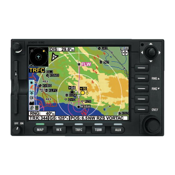
550/850 display and discusses the proper use of the displayed data for strategic weather planning. The detailed description of the general oper- ation of the KMD 550/850 is contained in the KMD 550/850 Pilot’s Guide. The Bendix/King KMD 550/850 is shown below with the Text METAR Page selected. CAUTION... -
Page 18: Datalink Weather Function Status Icons
Basic Service Weather Products DATALINK WEATHER FUNCTION STATUS ICONS The Datalink Weather Function Status Icons are located in the lower left of the display. They are used to indicate whether or not the KMD 550/850 is currently receiving and/or displaying weather information. The following table shows the various icons and their meanings. -
Page 19: Basic Service Weather Products
Basic Service Weather Products VDL Icon XM Icon Colors Description No TFR Icon TFR data is not being received. present. Black on gray. TFR data is being received but is not cur- rently being displayed. TFR data is being received and displayed. Black on cyan. -
Page 20: Speci
Basic Service Weather Products 2. ICAO station identifier 3. Date and time of issue 4. Modifier (AUTO if automated report or COR if corrected observation) 5. Wind 6. Visibility 7. Runway visual range (as required) 8. Weather phenomena 9. Sky condition 10. -
Page 21: Taf
Basic Service Weather Products Refer to the section on METARs for an explanation of the elements. The element sequence and content will be the same as those in a METAR report with the exception of the first element denoting report type. “SPECI”... -
Page 22: Pirep (Vdl Only)
Basic Service Weather Products PIREP (VDL ONLY) A PIREP (Pilot Weather Report) is an observation of conditions at a spe- cific location or along a specific route. These conditions are reported by pilots when communications are established with ground facilities such EFAS, AFSS/FSS, ARTCC or ATC. -
Page 23: Sigmet
Basic Service Weather Products 3. Date and time issued 4. Report designation and reason for issuance 5. Validity period 6. Area of coverage 7. Weather phenomenon details. These reports are displayed in an encoded textual format. NOTE: AIRMETs may be issued up to 15 minutes prior to the start of the validity period. -
Page 24: Convective Sigmet
Basic Service Weather Products When an SIGMET is cancelled, neither the original report nor the cance- lation message can be displayed. See Appendix A for instructions on decoding textual SIGMETs. CONVECTIVE SIGMET A Convective SIGMET (Convective Significant Meteorological Information) is an advisory of convective weather that the forecaster believes haz- ardous to all aircraft. -
Page 25: Value Added Service Weather Products
Value Added Service Weather Products VALUE ADDED SERVICE WEATHER PRODUCTS The following is a discussion of weather products offered with the value added VDL subscription service. Accessing and navigating these ser- vices will be discussed in detail later in this addendum. All basic and value-added products (except those identified as VDL Only) can also be obtained through a single fee-based XM subscription service. -
Page 26: Nexrad Abnormalities
Value Added Service Weather Products The display range may be changed to zoom in on a specific area to get a more detailed weather picture, or zoom out to display a wider range. NEXRAD ABNORMALITIES The following is a list of NEXRAD abnormalities that may be experi- enced: 1. -
Page 27: Nexrad Limitations
Value Added Service Weather Products 10. Echoes from migrating birds, bats, and insects will be displayed as circular patterns of level 1 reflectivity centered near NEXRAD sites. 11. Significant variation in humidity with altitude can cause reflections from the Earth's surface. These reflections are also displayed as large circular or oval areas of uniform low intensity. -
Page 28: Intensity
Value Added Service Weather Products The resolution of NEXRAD XM data is 2 km. Thus, when zoomed in on the display, each square block is 2 km on a side. The intensity level reflected by the square will be the highest level sampled within the 2 km area. -
Page 29: Precipitation Type At Surface
Value Added Service Weather Products PRECIPITATION TYPE (AT SURFACE) (XM ONLY) The Precipitation Type (At Surface) product is decoded the same as the NEXRAD information is. It is displayed as shown in Figure 4. Moving the joy stick in any direction displays the MORE INFO soft key on the right Figure 4... -
Page 30: Freezing Levels
Value Added Service Weather Products Pressing and holding the OVERLAY key will display the FIS Overlays window. This window displays the status of the overlays that available Precipitation Type screen as shown in Figure 8. The window will no longer be dis- played when the overlay key is released. - Page 31 Value Added Service Weather Products Moving the Joy stick will cause the MORE INFO and RESET STICK soft keys to be displayed on the right. Pressing the MORE INFO soft key will display the full Freezing Levels Legend. This includes the range of each level.
-
Page 32: Winds Aloft
Value Added Service Weather Products Pressing and holding the OVERLAY key will display the FIS Overlays window. This window displays the status of the overlays of the Freezing Levels screen as shown in Figure 13. The window will no longer be dis- played when the overlay key is released. - Page 33 Value Added Service Weather Products This condition will always be true in the Rocky mountain area at 3000ft and below. When there is not any wind data available for the selected Flight Level the message “WINDS ALOFT DATA AT THIS FLIGHT LEVEL NOT AVAILABLE DATA NOT RECEIVED”...
- Page 34 Value Added Service Weather Products Pressing the MORE INFO key displays the Winds Aloft Legend as shown in Figure 19. Moving the joy Stick or after 30 seconds the display returns to the previous Winds Aloft selection. Figure 19 Revision 6 Feb/2009 KMD 550/850 FIS Addendum...
-
Page 35: Graphical Metar
Value Added Service Weather Products GRAPHICAL METAR The graphical METAR is derived from the most cur- rently received textual METAR or SPECI data from reporting sites. This is dis- played on a map back- ground to enhance situa- tional awareness as shown on Figure 20. -
Page 36: Graphical Airmet
Value Added Service Weather Products GRAPHICAL AIRMET The graphical AIRMET is derived from the location description (if provided) in the textual AIRMET and dis- played as a boundary box with the appropriate color for the condition as shown in the legend (for a description, see AIRMETs in the Basic Weather Services section). -
Page 37: Graphical Convective Sigmet
Value Added Service Weather Products GRAPHICAL CONVECTIVE SIGMET The graphical Convective SIGMET is derived from the location description in the textual Convective SIGMET and displayed as a yellow boundary box (for a descrip- tion, see CONVECTIVE SIGMETs in the Basic Weather Services section). -
Page 38: Startup
Startup STARTUP If a display such as Figure 26 is seen at startup, per- form the steps in Setting Up a FIS Subscription. Figure 27 is displayed at the end of the startup process on the KMD 550/850 if a FIS system is installed. - Page 39 FIS Subscriptions NOTE: Although the basic textual products are free of charge, they still require a subscription to receive the service as well as a current data card. To accommodate users with varying service needs (for example, during different flying seasons over the course of a year), the display unit allows storage for up to four individual subscriptions, in much the same way that a computer can support multiple user accounts with different passwords.
-
Page 40: Setting Up A Vdl Subscription
FIS Subscriptions Enter Display ID during Go to Bendixking.com Get Display ID registration or call 1-800-247-0230 from unit in airplane (This is only required first to subscribe to FIS Services time you subscribe) Take printed out code(s) Receive Subscription Select the desired to the airplane and enter Code(s) and print them services... - Page 41 FIS Subscriptions 3. Press the FIS softkey to display the FIS Setup Cover Page as shown in Figure 30. 4. Press the FIS SUBSCR softkey to display Figure 31. On initial subscription setup the subscription window will show only blank spaces as shown in Figure 31, unless services were pre-provi- sioned at the factory.
- Page 42 FIS Subscriptions 6. The inner Control Knob selects the alphanumeric character and the outer Control Knob selects the character position. Turn the inner Control Knob until the first character Subscription Code is dis- played in first space. Turn the outer Control Knob clock- wise to move to the next space to the right.
-
Page 43: Checking Fis Vdl Subscriptions
FIS Subscriptions 8. After the subscription has been accepted, Figure 36 will be displayed showing the subscription validity period and status. If the subscription has been entered prior to the beginning of subscription ser- vice, the entered subscription will begin when subscription services are turned on. -
Page 44: Xm Wx Subscriptions
FIS Subscriptions XM WX SUBSCRIPTIONS An XM subscription must be set up to receive XM WX services. This process involves accessing the XM Radio website and a toll-free phone call to XM Radio. SETTING UP AN XM WX SUBSCRIPTION NOTE: The following details require selection of an XM receiver (such as a KDR-610 ) as the source for datalink weather data. -
Page 45: Checking Xm Wx Subscriptions
FIS Subscriptions should remain in view of the satellites during the subscription process. 5. Verify the activation of the receiver and the subscription validity by selecting and viewing the “FIS Subscription Status Page” on the KMD screen. If for any reason the receiver was not exposed to the XM signal within the initial 24 hour broadcast period, or is not successfully authorized for some other reason, a subsequent 15 minute resend of the subscription information can be obtained. - Page 46 FIS Subscriptions The following table lists the XM Radio assignment of App IDs for weather products. Assignments within the broadcast data stream may change and the most current assignments may not be reflected below. Contact XM concerning App ID information if the powered receiver has been in view of the satellites for 10 minutes or more and the correct products are not received.
-
Page 47: Normal Operation
Normal Operation NORMAL OPERATION To display the FIS pages, press the WX Function Select Key. Each press will cycle through Weather Radar (KMD 850 only), Stormscope® (if installed), FIS Graphics Page (Graphical METAR, NEXRAD, AIRMETs, SIGMETs, Convective SIGMETs and Alert Weather Watches (VDL Only) depending on what was last selected) and FIS Text Page. -
Page 48: Nexrad Page
Normal Operation When the Control Knob Icon is dis- played in the MODE field at the top of the display, as shown here, either the inner or outer Control Knob may be used to select and cycle through the available graphical weather products without having to use the SELECT FIS PRODUCT... -
Page 49: Nexrad Page Operational Controls
Normal Operation NEXRAD PAGE OPERATIONAL CONTROLS CAUTION: NEXRAD data must only be used for strategic planning purposes. Due to inherent delays and relative age of the data that can be experienced, NEXRAD data cannot be used for tactical avoidance of weather. MODE - Displays the Select FIS Product Menu. - Page 50 Normal Operation NOTE: If a message such as that shown in Figure 41 is displayed, it may be that the system has not had time to acquire a signal or has acquired a signal and not yet received all the data for a NEXRAD image.
- Page 51 Normal Operation Pressing the MORE INFO softkey will display the VDL NEXRAD LEGEND (Figure 43a) or the XM NEXRAD LEGEND (Figure 43b). To clear the legend from the dis- play, move the joystick. The XM legend reflects the lower limit of 10 dBz for light precip- itation.
- Page 52 Normal Operation Press the SAVE & EXIT softkey to retain the selec- tions on the display (see Figure 46). If the severe weather storm track (SCIT) overlay is active the SCIT icon will be dis- played in the legend on the left side of the screen.
-
Page 53: Precipitation Type At Surface
Normal Operation PRECIPITATION TYPE PAGE 1 Range Scale - Indicates selected range. 2 Available Functions - Displays icons representing data available (black) and displayed (color). 3 Age Status Bar - Indicates percentage of age versus elapsed time before expiration. The bar will be green the first 50% then turn yellow. 4 North Pointer - Indicates north. -
Page 54: Precipitation Type Page Operational Controls
Normal Operation PRECIPITATION TYPE PAGE OPERATIONAL CONTROLS MODE - Displays the Select FIS Product Menu. Joystick - Moving the joystick allows panning of the map and placement of the pointer over the desired PRECIPITATION TYPE icon to be viewed. RNG▲ ▲ / / RNG▼ ▼ - Displays ZOOMING TO ### nm and advances the indicator to the next range. -
Page 55: Freezing Levels
Normal Operation FREEZING LEVELS PAGE 1 Range Scale - Indicates selected range. 2 Available Functions - Displays icons representing data available (black) and displayed (color). 3 Age Status Bar - Indicates percentage of age versus elapsed time before expiration. The bar will be green the first 50% then turn yellow. 4 North Pointer - Indicates north. -
Page 56: Freezing Levels Page Operational Controls
Normal Operation FREEZING LEVELS PAGE OPERATIONAL CONTROLS MODE - Displays the Select FIS Product Menu. Joystick - Moving the joystick allows panning of the map and placement of the pointer over the desired FREEZING LEVELS icon to be viewed. RNG▲ ▲ / / RNG▼ ▼ - Displays ZOOMING TO ### nm and advances the indicator to the next range. -
Page 57: Winds Aloft
Normal Operation WINDS ALOFT PAGE 1 Range Scale - Indicates selected range. 2 Available Functions - Displays icons representing data available (black) and displayed (color). 3 Age Status Bar - Indicates percentage of age versus elapsed time before expiration. The bar will be green the first 50% then turn yellow. 4 North Pointer - Indicates north. -
Page 58: Winds Aloft Page Operational Controls
Normal Operation WINDS ALOFT PAGE OPERATIONAL CONTROLS MODE - Displays the Select FIS Product Menu. Joystick - Moving the joystick allows panning of the map and placement of the pointer over the desired WINDS ALOFT icon to be viewed. RNG▲ ▲ / / RNG▼ ▼ - Displays ZOOMING TO ### nm and advances the indicator to the next range. -
Page 59: Graphical Metars Page
Normal Operation GRAPHICAL METARS PAGE The following illustration describes the Graphical METARs display. The only difference between VDL and XM is the Datalink Wx Status icon. 1 Range Scale - Indicates selected range. 2 Available Functions - Displays icons representing data available (black) and displayed (color). -
Page 60: Graphical Metars Page Operational Controls
Normal Operation GRAPHICAL METARS PAGE OPERATIONAL CONTROLS MODE - Displays the Select FIS Product Menu. Joystick - Moving the joystick allows panning of the map and placement of the pointer over the desired METAR icon to be viewed. RNG▲ ▲ / / RNG▼ ▼ - Displays ZOOMING TO ### nm and advances the indicator to the next range. - Page 61 Normal Operation 2. Press the RNG▲ ▲ / / RNG▼ ▼ Key to zoom in on the dis- play. The map is centered on the present position indicated by the symbolic aircraft. 3. To view specific METAR, move the joystick in the desired direction.
- Page 62 Normal Operation 8. To view the graphical METAR LEGEND, move the joystick pointer to an area with no icons and press the MORE INFO softkey. The legend will be displayed as in Figure 53. Move the joystick to remove the legend from the display.
-
Page 63: Graphical Airmets Page
Normal Operation GRAPHICAL AIRMETS PAGE The following illustration describes the Graphical AIRMETs display. The only difference between VDL and XM is the Datalink Wx Status icon. 1 Range Scale - Indicates selected range. 2 Available Functions - Displays icons representing data available (black) and displayed (color). -
Page 64: Graphical Airmets Page Operational Controls
Normal Operation GRAPHICAL AIRMETS PAGE OPERATIONAL CONTROLS MODE - Displays the Select FIS Product Menu. Joystick - Moving the joystick allows panning of the map and placement of the pointer over the desired AIRMET to be viewed. RNG▲ ▲ / / RNG▼ ▼ - Displays ZOOMING TO ### nm and advances the indicator to the next range. - Page 65 Normal Operation 3. To view specific AIRMET, move the joystick in the desired direction and place the pointer on the desired AIRMET border (see Figure 57). A box will pop up containing the AIRMET des- ignator, TYPE and the AGE of the report.
- Page 66 Normal Operation 9. Press the OVLY Key to overlay flightplan and/or Stormscope® data on the Graphical AIRMET map (see Figure 60). If a Stormscope® system is not installed, the STORMSCOPE Softkey will not be displayed. The FLIGHT PLAN softkey toggles the overlay on or off Figure STORMSCOPE Softkey will Figure 60...
-
Page 67: Graphical Sigmets Page
Normal Operation GRAPHICAL SIGMETS PAGE The following illustration describes the Graphical SIGMETs display. The only difference between VDL and XM is the Datalink Wx Status icon. 1 Range Scale - Indicates selected range. 2 Available Functions - Displays icons representing data available (black) and displayed (color). -
Page 68: Selecting And Using The Graphical Sigmets Page
Normal Operation GRAPHICAL SIGMETS PAGE OPERATIONAL CONTROLS MODE - Displays the Select FIS Product Menu. Joystick - Moving the joystick allows panning of the map and placement of the pointer over the desired SIGMET to be viewed. RNG▲ ▲ / / RNG▼ ▼ - Displays ZOOMING TO ### nm and advances the indicator to the next range. - Page 69 Normal Operation 2. Press the RNG▲ ▲ / / RNG▼ ▼ Key to zoom in on the dis- play. The map is centered on the present position indicated by the symbolic aircraft. 3. To view specific SIGMET, move the joystick in the desired direction and place the pointer on the desired SIGMET border (see...
- Page 70 Normal Operation 9. Press the OVLY Key to overlay flightplan and/or Stormscope® data on the Graphical SIGMET map (see Figure 66). If a Stormscope® system is not installed, the STORMSCOPE Softkey will not be displayed. The FLIGHT PLAN softkey toggles the overlay on or off Figure STORMSCOPE Softkey will Figure 66...
-
Page 71: Graphical Convective Sigmets Page
Normal Operation GRAPHICAL CONVECTIVE SIGMETS PAGE The following illustration describes the Graphical Convective SIGMETs display. The only difference between VDL and XM is the Datalink Wx Status icon. 1 Range Scale - Indicates selected range. 2 Available Functions - Displays icons representing data available (black) and displayed (color). -
Page 72: Graphical Convective Sigmets Page Operational Controls
Normal Operation GRAPHICAL CONVECTIVE SIGMETS PAGE OPERATIONAL CONTROLS MODE - Displays the Select FIS Product Menu. Joystick - Moving the joystick allows panning of the map and placement of the pointer over the desired Convective SIGMET to be viewed. RNG▲ ▲ / / RNG▼ ▼ - Displays ZOOMING TO ### nm and advances the indicator to the next range. - Page 73 Normal Operation 3. To view specific Convective SIGMET, move the joystick in the desired direction and place the pointer on the desired Convective SIGMET border (see Figure 69). A box will pop up containing the Convective SIGMET desig- nator, TYPE and the AGE of the report.
- Page 74 Normal Operation 9. Press the OVLY Key to overlay flightplan and/or Stormscope® data on the Graphical Convective SIGMET map (see Figure 72). If a Stormscope® system is not installed, the STORMSCOPE Softkey will not be displayed. The FLIGHT PLAN softkey toggles the overlay on or off Figure Figure 72...
-
Page 75: Graphical Alert Weather Watches Page (Aww)
Normal Operation GRAPHICAL ALERT WEATHER WATCHES PAGE (AWW) (VDL ONLY) The following illustration describes the Graphical Alert Weather Watches (AWW) display. 1 Range Scale - Indicates selected range. 2 Available Functions - Displays icons representing data available (black) and displayed (color). 3 North Pointer - Indicates north. -
Page 76: Graphical Alert Weather Watches Page Operational Controls
Normal Operation GRAPHICAL ALERT WEATHER WATCHES PAGE OPERATIONAL CONTROLS MODE - Displays the Select FIS Product Menu. Joystick - Moving the joystick allows panning of the map and placement of the pointer over the desired Weather Watch to be viewed. RNG▲... - Page 77 Normal Operation 3. To view a specific Alert Weather Watch, move the joystick in the desired direc- tion and place the pointer on the desired Weather Watch border (see Figure 75). A box will pop up containing the Weather Watch designator, TYPE and the AGE of the report.
- Page 78 Normal Operation 9. Press the OVLY Key to overlay flightplan and/or Stormscope® data on the Graphical Alert Weather Watch map (see Figure 78). If a Stormscope® system is not installed, the STORM- SCOPE Softkey will not be displayed. The FLIGHT PLAN softkey toggles the overlay on or off Figure Figure 78...
-
Page 79: Fis Text Page
Normal Operation FIS TEXT PAGE Press the WX Function Select Key until the FIS Text Page is displayed. The following illustration describes the FIS Text Page display. The only difference between VDL and XM is the Datalink Wx Status icon. 1 Text Field - The translated METARS data is displayed first in this window followed by the encoded weather report is displayed in this field. -
Page 80: Fis Text Page Operational Controls
Normal Operation FIS TEXT PAGE OPERATIONAL CONTROLS MODE - Displays the Select FIS Product Menu. Joystick - Moving the joystick right or left moves the cursor through the available reports. CHANGE AREA - Pressing the CHANGE AREA softkey will cycle through the four options available for the AREA field in the upper right of the display. -
Page 81: Using The Fis Text Page
Normal Operation USING THE FIS TEXT PAGE Press the WX Function Select Key until the FIS Text Page is displayed as shown in Figure 80. NOTE: If a message such as that shown in Figure 81 (METARs or other weather product) is displayed, it may be that the system has not had time to acquire a signal. -
Page 82: Changing Modes & Area
Normal Operation CHANGING MODES & AREA 1. Press the MODE Key to display the SELECT FIS PRODUCT Menu as shown in Figure 83. Use the Joystick or the Control Knobs to select the desired textual product. The type of report selected is then displayed in the MODE field at the top of the display. -
Page 83: Selecting Identifiers Using The Data/Scan Knob
Normal Operation 2. Press the CHANGE AREA softkey to view reports for either NEAREST to present position, USER DEFINED location, DESTINA- TION (last waypoint in a flightplan) or FPLN WPT (any waypoint in an active flightplan). The softkey cycles through the AREAs as shown in Figure 85. - Page 84 Normal Operation 1. The cursor will be over the first character of the way- point identifier. Select the desired character by turning the inner knob. The screen will change to that shown in Figure 88. 2. Turn the outer knob one click clockwise to move the cursor to the next character field as shown in Figure 89.
-
Page 85: Finding User Defined Areas By Name Or City
Normal Operation 5. Press the OK softkey when finished making selec- tions. The display will be as shown in Figure 91. 6. Move the joystick right or left to view available reports. NOTE: Available reports highlighted in yellow, like KMCW in Figure 91, indi- cates the report is a special report, urgent report or an amended or corrected report. - Page 86 Normal Operation 2. Continue to turn the outer knob clockwise to highlight the N as shown in Figure 94. 3. Turn the inner knob coun- terclockwise until an E is selected as shown in Figure 4. Turn the outer knob clock- wise until the cursor is posi- tioned for the next character.
- Page 87 Normal Operation 5. Turn the outer knob clock- wise until the cursor is posi- tioned for the next character entry. Turn the inner knob to select a G as in Figure 97. 6. Turn the outer knob clock- wise until the cursor is posi- tioned for the next desired character entry.
- Page 88 Normal Operation 4. Turn the inner knob to sequence through all the location names in the data- base beginning with EAGLE. stopping at the desired name as in Figure 100. NOTE: This same method may be used with the name of the city where the airport is located.
-
Page 89: Fis Network Status Page (Vdl Only)
Normal Operation FIS NETWORK STATUS PAGE (VDL ONLY) The FIS Network Status Page displays the location and identifier of installed VDL ground stations. This page can also be used to determine which stations are being received and the status of each station. The following illustration describes the FIS Network Status Page display. - Page 90 Normal Operation 1. Press the AUX Function Select Key to display the Auxiliary Mode Cover Page as shown in Figure 101. 2. Press the WX SETUP softkey to display the WX Setup Cover Page as shown in Figure 102. 3. Press the FIS softkey to display the FIS Setup Cover Page as shown in Figure 103.
- Page 91 Normal Operation 4. Press the FIS STATUS softkey to display the FIS Network Status Page as shown in Figure 104. A ground station icon with “transmitting rays” emanating from that location is a station from which data received within the last 30 seconds.
-
Page 92: Messages
Messages MESSAGES The following are descriptions of messages that may be displayed. FIS ALERT, NO VALID FIS SUBSCRIPTIONS The message shown in Figure 106 would indicate that no subscriptions have been set up or previously entered subscriptions have expired or will become valid at a future date. -
Page 93: No (Product) Available In Selected Area
Messages NO (PRODUCT) AVAIL- ABLE IN SELECTED AREA A message such as the METARs example shown in Figure 109 will be displayed if no data for the FIS product selected is available in the selected area. This message means that the FIS system is working Figure 109 properly, there are simply no... -
Page 94: Invalid Entry, Please Check Code (Vdl Only)
Messages INVALID ENTRY, PLEASE CHECK CODE (VDL ONLY) This message will be dis- played (Figure 112) if an invalid Subscription Code is entered. This may be due to error entering Subscription Code. Also, it may be due to a Subscription Code being entered that is Figure 112 associated with a different... -
Page 95: Network Status Not Available, Data Not Received
Messages NETWORK STATUS NOT AVAILABLE, DATA NOT RECEIVED (VDL ONLY) This message will be dis- played (Figure 115) if no valid network status data is available. FIS ALERT, ONE OR Figure 115 MORE FIS SUBSCRIP- TIONS ARE CLOSE TO EXPIRING. PLEASE REVIEW YOUR SUB- SCRIPTIONS (VDL ONLY) -
Page 96: Fis Alert, Data Card Update Required For Continued
Messages FIS ALERT, DATA CARD UPDATE REQUIRED FOR CON- TINUED RECEPTION OF FIS DATA (VDL ONLY) If the system detects that the system date is within 30 days of the ending date of the data card a message such as that shown in Figure 118 will be displayed. -
Page 97: Fis Alert, Fis Subscription Error. Switch Off And Replace Data Card (Vdl Only)
Messages FIS ALERT, FIS SUB- SCRIPTION ERROR. SWITCH OFF AND REPLACE DATA CARD (VDL ONLY) A message such as that shown in Figure 121 will be displayed if there is a problem internal to the data card. Figure 121 FIS ALERT, FIS DECRYPTION ERROR. -
Page 98: Appendix A, Understanding Textual Aviation Weather Reports
Understanding Weather Reports APPENDIX A UNDERSTANDING TEXTUAL AVIATION WEATHER REPORTS UNDERSTANDING METARS METAR KPIT 201955Z AUTO 22015G25KT 3/4SM R28R/2600FT TSRA OVC010CB 18/16 A2992 RMK SLPO13 T01760158 PK WND 22030/15 $ Refer to the numbers on the following diagram to find the appropriate descriptions. - Page 99 Understanding Weather Reports feet (2600FT). An “M” in this distance number indicates visibility is less than the lowest reportable sensor value. A “P” indicates visibility greater than the highest reportable sensor value. NOTE: Only reported at those locations with certified RVR reporting capability.
- Page 100 Understanding Weather Reports 8. Sky Condition: OVC010CB OVC indicates the sky is overcast. Cloud cover is based on the sky being divided into eighths or octas. Overcast means the sky is 8 octas covered. The cloud cover designators are as follows: SKC Sky Clear CLR Clear below 12,000 ft.
- Page 101 Understanding Weather Reports PK WND denotes peak wind. 200 indicates wind direction from 200°. 30/15 indicates a maximum instantaneous wind of 30 knots occurred at 15 minutes past the hour. 12. Maintenance Indicator: $ $ designates that the sensor needs maintenance. NOTE: When the maintenance indicator is shown, some of the data may be inaccurate.
- Page 102 Understanding Weather Reports 5. Forecast Wind: 22020KT See #5 in the UNDERSTANDING METARs section for details. 6. Forecast Visibility: 3SM See #6 in the UNDERSTANDING METARs section for details, except RVR is not included in a TAF 7. Forecast Weather Phenomenon: -SHRA See #7 in the UNDERSTANDING METARs section for details.
- Page 103 Understanding Weather Reports 18. Sky Conditions Becoming: SKC See #8 in the UNDERSTANDING METARs section for details. This element may be omitted if no change is expected. 19. Change in Conditions: TEMPO 2022 TEMPO indicates “temporary” changes expected as described between 2000Z (20)and 2200Z (22).
- Page 104 Understanding Weather Reports The next series of elements contain data that is read much like that in METARs and TAFs. Each element starts with a 2-letter designator which denotes the type of data with that element. The following defines the element designators: /TM: Time as Coordinated Universal Time /FL: Altitude as Flight Level /TP: Aircraft Type...
- Page 105 Understanding Weather Reports LGT - Light - Rate of accumulation may be a problem if flight is prolonged for longer than 1 hour without deicing/anti-icing equipment. Deicing/anti-icing removes and/or prevents accu- mulation. MOD - Moderate - The rate of accumulation is such that even short encounters become potentially hazardous.
- Page 106 Understanding Weather Reports Sierra IFR Ceilings < 1,000 feet and/or visibility < 3 miles affecting > 50% of the area at one time or extensive mountain obscu- ration. Tango Turbulence Moderate turbulence, sustained suface winds of ≥ 30 knots at the surface or low level windshear.
- Page 107 Understanding Weather Reports Moderate (MOD) turbulence (TURB) below (BLW) 10,000 feet expected (EXPCD). 10. Conditions (CONDS) improving (IPVG) after (AFT) the 16th day (16) of the month 0000 UTC. If conditions end more than one hour prior to the indicated expiration time, an amended AIRMET will be issued stating it’s cancellation.
- Page 108 Understanding Weather Reports XRAY YANKEE SIGMETs are issued for: Severe icing not associated with thunderstorms Severe or extreme turbulence or clear air turbulence (CAT) Dust storms or sandstorms lowering visibilities to < 3 miles Volcanic ash Report Type: UWS UWS indicates this is the first issuance of report ROMEO. Subsequent reports for ROMEO would display WS.
- Page 109 Understanding Weather Reports RPRTD (reported) BY ACFT (aircraft) IN VCNTY (vicinity) RPRTD BY SVRL (several) ACFT Issuers initials. If conditions end more than one half hour prior to the indicated expiration time, and the report does not state that conditions will continue, a cancel- lation will be issued with CNCL SIGMET as the report designator.
- Page 110 Understanding Weather Reports Report Type: WST WST indicates this is a convective SIGMET. 3. Date and Time Issued: 221855. 22 indicates the 22nd day of the month. 1855 indicates UTC. This line is the identifying number of the Convective SIGMET. Numbering begins daily at 0000 UTC.
- Page 111 Understanding Weather Reports For a single cell thunderstorm: ISOLD (isolated) SVR TSTM (severe thunderstorm) D30 (30 nm in diameter) MOVG (moving) FROM 2520 (250 degrees at 20 knots). Storm TOPS ABV (above) FL450 (flight level 4-5-0). HAIL TO 2 IN (inches in diameter) WIND GUSTS TO 65 KT (knots) PSBL (pos- sible).
- Page 112 Understanding Weather Reports 3. Date and Time Issued: 162236. 16 indicates the 16th day of the month. 2236 indicates UTC. WW 1162 is the identifying number of the Alert Weather Watch. Numbering begins yearly at 0000. This line indicates the type of weather and the affected areas. SEVERE TSTM (severe thunderstorm) for MS (Mississippi) AL (Alabama) FL (Florida) AND ADJ CSTL WTRS (adjacent coastal waters).
- Page 113 Understanding Weather Reports Intentionally left blank KMD 550/850 FIS Addendum A-16 Revision 6 Feb/2009 Appendix A...
-
Page 114: Appendix B, Common Weather Abbreviations
Common Weather Abbreviations APPENDIX B COMMON WEATHER ABBREVIATIONS ABNDT Abundant ADVYS Advisories ABNML Abnormal AFCT Affect About AFCTD Affected Above AFCTG Affecting AFDK After dark Convective outlook or altocumulus AFOS Automated Field Altocumulus castel- Operations System lanus clouds AFSS Automated Flight ACCAS Altocumulus castel- Service Station... - Page 115 Common Weather Abbreviations Amplify ATTN Attention AMPG Amplifying AUTO Automated report AMPLTD Amplitude AVBL Available Air mass Average Amount Aviation model ANLYS Analysis Aviation Weather Center Answer AWIPS Advanced Interactive Automated Weather Processing Reporting Station System Automated AWOS Automated Weather Reporting Station Observing system At or above...
- Page 116 Common Weather Abbreviations BLDG Building Cold air advection BLDS Builds CAPE Convective available potential energy BLDUP Buildup CARIB Caribbean BLKHLS Black Hills Committee for BLKT Blanket Aviation Services BLKTG Blanketing CASCDS Cascades BLKTS Blankets Clear air turbulence Below or below CAVOK Ceiling and visibility clouds...
- Page 117 Common Weather Abbreviations secondary location COMPR Compare not available COMPRG Comparing CHOP Turbulence type COMPRD Compared characterized by COMPRS Compares rapid, rhythmic jolts COND Condition CHSPK Chesapeake CONS Continuous Cirrus CONT Continue Ceiling CONTD Continued CIGS Ceilings CONTLY Continually Convective inhibition CONTG Continuing Cloud...
- Page 118 Common Weather Abbreviations CVRS Covers Daily CWSU Center Weather Damage Service Units DMGD Damaged Cyclonic DMGG Damaging CYCLGN Cyclogenesis DMNT Dominant DABRK Daybreak DMSH Diminish DALGT Daylight DMSHD Diminished Double DMSHG Diminishing District of Columbia DMSHS Diminishes Decrease DNDFTS Downdrafts DCRD Decreased Dense...
- Page 119 Common Weather Abbreviations DSNT Distant EMBD Embedded DSTBLZ Destabilize EMBDD Embedded DSTBLZD Destabilized EMERG Emergency DSTBLZG Destabilizing ENCTR Encounter DSTBLZS Destabilizes ENDG Ending DSTBLZN Destabilization East-northeast DSTC Distance ENELY East-northeasterly ENERN East-northeastern DTRT Deteriorate DTRTD Deteriorated ENEWD East-northeastward DTRTG Deteriorating ENHNC Enhance DTRTS...
- Page 120 Common Weather Abbreviations EXTDD Extended erage at manual station EXTDG Extending Florida or flight level EXTDS Extends Falling EXTN Extension FLRY Flurry EXTRAP Extrapolate FLRYS Flurries EXTRAPD Extrapolated Flight EXTRM Extreme Follow EXTRMLY Extremely FLWG Following EXTSV Extensive From Fahrenheit FMGGgg From the time (UTC) Aviation area fore-...
- Page 121 Common Weather Abbreviations Feet or 1/4 inch in diameter) Terminal Forecast GSTS Gusts FTHR Further GSTY Gusty Smoke Global Telecommuni- Flight visibility cation System FVRBL Favorable Ground visibility Forward Hazard For your information HCVIS High clouds visible Freezing HDFRZ Hard freeze FZRANO Freezing rain HDSVLY...
- Page 122 Common Weather Abbreviations ICGICIP Icing in clouds and INTSFY Intensify in precipitation INTSFYD Intensified ICGIP Icing in precipitation INTSFYG Intensifying Idaho INTSFYS Intensifies Instrument flight INTSTY Intensity rules INTVL Interval Illinois INVRN Inversion Instrument meteo- IOVC In overcast rolgical conditions INVOF In vicinity of IMDT...
- Page 123 Common Weather Abbreviations LCTMP Little change in tem- ground perature LTGCCCG Lightning cloud-to- Landing cloud cloud-to- ground LEVEL Level LTGCW Lightning cloud-to- Limited fine mesh water model LTGIC Lightning in cloud LFTG Lifting Little LGRNG Long-range LTLCG Little change Light Later LGTR Lighter...
- Page 124 Common Weather Abbreviations Weather Report MULTILVL Multilevel METRO Metropolitan MVFR Marginal visual flight rules Mexico Meteorological MHKVLY Mohawk Valley Watch Office Michigan , shallow, Mixed (character- or mile ized as a combina- Middle tion of clear and rime ice MIDN Midnight Mixed Military...
- Page 125 Common Weather Abbreviations NFLD Newfoundland Nova Scotia Nested grid model No significant cloud Night No significant weather New Hampshire NTFY Notify National Hurricane Center NTFYD Notified None Nevada New Jersey Negative vorticity advection No layers Northwest Not later than Northward Northerly NWLY Northwesterly...
- Page 126 Common Weather Abbreviations Ohio PERM Permanent Overhead PGTSND Puget Sound Oklahoma PHYS Physical OMTNS Over mountains PIBAL Pilot balloon obser- vation ONSHR On shore PIREP Pilot weather report Oregon PK WND Peak wind ORGPHC Orographic Ice pellets ORIG Original PLNS Plains Ocean station vessel...
- Page 127 Common Weather Abbreviations PROB Probability PUGET Puget Sound PROBC C Forecaster’s Positive vorticity assessment of the advection probability of occur- Prevail rence of a thunder- PVLD Prevailed storm or precipita- tion event, along PVLG Prevailing with associated PVLS Prevails weather elements PVLT Prevalent (wind, visibility,...
- Page 128 Common Weather Abbreviations RCMDD Recommended RLBL Reliable RCMDG Recommending RLTV Relative RCMDS Recommends RLTVLY Relatively RCRD Record Remarks RCRDS Records Remark Receive Remain RMND Remained RCVD Received RCVG Receiving RMNDR Remainder RCVS Receives RMNG Remaining Reduce RMNS Remains RDGG Ridging RNFL Rainfall Radar...
- Page 129 Common Weather Abbreviations RSNG Reasoning (describing cloud cover or weather RSNS Reasons phenomena, 3 to 4 RSTR Restrict octas cloud amount RSTRD Restricted SCTD Scattered RSTRG Restricting SCTR Sector RSTRS Restricts South Dakota RTRN Return Southeast RTRND Returned Second RTRNG Returning SELY Southeasterly...
- Page 130 Common Weather Abbreviations SLGTLY Slightly SPENES Satellite precip. estimate statement Slow SPKL Sprinkle SLOLY Slowly SPLNS Southern Plains SLOR Slower SPRD Spread Slope or sea level pressure SPRDG Spreading SLPG Sloping SPRDS Spreads SLPNO Sea-level pressure SPRL Spiral not available Squall Sleet SQAL...
- Page 131 Common Weather Abbreviations STMS Storms Forecast Station Turbulence STNRY Stationary TCNTL Transcontinental Substitute Towering cumulus SUBTRPCL Subtropical Today Sufficient Text element indi- cator SUFLY Sufficiently TEMP Temperature Suggest TEMPO Temporary SUGG Suggesting Thunderhead SUGS Suggests THDR Thunder Supply Thick SUPG Supplying THKNG Thickening...
- Page 132 Common Weather Abbreviations Top of Climb snow showers Top of Clouds TSW+ Thunderstorm with heavy snow showers TOPS Tops TURBC Turbulence TOVC Top of overcast TURBT Turbulent Type of aircraft Toward Topping TWDS Towards TRBL Trouble Twilight TRIB Tributary Tower TRKG Tracking TWRG...
- Page 133 Common Weather Abbreviations Urgent PIREP Weather Reports Omnidirectional Radio Range Upward vertical velocity VORT Vorticity UWNDS Upper winds VORTAC VOR and TACAN combination Varies Veer Virginia or Volcanic Variable VAAC Volcanic Ash Veering Advisory Center VRBL Variable VAAS Volcanic Ash VRISL Vancouver Island,BC Advisory Statement...
- Page 134 Common Weather Abbreviations WKDAY Weekday Water WKEND Weekend WTSPT Waterspout WKNG Weakening Would WKNS Weakens West Virginia or wind Weaker Waves WKST Weakest Severe weather watch Weaken Westward Will Severe weather Westerly watches World Meteorological Weather Organization Wyoming Wind Except WNDS Winds Expect...
- Page 135 Common Weather Abbreviations Intentionally left blank KMD 550/850 FIS Addendum B-22 Revision 6 Feb/2009 Appendix B...
- Page 136 Honeywell Aerospace Business and General Aviation Honeywell International Inc. One Technology Center 23500 West 105th Street Olathe, KS 66061 Telephone: (913) 712-0400 FAX: (913) 712-1302 www.honeywell.com 006-18227-0000 Rev. 6 02/09 © 2001, 2002, 2004, 2007, 2009 Honeywell International Inc.
Need help?
Do you have a question about the Bendix/King KMD 550 and is the answer not in the manual?
Questions and answers