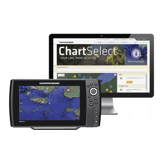
Humminbird ChartSelect User Manual

Humminbird ChartSelect User Manual

Hide thumbs Also See for ChartSelect:

Advertisement

C
HART
T
C
ABLE OF
ONTENTS
Overview. . . . . . . . . . . . . . . . . . . . . . . . . . . . . . . . . . . . . . . . . . . . . 1
Preparation. . . . . . . . . . . . . . . . . . . . . . . . . . . . . . . . . . . . . . . . . . 2
Using ChartSelect. . . . . . . . . . . . . . . . . . . . . . . . . . . . . . . . . . . . . . 4
FishSmart Overview. . . . . . . . . . . . . . . . . . . . . . . . . . . . . . . . . . 14
Using FishSmart. . . . . . . . . . . . . . . . . . . . . . . . . . . . . . . . . . . . . 15
S
ELECT and
Navigating with FishSmart. . . . . . . . . . . . . . . . . . . . . . . . . . . 32
Importing/Exporting Navigation Data. . . . . . . . . . . . . . . . . . . 35
Connecting Wirelessly. . . . . . . . . . . . . . . . . . . . . . . . . . . . . . . . . 36
Transferring Charts to the Control Head. . . . . . . . . . . . . . . . . 37
Updating Software from FishSmart. . . . . . . . . . . . . . . . . . . . 39
Contact Humminbird. . . . . . . . . . . . . . . . . . . . . . . . . . . . . . . . . . 40
F
S
ISH
MART
User Manual
532362-3_A

Advertisement

Table of Contents
loading
Need help?

Need help?

Do you have a question about the ChartSelect and is the answer not in the manual?

Questions and answers

Subscribe to Our Youtube Channel

Summary of Contents for Humminbird ChartSelect

  • Page 1: Table Of Contents

    Using ChartSelect........4...
  • Page 2 HANK Thank you for choosing Humminbird®, the #1 name in marine electronics. Humminbird has built its reputation by designing and manufacturing top-quality, thoroughly reliable marine equipment. We encourage you to read this manual carefully in order to get full benefit from all the features and applications of your Humminbird product.
  • Page 3 January 2003 on the restriction of the use of certain hazardous substances in electrical and electronic equipment. AutoChart®, AutoChart PRO®, AutoChart ZeroLine Map Card™, ChartSelect®, FishSmart™, HELIX®, Humminbird®, HumminbirdPC™, LakeMaster®, SOLIX® are trademarked by or registered trademarks of Johnson Outdoors Marine Electronics, Inc.
  • Page 4: Overview

    LakeMaster products are available for download on our Web site at humminbird.com. Humminbird ChartSelect Humminbird ChartSelect allows you to purchase Humminbird charts and chart layers that you can save to encrypted SD or microSD cards. You can also purchase AutoChart ZeroLine region maps and AutoChart software for your PC (personal computer).
  • Page 5: Preparation

    2. Enter your information and follow the on-screen prompts to create a new account. 3. Confirm Account: A confirmation e-mail will be sent to the e-mail address saved to your ChartSelect account. Open the e-mail and follow the instructions provided to confirm your ChartSelect account.
  • Page 6 Compatibililty: Visit our Web site at humminbird.com for the latest list of compatible models. Supplies: In addition to your Humminbird equipment, you will need a PC with Internet access and a blank SD or microSD card. 1. Before the control head software is updated or restored to system defaults, export your...
  • Page 7: Using Chartselect

    Supplies In addition to your Humminbird control head, you will need a computer with high-speed Internet access and a blank 32 GB (gigabyte) SD or microSD card (depending on your control head model) that is formatted to the FAT32 file system.
  • Page 8 1. Select a LakeMaster Chart 1. Log in to your chartselect.humminbird.com account. 2. Select Store > LakeMaster. 3. Search with the Map: Use the on-screen map to search for available lake charts. Search by Lake Name: Type the lake name into the search bar.
  • Page 9 Purchase Individual Chart Layers: To purchase individual chart layers, select the layer(s) under Available Multilayers. Click Add to Cart. Selecting a Lake Chart and/or Chart Layers search by lake name close lake details purchase selected lake chart and all available layers as selected lake a bundle displayed on the map select individual chart layers Using ChartSelect...
  • Page 10 Confirming Control Head Compatibility Click the plus (+) sign to select your control head model. 2. Repeat: Repeat procedures 1 and 2 to purchase additional LakeMaster charts. 3. To complete your purchase, proceed to Complete your Chart Purchase. Using ChartSelect...
  • Page 11 If you already own AutoChart or AutoChart PRO software, skip this section and proceed to Purchase Individual AutoChart ZeroLine Maps. 1. Log in to your chartselect.humminbird.com account. 2. Select Store > AutoChart. 3. Select an AutoChart software bundle. Click Add to Cart.
  • Page 12 • To change the quantity of a specific item in your cart, click plus (+) or minus (-) under Quantity. Completing your Chart Purchase cart tab 3. Enter your payment information. When you are ready to complete the purchase, click Purchase. 4. Keep the ChartSelect web page open and proceed to the next section. Using ChartSelect...
  • Page 13 AutoChart PC . Install the ChartSelect Downloader Tool (with LakeMaster and AutoChart Zeroline map purchases) The ChartSelect Downloader Tool is a computer application that allows you to manage your purchased charts and save them to encrypted SD or microSD cards.
  • Page 14 NOTE: It is important to save your AutoChart serial number. You will need it any time you wish to install the software. Register your AutoChart Serial Number (with AutoChart downloads only) It is important to register your AutoChart serial number so that you will receive the latest Humminbird news, including accessory compatibility and software update information.
  • Page 15 1. Insert the unlocked, encrypted SD card or microSD card (with adapter) into the card slot on your computer. 2. Open the ChartSelect Downloader tool. • PC: Start > All Programs > Humminbird ChartSelect Log in to your ChartSelect account using your • Mac: Applications > Humminbird ChartSelect e-mail address and password.
  • Page 16 7. Click Download. A status bar will display to indicate the download progress. 8. A confirmation box will display when the download is complete. Click OK. Saving a Lake Chart to an SD or MicroSD Card link to ChartSelect store ChartSelect Help currently selected chart...
  • Page 17: Fishsmart Overview

    • Share Saved Navigation Data: Import and export saved waypoints, routes, and tracks, so that you can save them to an SD or microSD card and display them on your Humminbird control head. Wi-Fi or cellular data must be enabled to share navigation data.
  • Page 18: Using Fishsmart

    SING MART Confirm you have read the setup instructions in the previous section FishSmart Overview. Use the following sections to get started using FishSmart. Refer to the instructions for your mobile device operating system: Apple iOS or Google Android. NOTE: Wi-Fi or cellular data must be enabled on your mobile device to download purchased charts and share navigation data. Location Services must also be enabled for GPS tracking.
  • Page 19 Menus Maps: Download and display purchased charts. System: Pair and connect to a Humminbird control head, view all connected systems on the network, and download software updates. Settings: Adjust the chart display by selecting depth highlights, display or hide the compass, change the base map type, etc.
  • Page 20 Touch Screen Overview A summary of the mobile device touch screen actions are shown here. NOTE: Some of the information and instructions may not apply to all mobile devices. Refer to the instructions included with your mobile device. Tap or Press and Hold Select a Menu or Icon: Tap the selection once.
  • Page 21 2 | Purchase Charts on your Mobile Device You can purchase LakeMaster charts directly from your mobile device. Charts previously purchased from ChartSelect are available for download on your mobile device (see Download and Display Purchased Charts on your Mobile Device). A Wi-Fi or cellular data connection is required.
  • Page 22 Purchasing a Chart from Chart Display Purchasing a Chart from Maps Menu (Apple iOS Phone) (Google Android Phone) more options icon lake map marker Tap to download a purchased chart. chart information Tap to purchase Tap to selected purchase chart. selected chart.
  • Page 23 A Wi-Fi or cellular data connection is required. NOTE: Visit our Web site at humminbird.chartselect.com to purchase lake charts from your personal computer or see the section Purchase Charts on your Mobile Device to make in-app purchases.
  • Page 24 4 | Set Up the Chart Display Use the following instructions to customize the chart display by adjusting the LakeMaster settings. See the Humminbird LakeMaster Accessory Manual for additional information about these features. 1. Apple iOS: Tap the Settings menu icon.
  • Page 25 Adjusting Chart Display Settings Viewing Chart Display Settings (Apple iOS Phone) (Google Android Phone) display depth and/or contour data depth highlight & depth highlight range (green) shallow water highlight LakeMaster (red) settings Tap to Select OR Adjust Settings Drag Slider to Adjust Settings Using FishSmart...
  • Page 26 5 | Set the Chart Orientation The default chart orientation is North-Up. Use the following instructions to change the chart orientation to Head-Up or Center Vessel. • North-Up: The chart is oriented with North up on the display, and the boat rotates according to its heading or COG (Course Over Ground).
  • Page 27 6 | Adjust the Chart Transparency Adjust the transparency of the displayed LakeMaster chart to see more or less detail. 1. Press and drag the orange slider bar left or right to adjust the setting. Adjusting the Chart Transpa rency (Google Android Phone) transparency slider bar...
  • Page 28: Marking Waypoints, Routes, And Tracks With Fishsmart

    Use the instructions in the following section to create waypoints, routes, and tracks using FishSmart on your mobile device. You can export saved navigation data as .GPX files that can be saved to SD or microSD cards to use on your Humminbird control head.
  • Page 29 Mark Waypoints Waypoints are saved latitude/longitude positions. They mark a position of interest such as your favorite fishing area, structure, or marker buoy. Display a LakeMaster chart on your mobile device and use the following instructions to mark waypoints on the chart. You can edit the waypoint name, coordinates, and add notes in the Waypoints menu.
  • Page 30 Display/Hide a Saved Waypoint Use the following instructions to display or hide a saved waypoint from the chart display. 1. Apple iOS: Tap the Waypoints menu icon. Google Android: Tap the FishSmart main menu. Select Waypoints. 2. Apple iOS: Select the waypoint. Tap Show/Hide. Google Android: Select a waypoint.
  • Page 31 Create Routes Routes link two or more waypoints together to create a path for navigation. A route represents your intended navigation and shows the shortest path from each data point to the next. The distance between each waypoint is a route leg. Display a LakeMaster chart on your mobile device and use the following instructions to create routes on the chart.
  • Page 32 4. Apple iOS: Tap Save. Google Android: Edits are automatically saved. Delete a Route 1. Apple iOS: Tap the Routes menu icon. Swipe left on the route name using one finger. Tap Delete. Google Android: Tap the FishSmart main menu. Select Routes. Press and hold a route until it is highlighted, and tap the Trash icon.
  • Page 33 Create New Tracks A track is a collection of track points that contains the boat’s detailed position history at set intervals. You can clear the Current Track or save it at any time. You can also edit saved track names and add notes in the Tracks menu. WARNING! You should always be aware of your surroundings and watch for any potential obstacles.
  • Page 34 Delete a Track 1. Apple iOS: Tap the Tracks menu icon. Swipe left on the track name using one finger. Tap Delete. Google Android: Tap the FishSmart main menu. Select Tracks. Press and hold a track until it is highlighted, and tap the Trash icon.
  • Page 35: Navigating With Fishsmart

    AVIGATING WITH MART Location Services must be enabled on your mobile device for GPS tracking and navigation. WARNING! This device should not be used as a navigational aid to prevent collision, grounding, boat damage, or personal injury. When the boat is moving, water depth may change too quickly to allow time for you to react. Always operate the boat at very slow speeds if you suspect shallow water or submerged objects.
  • Page 36 Start Navigation Use the following instructions to begin navigating a saved waypoint, route, or track. To start navigating a new track, see the section Create New Tracks. Navigate a Saved Waypoint, Route, or Track 1. Apple iOS: Tap the Waypoints, Routes, or Tracks menu icon. Google Android: Tap the FishSmart main menu.
  • Page 37 End Navigation Use the following instructions to stop navigating. 1. Apple iOS: Tap the Waypoints, Routes, or Tracks menu icon. Google Android: Tap the FishSmart main menu. Select Waypoints, Routes, or Tracks. 2. Apple iOS: Select the waypoint, route, or track you are navigating. Select End Navigation. Google Android: Tap the More Options icon next to the waypoint, route, or track you are navigating, and select End Navigation.
  • Page 38: Importing/Exporting Navigation Data

    .GPX files. You can export these files via e-mail, save to your cloud storage, or use an application that is compatible with .GPX files. Use HumminbirdPC to manage your Humminbird navigation data. Save navigation data to SD or microSD cards to display on your Humminbird control head(s).
  • Page 39: Connecting Wirelessly

    Use the instructions in this section to wirelessly connect your mobile device to your control head. Then you can transfer charts and update system software on your Bluetooth-enabled Humminbird unit with your mobile device and the FishSmart app. Locate the instructions below for your control head model.
  • Page 40: Transferring Charts To The Control Head

    NOTE: A downloaded ChartSelect chart can only be saved to one SD or microSD card for the life of the product. Purchased charts will remain available for re-download (to the same SD or microSDcard) for 1 year from the date of purchase.
  • Page 41 4 | Display the Chart on the Control Head Once the chart has been uploaded to the SD or microSD card, LakeMaster menu options are automatically added to the control head menu system. See your control head operations manual for further details about selecting chart sources. SOLIX Series 1.
  • Page 42: Updating Software From Fishsmart

    OFTWARE MART You can download software updates straight to your mobile device, then upload them to your Bluetooth-enabled Humminbird unit. Preparation: We recommend that you read this section completely before starting any software updates. Control heads take approximately 10 minutes to update, and each control head on the network must be updated individually. Accessories take approximately 3 minutes to udpate.
  • Page 43: Contact Humminbird

    ONTACT UMMINBIRD Contact Humminbird Customer Service in any of the following ways: Web site: humminbird.com E-mail: service@humminbird.com Telephone: 1-800-633-1468 Direct Shipping: Humminbird Service Department 678 Humminbird Lane Eufaula, AL 36027 USA Hours of Operation: Monday - Friday 8:00 a.m. to 4:30 p.m. (Central Standard Time) Social Media Resources: Facebook.com/HumminbirdElectronics...

This manual is also suitable for:

FishsmartHelix10

Table of Contents