
Related Manuals for Raytheon HSB L760


Summary of Contents for Raytheon HSB L760
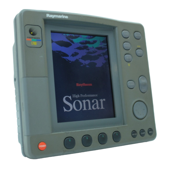
- Page 1 HSB Series L755 and L760 Fishfinder Owner’s Handbook Document number: 81169_3 Date: November 1st 2000...
- Page 3 This unit should not be relied upon as a substitute for such prudence and judgement. RAYTHEON MARINE products are supported by a network of Authorized Service Representatives. For information on Raytheon products and services, contact either of the following:...
- Page 4 HSB Series L755 and L760 Fishfinder The technical and graphical information contained in this handbook, to the best of our knowledge, was correct as it went to press. However, the Raytheon policy of continuous improvement and updating may change product specifications without prior notice.
-
Page 5: Warranty
Preface Preface This handbook describes the Raytheon HSB Series L755 and L760 LCD display units. The L755 and L760 are combined fishfinder and chartplotter devices intended for recreational purposes. The chartplotter unit is intended as an aid to navigation and should not be relied upon as a substitute for official navigation charts. -
Page 6: Emc Conformance
HSB Series L755 and L760 Fishfinder EMC Conformance All Raytheon equipment and accessories are designed to the best industry standards for use in the recreational marine environment. The design and manufacture of Raytheon equipment and accessories conform to the appropriate Electromagnetic Compatibility (EMC) standards, but... -
Page 7: Table Of Contents
Contents Contents Warranty ..................v EMC Conformance ................. vi Chapter 1: Overview ..................1-1 1.1 Introduction .................. 1-1 General ..................1-2 Display Unit Features ..............1-4 Operating Modes ................1-4 1.2 The Fishfinder Display ..............1-6 Fishfinder Options ................ 1-7 Fishfinder Functions .............. - Page 8 viii HSB Series L755 and L760 Fishfinder 2.5 Installing the Transom Mount Transducer ........2-15 Preparation .................. 2-15 Installation .................. 2-16 2.6 Installing the Thru-hull Transducer ..........2-17 Tools and Material Needed ............2-17 Preparation .................. 2-17 Installation .................. 2-20 Installation in a Cored Fiberglass Hull ........
- Page 9 Contents 3.4 Fishfinder Display Control Functions ........3-16 Viewing Data Boxes ..............3-16 Changing the Scroll Speed ............3-16 Changing the Fishfinder Range ..........3-18 Selecting the Frequency .............. 3-19 Using Bottom Lock ..............3-20 Using A-Scope ................3-22 Using Zoom ................3-23 3.5 Chart Display Control Functions ..........
- Page 10 HSB Series L755 and L760 Fishfinder Displaying the Chart Data ............. 5-3 Displaying Object Information ............. 5-4 5.3 Working with Waypoints .............. 5-8 Introduction .................. 5-8 Placing a Waypoint ............... 5-9 Selecting a Waypoint ..............5-10 Waypoint Data Display ............... 5-10 Editing the Waypoint Details ............
- Page 11 Contents Setting Alarms and Timers ............6-4 6.4 Man Overboard (MOB) ..............6-6 6.5 Cursor Echo .................. 6-7 6.6 GPS Setup ..................6-8 6.7 Data Log Mode ................6-9 Chapter 7: Setting Up the System Defaults ..........7-1 7.1 Introduction .................. 7-1 7.2 Changing the Set Up Parameters ..........
- Page 12 Cleaning Instructions ..............8-1 EMC Servicing and Safety Guidelines ......... 8-2 8.2 Resetting the System ..............8-3 8.3 Problem Solving ................8-4 How to Contact Raytheon (US) ............ 8-5 How to Contact Raytheon (Europe) ..........8-6 Worldwide Support ............... 8-7 Appendix A: Specifications ................A-1...
-
Page 13: Chapter 1: Overview
Chapter 1: Overview Chapter 1: Overview 1.1 Introduction This handbook describes the following HSB Series systems: L755 Fishfinder with Chartplotter, 7" Monochrome LCD Display L760 Fishfinder with Chartplotter, 7" Color LCD Display If you have an HSB Series LCD display, it is possible to connect another HSB series LCD or CRT display to provide an integrated system. -
Page 14: General
HSB Series L755 and L760 Fishfinder Appendix D defines the SeaTalk and NMEA data that is transferred on integrated systems. A List of Abbreviations, Index and warranty information are included at the end of the handbook. A summary of the fishfinder and chartplotter controls are provided on the Quick Reference Cards supplied with your system. - Page 15 Note: Your HSB Series display may require a software upgrade to repeat Fishfinder data. Please contact your authorized Raytheon dealer for details. Full functionality of the fishfinder/chartplotter is achieved when it is part of an integrated system, with other equipment (in addition to another HSB unit) connected via SeaTalk or NMEA 0183.
-
Page 16: Display Unit Features
HSB Series L755 and L760 Fishfinder Transducer The HSB Series Fishfinder is supplied with a thru-hull bronze transducer or a transom-mount plastic transducer. The transducers measure water depth and temperature, distance traveled is also measured and is used to calculate speed. It is important to position your transducer correctly, as described in Chapter 2. - Page 17 Chapter 1: Overview Half -Screen Window Options The following information, if available on your system, can be shown: Table 1-1: Window Options for Combined/Integrated Systems Full-screen Half-screen Window Options Half-screen Window Options - mode - FishfinderDisplay only Fishfinder + Radar Displays Fishfinder Mode Depth/temp, Chart, CDI, BDI, or Depth/temp, Chart or CDI, BDI...
-
Page 18: The Fishfinder Display
HSB Series L755 and L760 Fishfinder 1.2 The Fishfinder Display When you first turn the display unit on and select fishfinder mode, the scrolling bottom graph is displayed. This is a graphical representation of the echoes seen by the Fishfinder. As time passes, this display scrolls from right to left and becomes a record of the echoes seen. -
Page 19: Fishfinder Options
Chapter 1: Overview Power Target Depth ID ON Frequency Frequency Auto Zoom Mode Range Alarm enabled Indicators Alarm Color gain Shallow, Deep Indicators Gain Fish 50kHz AUTO GCRZFH Water surface Fish echo Cursor, controlled Depth markers by trackpad Fish depth Bottom depth Range FREQUENCY... -
Page 20: Fishfinder Functions
HSB Series L755 and L760 Fishfinder • A-scope – displays a real-time image of the bottom structure and fish directly below the transducer. The A-scope window also displays the pat- ented Bottom Coverage width indication. • Zoom – enlarges all or part of the bottom graph display. You can select x2, x4 or x6 magnification and the zoom area can be automatically or manu- ally adjusted. - Page 21 Chapter 1: Overview SPLIT SPLIT AUTO G Z AUTO G Z 200kHz 200kHz 50kHz 50kHz 52.3 FREQUENCY ZOOM BTM.LOCK A-SCOPE FREQUENCY ZOOM BTM.LOCK A-SCOPE Split Frequency Split Frequency with A-Scope 200kHz SPLIT AUTO G Z AUTO G 200kHz 50kHz FREQUENCY ZOOM BTM.LOCK A-SCOPE...
-
Page 22: The Chartplotter Display
1-10 HSB Series L755 and L760 Fishfinder 1.3 The Chartplotter Display The HSB Series Fishfinder Display includes a Chartplotter. The chartplotter includes a small-scale world map and detailed navigation information is displayed when a cartographic chart card is installed. A plotter mode is provided to enable route plotting and tracking at large scales even when a chart card is not installed A typical chartplotter screen is shown in Figure 1-4 The chartplotter uses position information from a GPS, DGPS or Loran-C... - Page 23 Chapter 1: Overview 1-11 Display options are provided in System Set Up and Chart Set Up as described in Chapter 7. In addition Screen Presentation Options, described in Chapter 3 are provided to switch: • Cursor Box and Databoxes On/Off •...
-
Page 24: Chartplotter Functions
1-12 HSB Series L755 and L760 Fishfinder Icons are displayed in detail, depth shading limit is 10 m and depth contour display is 0-100 m. A complete list of chart features is given in Appendix C. Chartplotter Functions The HSB Series Chartplotter includes the following functions: •... -
Page 25: Operating Controls
Chapter 1: Overview 1-13 1.4 Operating Controls You operate the fishfinder and chart systems using a variety of controls: • A trackpad providing up, down, left, right and diagonal control of an on screen cursor. • Eleven dedicated (labeled) control keys. •... -
Page 26: Trackpad And Cursor
1-14 HSB Series L755 and L760 Fishfinder Trackpad and Cursor The trackpad has several functions: • To move the cursor around the screen • To select an item from a pop-up menu • To adjust a variable soft key control The cursor is used to: •... -
Page 27: Dedicated Keys
Chapter 1: Overview 1-15 Table 1-2: Context-Sensitive Cursor Text Labels Text Label Feature Fishfinder/Chart ➟ Ruler line Chart Course Over Ground vector Chart Heading vector Chart Vessel’s position Chart Route leg Chart TIDE Tide vector Chart Chart Icons Various Chart Some items on the fishfinder/chartplotter screen, such as the cursor have information associated with them. -
Page 28: Soft Keys
1-16 HSB Series L755 and L760 Fishfinder Soft Keys The four keys below the screen are called soft keys because their functions change according to the operation. The soft keys are grouped into related sets and subsets providing access to the various functions. The soft key labels are displayed on the screen just above the keys. -
Page 29: Database Lists
Chapter 1: Overview 1-17 You use the trackpad to select an option from the menu, then use the appropriate soft key to set the option. For example, you can toggle the OFF TRACK ALARM on/off. Database Lists The waypoints, routes and tracks that you create on the chartplotter are stored in database lists. - Page 30 1-18 HSB Series L755 and L760 Fishfinder...
-
Page 31: Chapter 2: Installation
Chapter 2: Installation Chapter 2: Installation 2.1 Introduction This chapter provides installation instructions for the L755 and L760 Fishfinders. Simple systems such as that in Figure 2-1 below, or integrated systems (see Section ) are explained. Details for installing the transducer, mounting the HSB Series LCD Display, and connecting the equipment are included. -
Page 32: Selecting The Correct Type Of Transducer
Bronze housings are recommended for wood or fiberglass hulls. • Installation of a bronze housing in a metal hull requires using of a fairing, available from your Raytheon dealer. • Never install a metal housing in a vessel with a positive ground system. -
Page 33: Planning The Installation
This will not damage the equipment, but may cause the loss of some information and may change the operating mode. • Raytheon specified cables are used. Cutting and rejoining these cables can compromise EMC performance and must be avoided unless doing so is detailed in the installation manual. - Page 34 Typical Suppression Ferrites Connections to Other Equipment If your Raytheon equipment is to be connected to other equipment using a cable not supplied by Raytheon, a suppression ferrite MUST always be attached to the cable near to the Raytheon unit.
-
Page 35: Unpacking And Inspecting The Components
Chapter 2: Installation 2.2 Unpacking and Inspecting the Components Unpack your system carefully, to prevent damage to the equipment. Save the carton and packing, in case you need to return a unit for service. Check that you have all the correct system components. These depend on your system package, as follows: Table 2-1: Parts and Accessories... -
Page 36: Selecting Theequipment Location
HSB Series L755 and L760 Fishfinder 2.3 Selecting theEquipment Location Transducer Mounting Location General It is very important that you mount the transducer correctly. The transducer provides the most reliable readings if it looks into water that is smooth and undisturbed. - Page 37 Chapter 2: Installation • Twin drive boat - If your boat has twin propellers (outboard or inboard- outboard), mount the transducer between the drives near the centerline of the boat. If the boat will be operated at high speeds, the transducer may be mounted closer to the centerline of the hull.
- Page 38 HSB Series L755 and L760 Fishfinder • On a boat with a fiberglass hull, the leading edge of the transducer should extend 1/8" (3.2 mm) to 1/4" (6 mm) below the bottom edge of the hull as shown in Figure 2-5. On an aluminium hull, the transducer should extend a bit more –...
- Page 39 Chapter 2: Installation Displacement hull Pressure waves 1/3 Aft Load waterline length (LWL) 6 -- 12 in (150 -- 300 mm) Planning hulls Outboard and I/O Inboard Full keel sailboat Step hull Fin keel sailboat D4857_1 Figure 2-6: Best Location for Thru-hull Transducer •...
-
Page 40: Display Unit Mounting Location
2-10 HSB Series L755 and L760 Fishfinder Display Unit Mounting Location The display unit can be mounted using the mounting bracket supplied, or console mounted using the optional flush-mounting kit. The dimensions of the display units, including the bracket, are shown in Figure 2-7 and Figure 2-8. - Page 41 Chapter 2: Installation 2-11 0.95 in (24.3 mm) 6.89 in (175 mm) 10.51 in (267 mm) 8.8 in (223.6 mm) GAIN DISPLAY VRM/EBL MARKS MULTI ALARMS RANGE POWER ENTER CLEAR MENU 4.53 in (115 mm) 1.42 in (36 mm) 6.9 in (176 mm) cable cleareance 3.15 in (80 mm)
- Page 42 2-12 HSB Series L755 and L760 Fishfinder 0.95 in 0.95 in (24 mm) 6.89 in (175 mm) (24 mm) 10.54 in (267.7 mm) 8.76 in (222.5 mm) GAIN DISPLAY VRM/EBL MARKS MULTI ALARMS RANGE POWER ENTER CLEAR MENU 3.2 in (81 mm) 1.45 in (37 mm) 6.9 in (176 mm) cable cleareance...
-
Page 43: Cable Runs
Chapter 2: Installation 2-13 2.4 Cable Runs Consider the following before installing the system cables: • You need to attach the power cable and the transducer cable. Additional cables will be required if you are installing an integrated system. • All cables should be adequately secured, protected from physical damage and protected from exposure to heat. -
Page 44: Transducer Cable
• If the 30 ft (10 m) cable is not long enough, extension cables are available from your Raytheon dealer. When you attach the extension cable, be sure that the connections are watertight. Use Dow Corning DC-4 or an equiva- lent sealing compound to protect the connector assemblies. -
Page 45: Installing The Transom Mount Transducer
Chapter 2: Installation 2-15 2.5 Installing the Transom Mount Transducer Preparation Transducer Mounting Bracket When installed, the lower surface of the transducer should tilt down toward the rear at a slight angle (2° to 5°). The mounting bracket includes a wedge; depending on the angle of the transom on your boat, you may need to install this wedge to get the correct transducer angle. -
Page 46: Installation
2-16 HSB Series L755 and L760 Fishfinder Installation 1. On a fiberglass hull, to minimize surface cracking of the gel coat: Before drilling the pilot holes, use a 1/4" (6 mm) drill bit to drill a shallow hole (chamfer) at each location about 1/16" (1.5 mm) deep. Drill pilot holes 3/4"... -
Page 47: Installing The Thru-Hull Transducer
Chapter 2: Installation 2-17 2.6 Installing the Thru-hull Transducer Tools and Material Needed Water-based antifouling paint (mandatory for boats kept in salt water) Safety goggles Dust mask Electric drill Drill bit: 1/8" (3 mm) Hole saw: Fiberglass or wood 2" (51 mm) Aluminium or steel hull 2 1/8"... - Page 48 • Reduce drag by directing the water around the multisensor A fairing is available from your Raytheon dealer (part number M99142). It is made of high impact urethane with an integrated cutting guide. The fairing can be shaped to accommodate a deadrise angle of up to 25° and a wide range of hull thicknesses as follows: Hull thickness (no fairing): ¼–2½"...
- Page 49 Chapter 2: Installation 2-19 Antifouling Paint Marine growth can accumulate rapidly on the transducer’s surface, reducing performance in weeks. Surfaces exposed to salt water must be coated with antifouling paint. Use water-based antifouling paint only. Never use ketone-based paint since ketones can attack many plastics, possibly damaging the transducer.
-
Page 50: Installation
2-20 HSB Series L755 and L760 Fishfinder Installation Note: To install the thru-hull transducer in a cored fiberglass hull, follow the instructions on Installation in a Cored Fiberglass Hull on page 2-26. Drilling Holes WARNING: Always wear safety goggles and a dust mask when drilling. 1. - Page 51 Chapter 2: Installation 2-21 Band saw table Cutting guide Deadrise angle Fence Bow end for installation on port side 4860_1 Figure 2-15: Cutting the Fairing CAUTION: The arrow on the fairing always points forward towards the bow. Be sure to orient the fairing on the band saw so the angle cut matches the intended side of the hull.
- Page 52 2-22 HSB Series L755 and L760 Fishfinder Pull ring Retaining pin Safety ring Cap nut Stem Hull nut Hull Backing block Fairing Marine sealant Marine sealant D4861_1 Figure 2-16: Seating 2. If a fairing is used, thread the transducer cable through it. 3.
- Page 53 Chapter 2: Installation 2-23 Attaching the transducer 1. From outside the hull, thread the cable through the mounting hole. 2. Push the stem of the transducer (with the fairing in place) into the mounting hole using a twisting motion to squeeze out excess sealant. If a fairing is used, be sure the button on the fairing is mated with the recess in the trans- ducer, the arrow on the fairing is pointing forward, and the assembly is aligned parallel to the centerline of the boat.
- Page 54 2-24 HSB Series L755 and L760 Fishfinder 5. Being sure the valve assembly is seated firmly in the housing, carefully screw the cap nut in place. Hand tighten it only; do not over tighten. 6. Remove any excess sealant on the outside of the hull to ensure smooth water flow over the transducer.
- Page 55 Chapter 2: Installation 2-25 Top view of paddlewheel insert Notches Pull ring Paddlewheel insert Flat side of paddlewheel blade faces bow Paddlewheel detail 'O' rings Housing Cable and valve assembly Key (2) Valve assembly Cap nut Housing D4864_1 Figure 2-19: Servicing the Paddle Wheel Insert and Valve Assembly...
-
Page 56: Installation In A Cored Fiberglass Hull
2-26 HSB Series L755 and L760 Fishfinder Installation in a Cored Fiberglass Hull The core (wood or foam) must be cut and sealed carefully. The core must be protected from water seepage and the hull must be reinforced to prevent it from crushing under the hull nut, allowing the housing to become loose. -
Page 57: Check For Leaks
Chapter 2: Installation 2-27 Dimension equal to the thickness of the hull's outer skin to ensure adequate clearance Inner skin Core Outer skin Solid or hollow cylinder D4865_1 Figure 2-20: Preparing a Cored Fiberglass Hull 6. Sand and clean the area around the hole, inside and outside, to ensure that the sealant will adhere properly to the hull. -
Page 58: Mounting The Display Unit
2-28 HSB Series L755 and L760 Fishfinder 2.7 Mounting the Display Unit The HSB Series LCD display unit is waterproof to CFR46 and can be installed either above or below deck. The display unit can be mounted using the mounting bracket supplied, or console mounted using the optional flush- mounting kit (see Section 2.2). - Page 59 Chapter 2: Installation 2-29 CAUTION: Make sure there are no hidden electrical wires or other items behind the location before proceeding. Make sure there is sufficient rear access for mounting and cabling. 1. Check the selected location for the unit. A clear, flat area at least 9 in (230 mm) wide by 8¼...
-
Page 60: System Connections
The power connection to the display should be made at either the output of the battery isolator switch, or at a DC power distribution panel. Raytheon recommends that power is fed directly to the display via its own dedicated cable system and MUST be protected by a thermal circuit breaker or fuse, installed close to the power connection. -
Page 61: Display Unit Connection
Chapter 2: Installation 2-31 Display Unit Connection The rear of the HSB Series LCD display provides the following connection sockets: • Transducer connection. • HSB, in/out connector for connecting to another HSB Series display (such as a radar or second Fishfinder display). •... - Page 62 2-32 HSB Series L755 and L760 Fishfinder 4. Slip the split ring and wedge tool over the connector body until aligned with the mounting groove on the connector. 5. Remove the wedge tool and seat the split ring in the mounting groove, making sure the connector protrusion falls into the split.
- Page 63 Chapter 2: Installation 2-33 CAUTION: Do not cut the transducer cable or remove the connector. Do not try to shorten or splice the cable. If the cable is cut, it cannot be repaired. Cutting the cable will also void the warranty. D4850-1 Pin No.
- Page 64 2-34 HSB Series L755 and L760 Fishfinder Power and NMEA Input Connection The DC power and NMEA input should be connected at the rear Power/ NMEA seven-pin connector. The connector (viewed from the outside) and pin functions are shown in the following diagram and table. The NMEA Input is detailed in Section .
-
Page 65: Emc Conformance
Chapter 2: Installation 2-35 EMC Conformance Always check the installation before going to sea to make sure that it is not affected by radio transmissions, engine starting etc. 2.9 Integrated Systems The HSB Series displays can be linked to other equipment to transfer data as follows: •... -
Page 66: Hsb™ High Speed Bus
Note: In order to repeat Fishfinder, your second display must have the correct software version. Display units with early versions of software can be upgrad- ed to provide full Fishfinder compatibility. Please contact your authorized Raytheon dealer for details. -
Page 67: Seatalk And Nmea In
Chapter 2: Installation 2-37 HSB Connection An In/Out connector is provided for an HSB series repeater or chartplotter display. Note: The HSB cables have ferrite clamps attached at each end to ensure EMC conformance. The cables are available in lengths of 1, 3, 6, 10 and 20 m. HSB connector HSB connector Pin name... - Page 68 2-38 HSB Series L755 and L760 Fishfinder Other data connected via a SeaTalk bus or via NMEA is generally displayed in data boxes, e.g. depth, apparent wind angle and speed, time. Note: The Fishfinder uses its own depth data, rather than any other depth data on SeaTalk.
- Page 69 SeaTalk The SeaTalk standard was originally developed by Autohelm (part of the Raytheon group), and allows compatible instruments to be connected by a single cable carrying power and data in/out. This means that additional instruments and functions can be added to a SeaTalk system, simply by plugging them into the network.
- Page 70 2-40 HSB Series L755 and L760 Fishfinder The SeaTalk input/output should be connected at the rear SeaTalk 3-pin connector. This appears as follows, when viewed from outside: SeaTalk In/Out 1. Red (No internal connection) 2. Screen (0V) 3. Yellow (Data) D3232-3 Figure 2-29: SeaTalk Connector Table 2-5:...
- Page 71 (Channel 2). Refer to Power and NMEA Input Connection on page 2-34 for further details. For example, to connect a Raytheon Heading Sensor to the NMEA Channel 1 input, connect the cables and power supply using a suitable connector block, as shown in the diagram below.
-
Page 72: Using The Seatalk Auxiliary Junction Box
Ensure correct polarity of the 12 V supply before applying SeaTalk power. Use a multimeter to check the connections. Figure 2-31 shows how to connect the junction box; Appendix B provides connection details for specific Raytheon, Apelco and Autohelm GPS and Beacon Receiver systems. -
Page 73: Data Output
Chapter 2: Installation 2-43 To GPS To Display Unit Power Out: 1 & 2 SeaTalk Socket Power In: 1 & 3 Spare Power Input Supply Fused Cable Core Terminal Function SeaTalk Black (screen) +12v Yellow SeaTalk Power Black (screen) +12V Black (screen) +12V Yellow... -
Page 74: Data Conversion
2-44 HSB Series L755 and L760 Fishfinder NMEA OUT connector NMEA OUT connector Pin name Function NMEA_GND NMEA ground NMEA_SIG NMEA data output Pin 2, white Pin 3, blue CGND Screen Pin 5, screen Pin 4, not connected *Pin 1 does not exist on this connector Rear of display NMEA out D4254_1... -
Page 75: Integrated System Checks
Chapter 2: Installation 2-45 2.10 Integrated System Checks Chart Display When you have connected your display unit to the required equipment ensure that position data is available at the display via NMEA or SeaTalk. To confirm your chartplotter is operating correctly, perform the following checks: 1. - Page 76 2-46 HSB Series L755 and L760 Fishfinder...
-
Page 77: Chapter 3: Getting Started & Adjusting The Display
Chapter 3: Getting Started & Adjusting the Display Chapter 3: Getting Started & Adjusting the Display 3.1 Introduction This chapter provides information, instructions to get you started using the L755 and L760 Fishfinder displays. It will help you to become familiar with the display and the functions of the controls before you start using the unit. -
Page 78: Switching The Display On And Off
HSB Series L755 and L760 Fishfinder 3.2 Switching the Display On and Off The factory default power-up mode is full-screen fishfinder. Once you have used the display unit it powers-up in the last used mode. The following sections describe the power-up sequence in fishfinder and chart modes, how to adjust the lighting and color controls, and how to select simulator mode. - Page 79 Chapter 3: Getting Started & Adjusting the Display Automatic Gain cannot be adjusted on the repeater display, but Manual Gain can be. STC cannot be adjusted on the repeater display. Depth offset, speed and temperature calibration (see Section 7.4) cannot be set on the repeater display.
- Page 80 HSB Series L755 and L760 Fishfinder Until unit beeps D4277-1 Figure 3-2: Switch On - Chart Mode Switch Off CAUTION: To provide protection against the damaging effects of UV light, it is advisable to replace the sun cover provided when the color LCD display is not in use.
-
Page 81: Simulator Mode
Chapter 3: Getting Started & Adjusting the Display When the counter reaches zero a beep sounds, and the display unit switches off. Release the POWER key. Note: Switch the display unit off before you remove the power cord. Simulator Mode When simulator mode is on a simulator database box is displayed. -
Page 82: Changing The Brightness & Color Settings (L760)
HSB Series L755 and L760 Fishfinder 2. Press the LIGHT soft key if it is not already highlighted. 3. The LIGHT soft key toggles lighting ON/OFF. 4. Use the trackpad (up or down) to increase or decrease the setting. You can press and hold the trackpad to change the setting more rapidly. - Page 83 Chapter 3: Getting Started & Adjusting the Display 2. The LIGHT soft key indicates the brightness level, use the trackpad (up or down) to increase or decrease the setting. You can press and hold the track- pad to change the setting more rapidly. The brightness level is adjusted as you change the setting.
-
Page 84: Power Settings
HSB Series L755 and L760 Fishfinder If you blank a color, the corresponding echoes are displayed in the background color. You can remove up to six colors, but you cannot remove the strongest color. The color threshold you select is used on all the fishfinder windows (scrolling bottom, Zoom, Bottom Lock and A-Scope). -
Page 85: Controlling The Display
Chapter 3: Getting Started & Adjusting the Display 3.3 Controlling the Display You control the display using the cursor and control keys. You start all operations from the default screen, that is the default soft keys are displayed: Fishfinder FREQUENCY ZOOM BTM.LOCK A-SCOPE... - Page 86 3-10 HSB Series L755 and L760 Fishfinder ➤ To change the mode, press the DISPLAY key to show the DISPLAY pop-up, then press again to cycle through the modes available, shown in the Figure 3-4. DISPLAY "DISPLAY" TO SELECT FULL SCREEN OPTION SOFTKEYS TO SELECT WINDOW OPTION CURSOR 099 o...
- Page 87 Chapter 3: Getting Started 3-11 GAIN Use to adjust GAIN, COLOR GAIN and STC DISPLAY Controls display mode windows. - Press to display soft keys - Press for display mode and soft keys display. - Press again to toggle through display modes, and ENTER. MANUAL AUTO - Press and hold for 2 seconds for full screen display.
- Page 88 3-12 HSB Series L755 and L760 Fishfinder DISPLAY GAIN Controls display mode and windows. Not used in Chart mode. - Press for display mode and soft keys display. - Press again to toggle through display modes, then ENTER. - Press and hold for 2 seconds for full screen display. WINDOWS SELECT OFF ON...
- Page 89 Chapter 3: Getting Started & Adjusting the Display 3-13 Fishfinder WINDOWS SELECT SPLIT DISPLAY OFF ON WINDOWS HOR VER D5011-1 Chart WINDOWS SELECT DISPLAY OFF ON WINDOW D4156-2 2. In fishfinder mode check that SPLIT is set to HOR. To select a different win- dow, press either SELECT WINDOWS soft key until the required window is highlighted.
- Page 90 3-14 HSB Series L755 and L760 Fishfinder Returning to the Full-Screen Display To return to the full-screen display you can turn windows off, as previously described. Alternatively, to return to full-screen display: ➤ Press and hold the DISPLAY key for 2 seconds to return to the currently selected full-screen (upper window) display.
- Page 91 Chapter 3: Getting Started & Adjusting the Display 3-15 CDI Window BDI Window 50kHz 50kHz AUTO G RZ AUTO G RZ 225°T 0.28 1.45 WPT BRG WPT BRG 351° 351° WPT RNG WPT RNG 26.8 23.1 STEER PORT STEER STARBOARD WAYPOINT 001 WAYPOINT 001 FREQUENCY...
-
Page 92: Fishfinder Display Control Functions
3-16 HSB Series L755 and L760 Fishfinder 3.4 Fishfinder Display Control Functions The Fishfinder automatically locates the bottom and displays the information using an appropriate scroll speed and range. However, controls are provided so you can adjust scroll speed and range. You can also select the transducer frequency and select certain data for display. - Page 93 Chapter 3: Getting Started & Adjusting the Display 3-17 Section of bottom shown at higher chart speed- Display shows more detail Section of bottom shown at slower chart speed- Display shows longer history D5024-1 Figure 3-6: Effect of the Scroll Speed The Fishfinder automatically adjusts the scroll speed, based on depth.
-
Page 94: Changing The Fishfinder Range
3-18 HSB Series L755 and L760 Fishfinder Changing the Fishfinder Range The Fishfinder automatically adjusts the display range. Alternatively, the RANGE key lets you select the maximum depth displayed on the scrolling bottom and A-scope displays. You can also set the shift value to move the image window up or down within the current range. -
Page 95: Selecting The Frequency
Chapter 3: Getting Started & Adjusting the Display 3-19 ➤ To adjust the range and shift values: 1. Press RANGE, this sets adjustment to manual and the range soft keys are displayed. The range adjusts up or down depending on the direction RANGE pressed. -
Page 96: Using Bottom Lock
3-20 HSB Series L755 and L760 Fishfinder ➤ To change the frequency: 1. Press the FREQUENCY soft key. The frequency selection soft keys are dis- FREQUENCY played. 2. Press the appropriate soft key – 50 KHZ, 200 KHZ or SPLIT. The scrolling bot- tom is displayed in the selected frequency. - Page 97 Chapter 3: Getting Started & Adjusting the Display 3-21 200kHz AUTO G Z FREQUENCY ZOOM BTM.LOCK A-SCOPE D5015-2 Figure 3-7: Bottom Lock Display 3. Press the BTM. LOCK FULL SPLIT soft key to toggle between a full window bottom lock image or split windows. The bottom lock image is displayed. If you select split windows, the fishfinder display is split vertically, with the bottom lock image in the left hand window and the scrolling bottom display in the right hand window.
-
Page 98: Using A-Scope
3-22 HSB Series L755 and L760 Fishfinder ➤ To reposition the bottom lock image: 1. Use the trackpad to move the cursor to the bottom image until the text BL is displayed near the cursor. 2. Press ENTER, a horizontal line appears, indicating the cursor is active. Use the trackpad to move the line to the required bottom lock image position. -
Page 99: Using Zoom
Chapter 3: Getting Started & Adjusting the Display 3-23 Mode 3 A-SCOPE Mode 1 Mode 2 50kHz AUTO G Z 52.3 52.3 52.3 52.3 A-SCOPE FREQUENCY ZOOM BTM.LOCK BTM.LOCK A-SCOPE A-SCOPE A-SCOPE D5258-1 Figure 3-8: The Three Modes of A-Scope Using Zoom Zoom enlarges all or part of the scrolling bottom display. - Page 100 3-24 HSB Series L755 and L760 Fishfinder ➤ To reposition the zoom window: If manual zoom is selected, you can reposition the area of the image that is zoomed. 1. Use the trackpad to place the cursor in the zoom window, the text ZOOM is displayed near the cursor.
-
Page 101: Chart Display Control Functions
Chapter 3: Getting Started & Adjusting the Display 3-25 3.5 Chart Display Control Functions Customizing the Screen Presentation Options The SCREEN soft key lets you set the following screen presentation options on or off: CRSR BOX CHRT GRID DATABOXES CUSTOM OFF ON OFF ON OFF ON... - Page 102 3-26 HSB Series L755 and L760 Fishfinder Note: If you select fishfinder, BDI, CDI or Nav Data for display in a half- screen window, the data boxes are temporarily hidden. At any time, you can switch the group of data boxes on or off using the SCREEN soft key.
-
Page 103: Moving Around The Chart
Chapter 3: Getting Started & Adjusting the Display 3-27 Moving Around the Chart You will normally operate the chartplotter with the chart showing your vessel’s current location. The default orientation is North-Up, and the vessel moves across the screen. You will need to move the chart if your vessel moves out of the area currently displayed, or if you wish to examine or place waypoints in another area. - Page 104 3-28 HSB Series L755 and L760 Fishfinder D4278-1 Figure 3-9: Changing the Chart Center 3. Use the trackpad to move the cursor to the required position. 4. Press ENTER to select the position and return to normal cursor control. The chart is redrawn with the vessel position at the cursor.
- Page 105 Chapter 3: Getting Started & Adjusting the Display 3-29 Plotter mode is available to allow you to zoom into a smaller area, even when no chart data is available for that scale. Section 7.5 describes how to set plotter mode on/off. You can change the chart scale for two purposes: •...
- Page 106 3-30 HSB Series L755 and L760 Fishfinder Chart Boundary - indicates further detail is available inside D4279-1 Figure 3-10: Chart Boundaries 4. When no further chart detail is available, as you press the bottom of the RANGE key, the effect depends on whether Plotter Mode is on or off as follows: •...
-
Page 107: Typical Chart Scenarios
Chapter 3: Getting Started & Adjusting the Display 3-31 3.6 Typical Chart Scenarios The following illustrations provide operating guidelines for typical navigation scenarios. These scenarios can be used as a training guide; they show you how to perform a particular operation and they introduce many of the chartplotter functions. -
Page 108: Place And Goto A Waypoint
3-32 HSB Series L755 and L760 Fishfinder Place and Goto a Waypoint 1. Press MARKS 2. Position Cursor as required Press the soft key Press the soft key to go to the waypoint selected by the cursor. D4267-1... - Page 109 Chapter 3: Getting Started & Adjusting the Display 3-33 The vessel navigates towards the target waypoint See: 5.3 Working wth Waypoints, Go to an Individual Target Point on page 5-27. D4267-3...
-
Page 110: Make And Follow A Route
3-34 HSB Series L755 and L760 Fishfinder Make and Follow a Route ROUTE GOTO SCREEN FIND SHIP Press the soft key CLEAR MAKE EDIT ROUTE ROUTE ROUTE MORE! Press the soft key 1. Position Cursor - in this example over an existing waypoint 2. - Page 111 Chapter 3: Getting Started & Adjusting the Display 3-35 Press the soft key. The route becomes the current route. ROUTE GOTO SCREEN FIND SHIP Press the soft key GOTO GOTO FOLLOW CURSOR WAYPOINT ROUTE Press the soft key The vessel starts to navigate to the first (target) waypoint in the route.
-
Page 112: Review Your Passage Plan
3-36 HSB Series L755 and L760 Fishfinder Review Your Passage Plan ROUTE GOTO SCREEN FIND SHIP Press the soft key MAKE EDIT CLEAR ROUTE ROUTE ROUTE MORE! Press the soft key REVERSE SAVE ROUTE ROUTE ROUTE LIST MORE! Press the soft key 1. - Page 113 Chapter 3: Getting Started & Adjusting the Display 3-37 See: Displaying Route Information on page 5-19. Change the TIME to HOURS - the display indicates it will take 32 minutes to reach the destination. You can change the PLANNED SOG; the display updates to indicate TIME required at the planned speed.
- Page 114 3-38 HSB Series L755 and L760 Fishfinder...
-
Page 115: Chapter 4: Fishfinder Operations
Chapter 4: Fishfinder Operations Chapter 4: Fishfinder Operations 4.1 Introduction Basic Fishfinder operation, including a description of the different display options, was given in Chapter 3. This chapter helps you the get the most from your Fishfinder. It describes how to fine-tune the image and use the controls to get additional information. -
Page 116: Fish Indications
HSB Series L755 and L760 Fishfinder Fish Indications When the Fishfinder detects a fish, it displays an arch-shaped mark. In general, a larger arch indicates a larger fish, though this rule is not always true. Let’s say that there are two fish of the same size: one is close to the surface, the other is near the bottom. -
Page 117: Bottom Indications
Chapter 4: Fishfinder Operations In Bottom lock mode the fish arches may appear distorted as the bottom topography is removed from the image. Bottom Indications The bottom usually produces a strong echo, so it is easy for the Fishfinder to see a lot of detail. -
Page 118: Using White Line
HSB Series L755 and L760 Fishfinder It is also possible that the sound waves are making two complete trips – hitting the bottom, bouncing off the boat, then reflecting off the bottom again; this can happen if the water is shallow, the bottom is hard, or gain is set high. Using White Line The White Line feature separates echoes from fish near the bottom and the bottom itself. - Page 119 Chapter 4: Fishfinder Operations Gain AUTO The GAIN, or sensitivity, of the display adjusts background noise by varying MULTI GAIN echo strength for display. The value of the GAIN control determines the strength above which echoes are displayed: If the gain is low only the GAIN strongest echoes are displayed;...
- Page 120 HSB Series L755 and L760 Fishfinder S TC (Sensitivity Time Control) reduces surface clutter by reducing the gain in MULTI GAIN the top 30-40 ft of the display: A low STC value has little effect on gain in shallow water; a high S TC value decreases the gain in shallow water, thus only the strongest echoes are displayed.
-
Page 121: Fishfinder Data Window
Chapter 4: Fishfinder Operations 4.3 Fishfinder Data Window The Fishfinder can display various measurements in large format data boxes. Use the DISPLAY key options to select a data window that is vertically split with the full-screen fishfinder display. Three data windows are available, each window provides several large-format data boxes for specific information as follows: Data Window A... -
Page 122: Using Alarms
HSB Series L755 and L760 Fishfinder 4.4 Using Alarms The ALARMS key is used to set up alarms; three alarms are available to alert ALARMS MULTI you of fish, shallow water and deep water. Each alarm can be toggled ON and OFF, and you set the depth at which shallow and deep water alarms are triggered (between the ranges 2–3000 feet/ 0.5–500 fathoms/1–1000 meters). -
Page 123: Using Vrm To Determine Depth & Distance From Boat
Chapter 4: Fishfinder Operations ➤ To set an alarm 1. Press the ALARMS key. The alarms soft keys are displayed. FISH ALARM SHALLOW DEEP ALARMS OFF ON ALARM ALARM D5031-1 2. For the shallow or deep alarms, press the SHALLOW ALARM or DEEP ALARM soft key then use the up or down soft keys to change the alarm limit. - Page 124 4-10 HSB Series L755 and L760 Fishfinder The distance-from-boat continues to update as your boat moves. How- ever, the vertical line does not scroll with the scrolling fishfinder image. If the display range changes, the VRM maintains the same position and may, therefore, move out of the visible display area.
-
Page 125: Waypoints
Chapter 4: Fishfinder Operations 4-11 4.6 Waypoints The MARKS key lets you to place up to 998 waypoints: a waypoint is a MARKS position, normally entered on a chart as a reference, or as a place to go to. However, the L755 and L760 units let you place waypoints in Fishfinder mode as well as Chartplotter mode. - Page 126 4-12 HSB Series L755 and L760 Fishfinder ➤ To place a waypoint using the Waypoint List: 1. Press MARKS, followed by the WAYPOINT LIST soft key. The Waypoint List MARKS and associated soft keys are displayed. WAYPOINT WAYPOINT LIST LIST SYMBOL NAME WAYPOINT 001...
-
Page 127: Mob
Chapter 4: Fishfinder Operations 4-13 4.7 MOB If you lose a person or object overboard, and need to return to the location, you should use the Man Overboard (MOB) function. You can select the type of data used for the MOB position using the set up menus (see Section 7.3). - Page 128 4-14 HSB Series L755 and L760 Fishfinder...
-
Page 129: Chapter 5: Standard Chart Operations
Chapter 5: Standard Chart Operations Chapter 5: Standard Chart Operations 5.1 Introduction This chapter explains how to use the chart functions to navigate with your L755 and L760 Combined Fishfinder/Chartplotter Display. It covers the following topics: • Using chart cards. •... -
Page 130: Using Chart Cards
HSB Series L755 and L760 Fishfinder 5.2 Using Chart Cards The chartplotter has a built-in world map; most areas are displayed on a scale of 4000 nm from the top to the bottom of the screen, and can be zoomed in to 150 nm. -
Page 131: Removing A Chart Card
Chapter 5: Standard Chart Operations D4158-1 Figure 5-1: Removing the Chart Card Removing a Chart Card ➤ To remove a chart card: 1. Open the card cover, at the lower left of the display front panel. 2. Press on the card you wish to remove, and move the top of the card to the left to clear the retaining pegs. -
Page 132: Displaying Object Information
HSB Series L755 and L760 Fishfinder ➤ To zoom in: 1. Use the trackpad to move the cursor inside one of the chart boxes, and press the lower part of the RANGE key. That area is expanded, with the cursor at the centre, so that you can see more detail. - Page 133 Chapter 5: Standard Chart Operations Port Area At large chart scales port area information is indicated by the symbol . An object information pop-up provides the name of the marina or port and a list of the facilities available. Where available, details for each facility can be displayed. This information includes items such as accommodation, slip sizes, fueling, sanitation, electrical or other maintenance services provided, VHF channels monitored, and other safety and navigation information.
- Page 134 HSB Series L755 and L760 Fishfinder Note: The predictions available are sufficiently accurate under moderate weather conditions, for the coastal areas served by the reference station, to be used for navigation planning. However, certain weather fronts and storms can alter tidal patterns and influence predicted times and heights. The cursor, represented by a dotted vertical line on the graph, is used to select a time for which the tide height is displayed.
- Page 135 Chapter 5: Standard Chart Operations Nearest ➤ To obtain the information for the nearest port facility: 1. Move the cursor to the required position – this can be anywhere on the chart and may be over an object – then press ENTER to display the object information pop-up.
-
Page 136: Working With Waypoints
HSB Series L755 and L760 Fishfinder 5.3 Working with Waypoints Introduction The HSB Series Chartplotter enables you to place up to 998 waypoints: a waypoint is a position entered on a chart as a reference, or as a place to go to. All waypoints placed on the chartplotter or fishfinder are stored in a waypoint database list which includes symbol, position, bearing, range and additional data. -
Page 137: Placing A Waypoint
Chapter 5: Standard Chart Operations Placing a Waypoint The scenario Place and Goto a Waypoint on page 3-32 provides a simple example of how to place a waypoint. ➤ To access the place waypoint soft keys, press MARKS: PLACE WPT PLACE WPT WAYPOINT MARKS... -
Page 138: Selecting A Waypoint
5-10 HSB Series L755 and L760 Fishfinder 2. Press the MAKE NEW WAYPOINT soft key. The waypoint is placed at the current vessel position, or if not available, the MAKE NEW WAYPOINT cursor position. It is added to the Waypoint List and named with the next available number. -
Page 139: Editing The Waypoint Details
Chapter 5: Standard Chart Operations 5-11 ➤ To display the waypoint data box, move the cursor over the waypoint. The waypoint data box is displayed, this indicates waypoint number/name, bearing and range (or latitude and longitude if selected in the system set up menu). -
Page 140: Erasing A Waypoint
5-12 HSB Series L755 and L760 Fishfinder 4. To edit the waypoint name, press the NAME soft key. The NAME WAYPOINT window is displayed. Use the trackpad to enter or edit the name: Use the left or right side of the trackpad to move the cursor to the character you wish to change. -
Page 141: Moving A Waypoint
Chapter 5: Standard Chart Operations 5-13 ➤ To delete a waypoint using the waypoint list: 1. Select the waypoint from the waypoint list as previously described. The MARKS waypoint list soft keys are displayed. 2. Press the EDIT WAYPOINT soft key, followed by ERASE WAYPOINT. The way- WAYPOINT LIST point is removed from the screen and the waypoint list is updated. -
Page 142: Working With Routes
5-14 HSB Series L755 and L760 Fishfinder 5.4 Working with Routes A route is made up of a series of waypoints (maximum 50). To make a route you place a series of waypoints on the chart. When a route is created it becomes the current route and is displayed on- screen. -
Page 143: Creating A New Route
Chapter 5: Standard Chart Operations 5-15 • Displaying route information, including the route leg data and waypoint details. Use the waypoint details to review your passage plans for different speeds. • Using the database list to erase and name existing routes. •... -
Page 144: Saving The Current Route
5-16 HSB Series L755 and L760 Fishfinder Note: If you Clear the route before it is Saved, the waypoint is removed. 4. Move the cursor to the next waypoint position. A dotted line connects the cursor to the last placed waypoint. 5. -
Page 145: Clearing The Current Route
Chapter 5: Standard Chart Operations 5-17 SAVE ROUTE EMPTY EMPTY EMPTY EMPTY EMPTY NAME ROUTE? D4155-1 Figure 5-5: Save Route Window 4. If you do not wish to name or re-name the route, press the NO soft key to clear the list. The route is saved and is listed as Route Not Named. If you wish to name the route press the YES soft key. -
Page 146: Retrieve A Route From The Database
5-18 HSB Series L755 and L760 Fishfinder 3. If the route has not been saved the SAVE ROUTE soft keys are displayed. SAVE To clear the route, without saving it in the route database, press NO. ROUTE To save the route in the database, press YES. The Name route soft keys are displayed and you should continue as described in the previous section, Saving the Current Route on page 5-16. -
Page 147: Displaying Route Information
Chapter 5: Standard Chart Operations 5-19 Displaying Route Information You can display the following information that relates to your route: • Route leg or waypoint information, using the context-sensitive cursor. • Details of waypoints in the route, using the soft keys. You can use this information to review your passage plan. - Page 148 5-20 HSB Series L755 and L760 Fishfinder ➤ To display information about any route in the database: 1. Press the ROUTE soft key, followed by MORE, then press ROUTE LIST. The ROUTE route list is displayed. The selection bar indicates the selected route. 2.
-
Page 149: Using The Route List To Erase And Name A Route
Chapter 5: Standard Chart Operations 5-21 4. Press ENTER to remove the Route Information window, then ENTER or CLEAR to return to the route soft keys. 5. To return to the default soft key display, press ENTER. Using the Route List to Erase and Name a Route You can delete a route and you can re-name a route by selecting the route on the route list. - Page 150 5-22 HSB Series L755 and L760 Fishfinder Inserting a Waypoint into a Route You can use the context-sensitive cursor to insert one or more waypoints in the current route. However, if the route is being followed you cannot insert a waypoint into the current leg.
- Page 151 Chapter 5: Standard Chart Operations 5-23 Removing a Waypoint from the Route ➤ To remove a waypoint from the current route: 1. Move the cursor over the required waypoint until the letters WPT are dis- played. The waypoint soft keys are displayed. 2.
-
Page 152: Following Routes And Going To Points
5-24 HSB Series L755 and L760 Fishfinder 5.5 Following Routes and Going to Points The default soft key GOTO accesses the functions to FOLLOW a route and GOTO a waypoint or cursor. When you select the target destination, the chartplotter calculates bearing, distance and cross track error;... - Page 153 Chapter 5: Standard Chart Operations 5-25 You should always check the target waypoint before initiating a follow route. ➤ To follow the current route: GOTO 1. Press the GOTO default soft key. The Goto/Follow soft keys are displayed. 2. Press the FOLLOW ROUTE soft key. FOLLOW ROUTE Alternatively, to follow a route:...
-
Page 154: Target Point Arrival
5-26 HSB Series L755 and L760 Fishfinder Target Point Arrival You can set up target alarms (see Section 6.3) to alert you when the vessel is approaching the target point. The arrival alarm is defined as a circle (not visible on the screen), with a specified radius around the target. The alarm is triggered when either of the following conditions is met: •... -
Page 155: Going To An Individual Target Point
Chapter 5: Standard Chart Operations 5-27 Advancing to a Waypoint ➤ Once you are following a route, you can advance to the next waypoint, even if you have not reached the current target waypoint: 1. If necessary, press the GOTO default soft key to display the Goto/Follow GOTO soft keys. -
Page 156: Stop Follow Or Stop Goto
5-28 HSB Series L755 and L760 Fishfinder 2. Press the GOTO WAYPOINT soft key. GOTO WAYPOINT Navigation to the selected waypoint begins. The soft key STOP GOTO is dis- played. 3. To return to the default soft key display, move the cursor away from the waypoint or press ENTER or CLEAR. -
Page 157: Transferring Waypoints And Routes
Chapter 5: Standard Chart Operations 5-29 5.6 Transferring Waypoints and Routes Displayed SeaTalk Waypoints In an integrated system, when a route is made current on any SeaTalk equipment it is sent to all SeaTalk instruments, including this chartplotter; this route will override any other current route. When GOTO waypoint or GOTO cursor is in operation it is considered a route. - Page 158 5-30 HSB Series L755 and L760 Fishfinder When waypoints are transmitted by other equipment they are added to the waypoint list on the chartplotter. Routes transmitted on NMEA are appended to the route list. 3. To disable waypoint transfer, press the soft key STOP RECEIVING WAY- POINTS.
-
Page 159: Using Tracks
Chapter 5: Standard Chart Operations 5-31 5.7 Using Tracks The Track function is used to mark on-screen the trail that your vessel has followed, as if it had left a visible fixed wake. While the track is turned on, it is recorded in the display unit’s memory. You specify the interval at which track points are made, a line is drawn on-screen between each point. -
Page 160: Setting Up A Track
5-32 HSB Series L755 and L760 Fishfinder Setting Up a Track You use the track soft keys to switch the track on and to specify the interval at which track points are saved. The interval default is a distance of 0.1nm. The maximum track length is 500 points, when the track has reached this length, the first points are overwritten. - Page 161 Chapter 5: Standard Chart Operations 5-33 Saving and Naming a Track You can save up to 5 named tracks in the Track List. These tracks can be re- displayed at a later date. ➤ To save and name the current track: 1.
- Page 162 5-34 HSB Series L755 and L760 Fishfinder Press YES to erase the track from the list, then ENTER to remove the track list. 4. If you SHOW a track, and you have a current track on screen, you are prompted to save the track. Proceed as previously described in Clearing the SHOW TRACK Current Track.
-
Page 163: Chapter 6: Further Chart Operations
Chapter 6: Further Chart Operations Chapter 6: Further Chart Operations 6.1 Introduction This chapter explains how to use the additional functions that are provided on the L755 and L760 Combined Fishfinder/Chartplotter. It covers the following topics: • Measuring distances and bearings on the chart, using the VRM/EBL key •... -
Page 164: Measuring Distances Using The Vrm/Ebl Key
HSB Series L755 and L760 Fishfinder 6.2 Measuring Distances Using the VRM/EBL Key You can obtain an accurate measurement of the distance and bearing between two points by using the VRM/EBL key. ➤ To place a ruler line and Ruler data box: 1. - Page 165 Chapter 6: Further Chart Operations ➤ To re-position one end of the ruler line: 1. Move the cursor over the ruler line towards the end that you want to re- position, until the letters A¡ B are displayed. 2. Press ENTER to take cursor control of the ruler. The ruler end moves to the cursor which changes to a four-headed arrow.
-
Page 166: Alarms And Timers
HSB Series L755 and L760 Fishfinder 6.3 Alarms and Timers Alarm Reporting The chartplotter reports the following alarms, that are set using the ALARMS ALARMS key: Alarm Indicates: Arrival Your vessel has arrived at the active waypoint: it has either reached the arrival circle (the radius of which is specified) or, has reached its closest point of approach (defined by a line passing through the waypoint and perpendicular to the route... - Page 167 Chapter 6: Further Chart Operations ALARMS SET UP ARRIVAL ALARM 0.01nm OFF TRACK ALARM ANCHOR ALARM COUNTDOWN TIMER 00:33:00 ALARM CLOCK SELECT ARRIVAL ALARM RADIUS D4265-1 Figure 6-2: Alarms Set Up List 3. Use the up or down soft keys to change the alarm setting. For example, for the arrival alarm you can adjust the radius from the waypoint at which the arrival alarm will be triggered.
-
Page 168: Man Overboard (Mob)
HSB Series L755 and L760 Fishfinder 6.4 Man Overboard (MOB) If you lose a person or object overboard, and need to return to the location, you should use the Man Overboard (MOB) function. You can select the type of data used for the MOB position using the set up menus (see Section 7.3). -
Page 169: Cursor Echo
Chapter 6: Further Chart Operations ➤ To cancel the MOB, press and hold the MARKS key for 2 seconds. The chart is re-drawn at its previous scale, and the MOB symbol and data box MARKS are removed. Note: The MOB procedure can also be initiated or cancelled if the appropri- ate SeaTalk message is received by the display unit. -
Page 170: Gps Setup
HSB Series L755 and L760 Fishfinder 6.6 GPS Setup GPS set up page provides you with information and the status of the tracked navigation satellites for a SeaTalk GPS. It also enables you to SET UP a SeaTalk Differential GPS, by manually retuning it to a different differential beacon. Note: The satellite information is not available when you use an NMEA GPS. -
Page 171: Data Log Mode
Chapter 6: Further Chart Operations 6.7 Data Log Mode You can set the chartplotter to log course data every thirty minutes. Up to 48 log entries are held, when 48 entries have been made, the chartplotter will start overwriting the first entries. You start the log using soft keys provided in Data Log Mode. - Page 172 6-10 HSB Series L755 and L760 Fishfinder TIME POSITION 6.86 15:30 50°21^890N 346° 001°20^610W 16:00 7.23 180° 50°18^010N 001°20^070W 7.23 16:30 012° 50°21^850N 001°19^290W 6.67 17:00 206° 50°18^500N 001°21^300W 5.74 17:30 50°20^990N 043° 001°18^280W 5.00 18:00 245° 50°19^660N 001°21^960W 4.63 18:30 093°...
-
Page 173: Chapter 7: Setting Up The System Defaults
Chapter 7: Setting Up the System Defaults Chapter 7: Setting Up the System Defaults 7.1 Introduction Once you have installed your display unit and are familiar with its basic operation (described in Chapter 1 and Chapter 3), you need to set it up so that it obtains the correct information from the equipment you have connected it to, operates according to your requirements, and displays information according to your preferences. -
Page 174: Changing The Set Up Parameters
HSB Series L755 and L760 Fishfinder 7.2 Changing the Set Up Parameters The set up parameters are divided into three sections: • System, to control the aspects of the system that are not specific to the fish- finder or chart. •... - Page 175 Chapter 7: Setting Up the System Defaults • For some parameters, a soft key provides access to a sub-menu of fur- ther options. 4. Press the soft key corresponding to the desired setting or, for scroll lists, use the soft keys to scroll forwards or backwards through the list until the required setting is displayed.
-
Page 176: System Set Up Parameters
HSB Series L755 and L760 Fishfinder 7.3 System Set Up Parameters The following table lists the System menus and their options, shows the factory default setting, and provides a space for you to make a note of your new default setting. Each parameter is described in the following subsections. Table 7-1: System Set Up Parameters Menu... -
Page 177: Data Boxes
Chapter 7: Setting Up the System Defaults Table 7-1: System Set Up Parameters Menu Options Factory Default Default TEMPERATURE UNITS CENTIGRADE, FAHRENHEIT FAHRENHEIT VARIATION SOURCE AUTO, MANUAL AUTO BRIDGE NMEA HEAD- OFF or ON CURSOR ECHO RADAR CURSOR IN OFF or ON CHART CURSOR IN OFF or ON S/T CURSOR OUT... -
Page 178: Bearing Mode
HSB Series L755 and L760 Fishfinder Bearing Mode The mode (magnetic or true) of all the bearing and heading data displayed. This is indicated in the radar status bar after the heading value. Cursor Reference The mode of the bearing data displayed for the cursor readout. The bearing information can be displayed in either of two forms: •... -
Page 179: Soft Keys
Chapter 7: Setting Up the System Defaults Soft Keys When the Soft Keys option is set to ON, the default soft keys are displayed if no other operation is in progress. When the Soft Keys option is set to OFF, the default soft keys are only displayed when a soft key is pressed, and they disappear if no operation is performed for 10 seconds. -
Page 180: Bridge Nmea Heading
HSB Series L755 and L760 Fishfinder Auto Mode (available in systems with HSB Radar) If you select Auto mode, the radar obtains the value of variation automatically, normally from received data. The variation value that is used depends on the data available, and is selected in the following order of priority: 1. -
Page 181: Cursor Echo (Systems With Hsb Radar)
Chapter 7: Setting Up the System Defaults You should therefore switch OFF the Bridge NMEA Heading option to ensure the course computer receives the same NMEA heading input as the radar system. Cursor Echo (Systems with HSB Radar) You can set up an integrated system so that radar and chartplotter displays connected via SeaTalk can display each other’s cursors. -
Page 182: Simulator
7-10 HSB Series L755 and L760 Fishfinder Simulator The simulator allows you to operate your display without data from the transducer and/or external data sources. The system set up simulator options have the following functions: • Data provides simulated numerical data, and a waypoint display. •... -
Page 183: Target Depth Id
Chapter 7: Setting Up the System Defaults 7-11 Target Depth ID You can select whether or not the depth is displayed for displayed fishfinder echoes. When Target Depth ID is set to ON, the depth is displayed just above each fish echo. When set to OFF, the depth of each echo is not displayed. Color Bar The color bar indicates the range of echoes displayed in each color/shade of gray. -
Page 184: Hsb Series L755 And L760 Fishfinder
7-12 HSB Series L755 and L760 Fishfinder If the Fishfinder reading is too low, set Temperature Calibration to a positive value. If the Fishfinder reading is to high, set Temperature Calibration to a negative value. Sonar Simulator The simulator allows you to operate your display without data from the transducer, in order to become familiar with the fishfinder features and functions. -
Page 185: Chart Set Up Parameters
Chapter 7: Setting Up the System Defaults 7-13 7.5 Chart Set Up Parameters The CHART SET UP option allows you to set up the chartplotter according to your system configuration and your personal preferences. The following table lists the Chart Set up parameters and their options, shows the factory default setting, and provides a space for you to make a note of your new default setting. -
Page 186: Plotter Mode
7-14 HSB Series L755 and L760 Fishfinder • chart text size (small, normal, large) • chart boundaries (on, off, custom) • spot soundings (on, off, custom) • depth shading limit (set the limit) • depth contours (on, off, custom) • depth contour display (set the upper and lower limits) •... -
Page 187: Object Information
Chapter 7: Setting Up the System Defaults 7-15 Object Information You can set Object Information ON or OFF. When set ON, object information is displayed in normal chartplotter operation when the cursor is placed over a chart object for two seconds. When set OFF, no information is displayed. Waypoint Options Waypoint Symbols controls whether or not the waypoints are shown on the Chart display, with their appropriate symbols. -
Page 188: Position Offset
7-16 HSB Series L755 and L760 Fishfinder Position Offset You can offset the vessel position to allow for differences between the GPS and paper chart data. This may be useful if you are using a datum that is not available on the Chartplotter, or if you are referring to a paper chart drawn to unknown datum. -
Page 189: Chapter 8: Maintenance And Problem Solving
Chapter 8: Maintenance and Problem Solving Chapter 8: Maintenance and Problem Solving This chapter provides information on routine maintenance and on possible causes of problems you may experience with your HSB Series display unit. 8.1 Maintenance WARNING: The display unit contains high voltage. Adjustments require specialized service procedures and tools only available to qualified service technicians - there are no user serviceable parts or adjustments and the operator should not attempt to service the equipment. -
Page 190: Emc Servicing And Safety Guidelines
Harsh cleaning solvents such as acetone may damage the transducer. EMC Servicing and Safety Guidelines • Raytheon equipment should be serviced only by authorized Raytheon ser- vice technicians. They will ensure that service procedures and replacement parts used will not affect performance. There are no user serviceable parts in any Raytheon product. -
Page 191: Resetting The System
Chapter 8: Maintenance and Problem Solving 8.2 Resetting the System There are three types of reset available for the Fishfinder display: • Factory Reset: This resets all values back to their original factory settings. CAUTION: The factory reset clears the Marks database, and the chartplotter Waypoints and Routes databases. -
Page 192: Problem Solving
HSB Series L755 and L760 Fishfinder 8.3 Problem Solving All Raytheon products are, prior to packing and shipping, subjected to comprehensive test and quality assurance programs. However, if this unit should develop a fault, please refer to the following table to identify the most likely cause and the corrective action required to restore normal operation. -
Page 193: How To Contact Raytheon (Us)
Technical Service is available Monday through Friday 8:15 AM to 5:00 PM Eastern Standard Time. Please have the Raytheon item or part number ready when calling if placing an order. If you are not sure which item is appropriate for your unit, you should first contact the Technical Support Department at: 1-800-539-5539 ext. -
Page 194: How To Contact Raytheon (Europe)
We will do everything possible to make the repair and return your unit as quickly as possible How to Contact Raytheon (Europe) In Europe, Raytheon support, service and accessories may be obtained from your authorised dealer, or contact: Raytheon Marine Company... -
Page 195: Worldwide Support
Installation chapter of this manual, and have the Raytheon part number ready when speaking with your dealer. If you are uncertain about what item to choose for your Raytheon unit, please contact our Customer Services Department prior to placing your order. - Page 196 HSB Series L755 and L760 Fishfinder...
-
Page 197: Appendix A: Specifications
Appendix A: Specifications Appendix A: Specifications HSB Series 7" LCD Displays General Approvals: CE - conform to 89/336/EEC (EMC), EN60945:1997 FCC - conforms to Part 80 (47CFR) and Part 2 (47CFR) Size: Mono 223 x 204 x 118mm (8.8" x 8" x 4.65"), excluding bracket Color 223 x 205 x 152 mm (8.8"... - Page 198 HSB Series L755 and L760 Fishfinder Connectors 7 pin transducer 3 pin HSB input/output 3 pin SeaTalk input/output 7 pin power including 2 NMEA input channels 4 pin NMEA output Interfaces 1 x SeaTalk, receive and transmit 1 x HSB, receive and transmit 2 x NMEA 0183, receive 1 x NMEA 0183, transmit C-MAP cartridge reader - 2 slots...
- Page 199 Appendix A: Specifications Chartplotter Features Cartography C-MAP® NT micro cartridges available from C-MAP® Chart of the world built in Display Windows Chart, Radar, Data Log, BDI, CDI, Navdata Chart Scaling 1/64 nm (if cartographic data is available) to 4000 nm Presentation Modes North up (selectable True or Magnetic) Head up or Course up Waypoints...
- Page 200 HSB Series L755 and L760 Fishfinder...
-
Page 201: Appendix B: Using The Auxiliary Junction Box
The following sections detail the connections to the Auxiliary Junction Box for several different types of GPS, including a beacon receiver if installed. Except for Raystar 114, the differential beacon receivers used are Raytheon NRD-2A, Apelco BR101 and the Autohelm Beacon Receiver. -
Page 202: Raystar 112, 105, Apelco 182 And 182Xt
To connect your Differential Beacon Receiver, you must cut off the 5-pin connector (Raytheon and Apelco versions), strip back the insulation on all the wires and connect to the Auxiliary Junction Box as shown in the second illustration below. -
Page 203: Autohelm Gps, Z260 And Z273
To connect your Differential Beacon Receiver, you must cut off the 5-pin connector (Raytheon and Apelco versions) strip back the insulation on all the wires and connect to the Auxiliary Junction Box as shown in the second illustration below. -
Page 204: Raystar 112Lp (Seatalk Version
HSB Series L755 and L760 Fishfinder Raystar 112LP (SeaTalk version) To connect your Raystar 112LP to your Chartplotter or Combined Radar/ Chartplotter, refer to the first illustration below or follow the instructions in Chapter 2. To connect the Raystar 112LP and your Differential Beacon Receiver, cut off the 5-pin connector and strip back the red, black and green wires. -
Page 205: Raystar 114 Combined Gps And Differential Beacon Receiver
Appendix B: Using the Auxiliary Junction Box Raystar 114 Combined GPS and Differential Beacon Receiver To connect your Raystar 114 Combined GPS and Differential Beacon Receiver to your Chartplotter or Combined Radar/Chartplotter, cut off the 5- pin connector, strip back the insulation on all the wires and connect to the Auxiliary Junction Box as shown in the illustration below. - Page 206 HSB Series L755 and L760 Fishfinder...
-
Page 207: Appendix C: C-Map Chart Card Features
Appendix C: C-MAP Chart Card Features Appendix C: C-MAP Chart Card Features The C_MAP chart cards display cartographic features which are derived from a library of symbols. The library includes a set of 16 x 16 pixel bitmaps which provide realistically shaped icons for many chart objects. However, these complex icons can overlap and clutter the display at some scales, so it possible for the user to select smaller, simple icons. - Page 208 HSB Series LCD Color Display Menu Option Chart Features CAUTION & ROUTING Caution Areas Tracks and Routes DATA Caution area Deep water route part Deep water route cen- Fishing facility Marine farm/cul- terline ture Fairway Cable, submarine Ferry route Cable area Navigation line Offshore prod’n Precautionary area...
- Page 209 Appendix C: C-MAP Chart Card Features Menu Option Chart Features LAND FEATURES Natural Features Cultural Features Building, religious Coastline Airport area Building, single Cemetery Dune Built-up area Hill Railway Fortified Structure Land elevation Road crossing Siloway route part Land region Road part Tank Land...
- Page 210 HSB Series LCD Color Display The following chart features are always displayed: Menu option Chart features PORTS Ports: Services Port Information Berthing facility Coastguard station Port area Causeway Pilot boarding Harbour master Checkpoint place Coast Guard Crane Rescue station Police Signal station, traf- Customs Distance mark...
- Page 211 Appendix C: C-MAP Chart Card Features The following chart features are always displayed: Menu option Chart features ROCKS Underwater Rock WRECKS Wrecks DEPTHS 1 Depth area DEPTHS 2 Dredged area DEPTHS 3 Intertidal area PORTS Mooring/Warping facility CAUTION AREAS Fish haven OFFSHORE INSTALLA- Diffuser TIONS...
- Page 212 HSB Series LCD Color Display...
-
Page 213: Appendix D: Seatalk And Nmea Data Received And Transmitted
Appendix D: SeaTalk and NMEA Data Received and Transmitted Appendix D: SeaTalk and NMEA Data Received and Transmitted The following table defines the data received on the NMEA/SeaTalk ports. Data sources are listed in order of priority except where indicated. Data Received Source Position (LAT/LON) - Page 214 HSB Series L755 and L760 Fishfinder The HSB Series display unit transmits the following data, if available, on SeaTalk: Data Output SeaTalk NMEA Out ✔ Position (LAT/LON) GGA, GLL, RMC , RMA ✔ Position (Loran C TD’s) ✔ Speed Over Ground and RMC, VTG , RMA Course Over Ground...
-
Page 215: Appendix E: Abbreviations
Appendix E: Abbreviations Appendix E: Abbreviations ANSI American National Standards Institute American Wire Gauge Bearing and Distance Indicator Bearing CCFL Cold Cathode Fluorescent Lamp Course Deviation Indicator Code of Federal Regulations Course Made Good Course Over Ground Cathode Ray Tube Center deciBels Direct Current... - Page 216 HSB Series L755 and L760 Fishfinder latitude pounds Liquid Crystal Display longitude Magnetic meters MARPA Mini Automatic Radar Plotting Aid Main Bang Suppression millimeter Man OverBoard Mark nautical mile NMEA National Marine Electronics Association Position (of vessel) Radio Frequency Range Revolutions Per Minute Single Side Band Ships Heading Marker...
- Page 217 Index Index Source 5-4 Tide 5-4 Definition 1-2 Mode 1-4 Full Screen 3-9 Moving 3-27 Accessories 2-5 Orientation 7-13 7-14 Adding Course Up 7-14 a Waypoint to a Route 5-15 5-22 Head Up 7-14 Alarm Clock Alarm 6-4 North Up 7-14 Alarms 4-8 Scale 3-27 5-15...
- Page 218 HSB Series L755 and L760 Fishfinder Control Functions Chart Object 5-4 Chartplotter 3-25 Nearest 5-7 Fishfinder 3-16 Port 5-4 Conventions Used 3-1 Tide 5-4 Cored Fiberglass Hull-Transducer Installation 2-26 Fishfinder 4-7 Countdown Timer Alarm 6-4 Route 5-15 Course Up 7-14 Data from other Equipment 2-44 4-13 Creating...
- Page 219 3-22 Heading Data Box 7-4 Bottom Lock 3-20 Heading Vector 7-13 7-15 White Line 4-1 Help 7-4 Zoom 1-8 3-23 Help from Raytheon Echoes 1-6 Europe 8-6 Features 1-6 US 8-5 Functions 1-8 High Voltage iii HSB Mode 7-10 7-11...
- Page 220 HSB Series L755 and L760 Fishfinder HSB Mode - Fishfinder 7-10 7-11 Make and Follow a Route Scenario 3-34 Man Overboard (MOB) - See MOB Managing Tracks 5-31 Marks 5-8 Installation MARKS Key 1-15 4-11 4-13 5-10 5-29 Cable Runs 2-3 2-13 EMC Conformance 2-35 Master Display 1-3...
- Page 221 Index Offsetting the Center 1-10 Remote Cursor Echo Operating Controls Chart 6-7 Cursor 1-13 1-14 Radar 6-7 Database List 1-13 1-17 Removing Dedicated Keys 1-3 1-13 1-15 a Waypoint from a Route 5-15 5-23 Pop-up Menus 1-13 1-16 Repeater Display 1-3 2-36 5-14 Soft Keys 1-3...
- Page 222 HSB Series L755 and L760 Fishfinder Sensitivity - See Gain 4-4 Temperature Data Box 4-7 Servicing Terminology 1-2 EMC Guidelines 8-2 Thru-hull Transducer 1-4 Setting Alarms and Timers 6-1 Installation 2-17 Setting Up Location 2-8 a GPS 6-1 Tide Data 5-4 Chart Parameters 7-2 7-13 Tide Set/Drift Data Box 7-4...
- Page 223 Index Data Display 5-8 5-10 5-19 Database List 4-11 4-12 5-15 5-27 Editing 5-8 Editing Details 5-11 Erasing 5-8 5-12 Goto 5-24 List 5-11 5-13 Moving 5-8 5-13 5-15 Naming 5-8 5-11 5-12 Numbers 7-13 7-15 Placing 4-11 5-15 Position 5-8 5-11 Removing from a Route 5-15 5-23...
- Page 224 viii HSB Series L755 and L760 Fishfinder...
Need help?
Do you have a question about the HSB L760 and is the answer not in the manual?
Questions and answers