Sign In
Upload
Manuals
Brands
Eagle Manuals
Fish Finder
IntelliMap 642C iGPS
Eagle IntelliMap 642C iGPS Manuals
Manuals and User Guides for Eagle IntelliMap 642C iGPS. We have
2
Eagle IntelliMap 642C iGPS manuals available for free PDF download: Installation And Operation Instructions Manual
Eagle IntelliMap 642C iGPS Installation And Operation Instructions Manual (196 pages)
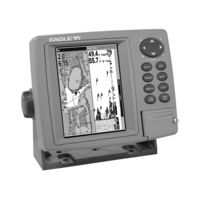
Eagle Electronics FishFinder Fish-finding Sonars & Mapping GPS Model FishElite 642C iGPS Manual
Brand:
Eagle
| Category:
Fish Finder
| Size: 6.85 MB
Table of Contents
Table of Contents
3
Section 1: Read Me First
9
Capabilities and Specifications
11
How Eagle Sonar Works
13
How GPS Works
14
Introduction to GPS and WAAS
15
Free Training Aids Available
18
How to Use this Manual: Typographical Conventions
19
Arrow Keys
19
Keyboard
19
Menu Commands
19
Instructions = Menu Sequences
19
Section 2: Installation & Accessories
21
Preparations
21
Transducer Installation
21
Recommended Tools and Supplies
22
Single-Frequency Transom Installations
22
Dual-Frequency Transom Installations
22
Single-Frequency Trolling Motor Installations
22
Shoot-Through Hull Installations
22
Selecting a Transducer Location
22
How Low Should You Go
24
Shoot-Thru-Hull Vs. Transom Mounting
24
Transom Transducer Assembly and Mounting
25
Trolling Motor Bracket Installation (Single-Frequency Only)
30
Transducer Orientation and Fish Arches
31
Shoot-Thru-Hull Preparation
32
Hulls with Flotation Materials
32
Testing Determines Best Location
32
Shoot-Thru-Hull Installation
34
Speed/Temperature Sensors
36
Optional Speed Sensor Installation
37
Power Connections
39
NMEA Cable Connections
40
NMEA Wiring
40
GPS Internal Antenna
40
Mounting the Unit: Bracket or Portable
41
MMC or SD Card Memory Card Installation
44
Other Accessories
45
Section 3: Basic Sonar Operation
47
Keyboard
47
Power/Lights on and off
48
Main Menu
48
Satellite Status Page
50
Navigation Page
51
Map Page
51
Sonar Page
52
Basic Sonar Quick Reference
55
Sonar Operations
56
Fish Symbols Vs. Full Sonar Chart
58
Section 4: Sonar Options & Features
59
ASP (Advanced Signal Processing)
59
Alarms
60
Depth Alarms
60
Zone Alarm
61
Fish Alarm
62
Calibrate Speed
62
Chart Speed
63
Colorline
63
Customize Page Displays
65
Depth Cursor
66
Depth Range - Automatic
67
Depth Range - Manual
67
Fastrack
68
Fish I.D
68
Fishtrack
69
Frequency (Seacharter Only)
70
Hyperscroll
71
Log Sonar Chart Data
71
Noise Rejection
72
Overlay Data
72
Ping Speed & Hyperscroll
75
Reset Options
77
Reset Water Distance
77
Set Keel Offset
78
Sensitivity & Auto Sensitivity
79
Automatic Sensitivity
79
Sonar Chart Mode
80
Sonar Page & Sonar Chart Display Options
81
Full Sonar Chart
81
Split Zoom Sonar Chart
82
Digital Data
82
Customizing the Digital Data Page
82
Map with Sonar
84
Sonar Simulator
84
Stop Chart
86
Surface Clarity
86
Zoom & Zoom Bar
87
Zoom Pan
88
Section 5: Sonar Troubleshooting
89
Section 6: Basic GPS Operations
93
Keyboard
93
Power/Lights on and off
94
Main Menu
94
Sonar Page
96
Satellite Status Page
96
Navigation Page
98
Map Page
100
Background Map Vs. Mapcreate Map Content
102
Resize Window Command
104
Basic GPS Quick Reference
106
Moving Around the Map: Zoom & Cursor Arrow Keys
107
Selecting any Map Item with the Cursor
108
Searching
108
Set a Waypoint
110
Create Waypoint at Current Position
111
Create Waypoint on Map
112
Create Waypoint by Entering a Position
112
Navigate to a Waypoint
113
Set man Overboard (MOB) Waypoint
114
Navigate Back to MOB Waypoint
114
Navigate to Cursor Position on Map
115
Navigate to a Point of Interest
116
Creating and Saving a Trail
116
Displaying a Saved Trail
118
Navigating Trails
118
Visual Trailing
119
Navigate a Trail
119
Navigate a Back Trail
121
Transfer Custom Maps and GPS Data Files
122
Custom Maps
122
GPS Data Files
122
Cancel Navigation
124
Section 7: Advanced GPS Operations
125
Find Distance Current Position to Another Location
125
Find Distance from Point to Point
125
Icons
126
Create Icon on Map
126
Create Icon at Current Position
126
Delete an Icon
126
Navigate to an Icon
127
Routes
127
Create and Save a Route
128
PC-Created Routes
128
Routes Created in the Unit
128
Delete a Route
130
Edit a Route Name
131
Edit Route Waypoints
131
Navigate a Route
131
Navigate a Route in Reverse
132
Trails
133
Delete a Trail
133
Edit a Trail Name
133
Edit a Trail Color
133
Edit a Trail Pattern
134
Utilities
134
Alarm Clock
134
Sun/Moon Rise & Set Calculator
134
Trip Calculator
134
Trip down Timer
134
Trip up Timer
134
Waypoints
135
Delete a Waypoint
135
Edit a Waypoint
135
Selecting a Waypoint
136
Set a Waypoint by Average Position
136
Set a Waypoint by Projecting a Position
136
Section 8: System & GPS Setup
139
Alarms
139
Communications Port Configuration
140
Check MMC Files and Storage Space
140
Configure NMEA
141
Coordinate System Selection
142
Map Fix
143
Customize Page Displays
145
GPS Simulator
146
Hide GPS Features
148
Initialize GPS
148
Map Auto Zoom
149
Map Data
149
Earth Map Detail
149
Pop-Up Map Information
150
Draw Map Boundaries
150
Fill Water with White
150
Map Overlays (Range Rings; Lat/Long Grid)
150
Map Datum Selection
150
Map Detail Category Drawn
151
Map Orientation
152
Nauticpath USA Marine Charts
153
Nautical Chart Notes
153
Port Information
154
Tidal Current Information
155
Tide Information
157
Navionics Charts
158
Pop-Up Help
159
Reset Options
160
Require WAAS
160
Screen Contrast and Brightness
161
Set Language
162
Set Local Time
162
Show WAAS Alarm
162
Software Version Information
163
Sounds Menu
164
Track Smoothing
164
Trail Options
165
General Trail Options
165
Specific Trail Options
167
Trail Visibility and Other Trail Options
167
Transparency
167
To Adjust Transparency Level
168
Units of Measure
168
Section 9: Searching
169
Find Addresses
170
Find any Item Selected by Map Cursor
172
Find Interstate Highway Exits
173
Find Map Places or Points of Interest (POI)
175
Find Streets or Intersections
177
Find a Street
177
Find an Intersection
178
Find Waypoints
180
Section 10: Supplemental Material
183
Fcc Compliance
187
How to Obtain Service
194
Advertisement
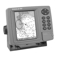
Eagle IntelliMap 642C iGPS Installation And Operation Instructions Manual (132 pages)
Mapping GPS Receiver
Brand:
Eagle
| Category:
GPS
| Size: 4.38 MB
Table of Contents
Table of Contents
3
Section 1: Read Me First
7
Capabilities and Specifications
8
How GPS Works
10
Introduction to GPS and WAAS
12
How to Use this Manual: Typographical Conventions
14
Arrow Keys
14
Keyboard
14
Menu Commands
14
Instructions = Menu Sequences
14
Section 2: Installation & Accessories
17
Preparations
17
Power Connections
17
NMEA Cable Connections
20
NMEA Wiring
20
Mounting the Unit: Bracket or Portable
20
MMC or SD Card Memory Card Installation
23
Other Accessories
24
Section 3: Basic GPS Operations
27
Keyboard
27
Power/Lights on and off
28
Main Menu
28
Satellite Status Page
30
Navigation Page
32
Map Page
34
Background Map Vs. Mapcreate Map Content
36
Resize Window Command
38
Basic GPS Quick Reference
40
Moving Around the Map: Zoom & Cursor Arrow Keys
41
Selecting any Map Item with the Cursor
42
Searching
42
Set a Waypoint
44
Navigate to a Waypoint
47
Set man Overboard (MOB) Waypoint
48
Navigate Back to MOB Waypoint
48
Navigate to Cursor Position on Map
49
Navigate to a Point of Interest
50
Creating and Saving a Trail
50
Displaying a Saved Trail
52
Navigating Trails
52
Visual Trailing
53
Navigate a Trail
53
Navigate a Back Trail
55
Transfer Custom Maps and GPS Data Files
56
Cancel Navigation
58
Section 4: Advanced GPS Operations
59
Find Distance Current Position to Another Location
59
Find Distance from Point to Point
59
Icons
60
Create Icon on Map
60
Create Icon at Current Position
60
Delete an Icon
60
Navigate to an Icon
61
Routes
61
Create and Save a Route
62
Delete a Route
64
Edit a Route Name
65
Edit Route Waypoints
65
Navigate a Route
65
Navigate a Route in Reverse
67
Trails
68
Delete a Trail
68
Edit a Trail Name
68
Edit a Trail Color
68
Edit a Trail Pattern
69
Utilities
69
Alarm Clock
69
Sun/Moon Rise & Set Calculator
69
Trip Calculator
69
Trip down Timer
69
Trip up Timer
69
Waypoints
70
Delete a Waypoint
70
Edit a Waypoint
70
Selecting a Waypoint
71
Set a Waypoint by Average Position
71
Set a Waypoint by Projecting a Position
71
Section 5: System & GPS Setup Options
73
Alarms
73
Check MMC Files and Storage Space
74
Communications Port Configuration
74
Configure NMEA
75
Coordinate System Selection
76
Customize Page Displays
77
GPS Simulator
78
Initialize GPS
80
Map Auto Zoom
80
Map Data
80
Earth Map Detail
81
Pop-Up Map Information
81
Draw Map Boundaries
81
Fill Water with White
81
Map Overlays (Range Rings; Lat/Long Grid)
81
Map Datum Selection
82
Map Detail Category Drawn
83
Map Fix
83
Map Orientation
85
Nauticpath USA Marine Charts
86
Nautical Chart Notes
86
Port Information
87
Tidal Current Information
88
Tide Information
90
Navionics Charts
91
Overlay Data
92
Pop-Up Help
94
Reset Options
95
Require WAAS
95
Screen Contrast and Brightness
96
Set Language
97
Set Local Time
97
Show WAAS Alarm
97
Software Version Information
98
Sounds Menu
98
Track Smoothing
99
Trail Options
99
Delete All Trails
100
Update Trail Option
100
Update Trail Criteria
100
Trail Update Rate
100
Delete Trail
101
New Trail
101
Trail Visibility and Other Trail Options
101
Transparency
102
Units of Measure
103
Section 6: Searching
105
Find Addresses
106
Find any Item Selected by Map Cursor
109
Find Interstate Highway Exits
109
Find Map Places or Points of Interest (POI)
111
Find Streets or Intersections
113
Find a Street
113
Find an Intersection
114
Find Waypoints
116
Section 7: Supplemental Material
119
Fcc Compliance
126
How to Obtain Service
130
Advertisement
Related Products
Eagle FishElite 640c
Eagle FishElite, SeaCharter 640C, 640cDF
Eagle SEACHARTER 640CDF - ADDITIONAL
Eagle SeaCharter 642C DF iGPS
Eagle IntelliMap 502C iGPS
Eagle LIBERTYTM 624
Eagle 6
Eagle LIBERTY 624MINI
Eagle 680022
Eagle 680570
Eagle Categories
Sonar
GPS
Cables and connectors
Fish Finder
Flood Light
More Eagle Manuals
Login
Sign In
OR
Sign in with Facebook
Sign in with Google
Upload manual
Upload from disk
Upload from URL